Written by Derek Ebert, GIS Coordinator at Iowa Regional Utilities Association
Introduction
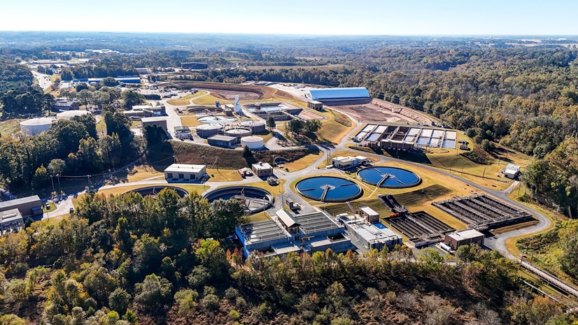
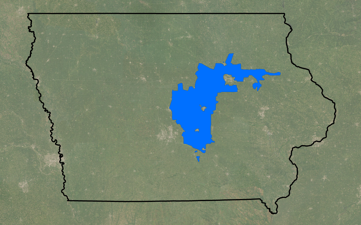
Iowa Regional Utilities Association (IRUA) is the largest water and wastewater utility in Iowa, serving more than 16,359 water service connections and 1,000 sewer connections across 18 centrally located counties. Its expansive regional system includes 27 IRUA-owned water towers, supplies bulk water to 27 communities, and maintains emergency interconnections with 16 additional municipalities to ensure reliable service when it’s needed most.
IRUA operates from two offices and employs 55 staff across construction, distribution, GPS, engineering, treatment, customer service, and administrative departments. The organization is committed to providing safe, reliable water service and recently began leveraging innovative geospatial technologies to improve efficiency, accuracy, and service delivery.
To support this geographically expansive system, IRUA modernized its mapping and asset management workflows using Esri’s ArcGIS platform. What began as a project focused solely on migration from legacy AutoCAD paper drawings to digital maps, evolved into a full transformation to ArcGIS Enterprise in the Amazon Web Services (AWS) Cloud that now serves as the organization’s authoritative source of truth for water and sewer infrastructure, along with utilizing the GIS platform in other areas of the organization, like land rights document management and customer service information.
The Challenge
Since its incorporation, IRUA has managed its water distribution system using paper maps and AutoCAD drawings. The network spans 18 counties and more than 80 township map sheets—many over 20 years old—making it increasingly difficult to maintain accurate, consistent records as infrastructure expanded.
Field crews and engineers often depended on outdated drawings or institutional knowledge to locate assets and plan projects. Paper maps could be misplaced, while disconnected CAD files lacked spatial accuracy, consistent attribution, and real-time updating capabilities. These limitations made coordination across departments and offices inefficient and increased the risk of miscommunication and inconsistent records.
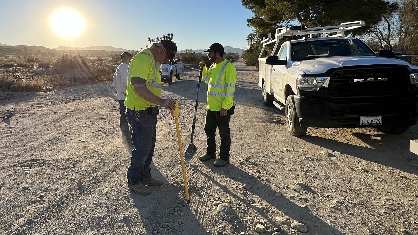
The challenges were especially evident in the 811 (“Call Before You Dig”) locate process. Serving an area larger than the State of Hawaii, technicians frequently spent more than two hours traveling to a job site, returned to the office to receive paper tickets, and then traveled back to the same area the following day, creating unnecessary repeat trips and delays.
Permitting workflows faced similar inefficiencies. Easement records were stored in filing cabinets, making retrieval slow and requiring staff to contact other offices to verify documentation or status. New construction updates could also take months to appear on paper maps, limiting visibility into recently installed assets and increasing the risk of using outdated information in the field.
IRUA recognized the need for a centralized, accurate, and accessible system that could serve as a single source of truth across the organization.

The Solution
IRUA implemented a full enterprise GIS transformation built on Esri technology, transitioning from AutoCAD-based workflows to a centralized ArcGIS Enterprise environment.
The initiative was led by Derek Ebert, IRUA’s GIS specialist/coordinator and one-person GIS department. His background in computer-aided drafting technology (CAD technology) provided firsthand knowledge of the organization’s legacy AutoCAD environment and the practical challenges of transitioning long-established workflows into an enterprise GIS. Through extensive Esri technical training and hands-on experience administering ArcGIS Online and ArcGIS Pro, he developed the expertise needed to lead IRUA’s day-to-day GIS program and guide the organization’s broader transition to an enterprise GIS platform.
Leveraging that foundation, Mr. Ebert coordinated and executed the migration of more than two decades of AutoCAD data into ArcGIS Pro and a unified geodatabase, consolidating 18 county systems and more than 80 township maps into a single, spatially accurate infrastructure model.
He approached the modernization effort through a three-phase, multistep transformation strategy: from AutoCAD to ArcGIS Pro, followed by Cloudpoint Geospatial’s ArcGIS Enterprise deployment, with a final migration to ArcGIS Utility Network still to come.
Phase 1: Migration from AutoCAD to ArcGIS Pro and Live Esri Applications
Within IRUA, the migration from AutoCAD to ArcGIS Pro and live Esri applications, was conceived, planned, and implemented entirely by Mr. Ebert. As the organization’s sole GIS professional, he managed every phase of the effort, from data auditing and migration to application development, mobile deployment, user training, and enterprise implementation planning.
Audit Mains and Structures (AutoCAD): Mr. Ebert manually audited 84 township drawings and repositioned mismapped asset blocks to their correct GPS locations.
Join Townships and Counties (AutoCAD): With mains and structures audited, Mr. Ebert joined all 84 township drawings into county maps within AutoCAD, verifying water mains connected and aligned across the 18-county system.
Layer Standardization (AutoCAD): Numerous CAD layers contained inconsistent naming conventions, duplicate layer structures, and typographical variations. After auditing and consolidating the data, 221 AutoCAD layers were standardized into 14 unified GIS layers within ArcGIS Pro.
File Conversion (ArcGIS Pro): Mr. Ebert converted legacy AutoCAD data into ArcGIS Pro feature classes using CAD To Geodatabase workflows, running many processes overnight for efficiency.
Apply Symbology (ArcGIS Pro): To maintain familiarity for end users, map symbology was designed to closely match the legacy AutoCAD appearance.
Import AutoCAD As-Built Annotations (ArcGIS Pro): IRUA recognized that field adoption would depend heavily on replicating the familiar appearance and usability of the legacy AutoCAD maps. To accomplish this, more than 215,000 as-built annotations were converted into a tile package and published through ArcGIS Online. This allowed ArcGIS Field Maps to closely resemble the organization’s historic CAD mapping environment while costing just under $1,500 annually in ArcGIS Online storage credits.
Setup Licensing and Users (ArcGIS Online): With the core dataset standardized and migrated, Mr. Ebert turned to provisioning the environment for organization-wide use. He configured user accounts and licensing within ArcGIS Online, ultimately establishing 34 named users across five distinct roles, supported by seat allocation included in IRUA’s Esri Small Utility Enterprise Agreement.
Setup and Configure GNSS Receivers and Smart Forms (Field Maps Designer): IRUA deployed high-accuracy GNSS equipment paired with ArcGIS Field Maps on iOS devices, implementing Trimble R12i, Trimble R580, and Trimble DA2 receivers, along with Juniper Systems Archer 4. Alongside the hardware rollout, Mr. Ebert developed custom smart forms within Field Maps Designer to streamline field collection and reduce manual typing. Default values were configured to accelerate collection activities. For example, they automatically populate the current date and retrieve latitude, longitude, and elevation data directly from the connected GNSS receivers.
Testing New iOS Devices with ArcGIS Field Maps: Once Field Maps was running reliably on iOS, Mr. Ebert tested the GNSS receivers directly against Field Maps to confirm smart forms were populating correctly and that GNSS metadata (latitude, longitude, and elevation) was accurate. To validate real-world performance, Mr. Ebert traveled with a GNSS receiver to every extremity of IRUA’s service area, testing positional accuracy against the newly built system map across the full geographic range the utility covers.
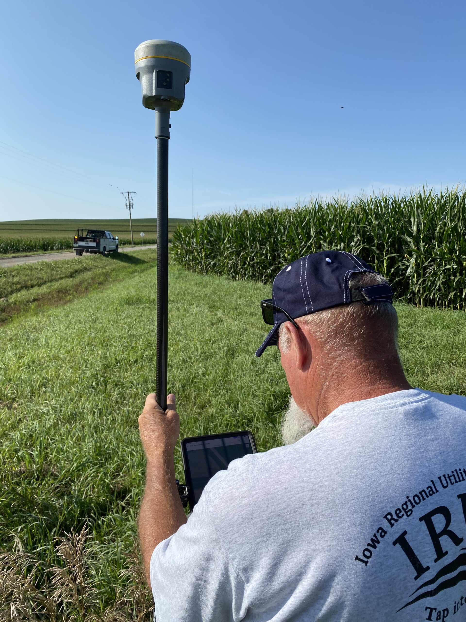
Employee Training (Collection and Locates): Mr. Ebert developed internal training documentation and delivered hands-on instruction to field and office staff across two sessions. GPS collection training used a mock data-collection course, marked with spray-painted simulated assets, so crews could practice with ArcGIS Field Maps and connected GNSS receivers while Mr. Ebert answered questions in real time. A separate locates training session covered the new workflow, how to use Field Maps in the field, and how to locate assets with GNSS receivers when GPS was available, defaulting to as-built annotation, using the receiver as a tape measure to drop points and measure from known reference features, when it wasn’t.
Phase 2: ArcGIS Enterprise Deployment
Mr. Ebert evaluated five Esri partners before selecting Cloudpoint Geospatial to design, implement, and manage IRUA’s cloud-based ArcGIS Enterprise architecture. Shortly after, Cloudpoint performed an ArcGIS Data Readiness Assessment, evaluating the newly migrated dataset and demonstrating 99.21 percent accuracy across 408,683 mapped assets. The results gave IRUA confidence in the quality of the migration and helped shape the scope of the enterprise GIS deployment that followed.
Following the completion of phase 1, IRUA’s Esri Water Representative hosted an in-person kickoff meeting involving key stakeholders from Esri, IRUA, Cloudpoint Geospatial, and Accela Novotx Elements XS asset management software.
With Cloudpoint Geospatial selected as the implementation partner, they led the ArcGIS Enterprise deployment, while Mr. Ebert supported the effort through quality assurance, data cleanup, and cross-team coordination.
AWS Setup: Cloudpoint provisioned and configured Amazon Web Services (AWS) as the hosting environment for IRUA’s ArcGIS Enterprise deployment, establishing the cloud infrastructure that would support centralized GIS administration, web applications, and mobile workflows going forward.
Deploy and Configure ArcGIS Enterprise: Cloudpoint installed and configured ArcGIS Enterprise on the newly provisioned AWS environment, laying the foundation for IRUA’s centralized GIS platform. The architecture for ArcGIS Enterprise was developed and implemented to accommodate the future Utility Network.
Deploy and Configure Database: Cloudpoint set up, configured, and deployed the PostgreSQL enterprise geodatabase that would serve as the organization’s central repository for infrastructure data, replacing the file geodatabase environment used during the AutoCAD migration.
Backup Configuration: Backup procedures were configured to protect the ArcGIS Enterprise environment as data volume and user activity increased, ensuring IRUA’s infrastructure data remained protected as the system scaled.
Data Migration: Cloudpoint utilized ArcGIS Data Interoperability to migrate data from ArcGIS Online into the ArcGIS Enterprise geodatabase. Feature layers were organized and consolidated into feature classes and tables in the enterprise geodatabase. During the many-to-one consolidation, field ordering was not retained within the enterprise geodatabase. For feature classes with as many as 30 attribute fields, this made it difficult for staff to navigate to the correct fields when populating or editing data. To resolve this, Mr. Ebert recreated the affected feature classes directly within the enterprise geodatabase, reordering fields by importance, and then appended the original data back over the corrected schema, restoring an intuitive field order for end users without losing any existing data.
ArcGIS Online Content Migration: Before IRUA went live on ArcGIS Enterprise, Cloudpoint performed a final pull of live data from ArcGIS Online to ensure the Enterprise environment launched with the most current dataset available. Rather than storing the as-built annotation tile layers directly within ArcGIS Enterprise, IRUA continues to host them in ArcGIS Online. This keeps storage demand and processing load off the enterprise environment, a deliberate choice, since branch versioning workflows are where server performance is most likely to bottleneck as edits accumulate across a multiuser system.
Project Documentation: To close out the engagement, Cloudpoint delivered full project documentation covering the deployed architecture, configuration decisions, and administrative procedures, giving Mr. Ebert a clear reference for maintaining and scaling the system going forward.
Overall, the migration from AutoCAD to ArcGIS Pro took slightly more than 18 months to complete, while the ArcGIS Enterprise deployment required just under one year.
“While ArcGIS Online met IRUA’s initial needs, the organization’s long-term goals required a more scalable and structured GIS environment. A key driver of the move to ArcGIS Enterprise was the transition to an enterprise geodatabase, which provides a stronger foundation for multiuser editing, centralized data management, and clearer data governance. This was more than a platform upgrade; it established a more structured foundation for how IRUA manages and uses its operational data as the organization continues to grow.”
Jeremy Conner, GISP, Cloudpoint Geospatial
Phase 3: ArcGIS Utility Network Migration
The final phase of IRUA’s long-term GIS strategy is the migration into ArcGIS Utility Network. This future implementation will support advanced tracing, subnetworks, asset modeling, and long-term infrastructure management capabilities.
Results
The migration to ArcGIS Enterprise transformed how IRUA manages infrastructure, field operations, permitting, and customer service across its 18-county service area. GIS is now the organization’s system of record, providing a single authoritative source of data for more than 408,000 assets, 4,770 miles of water mains, and 27 water towers.
The most immediate impact has been the modernization of Iowa One Call (811) locate operations. IRUA now processes 25 to 125 locate requests daily through a fully digital workflow, eliminating paper maps, manual ticket handling, and redundant travel. Locate tickets are delivered directly to technicians’ mobile devices, saving nearly four labor hours per day for administrative staff and approximately 40 labor hours per week for field crews, equivalent to adding a full-time employee without increasing headcount.
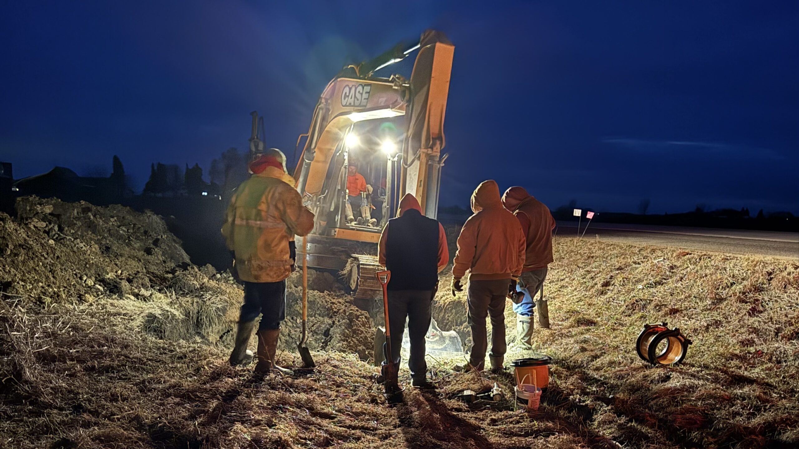
Field and office staff now work from the same real-time GIS environment, improving coordination, reducing data discrepancies, and accelerating decision-making across departments and office locations. GPS-collected field updates are available almost immediately within ArcGIS, replacing outdated mapping workflows that previously delayed infrastructure updates for weeks or months.
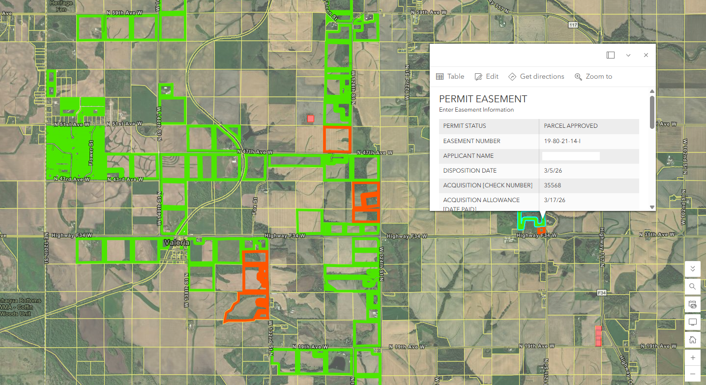
ArcGIS Enterprise has also streamlined multiuser editing through branch versioning, allowing multiple staff members to work simultaneously while maintaining data quality and reducing traditional QA/QC bottlenecks. This foundation positions IRUA for a smoother ArcGIS Utility Network implementation in the future. Beyond operations, IRUA modernized its permitting and easement management processes by creating a centralized GIS-based system that integrates parcel information from all 18 counties. Easement status, supporting documents, crop damage records, and permit information are now managed spatially and accessible in real time. Staff can independently verify property and easement information directly from the map, reducing interdepartmental coordination, eliminating reliance on paper records, and accelerating project delivery.
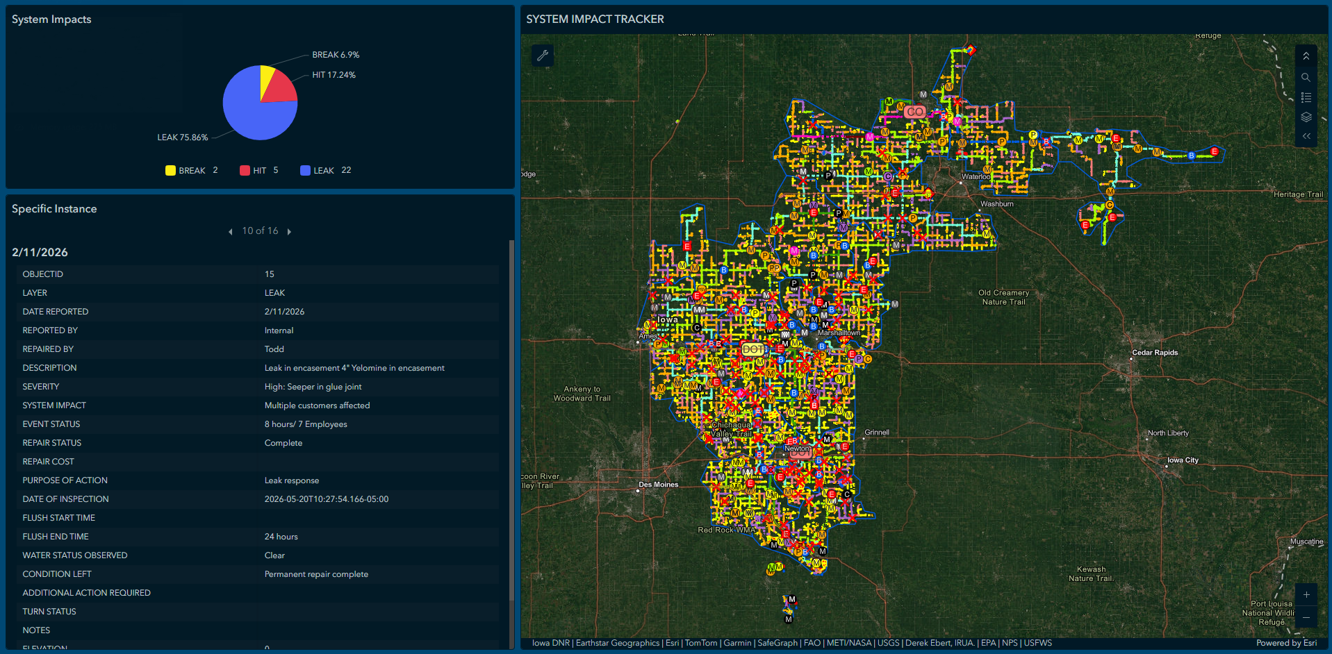
Custom GIS applications, mobile workflows, and dashboards further support day-to-day operations by enabling staff to capture asset updates, attach photos, monitor field activities, and maintain current infrastructure records. Leadership now has real-time visibility into system conditions and operational activity, improving situational awareness across the organization.
Key Outcomes:
- Saved nearly 4 labor hours per day by digitizing 811 locate administration workflows
- Approximately 40 labor hours per week for field technicians are saved, equivalent to one full-time employee
- Eliminated the routine printing of more than 25 map sheets per day
- Enabled near real-time infrastructure updates using ArcGIS Field Maps and GNSS data collection
- Improved data accuracy through standardized GIS editing workflows
- Centralized management of 408,683 assets, 4,770 miles of water mains, and 27 water towers
- Created a GIS-based permitting and easement management system spanning 18 counties
- Improved collaboration across departments using a single authoritative data source
- Reduced response times for customer inquiries and field operations through instant access to asset information
- Established a scalable GIS foundation to support future ArcGIS Utility Network deployment
Looking Ahead
IRUA’s next major milestone is the implementation of the ArcGIS Utility Network, which will further enhance network tracing, asset modeling, subnetworks, and long-term asset management capabilities while creating opportunities to leverage GIS for advanced engineering, hydraulic modeling, and technical analysis. As its enterprise GIS continues to mature, IRUA also plans to integrate additional business systems, including Continental Utility Solutions, Inc. (CUSI) customer information and billing system, and evaluate integration with Accela Novotx Elements XS asset management software to further connect customer information, asset records, maintenance activities, and spatial data.
This next phase builds on the organization’s strong enterprise GIS foundation and will continue to support IRUA’s mission of delivering reliable, high-quality water and wastewater services across rural Iowa.
What began as a migration from legacy AutoCAD drawings has evolved into a comprehensive enterprise GIS platform that supports nearly every aspect of IRUA’s daily operations. From engineering and field operations to permitting, Iowa One Call, and executive decision-making, ArcGIS has become the organization’s authoritative record. As IRUA continues its journey toward the ArcGIS Utility Network and broader enterprise system integration, it is building a scalable GIS foundation that will support reliable water and wastewater services for rural Iowa for decades to come.
“When I look back on this project, I’m proud that we simplified and improved the way people work. We moved from paper maps, disconnected CAD drawings, and outdated workflows to a culture where everyone works from the same trusted information. GIS became more than a mapping tool. It became the foundation for collaboration across the organization.” -Derek Ebert, GIS Specialist/Coordinator, Iowa Regional Utilities Association
For more information, contact Derek Ebert at debert@irua.net.
Stay Connected with Esri’s Water Team
ArcGIS is an enterprise geospatial platform that enables modernization of workflows with easy-to-use applications for the field and office. Strengthen your organization with geospatial solutions that will increase efficiency and provide insight for decision-makers.
Visit the Esri Water Utilities web site for more information.
Join the Water Utilities Community
Follow #EsriWater on social media: X | LinkedIn
Subscribe to the Water Industry newsletter “Esri News for Water Utilities and Water Resources“
Learn more about how Esri supports rural and small water.
Learn more about how GIS supports digital transformation.