How Simplicity, Collaboration, and Governance Are Modernizing Fire Service Mapping Across Orange County
For years, fire service maps often reflected the limitations of the tools used to create them. Paper map books were replaced with PDFs, but the underlying problem remained: symbols varied, updates were difficult, and the information a company officer saw sometimes depended on who built the map. At the 2026 Esri Safety & Security Summit, Orange County Fire Authority (OCFA) captain Danny Moore shared how OCFA is moving beyond that model. The agency is turning static preplans into a living, governed mapping system designed for the way firefighters actually make decisions.
The technology matters, but Moore’s central message was not a software story. It was a leadership story built around three choices: simplify the user experience, collaborate to create scale, and govern the work so that it lasts.
Simplicity Enables Action
Decisions on the fireground happen fast. Crews rely on experience, pattern recognition, and the information immediately in front of them. At the summit, Moore connected that reality to the psychologist Daniel Kahneman’s distinction between fast, intuitive thinking and slower, analytical thinking. The operational goal is not to place every available data point on the screen. It is to present the right information clearly enough that firefighters can orient themselves with the map, recognize what matters, and act with confidence.
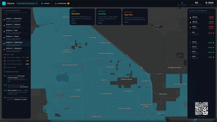
OCFA’s answer was deliberately unexciting: a clean map. Scale-dependent visibility reveals roads, building footprints, addresses, and preplan points only when they are useful. Less relevant data remains available in the layer list, but it does not compete for attention at the moment of decision. Moore called the result a boring gray map and made clear that he was proud of it. In an emergency interface, boring can mean trusted.
“Solutions in the fire service need to be PhD clever but crayon simple.”
Captain Danny Moore (quoting retired chief Jeff Johnson),
Orange County Fire Authority
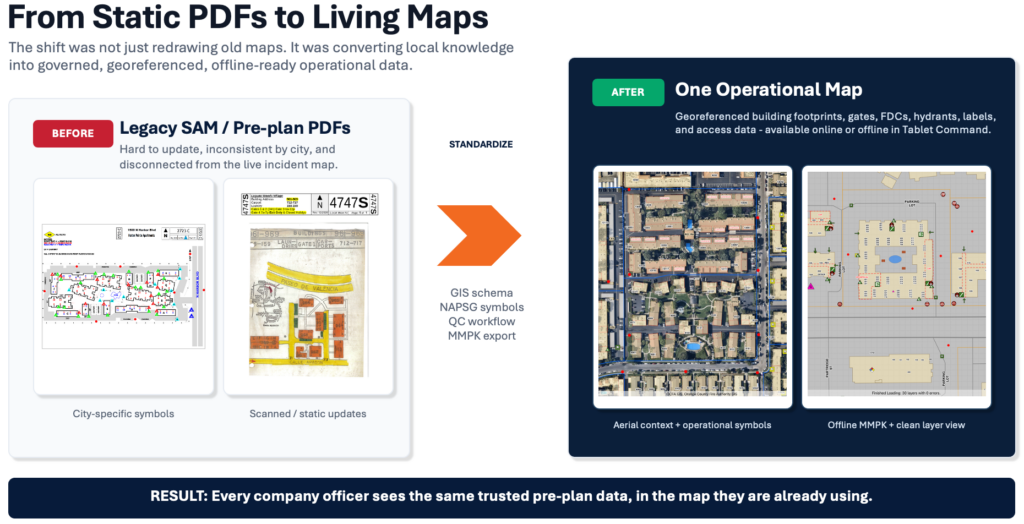
The same principle guided OCFA’s movement from legacy preplan PDFs to standardized, georeferenced operational data. Earlier products required crews to read a legend, orient the map, and interpret symbols that could vary from one author or jurisdiction to another. The newer approach standardizes those points, provides current building footprints and aerial context, and packages the information for offline use in their Tablet Command software. ArcGIS Field Maps also gives crews a way to validate preplan information and improve accuracy from the field.
Collaboration Is the Force Multiplier
Standardization becomes more valuable when the next-due unit crosses a boundary. In Orange County’s automatic-aid environment, agencies move across jurisdictions every day. OCFA recognized that a preplan standard used by only one department would not solve the larger operational problem. OCFA staff began conversations with surrounding agencies, formed a committee, and developed a shared data standard for the county.
The collaboration worked because OCFA did not arrive insisting that the largest agency should control the answer. At the summit, Moore described a simpler posture: Agree on the need for standardization, ask neighboring departments what already works, and adopt an existing standard where possible. The committee selected and curated established public safety symbology rather than inventing another local symbol set. That decision removed barriers and focused the conversation on the shared mission.
The resultant governance model balances local authority with countywide visibility. Jurisdictions are geofenced by administrative boundary. Participating agencies can edit the data within their own area and view data outside it. Each agency remains responsible for the information it knows best, and responders crossing a boundary can see the same standardized operational picture.
Connecting UAS Intelligence to the Map Crews Already Use
OCFA applied the same collaborative mindset to unpiloted aircraft system (UAS) data. The operational need was straightforward: to get current drone intelligence into Tablet Command. No single partner had a complete answer, so OCFA connected several existing capabilities. UAS operators collect imagery and infrared data. Nova Software Company processes the raw data. Technology from Intterra serves as the integration hub and stores source material, while an operational layer is published through ArcGIS Online and delivered into Tablet Command.
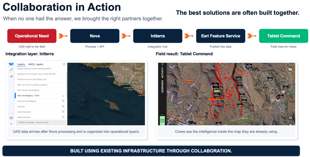
Moore described the field result through a vegetation fire example. Drone operators mapped an incident perimeter and identified hot spots for mop-up. Those features remained available to match the agency’s pace of operations, allowing crews to walk the line with a phone or tablet and see the latest published intelligence. A subsequent flight could refresh the picture without requiring someone to rebuild the map by hand.
Governance Beats Heroics
Innovative public safety programs often begin with a motivated individual. That energy can launch a project, but it cannot be the sustainment plan. People get promoted, retire, transfer, or burn out. Moore’s most direct warning was that if a system depends on one fire captain signing in during the night to keep it current, the organization does not have a system. It has a liability.
OCFA is addressing that risk through policy. Its updated standard operating procedure replaces distribution rules from the map book era with a repeatable digital process for creating, verifying, distributing, and maintaining mobile map packages and preplan information. The county’s operational annex establishes the common data standard for agencies participating in automatic aid. The UAS workflow also depends on agreed-upon naming, file, and data conventions so that each integration can read and move information consistently.
This is the less-visible work behind the map, but it may be the most important. Governance identifies who owns the data, who can change it, how quality is checked, when updates are published, and how the standard itself evolves. It turns a promising project into an operating system the organization can sustain.
Making Digital Mapping Commonplace
OCFA’s transition is still underway. Moore was candid that adoption varies across a large fire organization. Training every unit is an important step, but repetition and operational value are what make a field application routine. OCFA is expanding its use of Field Maps beyond structure preplans to include additional workflows, including search and rescue, so that crews encounter the same application across multiple missions.
That approach reflects the larger lesson from the presentation. Adoption is not created by adding more capability. It is created when the capability is easy to understand, useful in the field, and supported by a dependable process. Simplicity builds trust. Collaboration builds scale. Governance protects the investment.
A Leadership Model for Fire Service Technology
OCFA’s work offers a practical model for agencies modernizing preplans, common operating pictures, and incident intelligence. Start with the decision the firefighter must make. Reduce the screen to the information needed at that moment. Build the standard with neighboring agencies, especially where mutual and automatic aid make cross-boundary response routine. Then put ownership, quality control, publishing, and maintenance into policy before the original champions move on.
The outcome is more than a better map. It is a shared operational language that follows crews across jurisdictional lines, incorporates current field intelligence, works when connectivity is limited, and continues to improve after the first project team leaves.
The Takeaway
Build the simplest trusted view. Share it through a standard that respects local ownership. Govern the workflow so that the system outlasts its champions.
For more information on how GIS can be used in the fire service, visit our Fire Rescue EMS website and reach out to the team with any questions.