Why Human Readiness Belongs in Your Operating Picture
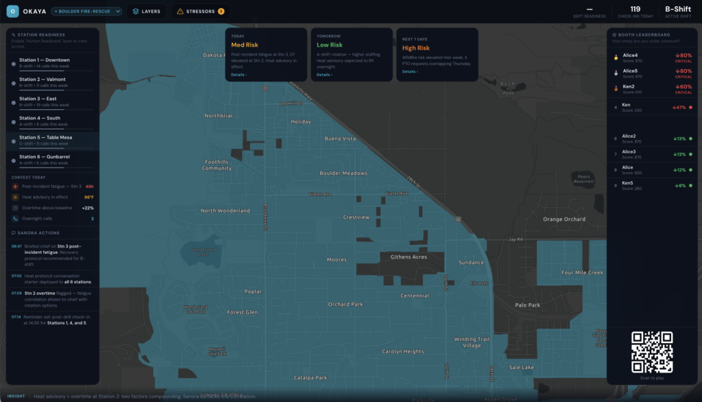
In the fire service, we don’t deploy resources based on instinct alone. We rely on data—coverage maps, response times, staffing levels, and incident demand—to understand risk and make informed decisions. ArcGIS gives departments a shared operating picture that shows where pressure is building across the community.
But there’s one critical layer that’s often missing: how the people staffing those resources are actually doing.
Departments have become exceptionally good at mapping operational risk—drive-time gaps, call volume, deployment coverage, and compliance. That level of visibility has transformed how agencies plan and respond. Yet decisions about people are still too often made after a problem surfaces, not before. In today’s environment of rising call volumes, staffing shortages, and tighter budgets, that lag matters.
What many fire service leaders tell us isn’t that they lack concern for their people—it’s that they lack visibility. By the time stress, fatigue, or burnout becomes visible, the impact is already significant. Injuries, absenteeism, turnover, and overtime all take a toll—especially when departments are already stretched thin.
This is where Esri partner Okaya brings an important new dimension to the operating picture.
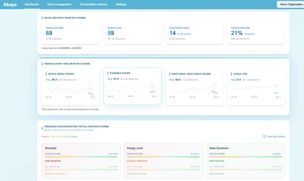
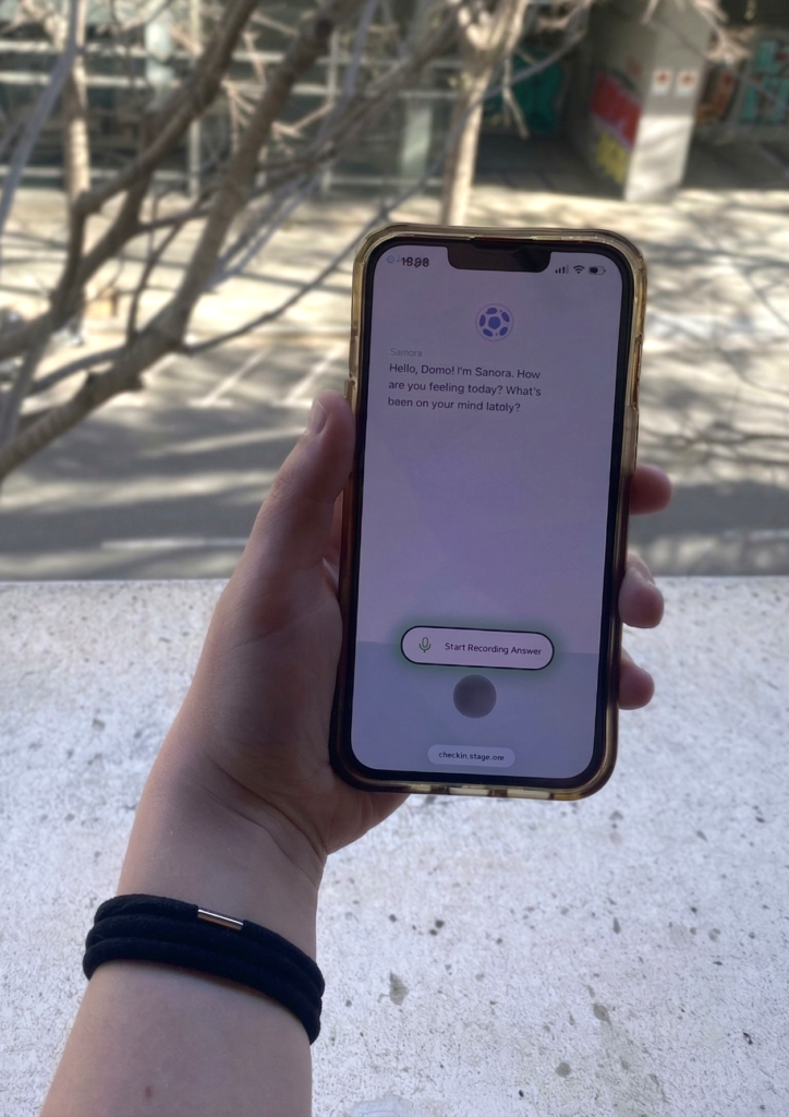
As part of the Esri Startup Program,Okaya is focused on integrating human readiness data into the same workflows departments already trust. The platform checks in with firefighters through brief check-ins delivered via voice and text to generate anonymous, aggregated readiness insights. Individual data is never exposed. Instead, leaders see patterns—trends across stations, shifts, and time.
When those patterns are visualized in ArcGIS, they gain critical context. Readiness can be viewed alongside call volume, incident demand, staffing, and schedules. Leaders can begin to see where pressure is building and ask operationally relevant questions: Is a station showing elevated stress after a sustained incident period? Is fatigue increasing on a shift covering higher mutual aid demand? Are readiness trends changing as call volume rises in a specific district?
These aren’t clinical questions. They’re operational ones—the same kind of questions fire service leaders already answer every day using GIS.
By bringing human readiness into the operating picture, departments can act earlier. Adjust workloads. Rotate assignments. Deploy peer support proactively. Give crews time to recover before small issues become major disruptions. And because the data is aggregated and privacy-protected, readiness becomes a defensible, operational layer—not a discretionary wellness initiative.
The fire service has long used GIS to understand where risk lives in the communities it serves. With partners like Okaya, that same discipline can now be applied to protecting the people doing the work.
That’s not a wellness conversation. It’s an operational one.
Visit Esri and Okaya at the Esri booth #1435 during FDIC International, April 20–25, to see the layer you’ve been missing.