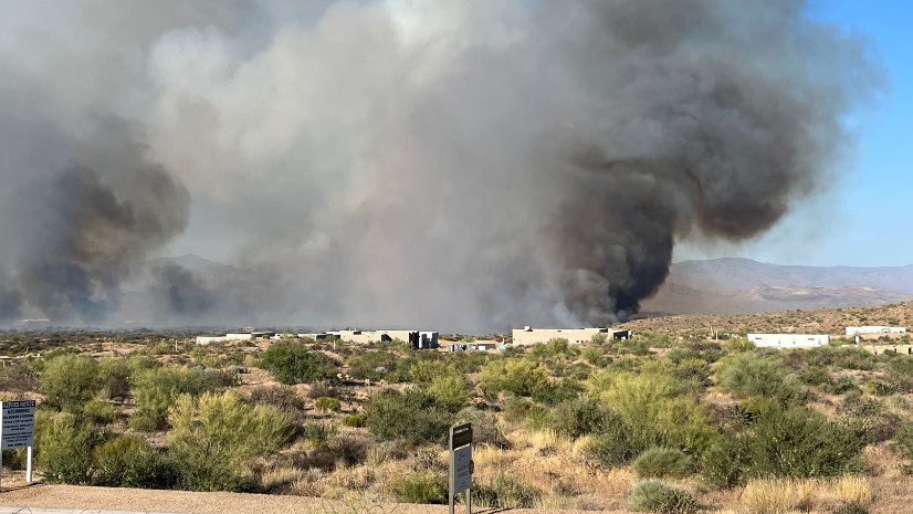
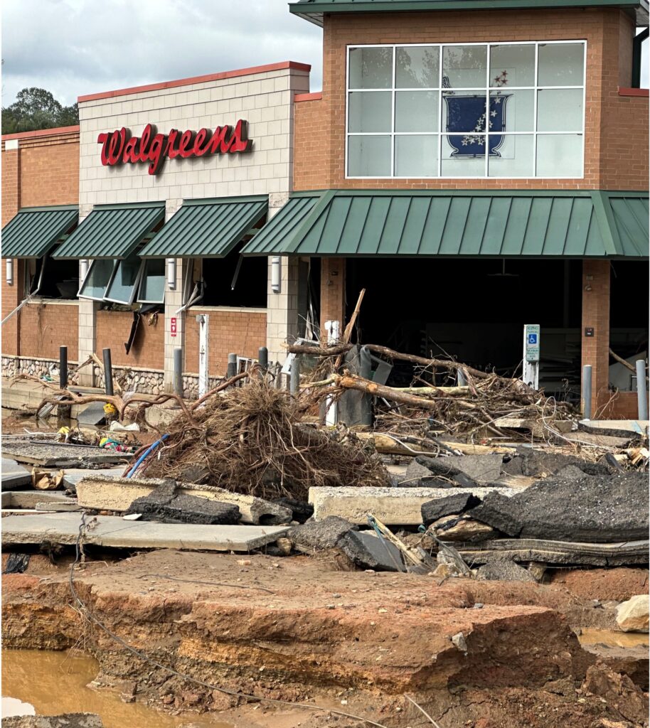
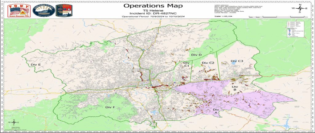
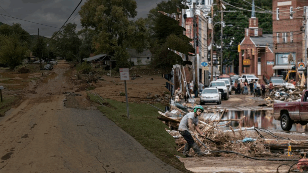
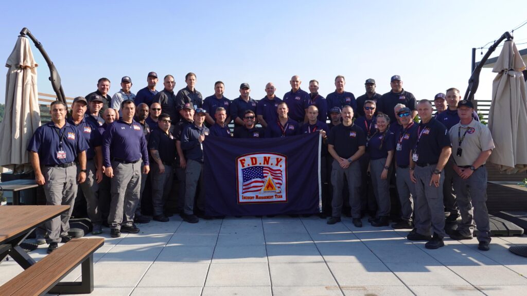
When Hurricane Helene swept through the Gulf and made landfall in Florida, few expected its devastation to reach deep into western North Carolina. Buncombe County, home to Asheville, found itself facing a disaster unlike anything in decades—flooded rivers, washed-out roads, and a population suddenly cut off from basic necessities. The Fire Department of New York (FDNY) Incident Management Team (IMT) deployed at the request of the State of North Carolina, not knowing exactly where they’d be sent or what their mission would be. But what they did know was that technology—and specifically GIS—would be at the heart of their response.
As the team arrived and took over operations for the county’s emergency operations center, they quickly realized the scale of the challenge. Buncombe County spans 660 square miles, with a population of 270,000, much of it rural and now isolated by the storm. “We were able to utilize technology, utilize GIS, utilize some of the services that Esri provides to get out there to find out who needed the help and what we could do to get them out,” Ryan Traina, FDNY IMT Deputy Incident Commander (IC) explained, capturing the urgency and adaptability that defined their approach.
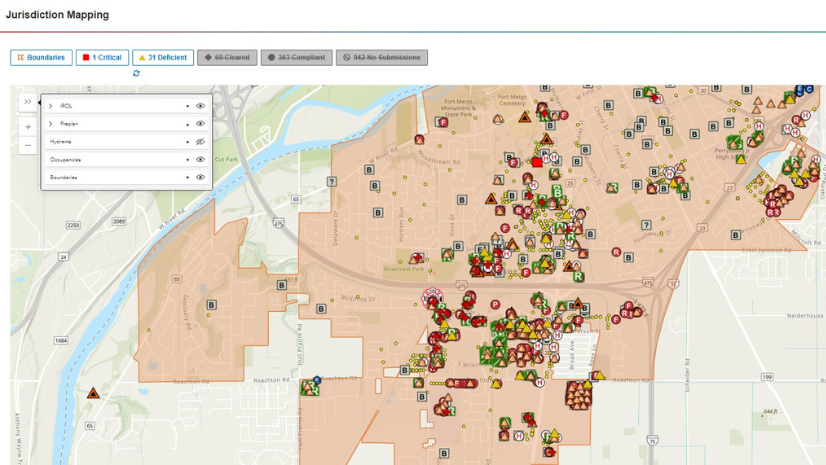
The FDNY IMT’s responsibilities ranged from overseeing community care stations and medical shelters to ensuring the continuity of fire and EMS services. But one of the most critical tasks was post-emergency canvassing—going door to door to check on homebound residents, seniors, and disabled individuals. To manage this, the team leaned heavily on Esri’s ArcGIS Survey123, creating and updating surveys daily to keep pace with changing needs. “Creating a survey and having it updated every day at the end of each operational period . . . because we had multiple things we were responsible for tracking, collecting, getting SA [situational awareness] on it, and every day the requests changed, so I wanted to make sure that the data was clean,” recalled Thomas Merkel Jr., FDNY IMT Situational Unit Leader. This flexibility allowed responders from across the country to collect and input data on their own devices, with just-in-time training ensuring everyone could contribute.
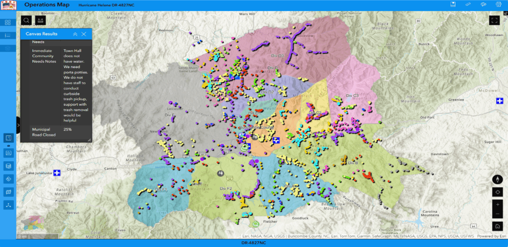
The power of GIS became even more apparent as the team tackled the daunting missing persons list. Multiple datasets poured in—volunteer reports, CAD data, 911 and 211 calls—each with hundreds of names. By overlaying these points in the system, the team could quickly identify duplicates, validate cases, and direct resources where they were needed most. “We leverage tools like Survey123, we use dashboards, right, to monitor progress against each objective, and we did it in real time. This approach eliminated the need for verbal updates that often monopolized radio traffic,” said Traina. Instead of waiting for post-shift briefings, commanders could see mission completion live, identify gaps in coverage, and redeploy teams instantly.
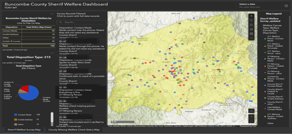
Empowering field units with GIS tools didn’t just boost accountability—it transformed the response. “Every entry was time stamped. It was geotagged. It was attributed to specific responders that were putting in the data. From a command perspective, this allowed us to track mission completion live. We were immediately able to identify the gaps in coverage, and then we had Chris Sweeney and his folks from operations say, hey, we can ship resources to other locations. Big game changer for us,” Merkel said. The ability to visualize operations in real time, using dashboards and maps built in ArcGIS Experience Builder, meant decisions could be made with confidence and speed.
The experience also underscored the importance of integrating GIS across all sections of the incident management team—not just planning or GIS specialists, but logistics, finance, and operations. Christopher Sweeney, FDNY IMT Operations Section Chief added, “A key takeaway for us from this deployment was that this shouldn’t just lie in the hands of folks from planning or from our GIS specialist role . . . Everybody should get a handle on this.” Even finance staff used geotagged data to trace equipment purchases and ensure a smooth transition back to the home agency.
As the response wound down, the team reflected on the lessons learned. “Success in complex incidents like tropical storm Helene doesn’t come down to luck. It comes down to clarity, coordination, and command grounded in real-time data. As the incident commander, my job was to bring focus to chaos. Esri’s tools allowed us to turn data into decisions, decisions into action with speed and accountability and confidence. This deployment proved that when GIS is integrated early, which we did, it’s shared across all sections . . . and we put it directly in the hands of first responders. It didn’t just enhance our response; it transformed how we led,” said Traina.
In the end, the FDNY IMT’s work in Buncombe County and Asheville was more than a demonstration of technical skill—it was a testament to the power of collaboration, transparency, and the right tools in the hands of those who need them most. Traina summed up the impactful response with this: “I’m proud of the work that our team accomplished down in Buncombe and even prouder of how we did it, transparently, collaboratively, and with the safety of responders in the community front and center. Thank you for the opportunity to share our story and to Esri for helping us lead a smarter, faster, and safer approach.”