Better understanding
Geospatially enabled statistics help you better understand trends, provide perspective and predictive insights, and further enhance your ability to make smart decisions for communities and nations around the world.

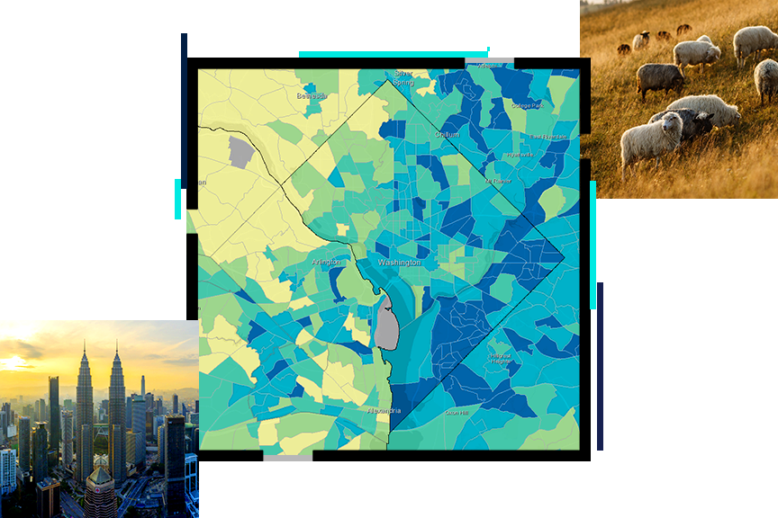
Enabling statistics for a smarter nation
ArcGIS can help strengthen statistical systems by integrating location, improving accuracy, and increasing efficiencies and effectiveness. Official statistics agencies can use ArcGIS to:

Esri's ArcGIS technology integrates many new innovations in data science, measurement, and computing. ArcGIS allows for the integration of new data sources from drones, satellites, and other sensors and the use of geospatial artificial intelligence (GeoAI).

This program provides resource-constrained countries with the GIS tools and training needed to conduct a successful census.
Learn more about the programGIS and the 2020 Census: Modernizing Official Statistics provides statistical organizations with the most recent GIS methodologies and technological tools to support census workers' needs at all the stages of a census.
Preview the bookHands-on tutorials help official statistics agencies modernize their workflows, covering every stage of the census process.
Learn more about GIS curriculumNational statistics organizations need to stay up-to-date with the latest national modernization trends, technology, and information. Attend informative webinars or speak to a statistics industry experts at an event.

Find out how your peers are using Esri technology to achieve their goals.

Statistics touches many parts of your life. From policy and decision-making to electoral boundaries, public safety, and sustainability, official statistics and GIS are making communities smarter.