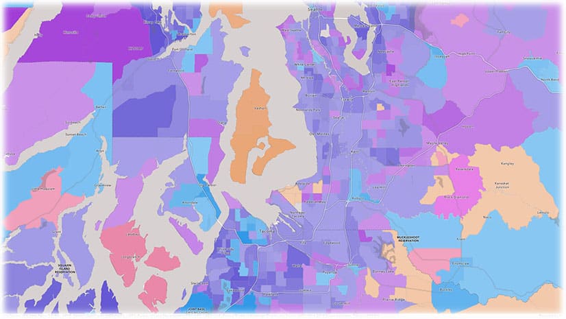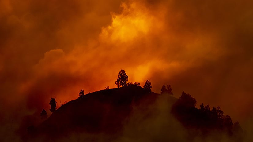
Fighting Megafires
With the climate changing, what can be done to better manage and protect forests from destructive megafires?
With the climate changing, what can be done to better manage and protect forests from destructive megafires?
With the updated Media Map configurable app in ArcGIS Online, you can use the express setup to create and embed maps within minutes.
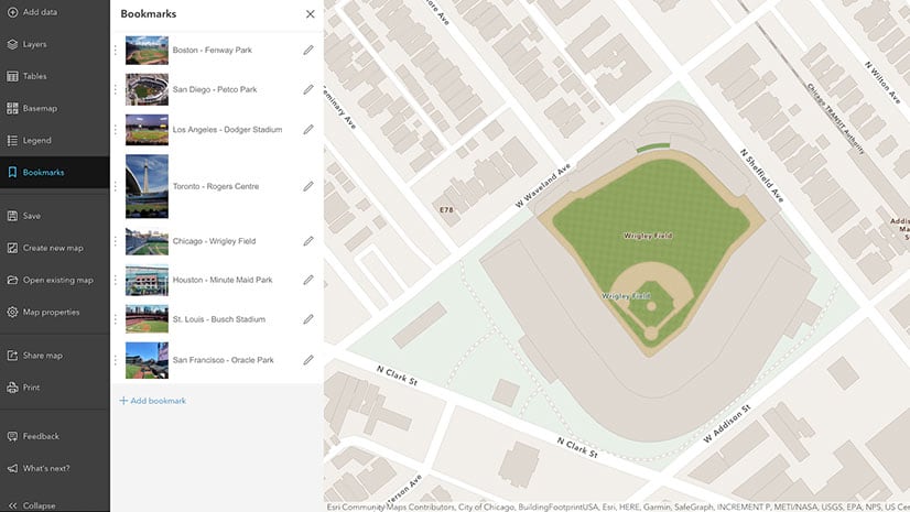
In Map Viewer Beta, you can now edit the extent, scale, and rotation of the bookmark and set a thumbnail on each bookmark in your web maps.
Knowing ahead of time exactly what message you want to convey will result in a better map.
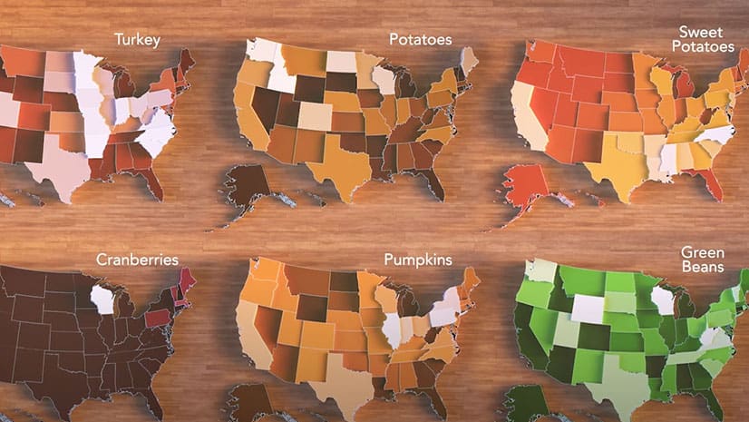
An animated map shows where the sweet potatoes; green beans; potatoes; pumpkins; and turkey that Americans eat on Thanksgiving are grown.
Join Stefan Arisona from the Zurich R & D Center for a fascinating introduction to building game engine experiences with ArcGIS CityEngine.
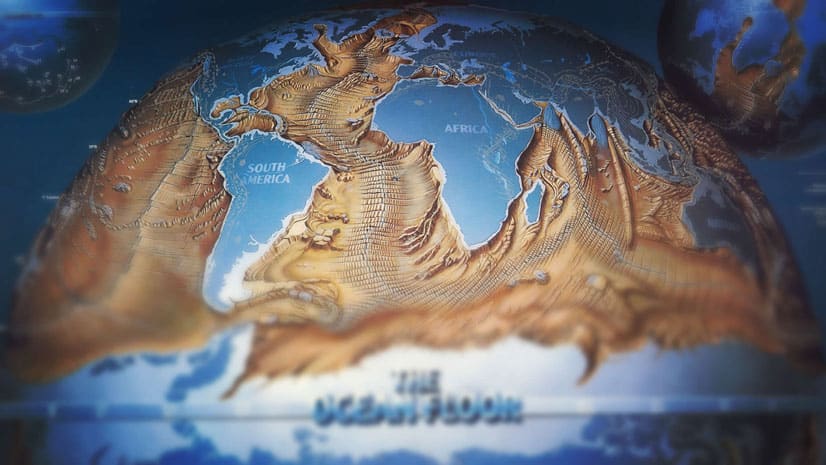
John Nelson of Esri dives deep into the David Rumsey Map Collection and finds a 1985 map called The Ocean floor that deserves to be revisited.
When working in 3D, you need to define a point or ‘camera’ in the 3D space from where you want people to view the scene. Learn how to do this.
You can now use geotagged photos to locate tour places in ArcGIS StoryMaps guided tours. That's just one of the new enhancements available.
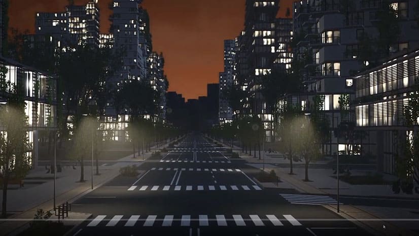
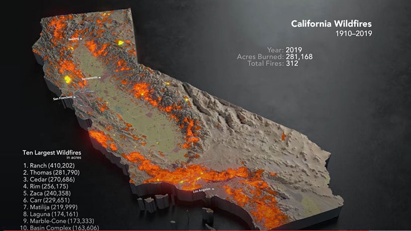
A map created using ArcGIS Pro, Cinema 4D, and other technologies shows an animation of the ten largest wildfires recorded over the last century.
Do you have to convert maps made in Map Viewer classic to Map Viewer beta? Learn the answer and get your other Map Viewer queries answered.
Allen Carroll, program manager for storytelling at Esri, shares a collection of his favorite stories created by the ArcGIS StoryMaps community.