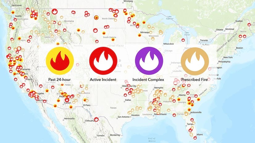
See Updates to USA Current Fires
Updates to the USA Current Wildfires map layer in ArcGIS Living Atlas include additional incident age fields and cartography changes.
Updates to the USA Current Wildfires map layer in ArcGIS Living Atlas include additional incident age fields and cartography changes.
Charlottesville Fire Department switched from conducting fire hydrant inspections with pen and paper to using the ArcGIS Field Maps app.
The Esri User Conference will be virtual again this year. But there’s still a lot of fun and learning in store.
During the Esri Federal GIS Conference, the United States Military Academy at West Point spotlighted the apps and maps it’s making with GIS.
The Esri Federal GIS Conference highlighted the GIS work being done by agencies such as the Census Bureau and showcased ArcGIS.
The Esri Redistricting Solution provides web-based tools and an environment to complete and share compliant redistricting plans.
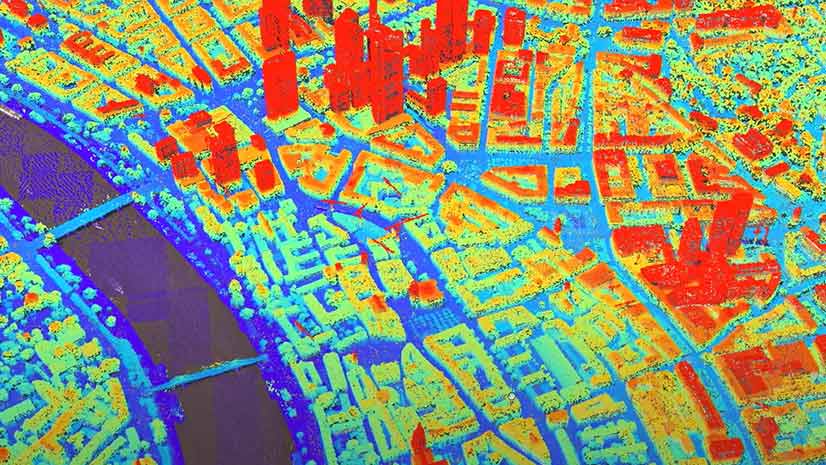
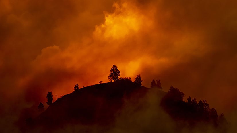
With the climate changing, what can be done to better manage and protect forests from destructive megafires?
Esri chief scientist Dawn Wright explains how businesses and government organizations can use GIS technology to manage sustainable practices.
The City of Seattle created a Web GIS app that maps eateries offering takeout, curbside, and delivery services during the COVID-19 pandemic.
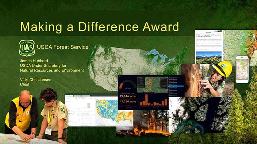
Federal GIS work was showcased at the 2020 Esri Federal GIS Conference, and the US Forest Service received the Making a Difference award.
Tan Boon Khai, chief executive of the Singapore Land Authority, speaks about the democratization of geospatial information in the 21st century.
The National Geospatial-Intelligence Agency staff demonstrates how Esri technology helps the organization conduct analysis.