Let’s Talk Cartography
Join Esri cartographers Edie Punt, John Nelson, and Kenneth Field for an informative and inspirational talk on cartography.
Join Esri cartographers Edie Punt, John Nelson, and Kenneth Field for an informative and inspirational talk on cartography.
Archaeologists Thomas Garrison and Marcello Canuto describe how technologies such as lidar has shed light on once-hidden Mayan civilizations.
Jeff Shaner of Esri talks about the making of the new ArcGIS Field Maps app in the first episode of the Field Notes podcast.
Esri will continue to support and update all existing Landsat Level-1 image services in addition to publishing Landsat Level 2 image services.
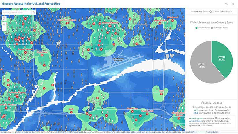
This map shows which areas are a 10-minute walk or 10-minute drive from a grocery store in the United States and Puerto Rico.
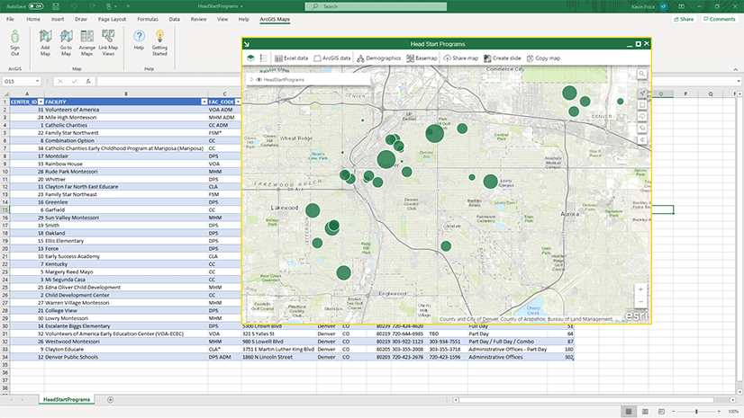
Esri instructor Kevin Price shows how to create a thematic map within an Excel spreadsheet using ArcGIS Maps for Office.
There are tips you can follow to make your ArcGIS StoryMaps content easy to read for people who are colorblind or have other sight issues.
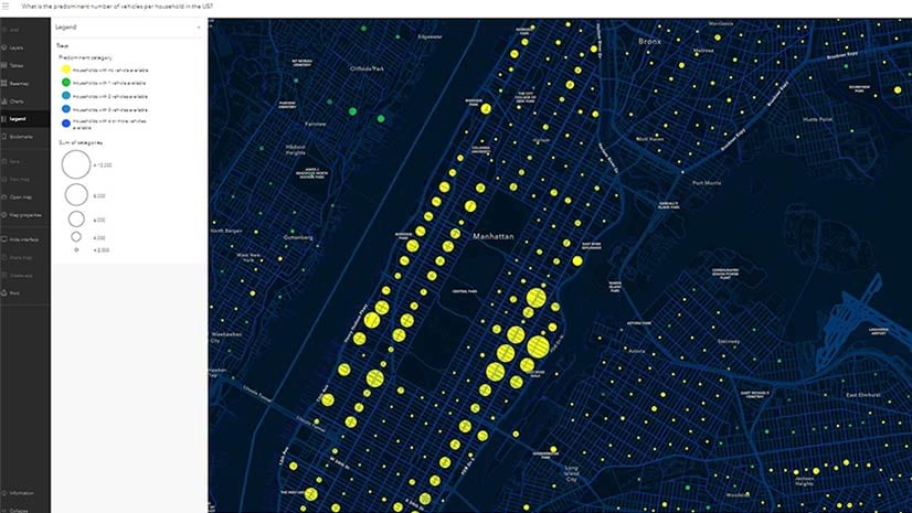
Where are one, two, three, and four vehicle households in the United States? And where are the most households with no vehicles? Think Manhattan.
Newly published Esri Press books spotlight GIS in state and local government, health, and conservation.
In the free e-book, Extend the Reach of Your GIS, you will Learn to quickly configure your ArcGIS Online organization using best practices.
Which of these two new gray accessible basemap versions do you like? Accessible basemaps increase legibility for people with visual impairments.
Configure or upgrade your GIS by packaging ArcGIS with a Dell EMC PowerEdge Server.