September 12, 2023 |
Brooks Patrick | Urban Planning
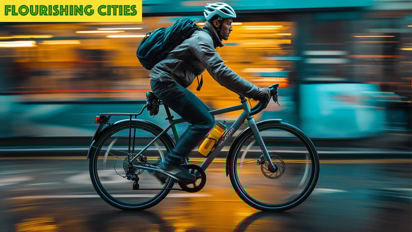
The car-centric designs of America’s cities and towns have given people greater mobility and personal freedom and boosted the nation’s economy—at a cost. Now, in communities big and small, a major shift is making the humble bicycle a winning solution to address several persistent global concerns.
Motorized transportation is a leading cause of carbon dioxide emissions, which pollute the air and cause temperatures to rise. Car-centric designs can also make bustling areas unsafe for walkers and cyclists, eliminating the casual social interactions that make people feel connected to their communities.
Being cocooned in vehicles for what amounts to more than 15 days per year has also taken a toll on the nation’s well-being. Drivers tend to be more sedentary and isolated during commutes, cut off from nature and one another. Inside cars, we often become passersby in our own communities.
The increase in traffic congestion as more people move to cities—coupled with the urgent need to improve air quality and address rising temperatures—intensifies the pressure for change.
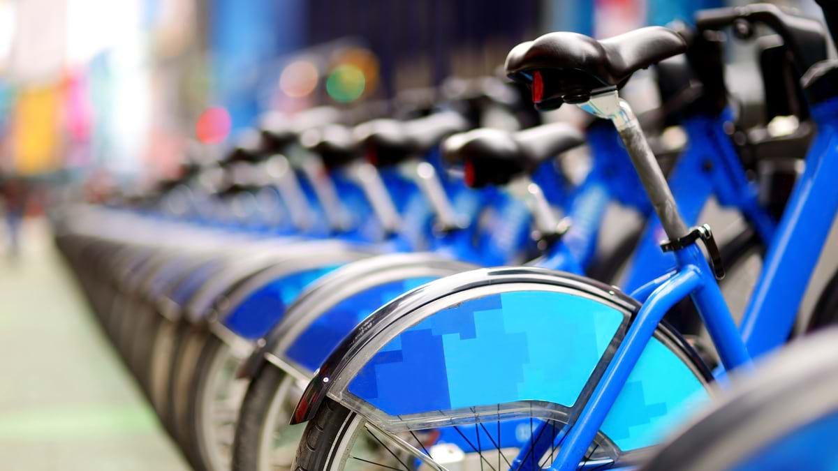
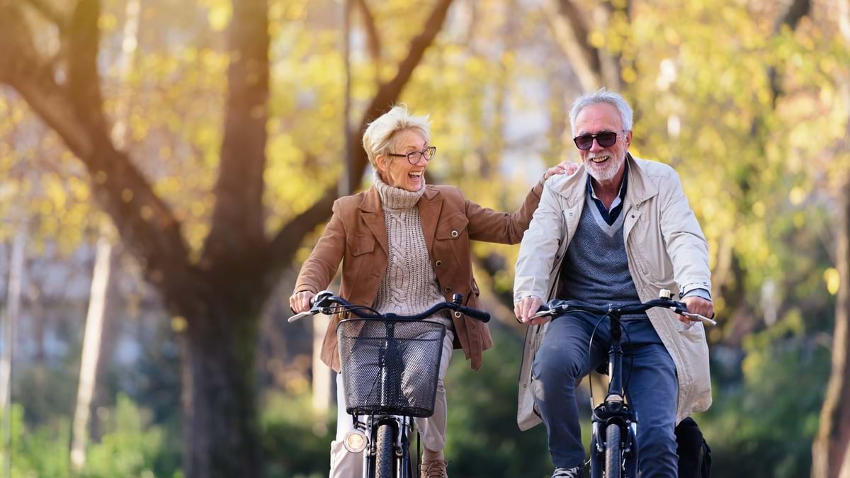
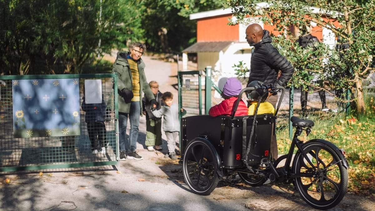
This is where cycling shines: as a cleaner, more affordable, and, therefore more accessible form of transportation. Bicycles require less space and cause less wear and tear on roads.
Well-designed and well-connected bikeways give people a way to take part in improving air quality and reducing carbon emissions while getting physically fit. Smart investments in improving active transportation networks empower people to boost their mental, physical, social, and economic well-being.
As impressive as those benefits sound, most people recognize that such a major mode shift—which would mean getting hundreds of thousands of drivers out of their sedans, trucks, and SUVs for even just a few local trips each week—will require vision, commitment, and careful planning.
Planning in many communities begins with a smart and dynamic map created with geographic information system (GIS) technology. By analyzing local data in the context of location, planners can see where transit connections could exist and where pathways and bicycle lanes could be extended.
This approach helps planners uncover obstacles and spot opportunities early. Already, many communities are taking this approach to create smarter, dynamic, and more sustainable transportation systems that also make those cities more fun.
“I don’t think there’s a better investment,” one official at a large city transportation agency said. “If you want to build a better city, you can start by building bike lanes.”
Drivers take an estimated 1.1 billion trips every day in the US. That’s about four trips per person, with 87 percent made in personal vehicles, according to the US Department of Transportation.
Transportation analysts have found another compelling statistic, and they hope it points to an inroad for knocking down emissions: Forty-eight percent of car travel in the nation is for distances of three miles or less—and 20 percent is for less than one mile.
If 10 percent of the population replaced one car trip a day with a bike ride, carbon from transportation could drop an estimated 10 percent, according to findings published in a transportation research journal.
In most communities, roadblocks slow a major mode shift among commuters and other travelers. To get more cyclists on the streets, city planners will look for pathways that are suitable:
“The cities that make these kinds of investments and changes are the cities that are growing and thriving in this century,” a large city transportation official said.
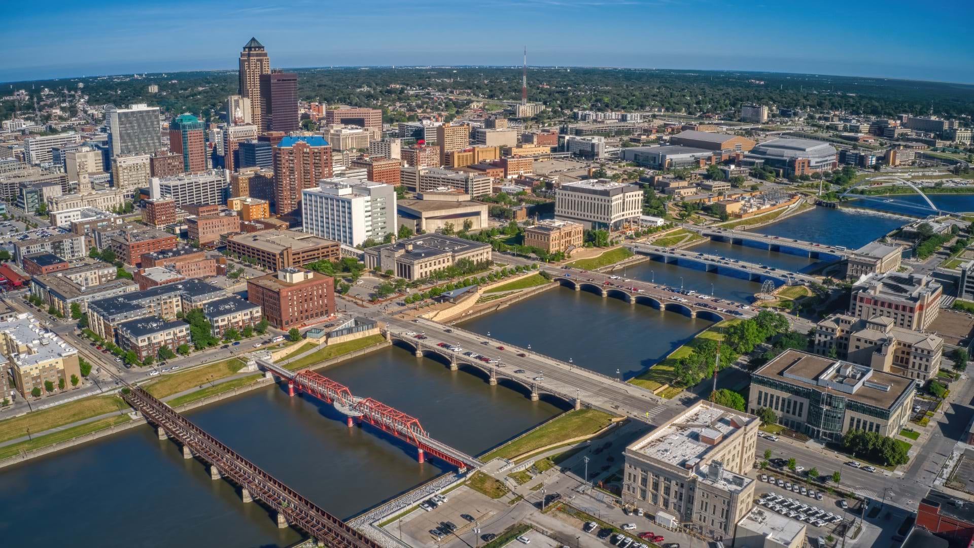
Minneapolis—with a population of more than 423,000 people—is spread across 59 square miles, making it less dense than many large cities. Yet, single-occupancy vehicles are often impractical even there, especially during large gatherings. Big-league ballgames, festivals, and other traffic-jamming events present opportunities for people to choose other modes of transportation, city officials say. Active transportation experts urge people to continue this pattern of leaving their cars at home for everyday outings.
Officials in Minneapolis set an ambitious goal for a mode switch. The city’s transportation action plan calls for 60 percent of all trips to be taken with a mode of travel other than a private vehicle by 2030.
Planners say bicycles should be the choice at least 10 percent of the time, while walking and public transit would be appropriate for many other trips. To support the mode switch, the city is improving its infrastructure network for bicycles.
“Our current infrastructure is not adequate,” said Alex Schieferdecker, the city’s pedestrian and bicycle coordinator. “The designs that we are building now and the routes that we have in the queue go a very long way toward being adequate.”
The city has begun building a network of bike lanes that are separate from sidewalks and roads but run parallel to them. Adding bikeways to roads can happen during maintenance work, making these improvements more cost-effective.
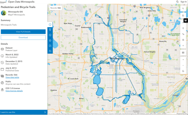
The city uses GIS mapping and analysis to prioritize these projects. Traffic analysis tools in GIS allow planners to identify high-crash areas; create designs that improve safety; and make bikeway connections to retail corridors, schools, parks, and other resources.
Planners can also prioritize roadway improvements based on equity. They use GIS to identify neighborhoods where decades of underinvestment have left residents with fewer choices for transportation compared to other areas of the city.
As a result of their detailed analysis, planners in Minneapolis have acquired other important insights.
“We know from research in other cities that cyclists spend more money in local businesses,” Schieferdecker said. “Corridors that are safer and more comfortable for pedestrians and bicyclists will mean greater health of the local economy. And when people are out walking, biking, seeing their neighbors, their friends, it’s good for their health.”
Bike-friendly policies help communities build momentum toward a mode shift. In California, legislators designated the state’s department of transportation (Caltrans) as the Active Transportation Program administrator. The program ensures that projects funded and overseen by Caltrans will be designed to provide comfortable, convenient, and connected infrastructure.
Safe Routes to Schools, a component of the Active Transportation Program, has completed more than 400 projects since 2017 to make it easier for children to bike and walk to school. Research has shown that physical activity can help improve students’ concentration. Reducing traffic around schools also makes for a safer environment. In Redding, California, new trails in the Lema Ranch neighborhood connect students to Mountain View Middle School and Redding School of the Arts.
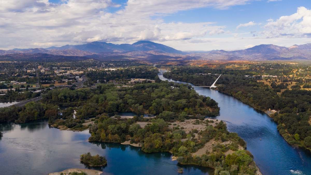
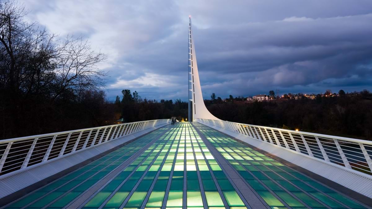
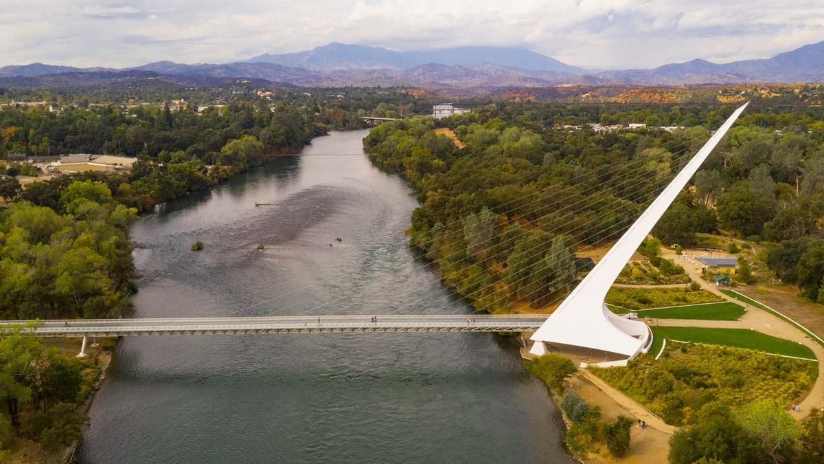
To fully appreciate the benefits of bike-friendly infrastructure, look to Redding’s Sundial Bridge. The bridge has transformed Redding’s tourism since opening in 2004, often drawing bigger crowds than the city’s downtown area.
The 700-foot structure—for cyclists and pedestrians only—crosses over the Sacramento River, offering access to the city’s breathtaking landscape. On the other side are the north and south campuses of Turtle Bay Exploration Park.
For decades, Redding has advocated for car-free transportation zones. It temporarily closed a two-mile stretch of Park Marina Drive in 2011 for an event called Shasta Living Streets. Redding was one of the first Open Streets events in Northern California. Open Streets programs are allowing people from New York City to Bogotá, Columbia, and Delhi, India, to regularly experience their city streets in a new way.
To further connect riders to notable local outdoor recreation sites and other amenities, Redding’s Bicycle Action Plan calls for adding more than 38 miles of paved, multiuse paths to the city’s 124-mile trails network. The city also plans to update 57 miles of existing dedicated bike lanes at major connection points to improve safety for cyclists of all ages.
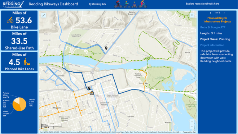
Redding provides maps of bikeways and recreational trails to help riders plan outings and learn about recreational events. The maps are enriched with data describing amenities for recreation, as well as information such as trail distance, grade, elevation, and status (open/closed).
For guidance on improving infrastructure, planners often turn to the Active Transportation Resource Center. It brings together the expertise of the California Department of Public Health and university researchers.
It’s true that cars give us freedom to travel quickly from one side of a city to the other. But now the challenge for communities is to remain viable and competitive. That means moving quickly toward more balanced, sustainable living. Those goals are closely linked with corporate recruitment and job creation. As such, a mode shift to bicycles—especially for short trips—is not only smart but necessary for communities to thrive.
Learn more about how planners use GIS to design communities that consider the human element and livability.