

November 29, 2022 |
Multiple Authors | Conservation
Every year, as summer turns to autumn, every healthy Swainson’s hawk in North America decides it’s time to fly south for the winter. They fly along the Rocky Mountains to the Great Plains and into Mexico.
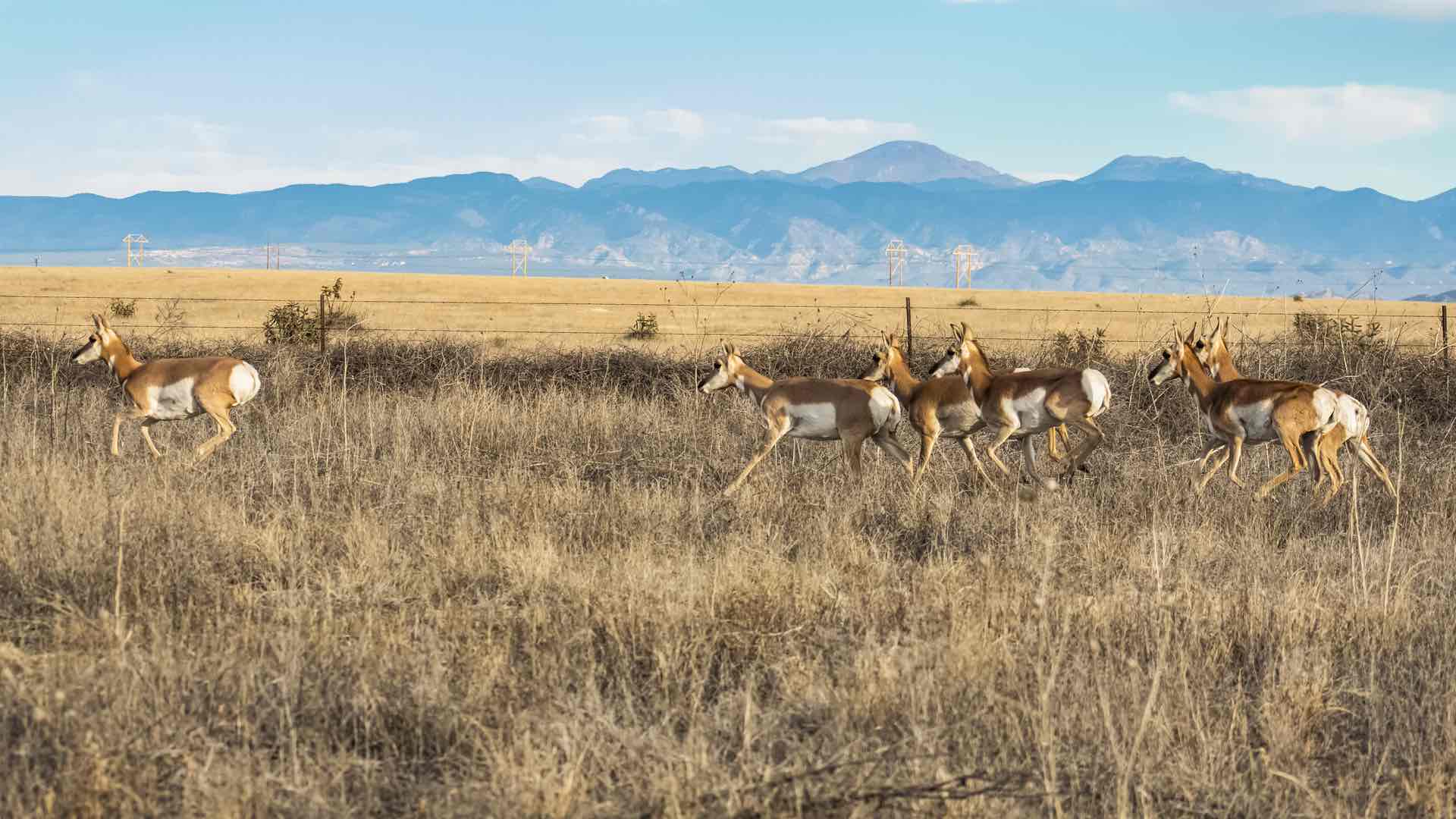
As many as six million other raptors, including ospreys, broad-winged hawks, turkey vultures, and peregrines, have the same idea, all following the same overland route. As the land narrows in southern Mexico, it creates a bottleneck effect among the birds, causing a river of raptors that begins near Veracruz.
When the landmass widens at the top of South America, many of the birds, including most Swainson’s hawks, decide to take a break to rest and refuel in Colombia. Millions of other species—songbirds, shorebirds, even some waterfowl—have the same idea.
The combination of migratory and native species makes Colombia the world’s most bird-rich nation, a haven for birders and a focal point for conservationists. Colombia has made a strong commitment to conservation and bird protection, establishing 122 national parks and 228 protected areas.
To support this work, the National Audubon Society recently released a mapping tool built with geographic information system (GIS) technology. The tool is called Alas Seguras, meaning “safe wings” in English.
Bill DeLuca, Audubon’s director of migration science, describes Alas Seguras as a “decision support system that helps users create custom maps of the important places for migratory birds and areas where investments in bird conservation can also benefit ecosystems and people.”
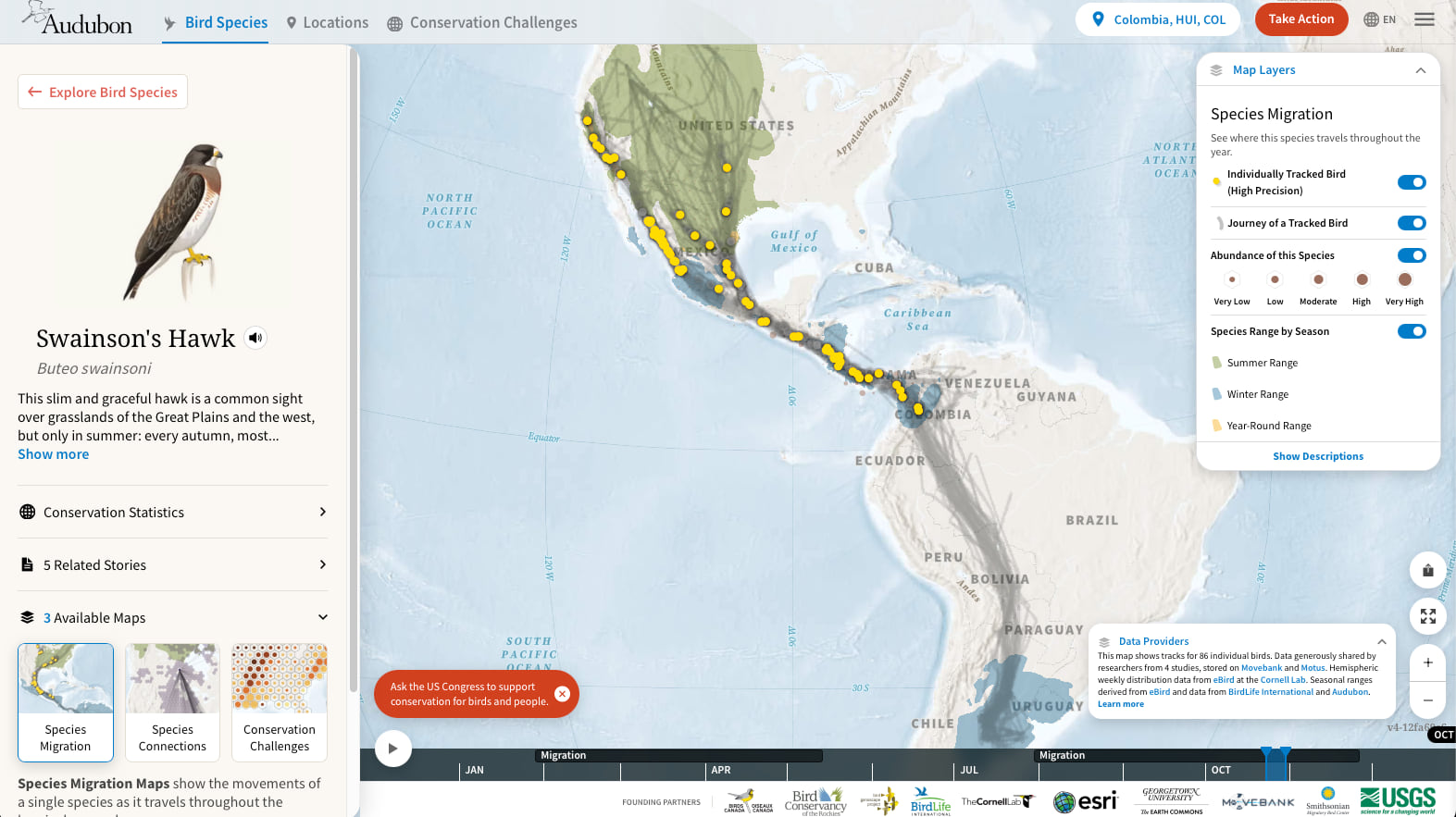
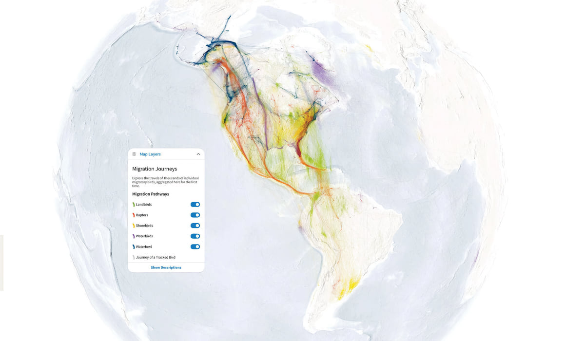
The National Audubon Society has a rich tradition of using GIS to further its mission. The organization’s visually stunning Bird Migration Explorer allows users to switch on a raptors layer to reveal the many tributaries—from as far away as Alaska—that form the raptor river. Audubon’s ArcGIS StoryMaps stories, including those about bird migration in the Americas and Swainson’s hawks range, combine maps and stories to add an emotional element to the information.
The Alas Seguras tool is a natural extension of these efforts. It’s also Audubon’s best attempt to make a map that shows the organization’s holistic idea of conservation.
Alas Seguras begins with a basemap of Colombia. On top of this map, users can select different layers, including data on specific birds, ecosystem types, forest structure, water availability, land use, and social and political boundaries.
The data reveals insights that help Audubon staff look at problem areas and decide which solutions to try first.
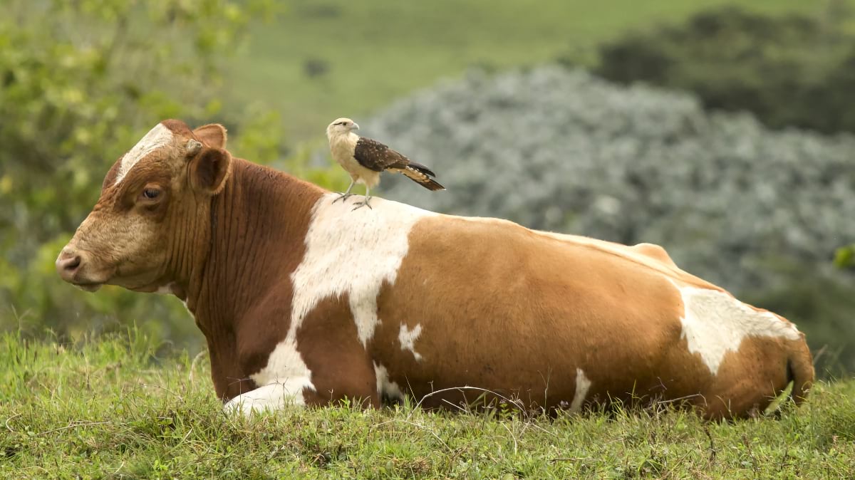
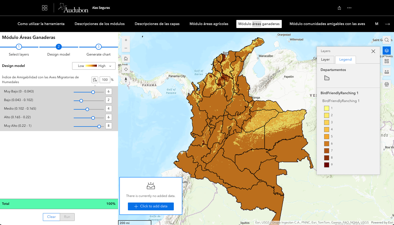
“One of our key use cases is a program we call conservation ranching,” said Christina Farber, Audubon’s director of enterprise GIS.
Many ranchers want to help with conservation efforts, especially since birding is a big part of Colombia’s economy. As the economic engine of Colombia’s ecotourism industry, birding generated US$774 million in 2016 and is expected to bring in US$2.43 billion annually by 2026.
But with private ranchland accounting for nearly 30 percent of Colombia’s total area, it’s hard to know where to start, whom to approach, and what to suggest they do. The Alas Seguras tool helps answer those questions.
“We can really demonstrate the high ecological value of different areas,” Farber said. “We can quickly access this data, combine it all, and put together visuals of where there could be bird-friendly ranching. Some steps we might recommend include changing their pesticide use or the way they handle water run-off.”
Audubon was recently contacted by someone who wanted to implement practices that increase the carbon stored in the soil; this would generate income from carbon credits as part of conservation ranching. Analysis with Alas Seguras showed where regenerative ranching practices (including rotational grazing and native grassland restoration) could help save migratory birds. Audubon used map layers to see if it was possible to promote these practices with more landowners in those areas. Audubon Americas launched the Sustainable Cattle Ranching Playbook, an illustrative publication for producers to showcase how cattle ranching can boost productivity while helping birds.
While Alas Seguras helps Audubon internally, it is designed to be used by anyone. In developing this sophisticated GIS tool, the communications team emphasized accessible information and user experience.
“There’s a very small subset of people who consider a design perspective when they’re building a GIS application,” Farber said. “One hill I will die on in the GIS world is that we need to take a product mindset when we design applications.”
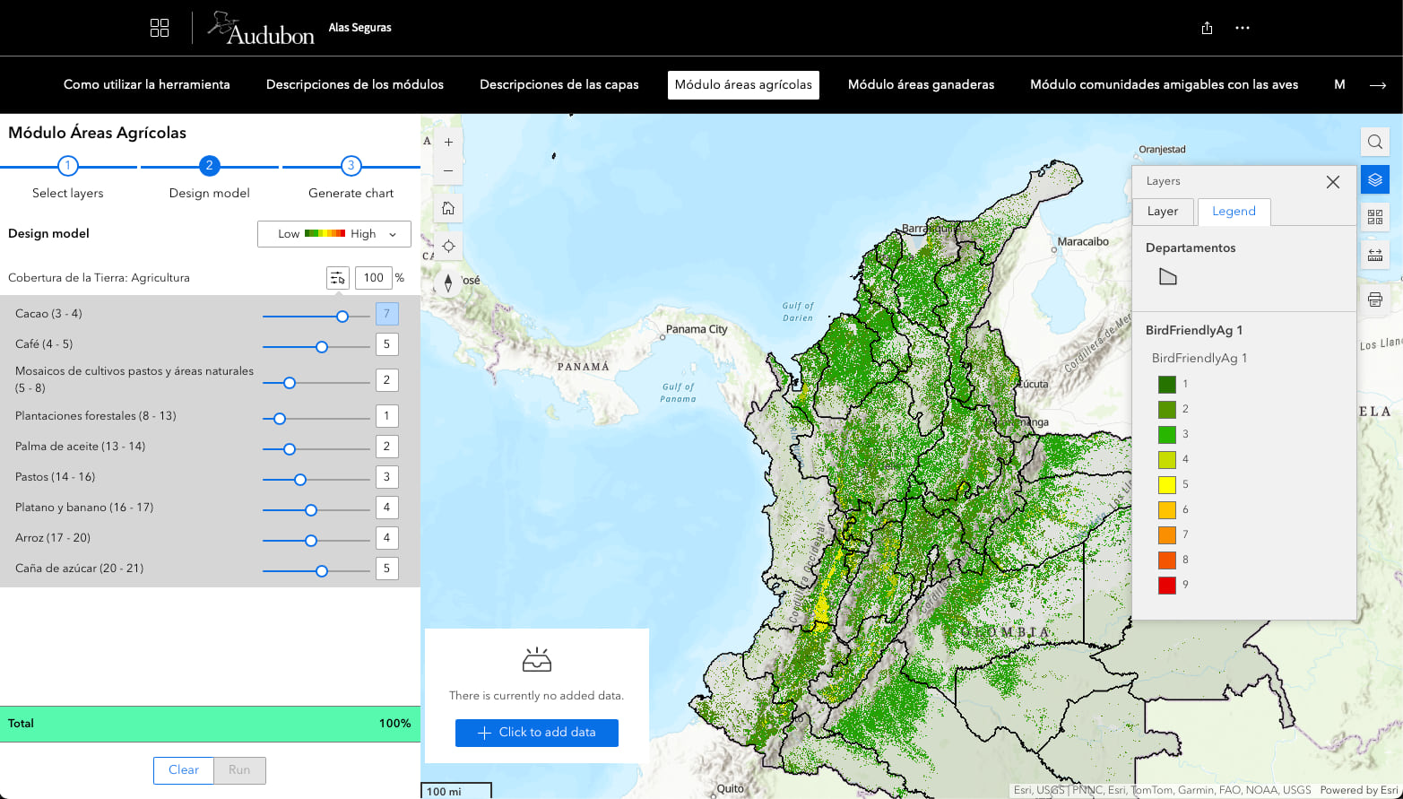
Alas Seguras focuses on four basic conservation solutions: bird-friendly ranching, bird-friendly communities, bird-friendly agriculture, and protected areas. Each solution has its own module, which users access through a common ArcGIS StoryMaps document. They are then presented with layers of data relevant to that module that they can add to a map.
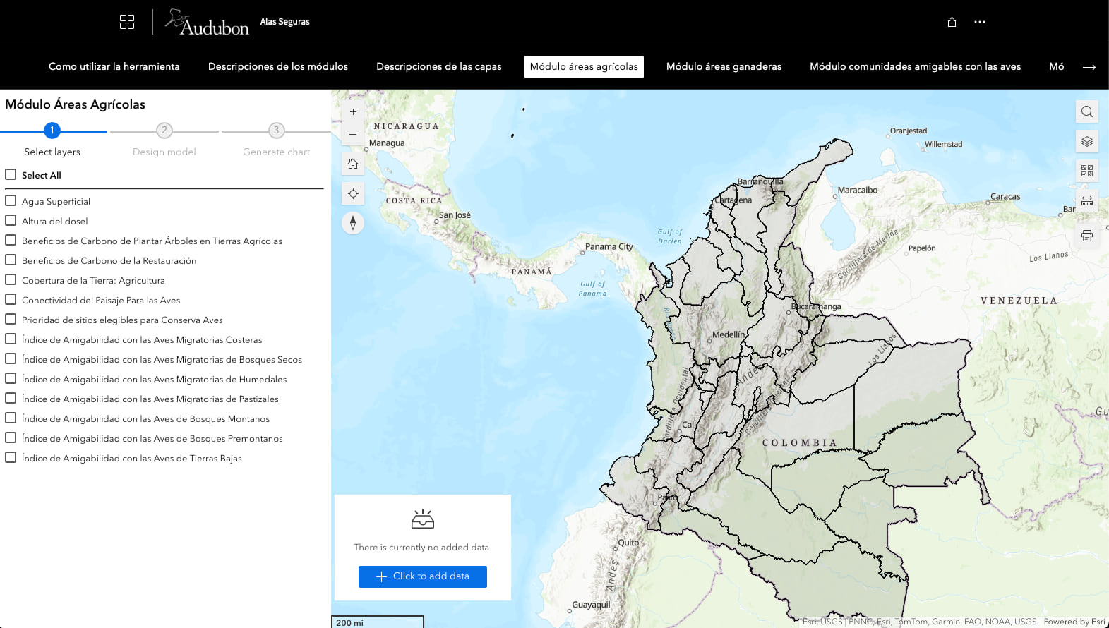
This allows novices to ease their way into the tool, rather than just being offered a single map with many layers. The custom maps that users generate become storytelling tools. The four modules are like the outlines, showing four main types of conservation solutions and letting users choose their own.
“One of the super key decisions Christina made was using the ArcGIS StoryMaps format,” DeLuca said. “It puts the solutions up front and the maps behind them, which might seem a little counterintuitive. But framing the tool helps anchor the user, who can start with an idea like ‘Hey, I’m interested in bird-friendly agriculture.’”
“When we were beginning to build Alas Seguras, we thought hard about what we wanted this tool to be,” Farber said. “That led us to the conclusion that this really is an ArcGIS StoryMaps collection. Our user stories needed to be filtered through these different decision points so that people see layers based on the type of question they’re asking.”
The result is a tool that is as high-flying and free-flowing as a river of raptors. The genius of Alas Seguras is that it offers basic categories of solutions, while allowing for an infinite number of interpretations of how to achieve them.
“Once something’s on a map, it opens up a conversation,” DeLuca added. “And I think that’s one of the really exciting things about what we’ve built.”
Ultimately, this is Alas Seguras’ breakthrough as a bird preservation tool. It turns conservation into a conversation. As bird migration connects continents with the invisible threads of flight, Alas Seguras brings together people, places, and possibilities. It invites us all to help shape a future as lively and connected as the skies above Colombia.
Learn how GIS users harness the power of maps to tell engaging stories.