December 13, 2022 |
Multiple Authors | Public Safety
This story begins with a tragedy. Five years ago, two brothers clung desperately to their capsized boat for 45 minutes in the Potomac River before succumbing to hypothermia. District of Columbia Fire and Emergency Medical Services Department (DC Fire & EMS) staff could have reached them in 35 minutes—if only they had known.
This preventable loss haunted firefighter Jeffrey Lenard. When he met Tim Hutchison, a geographic information system (GIS) analyst with DC’s Office of the Chief Technology Officer (OCTO), the two worked together on a solution.
They combined Hutchison’s GIS technology skills with Lenard’s first responder knowledge and OCTO’s government-leading GIS capability (see sidebar).
The collaboration began with a simple question: What if we could see the location of everything that matters—all at once in real time?
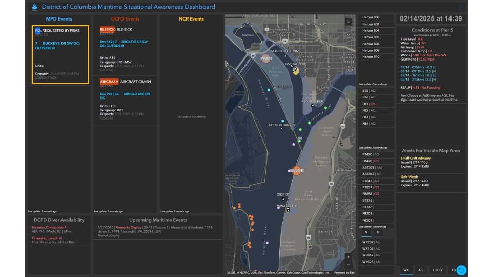
Their first creation, a maritime dashboard that gathers incident data from stakeholders along the Potomac, resolved a primary objective: to know who needed help and where. The dashboard quickly established the department’s fireboat unit as the region’s leading maritime search and rescue resource. “It puts us where we need to be,” Lenard said.
After this initial success, Lenard and Hutchison saw more opportunities to improve the department’s operational tools. “We realized DC Fire & EMS could do so much better,” Lenard says. “We started making one-off dashboards so battalions would be less frustrated and more efficient. It took off faster than we expected.”
For instance, they created the Unit Welfare Timer dashboard, which can tell supervisors if anyone on staff has been on the scene of an incident for more than 30 minutes without checking in—indicating a potential health or safety threat.
Their Rail Incident Management dashboard shows data related to incidents; access challenges; and construction updates for the Metro subway, Virginia Railway Express, Maryland commuter trains, and Amtrak.
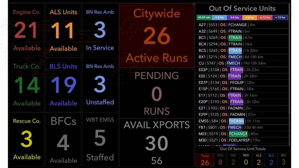
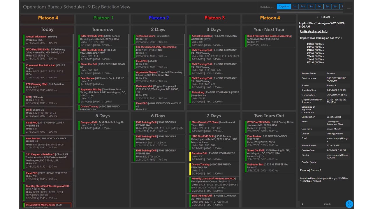
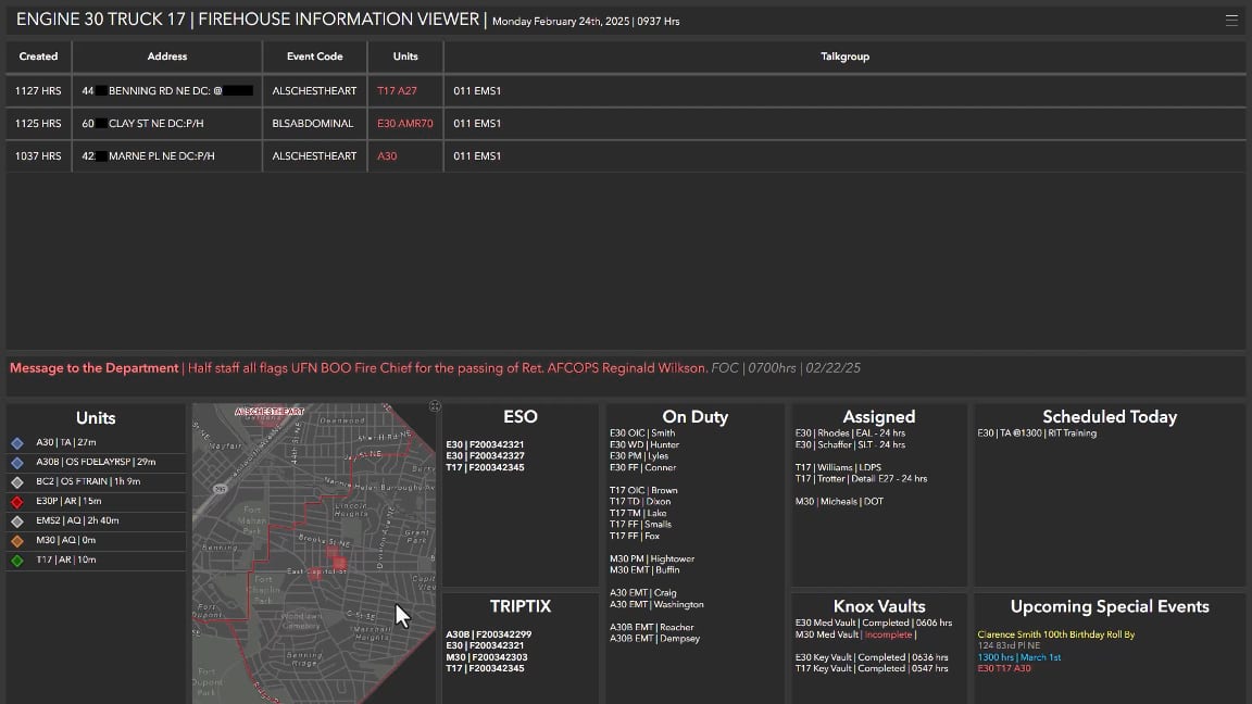
Perhaps their most significant creation is the Operational Scheduler, which gives all 33 fire stations and six battalion chiefs a comprehensive picture of resources and availability.
Before this solution, the six bureaus of DC Fire & EMS coordinated through a chaotic mix of emails and isolated spreadsheets. Battalion chiefs had no visibility into other units’ activities, creating a three-hour window of confusion every morning.
“Between 5:00 and 8:00 a.m., everyone was running around like their hair was on fire,” Lenard recalled. Now, he said, “they can’t imagine going back to the way we managed things before.”
The team has received positive feedback and can see many examples of real-world impact. “[Lenard] will send me links to incidents where our dashboards helped responders get there quickly. That makes this work worthwhile,” Hutchison said.
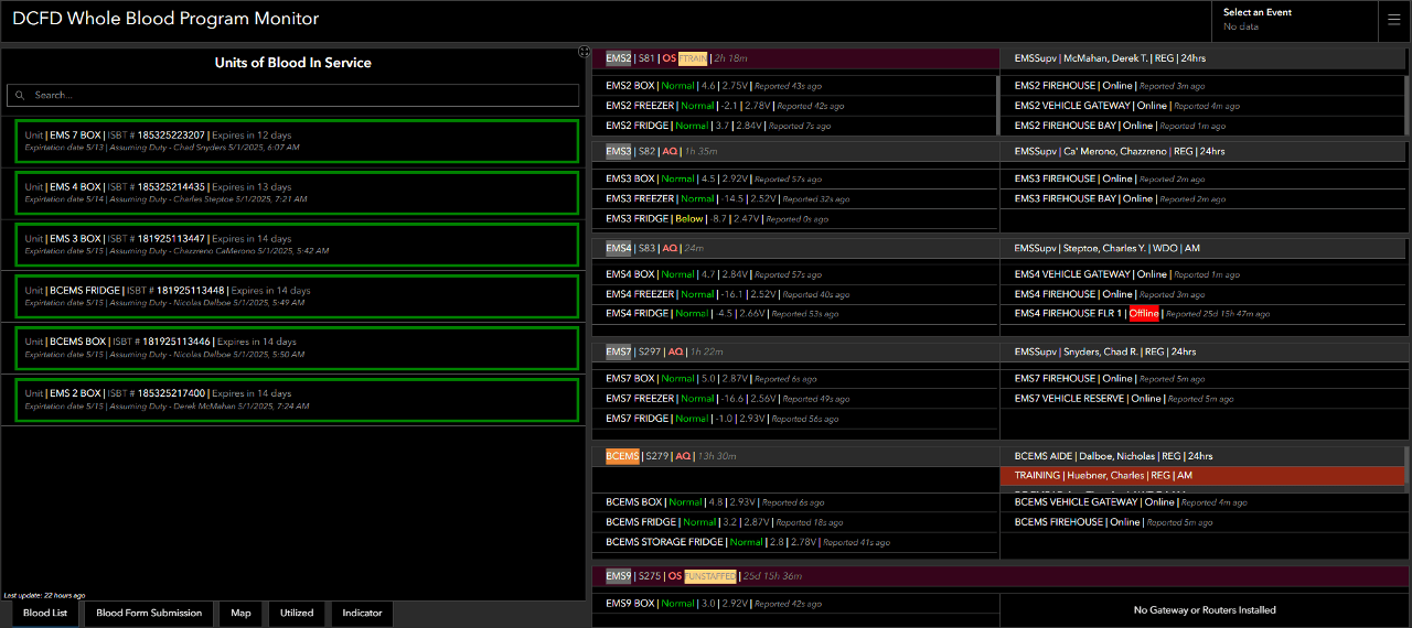
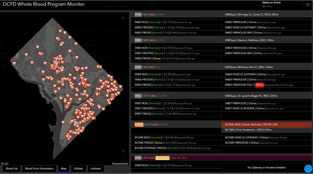
The duo’s GIS innovation extends to emergency medicine, working with EMS supervisor Holly O’Byrne to track the supply of blood needed by her teams.
“The capability of transfusing blood at the scene is new across the country, derived from battlefield medicine during the global war on terror,” Lenard said. “The survival rates increase dramatically.”
Now, the Blood Management dashboard tracks every unit of blood throughout its life cycle—from acquisition to use—documenting custody, location, and expiration status. The result is reduced waste and optimized deployment of a critical, perishable resource. Blood units nearing expiration are strategically relocated to where they are needed most.
The solution has received national attention. “Government and private sector medical agencies are coming to DC to see how we’re managing this,” Lenard said. Meanwhile, Hutchison is enhancing this solution by developing predictive analytics using GIS to anticipate when and where blood will be needed most.
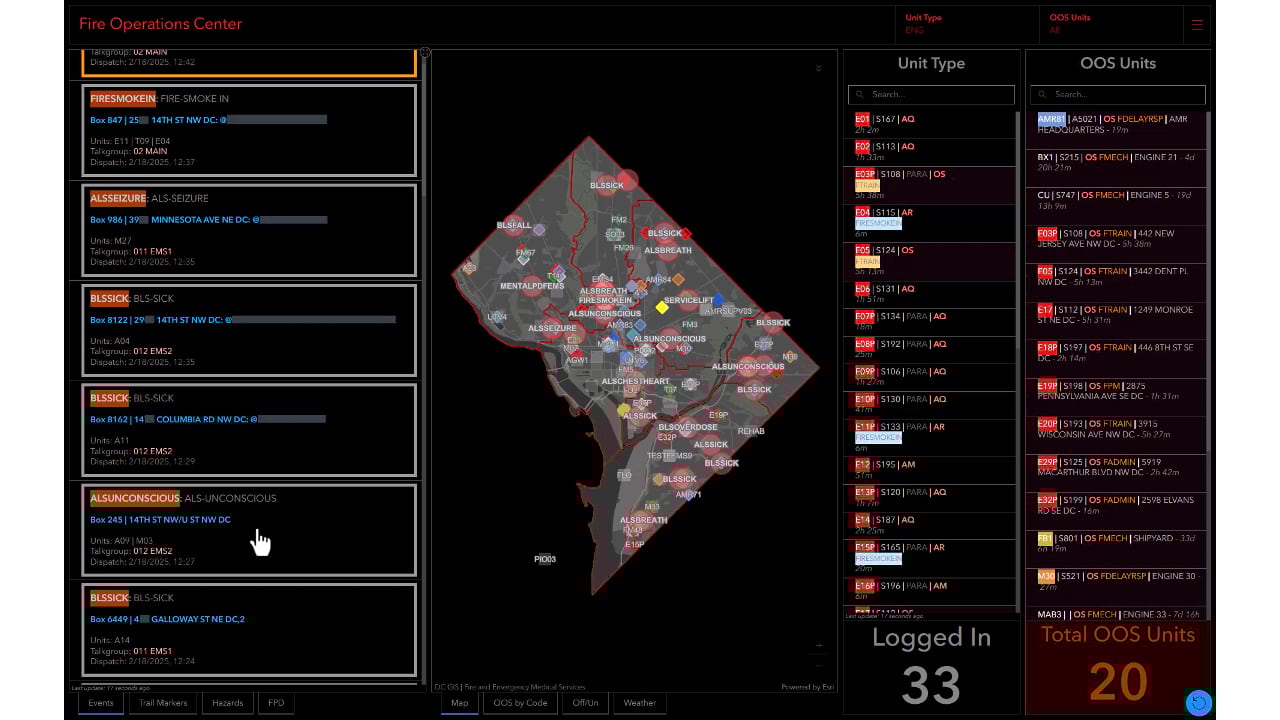
One feature that makes the dashboards effective in a place as demanding as DC is their ability to command users’ attention. Hutchison enhanced the dashboards with critical alerts that flash, change color, and emit sounds.
“When you’re in a buzzing operations center, on the phone and doing multiple things simultaneously, having that knock on the door to say, ‘Hey, pay attention!’ is a game changer,” Lenard said.
To make sure the data is comprehensive, GIS dashboards connect to other DC Fire & EMS enterprise systems, along with sensors to detect fire temperatures and sonar to see below the water’s surface.
One new program is experimenting with radio-frequency identification (RFID) technology in wearable devices to track the location and vital signs of firefighters. Lenard envisions a system where incident commanders can track personnel in real time within a 3D building visualization.
“A chief could watch as the recon group moves through a building and relay if they’re close to an exit if they need to evacuate,” he said. “That technology could save my life tomorrow.”
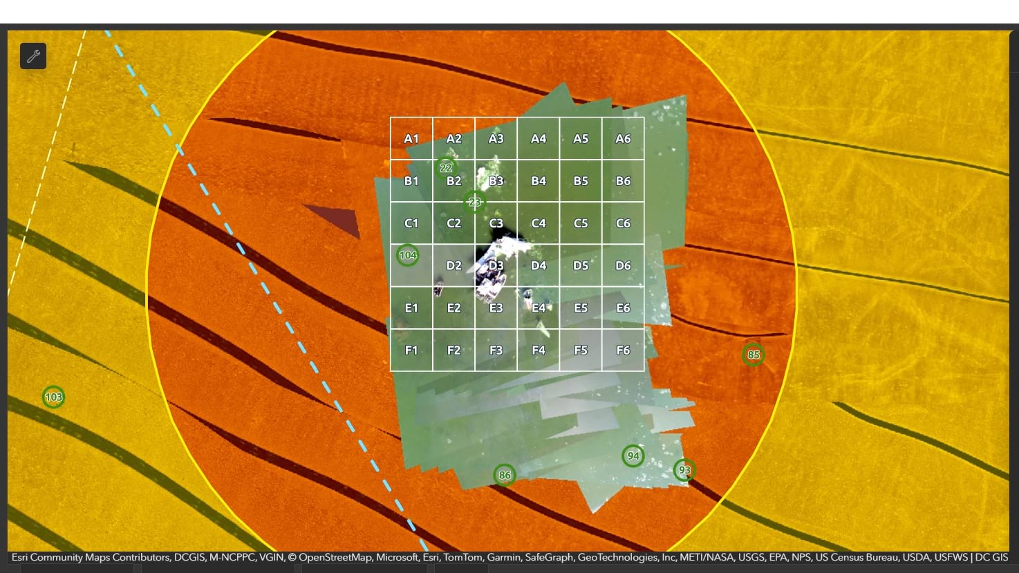
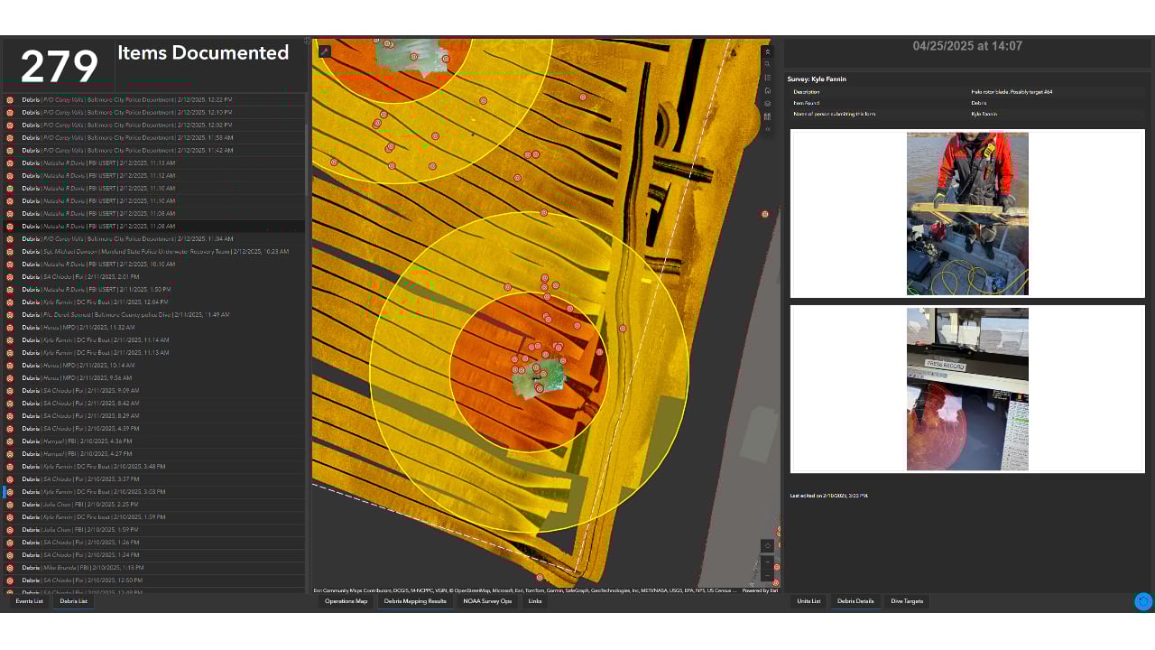
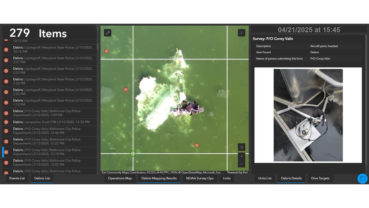
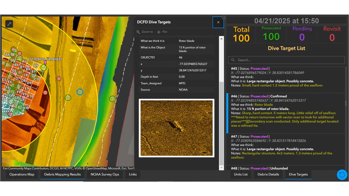
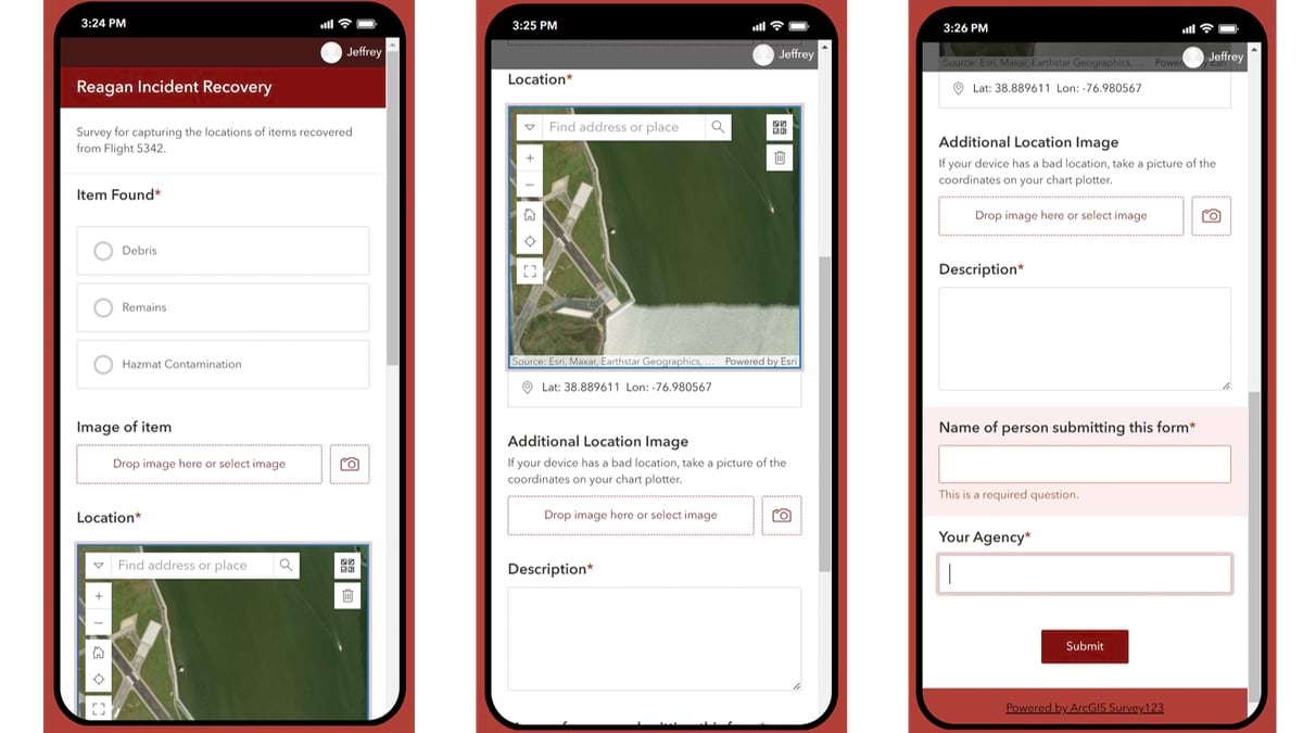
In January 2025, when 67 lives were lost in the Potomac River after the midair collision between a regional jet and an army helicopter, DC firefighters were quick to respond. The divers used an app to document their work and a dashboard was used to track recovery progress.
Using sonar technology and comprehensive underwater mapping, DC Fire & EMS recovered all 67 victims within a week despite floating ice, jet fuel contamination, and strong currents. The team was motivated to act quickly for the peace of mind of grieving families.
Lenard reflected on how the team progressed from being too late to providing an important service in response to a national tragedy. He said, “Technology is not just a tool, it’s a force multiplier that helps us do our job better.”
For Hutchison, the collaboration amplified what he called his “mission as a GIS professional to enable people to be successful with GIS.”
The two believe strongly in empowering people to do good work. Lenard talks about being team yes rather than team no and Hutchison says he is driven to find the most efficient and reliable way to accomplish goals.
Their partnership continues to save lives through smarter, faster decision-making—proving that when technology meets practical expertise, the impact is far-reaching.
Learn more about how public safety professionals keep communities safe with real-time GIS technology and solutions.