
It's not just about creating something nice. It's about making sure that it's being used to deliver projects—and that is quite a responsibility.
George Floros
Head of Digital Construction Nuclear & Power EMEA, AtkinsRéalis
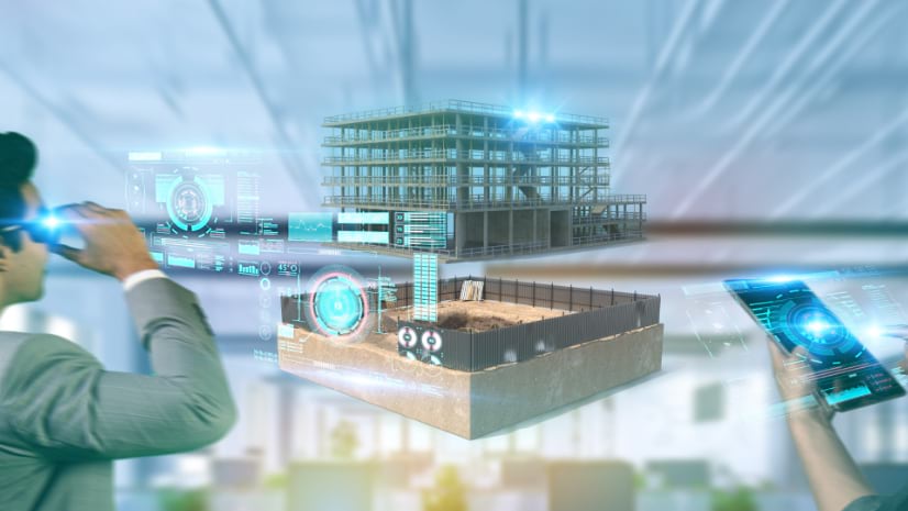
The marriage of geographic information system (GIS) and building information modeling (BIM) technologies represents one of the most significant technological advances in modern engineering and construction. What began as separate digital domains—one focused on spatial context and the other on detailed 3D modeling—has evolved into a powerful integrated approach that’s transforming how complex infrastructure projects are planned, built, and operated.
George Floros has spent over a decade at the forefront of this convergence, implementing GIS and BIM (GeoBIM) integrations across diverse sectors from aviation and transportation to nuclear energy. As associate director of Digital Construction at AtkinsRéalis, he’s witnessed firsthand how this integration moves beyond creating impressive visualizations to delivering tangible improvements in project coordination, safety, and operational efficiency.
The timing couldn’t be more critical. Today’s infrastructure projects operate under unprecedented complexity—airports must maintain 24/7 operations while undergoing major renovations, nuclear facilities require precision with zero tolerance for error, and all projects face mounting pressure to deliver faster, safer, and more sustainably. Traditional approaches that treat spatial context and detailed modeling as separate concerns are proving inadequate.
Floros’s journey has been focused on applying a systems-thinking approach to creating what he calls digital replicas of physical assets—interconnected, data-driven digital twins that capture not just the geometry of structures, but their contextual relationships, temporal sequencing, and operational dynamics. This integration is particularly powerful in sectors experiencing rapid growth and transformation. The resurgence of nuclear power, driven by clean energy demands and the massive electrical requirements of AI and data centers, presents unique challenges that benefit enormously from GeoBIM approaches. Similarly, airport infrastructure projects—operating within severely constrained environments while maintaining critical operations—rely heavily on the spatial intelligence and coordination capabilities that emerge when GIS and BIM work together.
This interview has been edited and condensed.
It's not just about creating something nice. It's about making sure that it's being used to deliver projects—and that is quite a responsibility.
Floros: It’s about moving beyond just having a 3D model of a building or structure to creating a comprehensive digital representation that includes spatial context, relationships with surrounding infrastructure, and the temporal dimension of how things get built and operate over time. Whether we’re talking about an airport terminal, a nuclear power plant, or a highway interchange, these assets don’t exist in isolation—they’re part of complex systems with intricate dependencies.
For example, when we’re working on airport infrastructure, we’re not just modeling the physical structure. We’re incorporating live traffic data, passenger flows, utility networks, access routes for construction equipment, and staging areas for materials. The GIS component brings in that broader operational context, while BIM provides the detailed engineering precision. Together, they create a platform where all stakeholders can understand not just what’s being built, but how it fits into and impacts the larger system.
Floros: Operational environments are incredibly complex because you’re essentially performing surgery on a living organism. Take airports—passengers are flowing through 24 hours a day, aircraft are landing and taking off, there are strict security protocols, and you have multiple contractors working simultaneously. Traditional approaches where teams work with separate drawings and schedules create coordination nightmares.
With GeoBIM, we can create what we call 4D sequencing—integrating the construction schedule with the 3D model and the spatial context. This allows all stakeholders to visualize exactly what’s happening when, where materials need to be staged, which access routes will be available, and how the work impacts ongoing operations. We can run simulations showing lane closures, passenger diversions, and logistics flows, then bring all the different teams together to validate the plan before anyone sets foot on site.
Floros: Nuclear is fascinating because it combines the most demanding safety and precision requirements with increasingly modular, component-based construction approaches. The industry is moving toward what’s essentially plug-and-play nuclear plants—standardized reactor designs that can be replicated across sites. This creates tremendous opportunities for GeoBIM because once you perfect the digital twin for one plant, you can adapt it for different sites while maintaining the precision and safety protocols that are absolutely critical.
Nuclear projects also have massive contextual infrastructure requirements—access roads for transporting huge components, temporary facilities, logistics coordination, and interfaces with existing power grids. The 4D capability (adding the time dimension) becomes crucial for sequencing construction activities while ensuring that specialized workforce and materials arrive exactly when needed. In nuclear, there’s zero tolerance for delays or errors, so the predictability and coordination that GeoBIM enables is invaluable.
The resurgence we’re seeing in nuclear is driven partly by AI and data center power demands. These facilities need consistent, carbon-free baseload power, and nuclear is really the only technology that can deliver that at scale. Interestingly, we’re starting to see proposals for data centers located adjacent to nuclear facilities to take advantage of that steady power supply.
Floros: The biggest challenge remains interoperability, though we’ve made significant progress from where we were a decade ago. BIM and GIS systems fundamentally model the world differently—BIM focuses on precise geometric relationships and detailed object properties, while GIS emphasizes spatial relationships and geographic context. The geometric issues have largely been solved on how to visualize and measure objects in 3D. We still face interoperability challenges where one system may label something a “wall” and another “a barrier” and when the system doesn’t adequately record the relationship between objects. Semantic intelligence is needed to make systems recognize they’re talking about the same thing, and systems need to share topological relationships (how things connect, touch, or relate to each other).
The second major challenge is systems thinking. Too often, organizations deploy GeoBIM as a standalone visualization tool rather than integrating it into their broader data landscape. The real power comes when you connect it to your enterprise resource planning systems (ERP), contract management platforms, financial systems, and operational databases. When someone can ask a natural language question about a construction activity and get back integrated information from design data, cost estimates, procurement schedules, and contract terms—that’s when you see transformational value.
Floros: I actually want to defend the construction industry here. The perception that construction workers resist change is often unfair. Change for the sake of change isn’t meaningful; change needs to deliver real value. Construction is intensely practical and physical. If you give people tools that actually make their jobs easier, faster, and safer, they’ll adopt them immediately.
The problem often lies with us as technology implementers. If we create solutions that take five minutes to load, don’t work well on mobile devices, or aren’t updated with the latest information, why would anyone choose to use them instead of proven methods? I always test the tools I design myself, and if I wouldn’t use them, I don’t expect anyone else to.
Trust is absolutely critical. You can spend years building trust in a digital system, but one incident where the information is wrong or outdated can set you back significantly. In construction, incorrect information can lead to safety incidents or costly mistakes, so reliability isn’t just about efficiency—it’s about people’s lives and livelihoods.
Floros: AI is creating new possibilities for data synthesis and natural language interaction with our integrated systems. Instead of requiring people to navigate multiple screens and platforms to correlate information, they can ask questions in plain language and get comprehensive responses that pull from design data, cost systems, contract platforms, and scheduling tools.
We’re also seeing breakthroughs in automated progress monitoring and object recognition. Reality capture technologies can now automatically identify and classify construction elements—recognizing piles of materials, tracking installation progress, and detecting quality issues. This connects beautifully with our “collect data once, use it many times” philosophy. A single drone flight can capture information used for stakeholder engagement, design review, progress monitoring, and quality verification.
Looking ahead, we’re developing what we call intelligent project delivery, with augmented reality. This involves workflows where field workers can raise issues, conduct inspections, or access information through immersive interfaces [such as VR headsets] connected to the integrated data environment.
Floros: Start with a systems thinking approach rather than viewing GeoBIM as a standalone tool. Understand how it fits into your broader information management processes and data landscape. Second, ensure your underlying data quality and information management processes are solid—the best technology in the world can’t compensate for poor data governance.
Most importantly, focus on solving real problems rather than creating impressive demonstrations. Talk to the people who will actually use these tools daily. Understand their workflow challenges and design solutions that genuinely make their work easier and more effective. If you can’t demonstrate clear value to end users, the technology will never achieve its potential.
The construction industry is ready for these tools—they just need to work reliably and solve real problems.
Learn more about how architecture, engineering, and construction professionals use GIS alongside BIM to better plan, design, build and operate infrastructure. Learn more about how ArcGIS GeoBIM connects to Autodesk Forma (formerly Autodesk Construction Cloud) to collaborate from initial design through to operations.