April 17, 2020 |
Christopher Thomas | GIS for Good
One of the strongest measures communities can take in the fight against coronavirus disease 2019 (COVID-19) is the collective ability to shelter, but many people across the US do not have a place to shelter, creating greater risk for them and others.
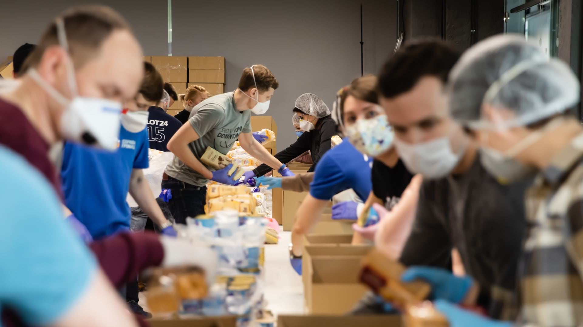
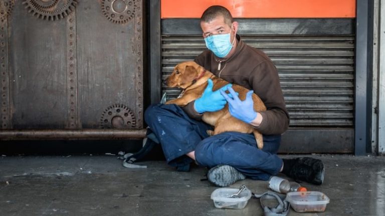
Although city and county officials have necessarily put on hold many everyday concerns while they address the COVID-19 pandemic, the ongoing plight of homelessness still demands attention. Outreach organizations have worked to address the immediate needs of the country’s homeless population—distributing hygiene kits and tents, organizing sanitation stations, and finding creative temporary shelter solutions.
Many agencies are finding pandemic-related solutions in the geographic information system (GIS) technology they already use for locating vulnerable populations and communicating across departments. As the battle against COVID-19 goes on, these agencies are relying on GIS to help manage and mitigate the impact of the virus on homeless residents.
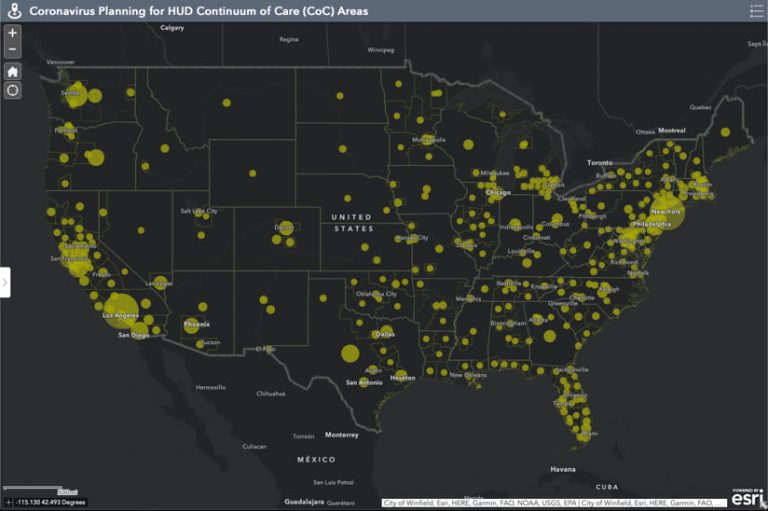
Counties and cities across the US work together with maps and apps to address the needs of the homeless. They use GIS to find and quantify concentrations of homeless people for the US Housing and Urban Development Agency’s Point-in-Time count that takes place on a single night in January every year.
This groundwork allows city, county, state, and federal officials to assess where resources are needed, and to organize outreach efforts near camps where the homeless gather. Since the onset of the COVID-19 crisis, officials have also used GIS to track potential and confirmed cases across known shelters.
Awareness of infection rates in shelters across a county gives officials the data they need to make decisions, such as how many quarantine spaces will be needed, and how to allocate supplies and other resources.
This GIS data collection and mapping work carries other outbreak-mitigating implications as well. One of the many challenges facing unsheltered residents during the crisis is the sudden unavailability of public spaces. On an average day, a person without a home might use libraries, fast-food restaurants, public parks, and similar places for sanitation and hygiene purposes as well as for shelter from inhospitable weather.
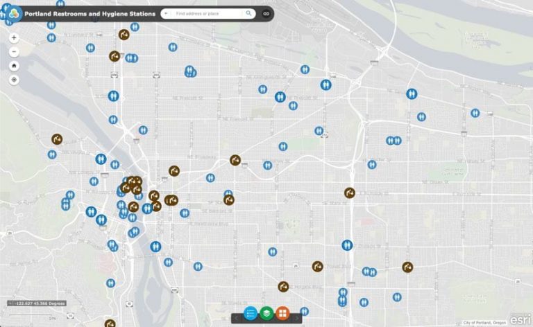
With most of these places closed, city and county officials are using location intelligence to map concentrations of homeless people against public spaces to determine where to put sanitation stations. Placing hand-washing stations and portable restrooms where homeless residents stay solves a pressing problem for a population that lacks mobility.
Staff at the City of Portland, Oregon, created a publicly accessible interactive map of portable restrooms and hygiene stations across the city. Hygiene stations deliver the most basic virus-prevention tools to the homeless—the ability to regularly wash their hands.
Connecting homeless people and families in need with services, shelters, and health care is a constant challenge that’s made harder by the COVID-19 crisis. Counties already use GIS maps, apps, and dashboards to reduce homelessness. Similar maps and dashboards support planning additional shelters and services, such as food banks.
As many homeless shelters operate at capacity, they must reduce occupancy to follow social distancing recommendations. Most shelters arrange beds close to each other to host as many people as possible. The mandate to keep six feet of space between occupants, combined with the need to quickly provide housing for as many people as possible, is forcing many cities to adopt unconventional solutions.
In San Diego, California, a city with one of the largest homeless populations in the country, officials made a bold move. To help vulnerable residents find shelter while achieving social distancing, the city adapted the massive San Diego Convention Center and the Golden Hall in the San Diego Concourse with beds, showers, laundry services, and health screening, among other accommodations.
In Boston, Massachusetts, a Suffolk University dormitory is being similarly repurposed, while the Boston Convention Center is transitioning to temporary use as a field hospital. Another innovative and well-publicized approach is the use of vacant motel and hotel rooms for housing and quarantining at-risk homeless people.
Local authorities and agencies use GIS maps and analysis in examining hospitality and event facilities to understand their availability and capacity. The technology also helps pinpoint potential locations for new shelters and isolation spaces, coordinate the distribution of beds and supplies, and keep up to date on progress.
Agencies dedicated to safeguarding the welfare of homeless people use data-driven, location-specific maps and dashboards to respond in swift, targeted ways. These GIS applications will improve services and outcomes for vulnerable populations now and into the future.
Learn about the many GIS solutions that health and human services agencies deploy to reduce homelessness.