

January 9, 2025 |
Adam Carnow | Infrastructure
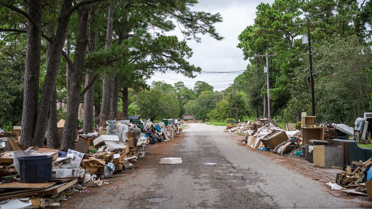
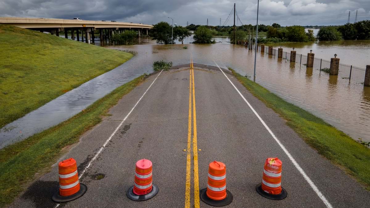
When Hurricane Beryl slammed into Houston, Texas, in July 2024, it tore through a city already weary from a series of natural disasters. Once again, the growing city’s aging infrastructure was strained. Roads flooded. Trees and power lines collapsed.
Home to more than 2.3 million people, Houston is the fourth-largest city in the country. The city relies on 4,000 Public Works employees to keep critical infrastructure running through numerous natural challenges compounded by its large size, flat terrain, and coastal proximity.
Public works uses a powerful combination of modern technologies to maintain the city—including an enterprise geographic information system (GIS), artificial intelligence (AI), and high-resolution imagery.
On a daily basis, the department uses GIS to keep the city’s water, wastewater, and transportation infrastructure systems running. Its GIS is kept up-to-date with information on all assets across these systems including asset location, condition, maintenance schedule, and history.
“Houston is a beast. We have a lot of old infrastructure, and we always need to know where our assets are located,” said Michelle Sparks, a programmer for Houston Public Works. “Knowing the location and status of assets helps us respond quickly and efficiently.”
During an emergency, its staff become critical first responders working out of the Houston Emergency Center. They keep field crews and command center managers updated on current conditions via GIS maps to ensure swift and coordinated responses.
Recently the department added another advantage to its modern tech platform—outfitting its fleet of vehicles with GPS equipment. That GPS data streams into GIS apps via ArcGIS GeoEvent Server for real-time situational awareness. Managers can see the locations of trucks and crews on shared maps.
“During an event, we deploy a dozen or so dump trucks which are strategically staged around the city to support high-water rescues when it floods, with benches in the back,” said Anthony Powell, interim IT assistant director for Houston Public Works. “It’s exciting to see where they are located, and we can direct them as they move around.”
In emergencies, public works feeds its GIS maps with real-time data from sensors and rain gauges to guide the number and placement of trucks and crews in flood-prone areas. Supervisors can assign work orders to the closest field crews, enhancing response times and coordination.
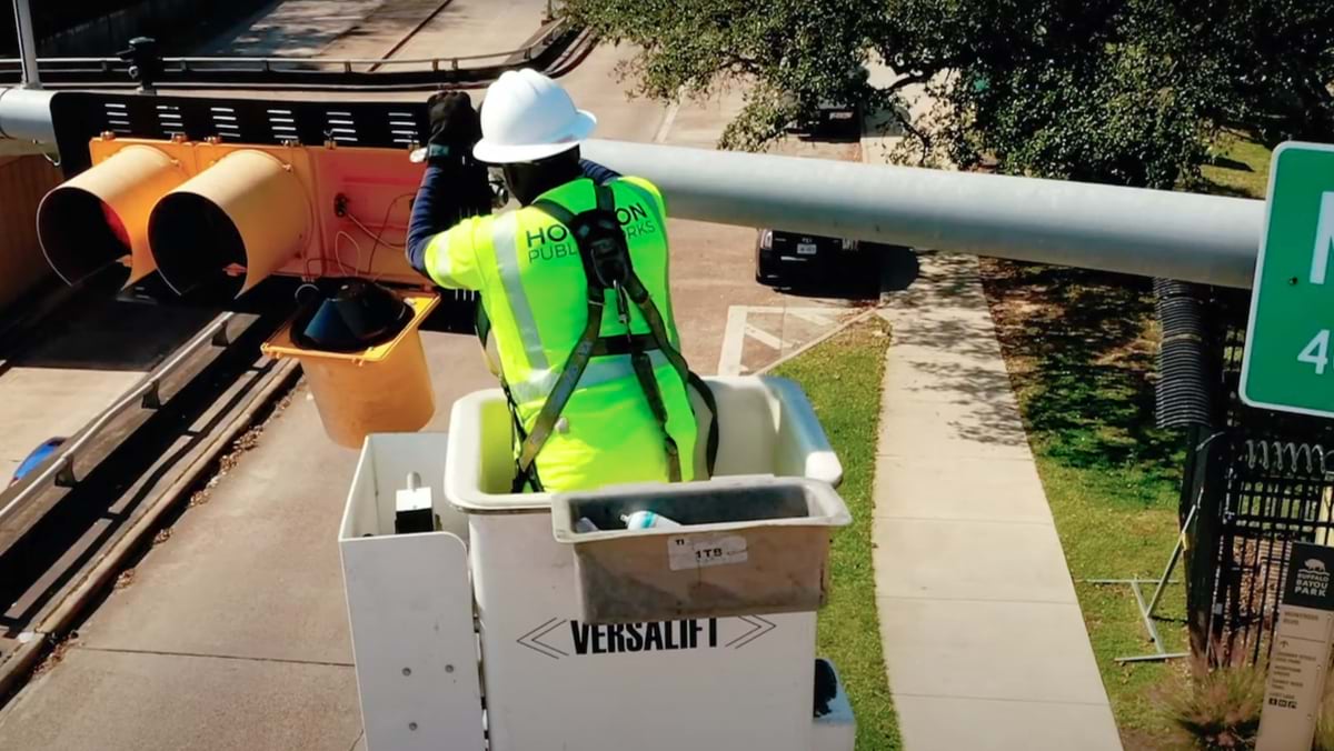
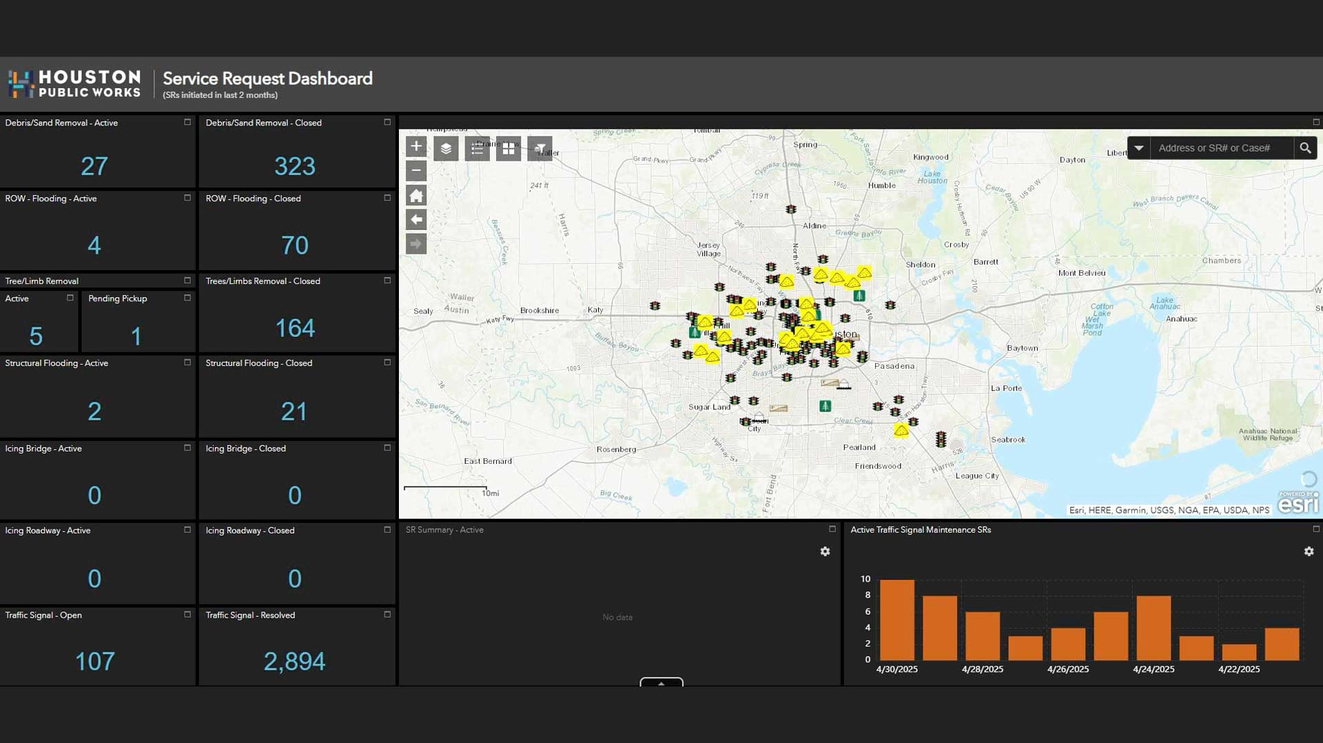
A GIS dashboard displays additional real-time updates, such as signal outages, traffic conditions, tree limb removal progress, and alerts from calls to 311. The shared GIS web maps and dashboards keep everyone informed—whether it’s city crews or staff from one of the thousands of companies that the city contracts with to conduct work. This degree of situational awareness and data accuracy amounts to a next-generation level of public works.
In Powell’s 20-year career with Houston Public Works, he has witnessed and helped bring about many digital transformations, guided by the application of GIS technology.
Today, the department applies GIS to all operations. But when Powell started as a GIS contractor decades ago, the processes were largely paper based.
Powell played a crucial role in mapping the city’s extensive utility pipelines—over 6,000 miles for wastewater, and over 7,000 miles for water distribution. This effort led to the creation of the city’s GIS platform known as Geographic Information Management Systems (GIMS), which made utility information available online for the first time.
“I was part of helping establish that, and it was a big game changer for everybody at the time, specifically for field crews,” Powell said.
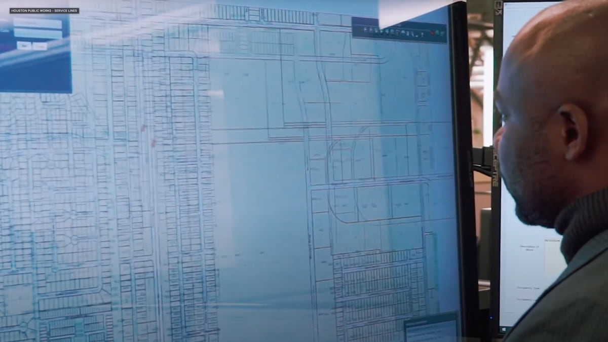
Before GIMS, field crews didn’t have direct access to up-to-date information. If they needed to see an engineering plan or drawing, they would have to visit a file room, request the file, and make a copy to take with them.
“We created a big grid system and plotted out map books for the field staff, and they loved it,” Powell said. GIMS allowed each truck access to the drawings that showed the location of the infrastructure field crews needed to maintain, saving them time because they didn’t have to request paper documents.

Houston’s early GIS modernization paved the way for a shift from paper-based map books to real-time data moving from the field to the office. This has been possible with an enterprise GIS approach strengthened by cloud computing.
A 2021 tropical storm accelerated Houston Public Works’ shift to the cloud—11 inches of rain fell over a nine-hour time span, flooding Houston’s downtown and critical city facilities. Lack of access to crucial data hamstrung the public works department.
“We struggled to provide the simplest map requests for the directors. We couldn’t do anything,” Powell said.
Now, using GIS in the cloud reduces the department’s risk of going offline and gives its staff greater flexibility.
Houston’s stormwater infrastructure includes over 4,000 miles of underground storm sewers, 2,800 miles of open roadside ditches, and more than 900 miles of channels. To better manage it, the public works department first worked to understand it.
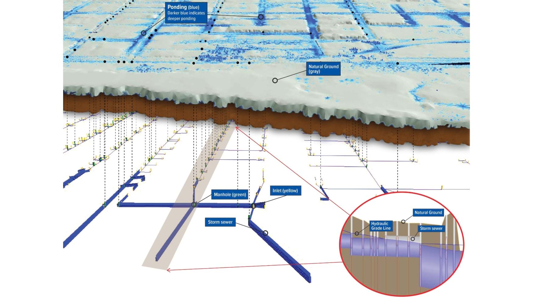
Staff partnered with an engineering firm, using advanced GIS modeling to help predict how water will move through the city during heavy rains or floods. The flood model uses precise measurements of underground structures, including stormwater assets and culverts, captured via mobile GIS applications. It integrates data from as-built plans, field observations, and city records.
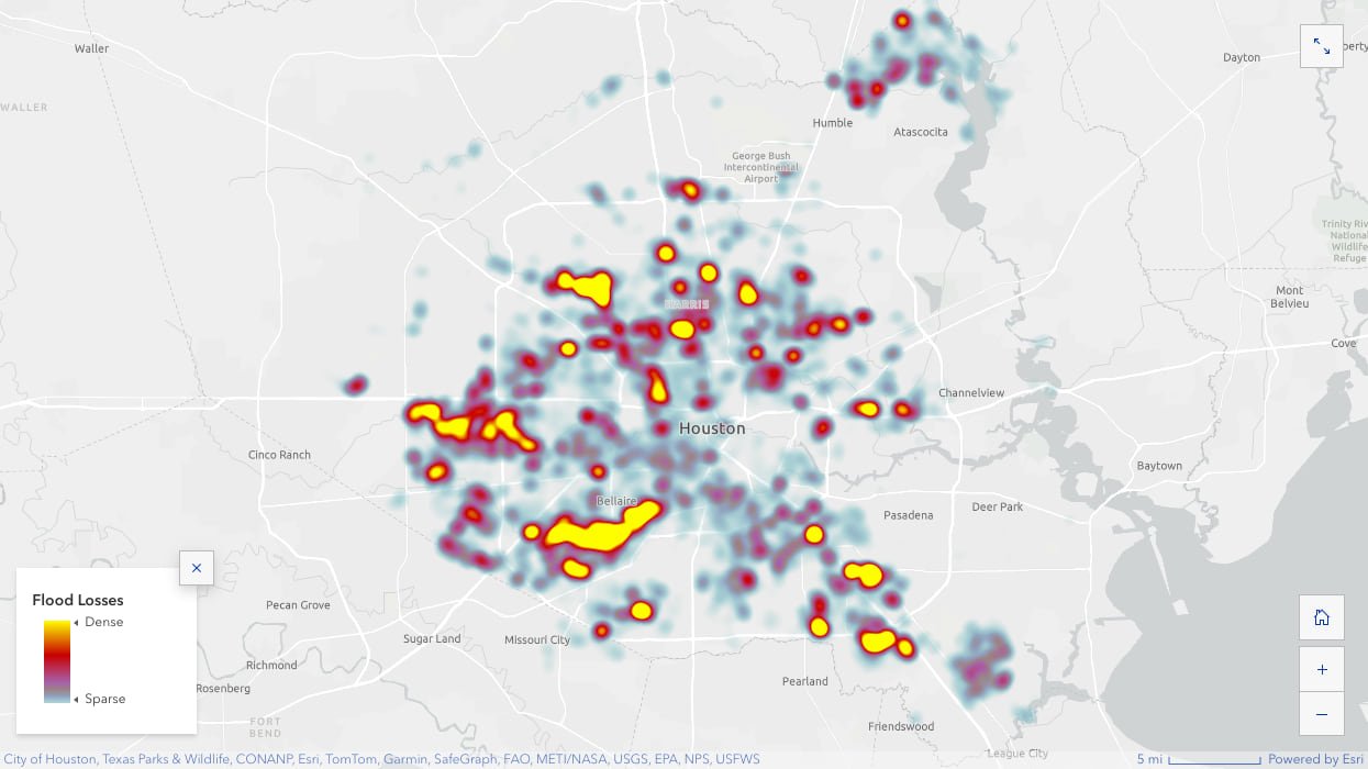
Now, these models reflect the capacity of each asset in the stormwater system. Houston Public Works can predict and see exactly how and where rainfall or flooding will impact communities.
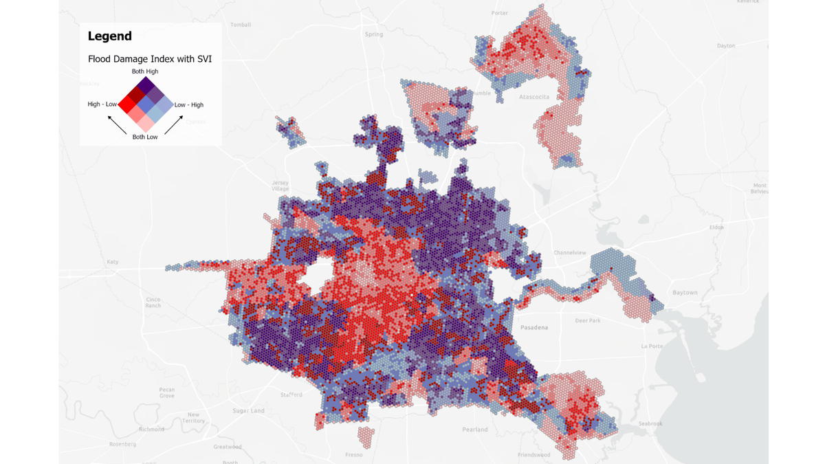
Currently staff are preparing reports on the flood model’s effectiveness for the Houston Public Works director to review and approve its future use. Once approved, city staff will call upon these models to better understand flood patterns and prepare for and respond to water-related emergencies. They will also be able to identify areas where vulnerable populations are especially affected by floods, ensuring that resources are directed to those most in need.
By 2023, the department’s full embrace of cloud and GIS technologies extended beyond natural disasters, driven by both the need for remote work and the evolving tech landscape.
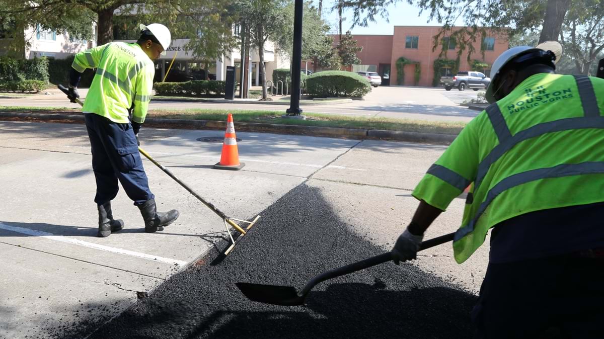
One of the first successes in this transition was the application of cloud and imagery capabilities to Houston’s extensive road network. Spanning 16,000 lane miles, it’s equivalent to more than six round trips between Houston and New York City. These roads are lined with millions of traffic signs and pavement markings that require regular maintenance to ensure motorist safety.
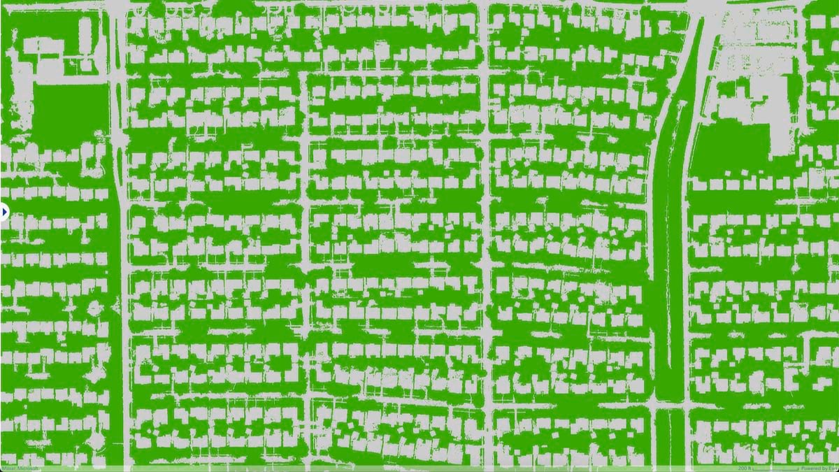
The public works department uses a GIS-based asset management system to maintain these roads and track changing conditions. Recently, the city—along with Harris County—partnered with Cyclomedia, a company that drives the roads, captures video, and applies AI to quickly provide assessments.
“They have the logic built into their models to accurately identify, extract, and provide a condition assessment of each extracted asset,” Powell said. He added that Cyclomedia staff “were able to tell us not only, ‘This is a stop sign,’ but also ‘It’s bent over.’”

Powell estimated it would have taken public works crews more than 10 years if they visited each sign and recorded its condition. With AI, they had the condition assessment back in months and could focus on making any necessary fixes to signs and other road assets.
Another area of focus for Powell has been water and wastewater workflows where he has applied digitization deliverables to reduce costly work duplication.
“The contractors were conducting the work digitally, whether in AutoCAD or GIS, and then we had our internal staff re-creating it in GIS,” Powell said. “So, we created a template for the contractors that minimizes that rework and automates the review process.”
Now every time a project is complete, the data is uploaded, and an email notifies reviewers to verify the work. The city benefits by speeding the flow of accurate, up-to-date data about assets; the contractor gets rapid feedback about whether their work meets requirements; and city workers are freed to focus on infrastructure challenges.
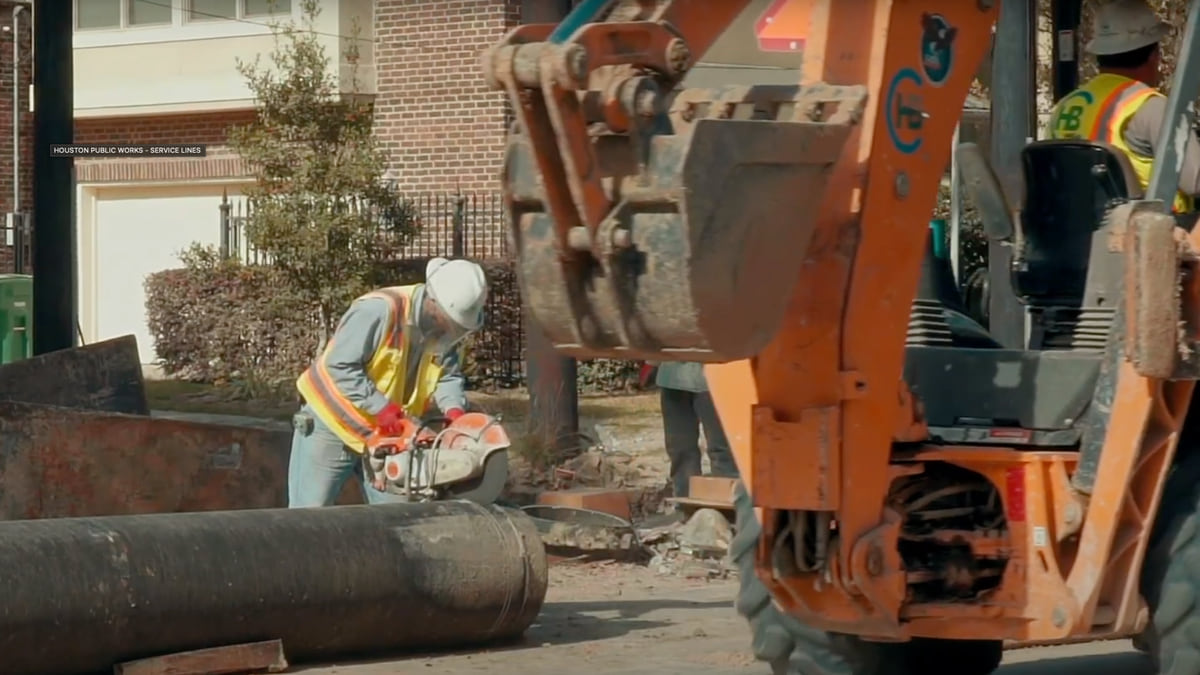
Streamlining these workflows helps improve data quality for some of the hardest assets to maintain—those that are underground. There is no technology yet that can easily measure underground asset conditions, but Houston has adopted new tools to better understand its complex networks.
The department’s transition to ArcGIS Utility Network has been a key part of this modernization. The new system enhances visualization, management, and analysis of utility data. By capturing networks in 2D, it provides detailed insights into where pipes are located and how deep they are buried. Enabling new features like network tracing will help staff not only quickly identify problem areas, such as water leaks, but also better plan and design expansions.
When there is a leak, Houston Public Works’ Drinking Water Operations Branch staff can troubleshoot issues more easily, such as quickly pinpointing which valve to turn off and where it is located. This enhanced level of detail helps the city protect public health and the environment while significantly improving customer service.
To further support residents, public works staff have created GIS applications such as the Water Service Line Inventory Map. The map shows where lead lines are being systematically replaced due to harmful health effects. Customers can see and report on the material in their water service lines, whether it’s lead, steel, copper, brass, or plastic.
Making the city’s asset condition data available to the public for editing—in the same way field crews make updates—creates a force multiplier for the city. Crews can prioritize visits to lead line locations to make these important replacements.
In January 2024, a new mayor and a new public works director took office. The new city leaders made the decision that it was time to break down the information silos between the public works business units, starting with a consolidated GIS team.
The reorganization brings together mapping experts from across departments. The aim is to better align staff’s GIS knowledge and skills, improve efficiency, enhance data reliability, and remove work duplications to better serve the residents of Houston.
As Houston continues to grow, the city’s public works department will keep striving to upgrade aging infrastructure and maintain resilience against natural disasters.
“One big area of focus for the reorganization is to keep a good handle on the growth and development,” Powell said, “because growth impacts our streets, drinking water, and storm water infrastructure.”
And Powell will continue to advocate for GIS solutions that will help the city adapt to changing conditions.
“It’s never a dull moment,” Powell said. “There’s always an area where we can implement some type of GIS solution. It’s endless because we touch so many facets of life that contribute to the well-being of our community. We’re just so big.”
Learn more about how enterprise GIS helps public works and engineering professionals improve municipal maintenance.