October 17, 2023 |
David Gadsden | Conservation
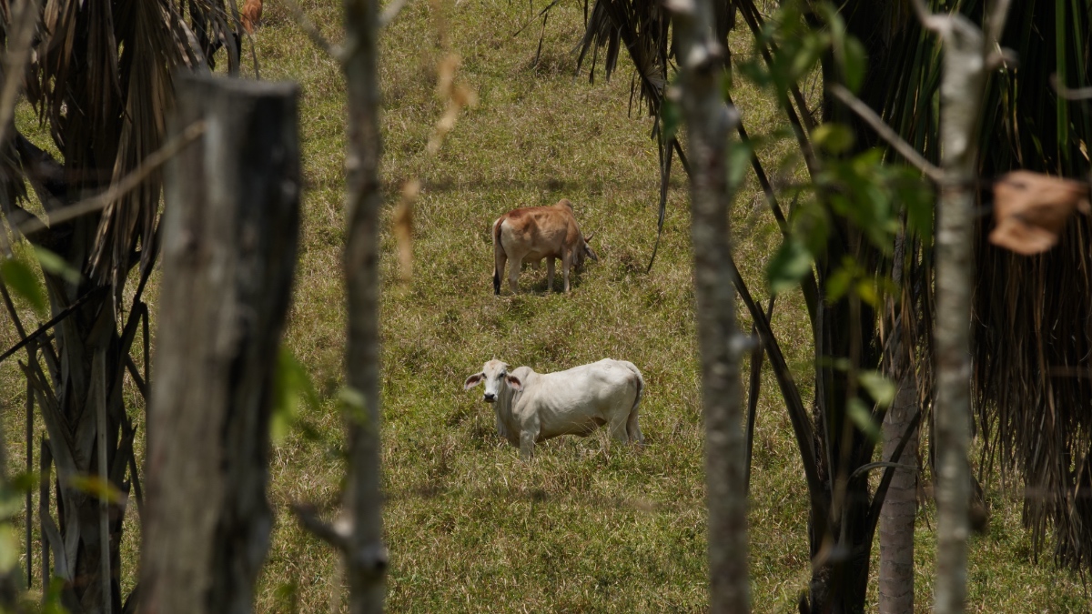
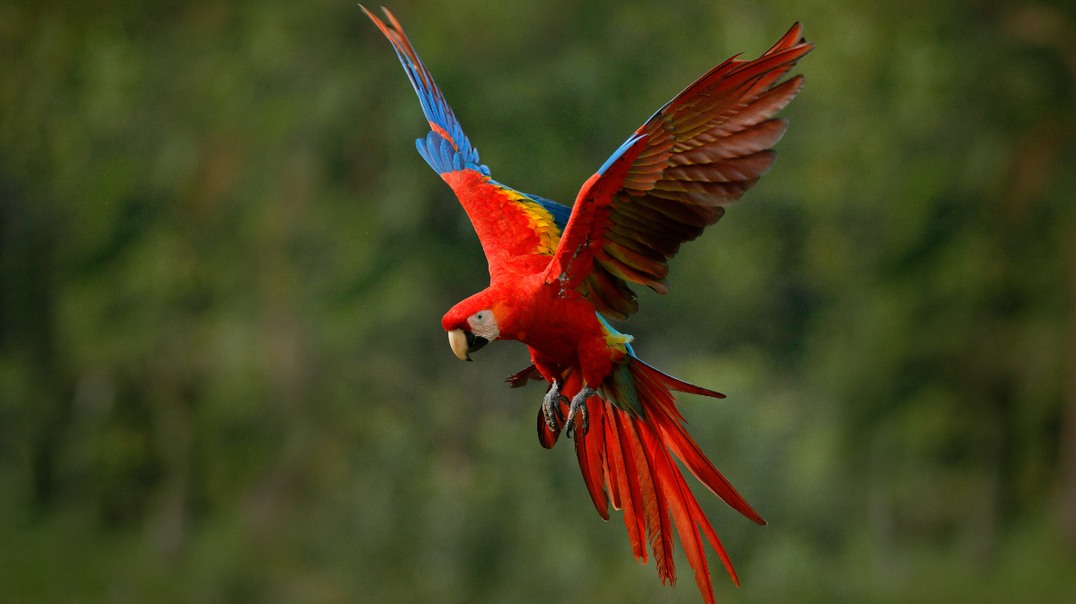
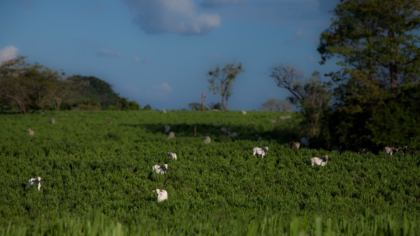
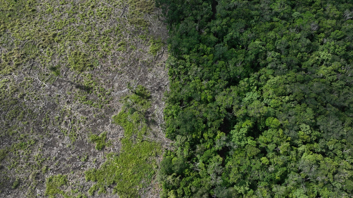
For decades, illegal cattle trafficking has driven deforestation across Central America, breaking once-continuous forests into isolated patches and cutting the wildlife corridors that biodiversity depends on. Criminal networks clear land, introduce cattle to claim territory, and move 800,000 head of cattle annually through protected areas and indigenous territories—devastating habitats that such endangered species as jaguars, tapirs, and scarlet macaws depend on for survival.
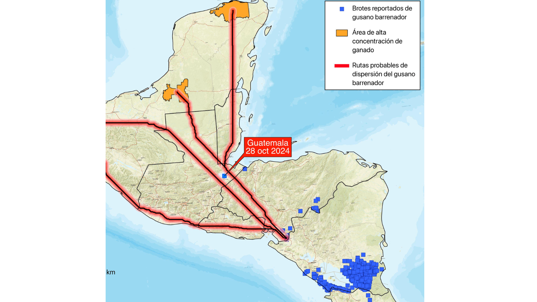
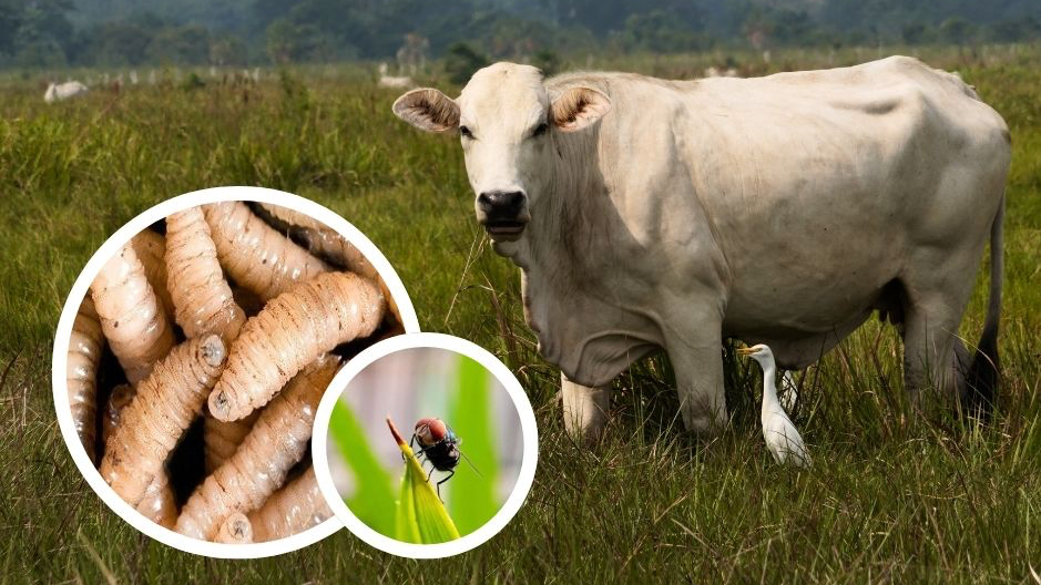
Now, the same criminal network spreads something deadlier: a flesh-eating parasite called the New World screwworm. The blowfly larva can infect any warm-blooded animal including humans. It has traveled north from Panama along cattle trafficking routes to within 70 miles of the US border and cost Mexico US$1.3 billion in lost cattle exports.
For conservationists like Jeremy Radachowsky of the Wildlife Conservation Society, this crisis presents an unexpected opportunity. “If people can’t be convinced to protect these forests for environmental reasons, do it for any reason, and we’ll be happy about the positive impacts,” Radachowsky said, who directs WCS’s Mesoamerican and western Caribbean programs.
The screwworm outbreak is forcing governments to take action against narcotrafficking networks that conservationists have fought for years.
This convergence of environmental destruction, organized crime, and public health crisis forced WCS to transform its monitoring approach. Conservationists first recognized the pattern of illegal ranching in Mesoamerica in 2007, and it has grown in volume and impact since then.
Now, WCS operates a network of field camps positioned every 10 kilometers along the agricultural frontier in Guatemala’s Maya Biosphere Reserve. Each camp serves as a monitoring station where patrol teams track forest incursions in apps that integrate observations on a shared map using geographic information system (GIS) technology. Satellite internet changed everything.
“It’s only been recently that we’ve gotten any kind of communication out there, and it’s made a difference,” Radachowsky said. Field teams can now alert authorities immediately when they spot illegal cattle drives entering protected areas.
In Central America’s dense forests, you can’t see far. Technology helps these field teams extend their view and gather evidence. WCS uses aircraft with mounted cameras to conduct cattle density estimates across vast landscapes. Drone imagery provides high-resolution local observations. WCS is also deploying AI-powered acoustic monitoring devices—technology that triangulates sounds to pinpoint where illegal activity is happening.
“The sensors detect gunshots, chainsaws, and other human activity,” Radachowsky said. “They give us a better estimate about what’s going on in different places, especially remote areas.”
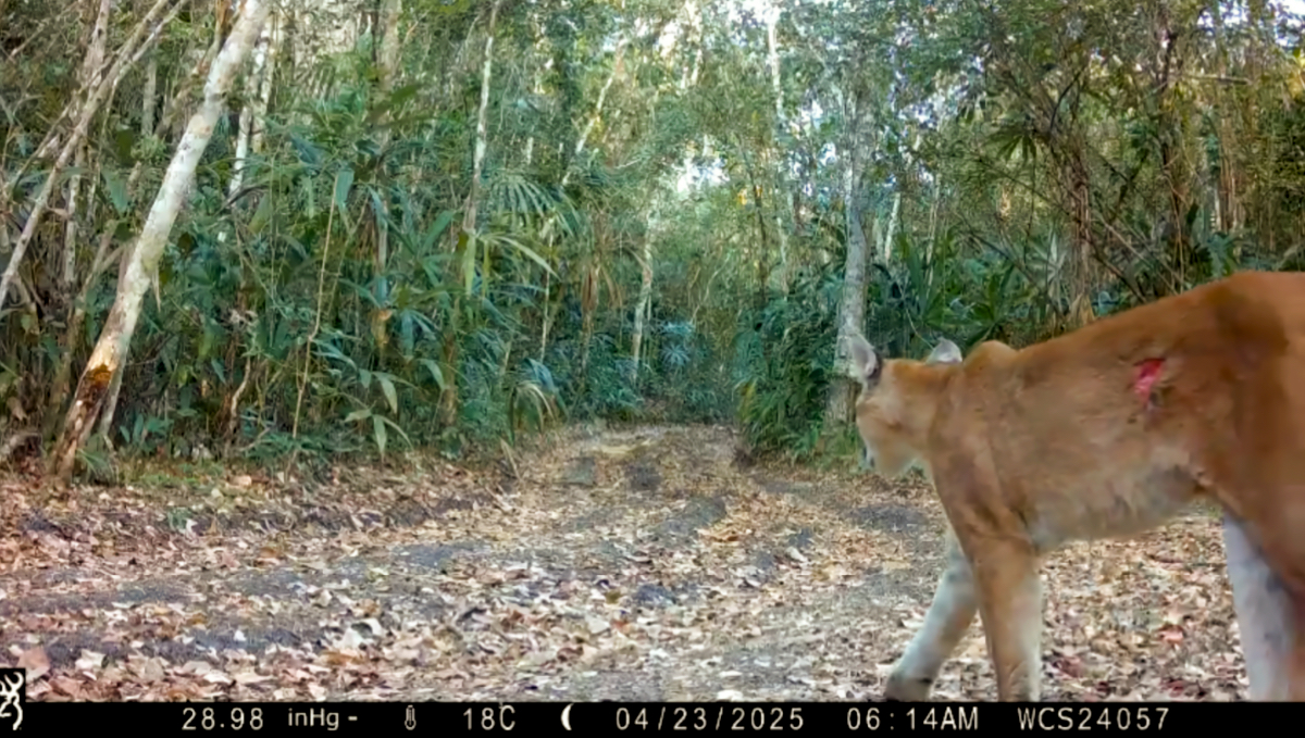
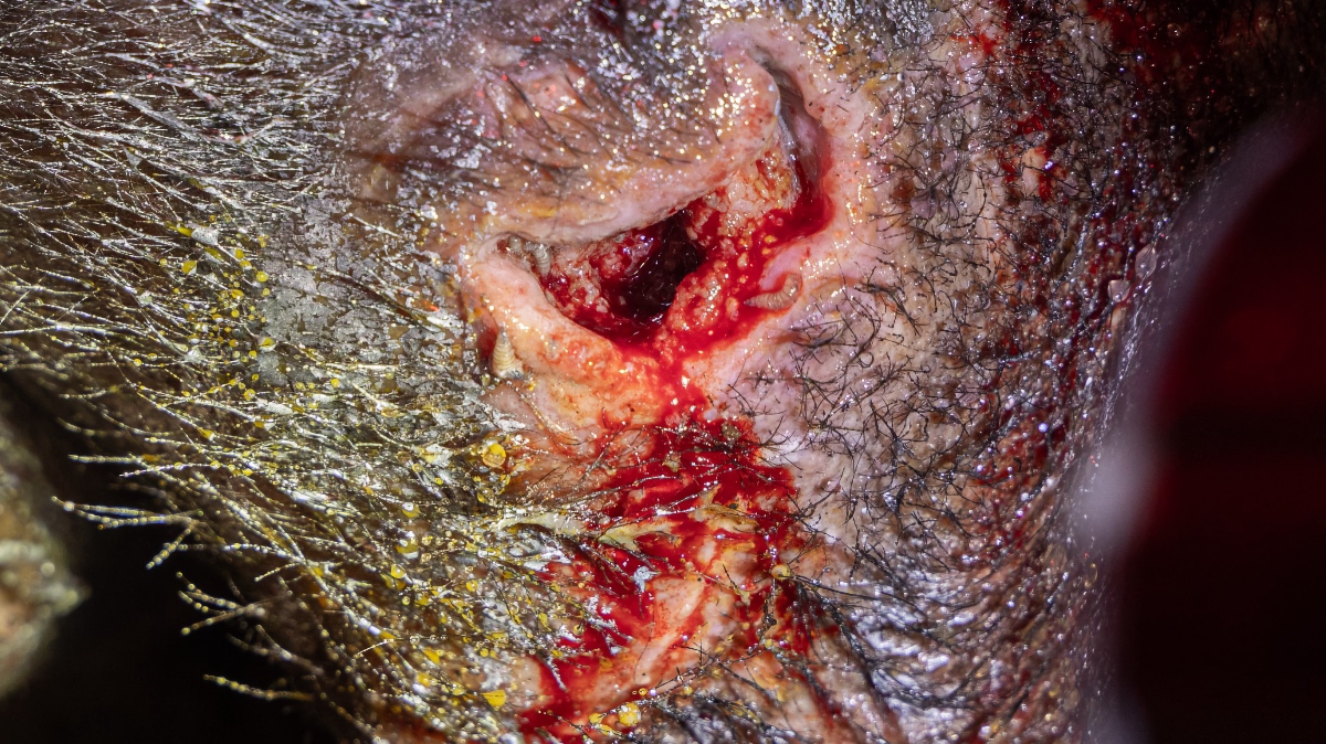
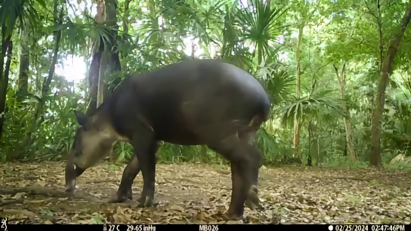
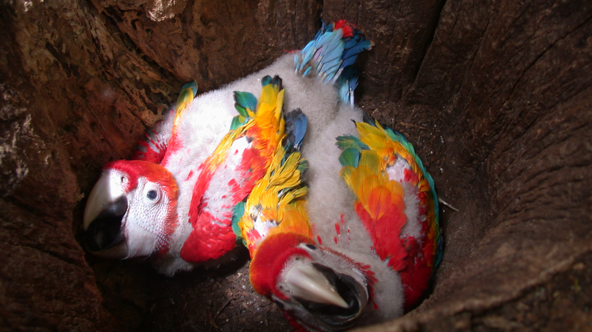
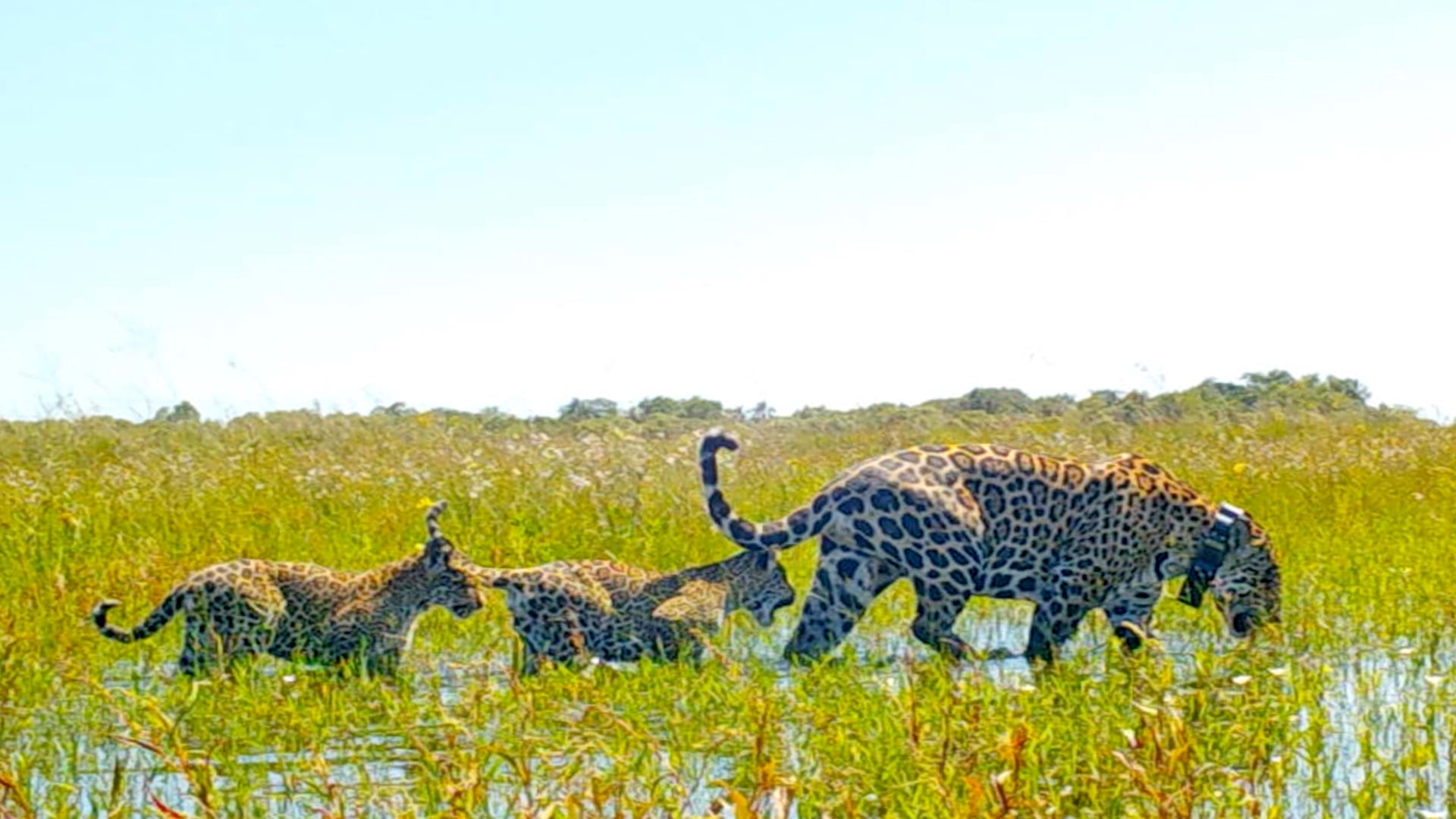
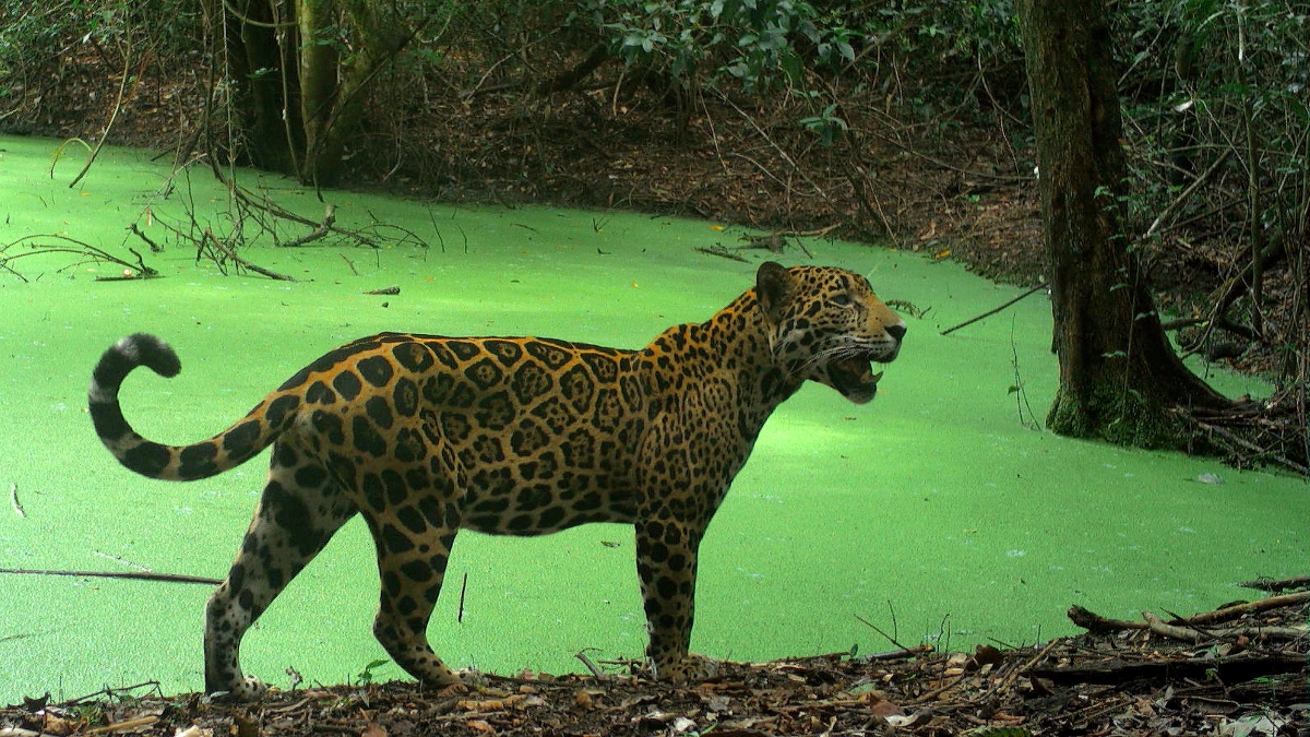
A network of camera traps throughout the forests captures both the wildlife that WCS protects and the threats destroying it. The same cameras that document healthy jaguars prowling wetland margins now reveal the screwworm crisis in real time. Recent camera trap footage shows pumas with visible screwworm infections—open wounds where the flesh-eating larvae burrow into muscle tissue. Tapirs display the horrific damage: gaping wounds packed with hundreds of writhing maggots devouring living flesh.
With GIS, WCS maps and tracks wildlife populations and behavior, documents disease spread patterns, and provides evidence of where cattle move through protected areas.
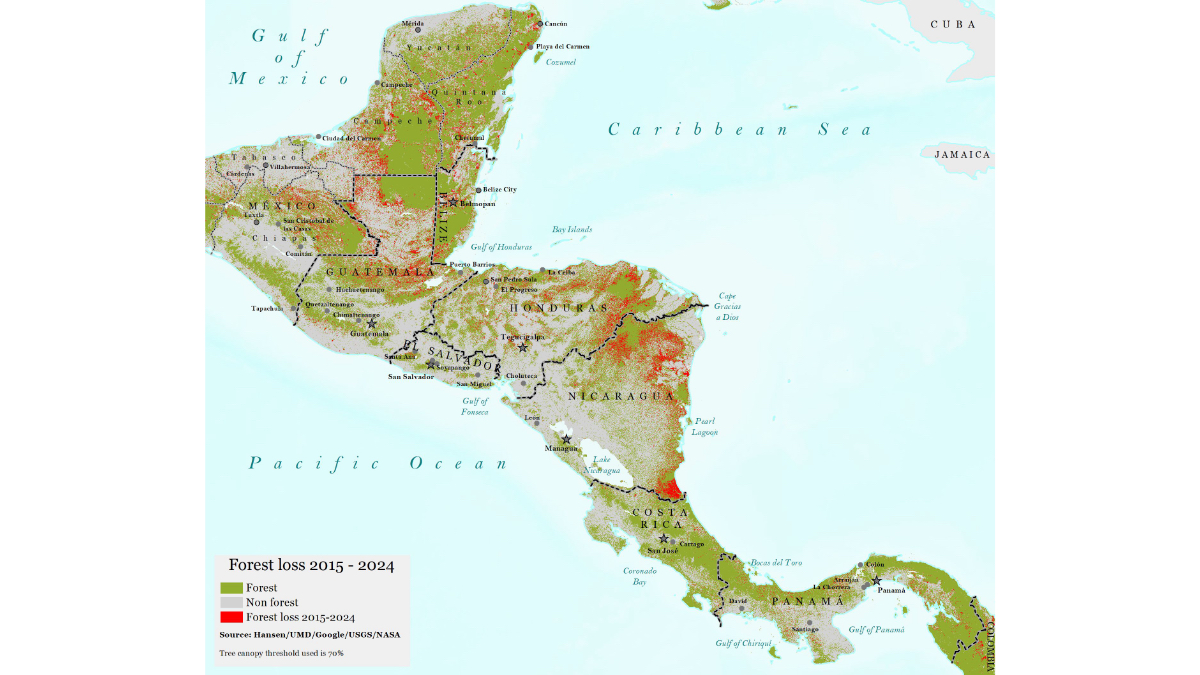
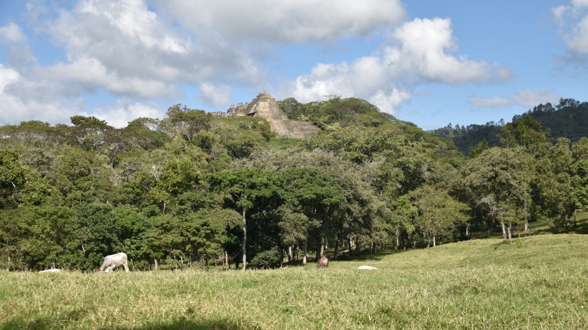
WCS has been working to preserve and protect the Five Great Forests of Mesoamerica—the last large, intact forest ecosystems in a region that once formed a continuous corridor from Mexico to South America. Together, these transboundary forests total 12 million hectares where endangered species that are facing increased threats find refuge.
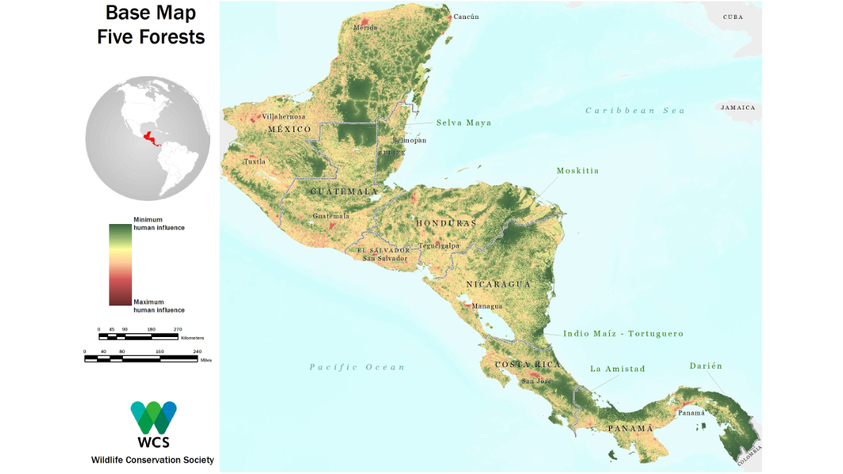
The Five Great Forests initiative began with analyzing the human footprint by using GIS. WCS mapped and analyzed data including forest cover, forest fires, recent deforestation, human population, roads, and navigable rivers.
Initially, the work focused on biodiversity, locating and mapping species to create a better understanding of each ecosystem. Teams documented where scarlet macaws nested. They tracked jaguar movements. And they identified critical wildlife communities. They were mapping the last of the wild: areas where the human footprint had the least impact, and where wildlife populations could thrive undisturbed.
Focus shifted from mapping what existed to monitoring what was disappearing. Maps that once showed where jaguars roamed now needed to capture where cattle ranchers cut roads, where illegal settlements popped up overnight, and where settlers burned the forest to create cattle pastures. Static maps needed to transform into urgent surveillance.
“We’re constantly monitoring things like forest cover and forest fires, in real time,” Radachowsky said. “We’re looking at hot spots as well as fire scars, both for immediate intervention and for assessing what’s happened.”
The illegal cattle trade operates as a sophisticated criminal network spanning all of Mesoamerica.
“Cattle are being grazed and moved from Nicaragua through Honduras through Guatemala, all the way to Mexico,” Radachowsky said. “It’s linked to organized crime and narcotrafficking in the region.”
Cattle generate income tied to money laundering. The animals graze illegally in protected areas and Indigenous territories before entering export and local markets. But now they also serve as vectors for disease.
“We did a spatial analysis of the spread of screwworm moving through Central America, and it was moving at the speed of trucks,” Radachowsky said. “It was moving along these contraband routes that we already watch.”
The crisis has reached top government levels, gaining attention from Mexico President Claudia Sheinbaum and Guatemala President Bernardo Arévalo. The US government has allocated $750 million for fly sterilization facilities to combat the parasite.
But Radachowsky warns this biological control will fail without stopping the source. “You can drop all the sterile flies you want, but you’re basically throwing tens of millions of dollars away because the reinfestation is very quick with the movement of illegal cattle,” he said.
That’s where WCS’s monitoring network becomes critical. By tracking cattle movements through remote sensing and field intelligence, they’re providing data that could help stop both the environmental destruction and the disease spread. The organization envisions comprehensive cattle traceability—individual tracking from birth to market using GIS technology.
“We would welcome a functional traceability system that could monitor every cow with a chip from space, individually identifiable from cradle to end product,” Radachowsky said. Such systems already exist in Uruguay, where officials track cattle via a GIS-based registry. But implementing this in regions controlled by organized crime presents challenges.
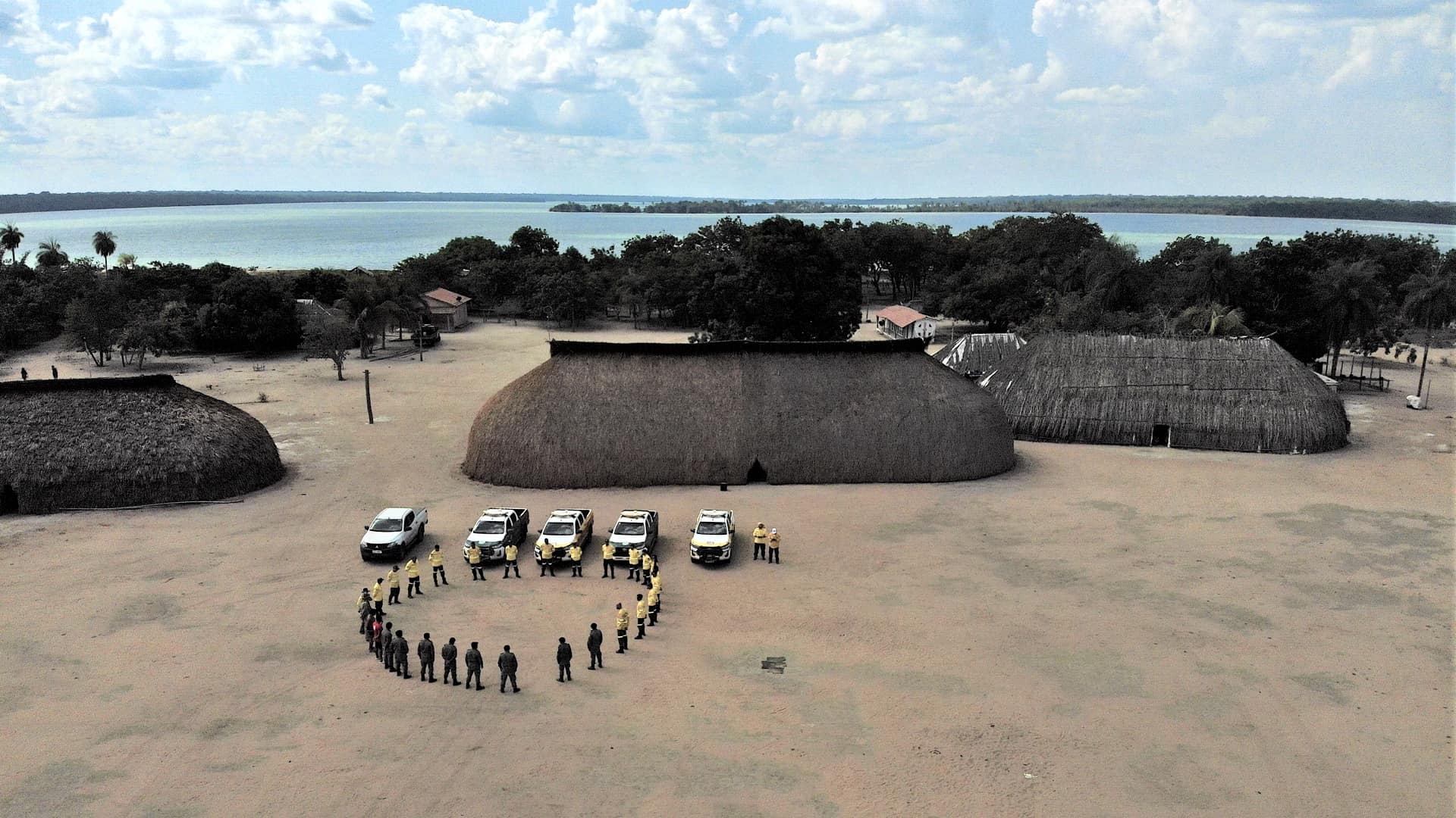
WCS works closely with Guatemala’s National Council for Protected Areas (CONAP) to monitor and report on cattle activity along the agricultural frontier in the Maya Biosphere Reserve.
“The idea is to understand and communicate what’s going on so we can affect conservation action,” Radachowsky said. “Sometimes that means trying to get increased government budget allocations for conservation through public campaigns. Sometimes it means identifying where threats are, to allocate people, resources, and control posts.”
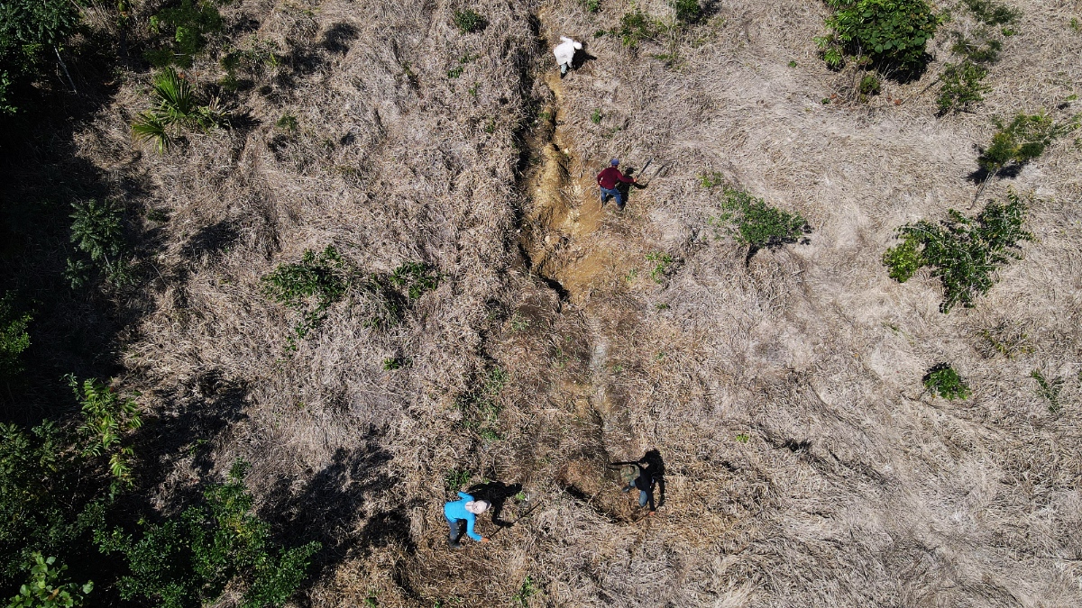
Despite challenges, WCS has achieved measurable success reclaiming and remediating cleared patches of forest. “We have recovered 155,000 hectares of forest that was in the hands of narco ranchers or speculators, and we’re in the process now of taking that land back and supporting local people to restore those forests,” Radachowsky said.
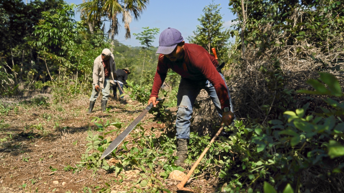
Half of the land comprising the Five Great Forests is managed by local and Indigenous communities, and WCS works closely with these partners on sustainable initiatives such as honey production, agroforestry, and restoration projects that provide livelihoods while rebuilding ecosystems.
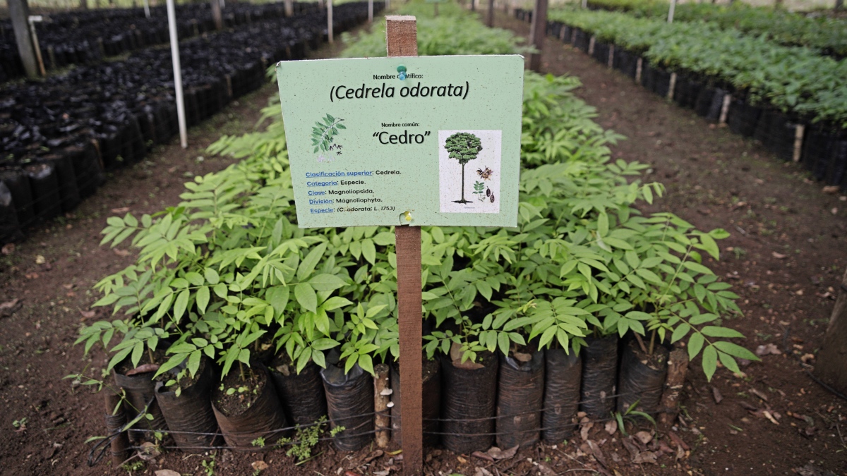
The restoration process involves multiple approaches: passive regeneration where natural seed banks remain intact, active replanting with native species from local nurseries, and planting agroforestry systems that provide sustainable livelihoods. Communities grow forest products including cacao, ramon (breadnut), and chicle (chewing gum resin) to provide income while keeping the forests intact.
As beef prices climb in the US and political pressure intensifies for alternative cattle sources, the screwworm crisis is spilling out of conservation circles and into national headlines. The parasite that devours flesh intertwines with the expanding human footprint that devours habitats. For WCS, now is the time to stop both and enact lasting protections.
“We’re starting to be successful in positioning this issue, using the screwworm as something that people care about,” Radachowsky said. Time will tell whether this moment of crisis generates the sustained political will to address the risks—and deadly consequences—threatening Mesoamerica’s forests.
Learn more about how GIS supports informed and sustainable land management decisions.