August 28, 2019 |
February 9, 2021
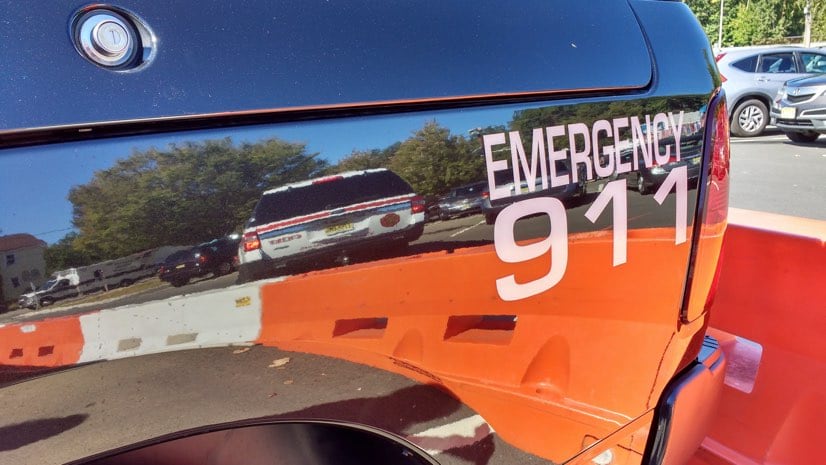
When someone in distress calls 911, the dispatcher and first responder must know where the caller is and how to reach them. The problem is, these questions can be far from clear. Cell phones don’t always convey an accurate location and street addresses don’t always match the map.
“A fire department deputy chief told me they regularly get calls from fire crews they send into a neighborhood where all the streets at one intersection have the same name,” said Peter Schoenfield, GIS analyst, Lake County, Illinois. “The dispatcher might say ‘Turn left on Lake Shore Drive,’ but they’re all Lake Shore Drive.”
That scenario is typical of how addresses can become barriers to accurate wayfinding. In the US, local authorities maintain addresses and update shared maps using a geographic information system (GIS). Data is then shared with 911 call centers, known as public-safety answering points (PSAPs).
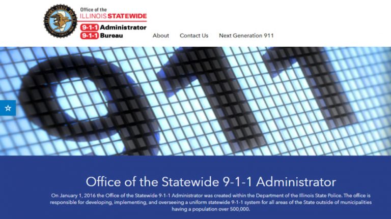
In Illinois, officials are working to solve this problem by undertaking a statewide modernization effort, Next Generation 911 (NG911), led by the Illinois State Police. NG911 will connect all 911 call centers and use GIS to increase address accuracy which will improve response times across the state. NG911 has been promoted at the national level, but it’s up to each state to tackle the move to internet-protocol hardware and associated enhancements.
“The old systems are antiquated, particularly the call-handling equipment that telecommunicators use at each PSAP,” said Cindy Barbera-Brelle, statewide-911 administrator at the Illinois State Police. “We’re getting to the point where 911 Systems have to look for parts on eBay, because the equipment is that old.”

Modernization will unlock entirely new capabilities to better communicate the nature and location of each call for help.
“You can text and send pictures and videos to friends and family, but you can’t to 911,” Barbera-Brelle said. “We’re really in a new environment where technology is advancing far more quickly than it ever has. Catching up to what consumers can do with their cell phones has been a driving force behind NG911.”
Modernization will also replace the standard Master Street Address Guide—a tabular database with address ranges that ties a phone number to an address. When it was introduced decades ago, the guide was a great leap forward. It became so reliable that 911 telecommunicators could first ask landline callers, ‘What is your emergency?’ because the location was already known. Now that most phones are mobile, telecommunicators have had to go back to also asking, ‘Where is your emergency?’
Illinois will answer that time-consuming and often confusing question by moving to geospatial routing and delivery of 911 calls. The new solution will automate turn-by-turn directions, using critical details in the GIS to improve location accuracy.
“Nowadays, the vast majority of calls coming into 911 centers are from cell phones,” Schoenfield said. “We’ve been building our data sets to be able to pick up the X-Y coordinate of that cell phone, drop it on a map, and pick out who the closest responders are. With NG911, a call won’t even get to the dispatch center until it’s been touched in some way by a GIS.”

Each PSAP uses GIS to record key layers of data that include boundaries of fire, EMS, and police response jurisdictions, street centerlines, and address points. GIS also records provisioning boundaries—coverage exceptions that get worked out between neighboring responders. “I’ll cover this, even though we share it,” Barbera-Brelle explained.
In addition, GIS includes many capabilities to accurately record and verify a location, represent it on a map, share address information, pinpoint a position, and direct responders to where they are needed. The use of GIS paves the way to include z-axis (vertical) support for call routing within buildings to specific floors or units.
To make the move to geospatial routing, boundaries and address data must be accurate and synchronized between PSAPs in order to assign the right responders and route them to the right location.
“From the beginning, I knew that GIS would be at the center of deploying the statewide NG911 System that I was tasked with,” Barbera-Brelle said.
The legislation that put the Illinois State Police in charge of statewide NG911 includes all 911 Systems in 102 counties across the state. Chicago, which is going through its own modernization effort, will connect to the statewide network. Barbera-Brelle will need to engage with 911 Systems in every county and get their data to carry out the ambitious plan.
Because funds generated for PSAPs are tied to land line, wireless, and Voice over IP customers, fewer land lines has meant less funding to modernize in rural areas. However, grant programs were created to provide for NG911 readiness.
To start, much of the investment went to modernizing call-handling and recording equipment to meet National Emergency Number Association (NENA) standards to deploy an Emergency Services IP network (ESInet)—a network of networks to connect all PSAPs. Funds have also gone to licenses and training for ArcGIS Online, Esri’s software-as-a-service GIS offering, and fresh aerial imagery to help counties update their maps.
“Some counties still have rural addresses that need to be updated, and I know that work is very labor-intensive,” Barbera-Brelle said. “So, we offered grant funding for GIS projects as well.”
An additional effort involves the use of ArcGIS Hub to enhance mutual aid and collaboration. The Illinois State Police NexGen911 Data Hub establishes workflows for data input that walk users through each step. It increases the visibility of progress across the state with a status map that shows data submitted and data quality. GIS data maintainers and administrators can access the hub to ask each other questions and share expertise.
“Once everybody submits their data, they need to work with neighbors to make sure boundaries and jurisdictions are not overlapping or gapping,” Barbera-Brelle said. “GIS allows them to see where any issues are. Then they can work it out, so we have consistency.”
The NG911 effort has already benefitted participants who use GIS for many other purposes, because it provides new levels of data accuracy and freshness.
“Having a statewide dataset that’s continuously updated is something that would not have even been thought of 10 years ago,” said Eric Creighton, GIS Analyst, City of St. Charles, Illinois. “The ability for any municipality or county to be able to pull down a statewide dataset is a huge byproduct of the NG911 initiative.”
Early in the effort, the Illinois GIS Association (ILGISA) became a gathering point for people who wanted to help improve address accuracy. Soon, they formed a NG911 advisory board, and its members have been instrumental in setting standards, workflows, and checking data quality.
“We took the initiative because as a statewide organization, we figured this is the perfect glove to put our hand into,” said Creighton who was president of ILGISA when the effort began. “It brought the community together. We started with an exploratory effort to understand GIS capacity across the state. We then created a schedule for the required datasets.”
In the beginning, Creighton was the primary data reviewer. Now, the GIS Center at Western Illinois University has taken a larger role for data quality checks. University students participate in the work, drawing pay and gaining practical knowledge.
“We get data of varying degrees of quality,” said Chad Sperry, director, Western Illinois University (WIU) GIS Center. “We’ve got validation and QA/QC procedures in place that make sure that this data is standardized, it’s scrubbed, and it’s clean before it’s ultimately uploaded to the state hub and centralized and merged. This is a really important project. We’ve got double-checks, and we review the data in multiple ways to make sure that we’re not missing anything.”
In the past, the smaller communities or GIS managers didn’t have time or a strong need to prioritize data quality. “It’s kind of a wake-up call for the GIS community,” Schoenfield said. “The importance of our data has been elevated.”
Now, the need for data accuracy is clear to everyone involved in the NG911 project.
“It’s rewarding to hear first responders screaming for this data,” Sperry said. “They realize they’re doing a disservice to their people if they don’t have good maps.”
The WIU GIS Center also works more directly with 16 counties in its region that are thankful for mapping and data assistance, because they have a history of not getting a lot of help.
“If you search on the word Forgottonia, it brings up the west central Illinois region,” Sperry said. “It was coined in the late 1960s in response to the lack of transportation funding and money coming from the state and federal government. I grew up on a farm in this area, so that’s where my desire to serve it comes in. We can’t be left behind.”
The fundamental steps of administrating an address aren’t difficult, but there are many ways for authorities to get addressing wrong. In Lake County, one of Illinois’ more populous regions with 700,000 people in the northeast corner of the state, ongoing issues prompted a large re-addressing effort.
“Back in the ’70s, the county took all unincorporated addresses and standardized them,” Schoenfield said. “A handful of subdivisions complained, and the county acquiesced and let them keep their old address numbers, while maintaining 5-digit addresses for county government use. A few years ago, we realized this ‘dual-addressing’ was a problem that needed to be fixed so we crafted a new address ordinance that allowed those non-standard addresses to remain if they were logically consistent—even on one side, odd on the other, with addressing flowing from low to high. When this couldn’t be maintained, new addresses or even street names were issued to correct the problem.”
The move was essential to create the consistency a computer can understand and that logically flows along a street, but it was far from trivial.
“It was a major chore,” Schoenfield said. “We had to meet with each homeowner’s association. We had to send letters out to all of the different stakeholders, not just fire and police, but sheriff, and all the different utility companies, the county clerk, the treasurer. We also had to talk with the data supplier of delivery services like FedEx and UPS to make sure they got our changes as fast as possible. Anybody that had a stake in the address, we had to notify that the address was changing.”
For delivery, the post office is the top priority.
“You have to get the post office the right address or it’s not going anywhere,” Schoenfield said. “We send over a list, and then check it every month to make sure they are recorded correctly, if we have any fixes, we wait another month and check it again. It’s a very involved process and you really have to have the fortitude before you embark on something like this.”
For first responders, changes in address flow cause problems that Schoenfield and his team hear about often.
“Each fire district we consulted with would tell us about streets that were messed up,” Schoenfield said. “Addresses might start with three-digits in a municipality, but then when you get halfway down the street they jump. Crews that don’t know the area, turn around thinking they missed the address without realizing they have to go another mile before the address system changes again.”
When time is critical, even momentary confusion can have dire consequences.
“First responders will tell you that two minutes is the difference between life and death,” Schoenfield said. “That’s why we need to make these changes. When NG911 is fully operational, we’ll all start reaping the benefits.”
Learn more about how GIS is applied to next generation emergency dispatch and response.

August 28, 2019 |

November 1, 2018 |

February 1, 2019 | Multiple Authors |