

July 6, 2021 |
Jen Van Deusen | Natural Resources
June 7, 2022
Ninety-one percent of South Africa’s land is at risk of becoming desert. The sense of urgency is palpable among conservationists working to improve water management practices in the diverse and majestic Kruger to Canyons Biosphere Region. The biosphere comprises 10 percent of the republic’s land yet provides more than half of its water.
Rivers, streams, wetlands, and other catchments in this 6.1-million-acre ecosystem are under pressure. Worsening droughts, pollution from human activity, and encroachment of invasive plants have diminished water quality and volume. A nonprofit company, Kruger to Canyons (K2C), is rallying residents and businesses to work together to protect the nation’s waterways.
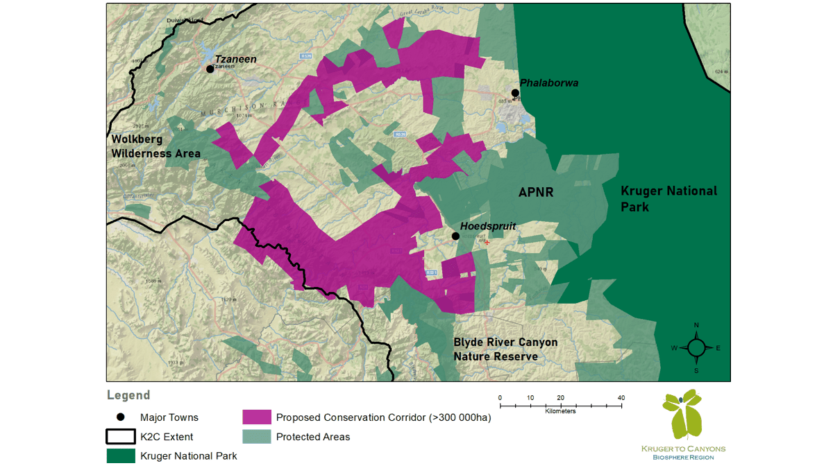
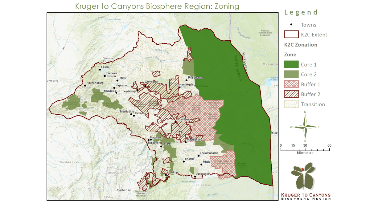
Using geographic information system (GIS) technology—including digital maps that mark the location of resources—K2C has created a library of scientific data as evidence of changing conditions in this ecosystem. The maps and data also serve as a compelling source of truth as the nonprofit works to build consensus among residents and businesses around the need for better resource management, more sustainable practices, and disaster risk reduction.
“If we don’t act now, we’re all really going to feel it 20 years down the line,” said Romy Antrobus Wuth, stewardship ecologist with K2C. “For this landscape to stay as beautiful as it is, where we all love to live, we all need to work together.”
Climate change in the South African drought belt is occurring more rapidly and bringing impacts that are more severe than the global average, according to a report from the Intergovernmental Panel on Climate Change. These conditions rank the republic among the 30 driest countries on earth. Rainfall accumulates at a rate roughly 40 percent lower than the annual world average.
Heat waves, rising temperatures, prolonged droughts, and intense floods are evidence of the changes occurring here. These conditions further degrade deforested and excessively grazed rangelands where family-owned livestock roam. Climate shifts also diminish the waterways that run through the rangelands.
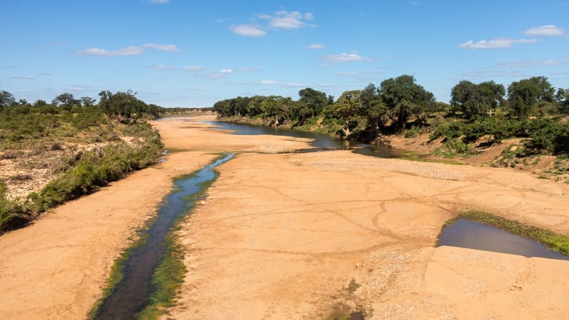
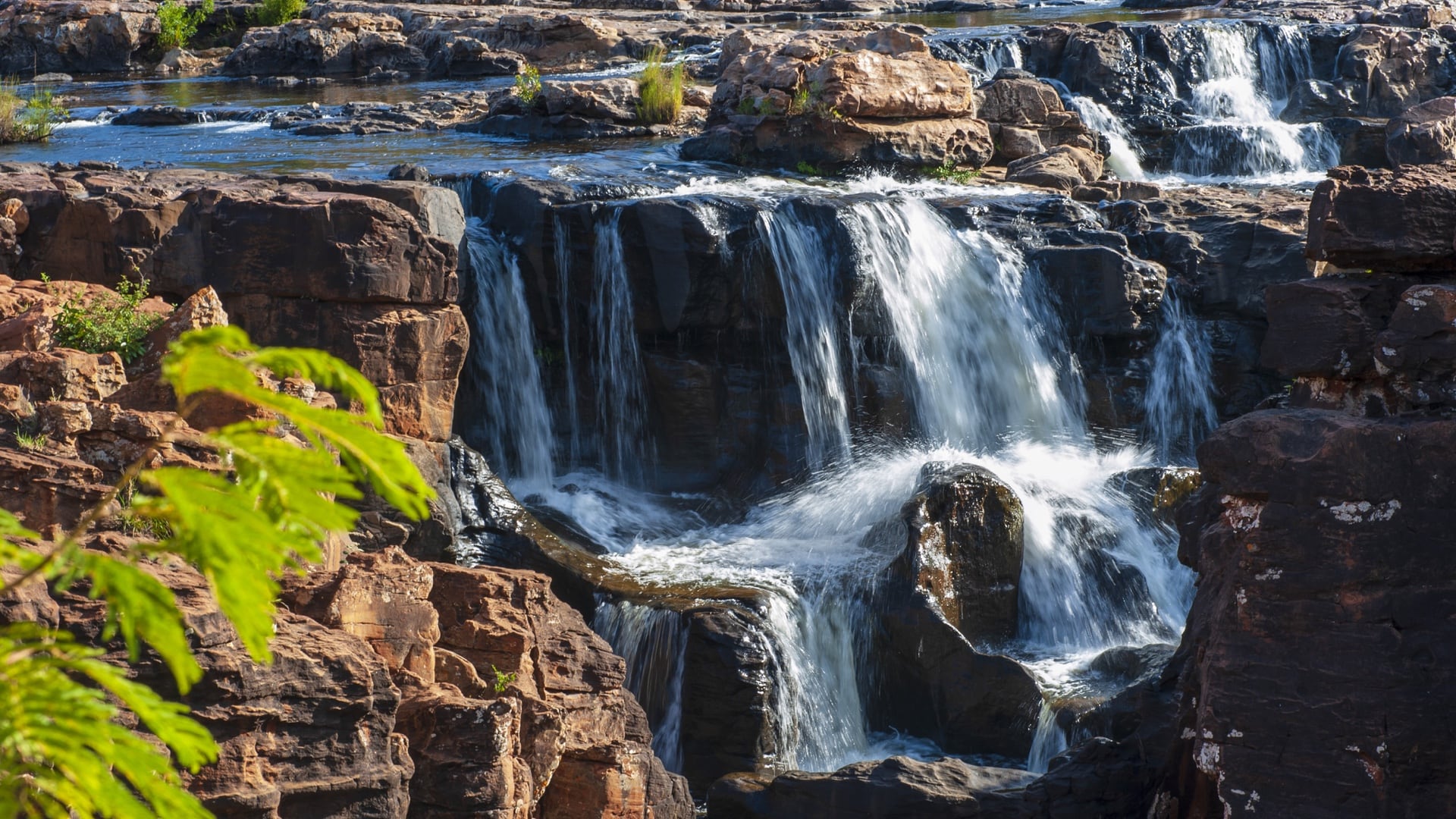
Unlike some regions of South Africa, rainfall in the Kruger to Canyons Biosphere Region’s escarpments remains ample, ranging from 39 to 78 inches (1,000–2,000 mm) per year. The water runoff helps sustain natural systems and people in the Lowveld region, where rainfall averages just 15 to 25 inches per year. K2C has used GIS technology to monitor conditions and document polluted waterways in residential areas and locations where sand mining operations exist. The data makes it clear that stakeholders must act now to protect water availability and purity to sustain life in the biosphere in the decades ahead.
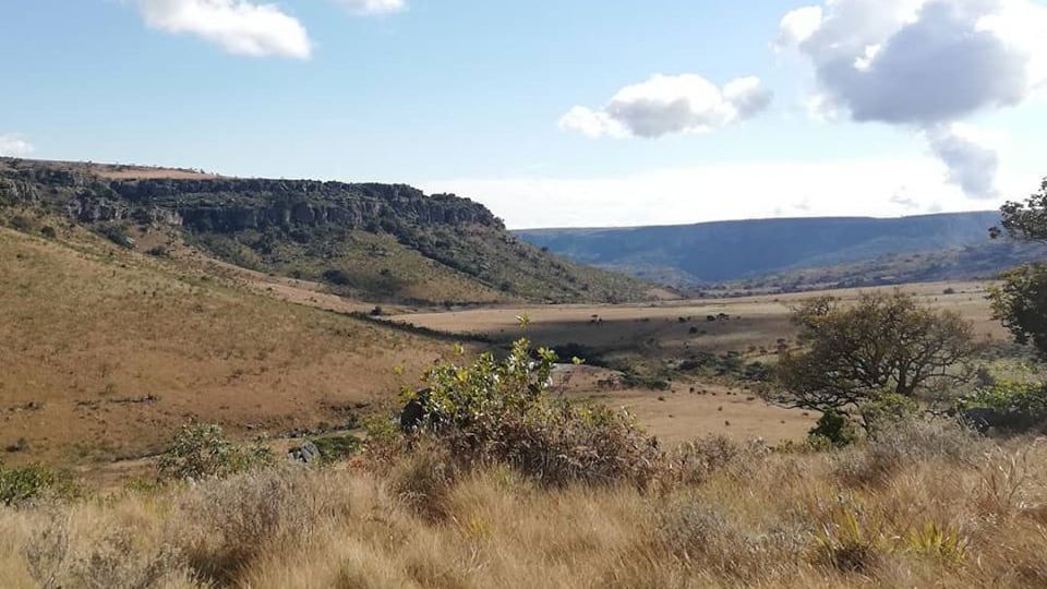
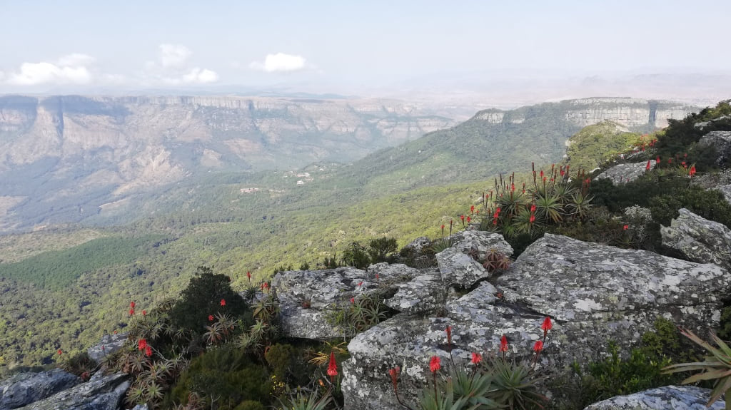
In the biosphere, water flows from breathtaking escarpments that reach into the clouds in the western region and then moves through vulnerable rural villages and commercial agriculture operations at lower elevations. Biomes of forest, grassland, and savannah also exist in this biodiversity hot spot.
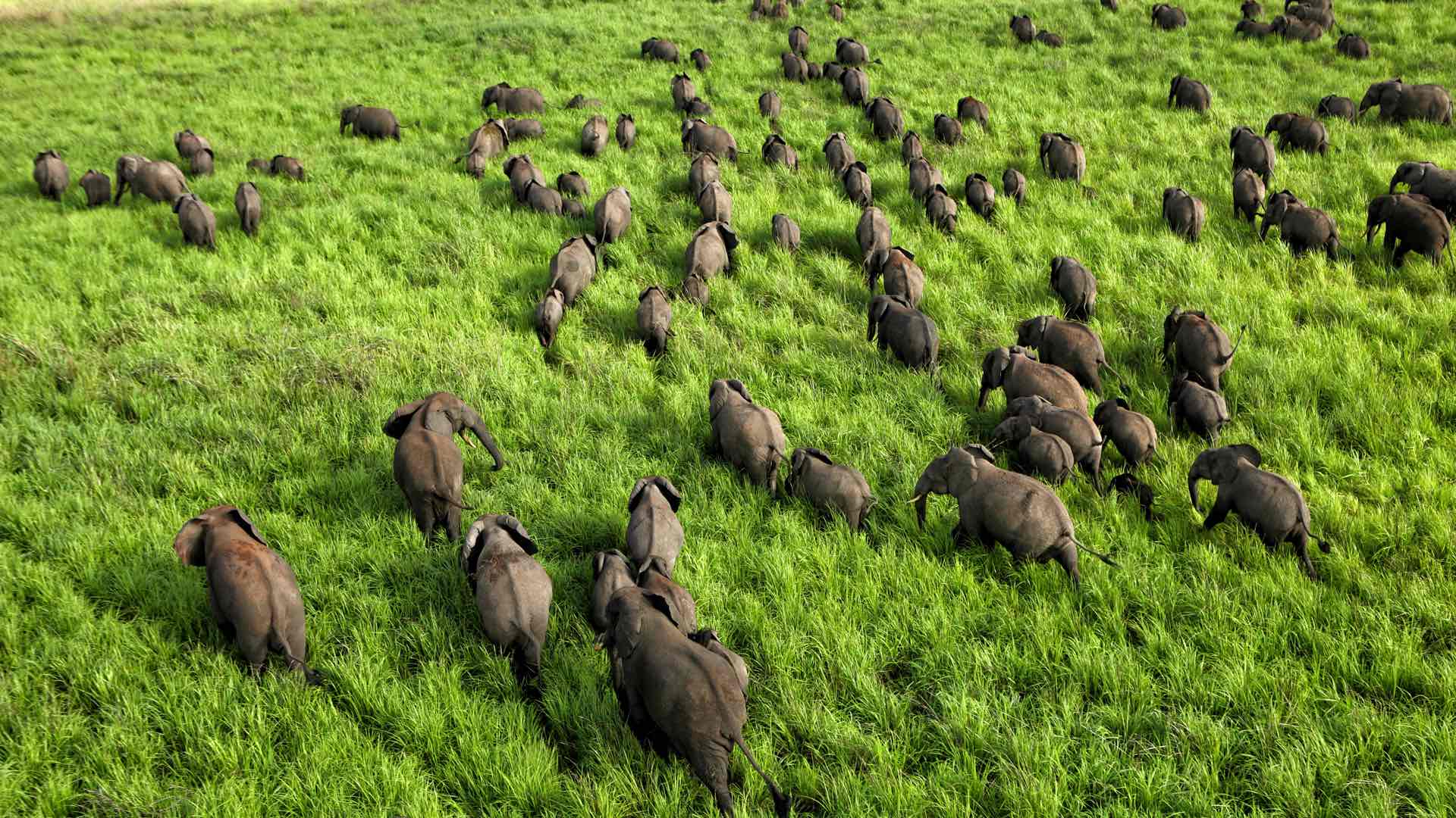
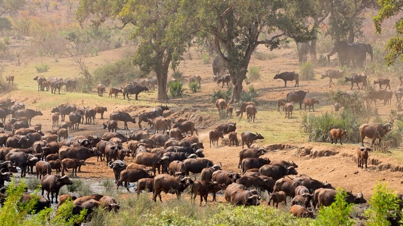
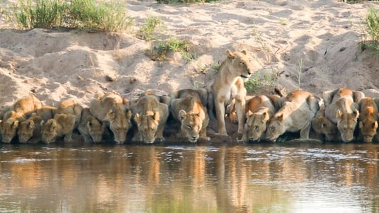
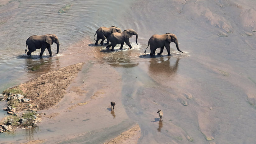
The eastern reaches of the biosphere include protected nature parks. The flagship is Kruger National Park, a renowned tourist destination. The park is considered the world’s premiere wildlife viewing area—home to 147 species of mammals, 507 species of birds, 114 species of reptiles, 49 species of amphibians, and 34 species of fish in the park’s seven rivers. However, extreme drought in the biosphere’s subtropical Lowveld region caused a shortage of food for the park’s wildlife in 2015 and 2016. Rangers had to put down 350 hippos and buffaloes to reduce the competition for resources.
The K2C team takes a modern, inclusive approach to outreach that makes stakeholders with disparate interests a force for action and equity. GIS technology supports K2C’s monitoring in the field; collecting and analyzing data; and, ultimately, providing environmental education for community groups, conservation partners, and stakeholders in industry. The resultant smart maps help stakeholders and partners see where to focus their efforts and set priorities.
“A map always tells an amazing story,” said Nick Theron, K2C senior program manager. “If you’re sitting together with a group of people and you need to explain what’s going on or get everyone onto the same page—or better understand our work and strategically how we plan—then we need maps.”
With such an expansive territory, the nonprofit is selective in activating or supporting projects as a partner. K2C’s projects must be manageable yet produce significant results. Priorities include protection of land around waterways, environmental education, clearance of invasive plants, and sustainable land management.
The Blyde River catchment, just west of Kruger National Park, has been designated a strategic water source for the country; this set in motion a notable restoration project where K2C was a partner with AWARD in combating invasive plant species that have degraded the ecosystem.
Through other initiatives, the K2C team has undertaken spatial analysis to mark the location and spread of alien plants that choke wetlands. By targeting and removing these plants, and documenting illegal dumping and sand mining, the K2C team expects to see long-term improvement in water quality.
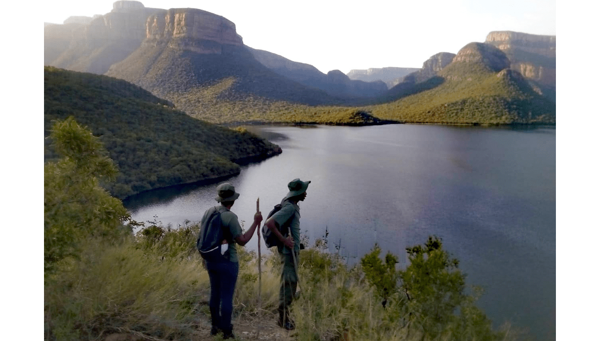
To help address high unemployment in the region, K2C has a program that employs residents as environmental monitors. The workers post daily updates, sending GPS coordinates and photographs from mobile devices when they find hazardous or improved conditions and enrich the GIS database with up-to-date information. These efforts also help preserve water corridors that serve as breeding grounds and migration routes for threatened wildlife.
K2C is helping villagers and farmers improve water access while safeguarding biodiversity; the recent cycle of flood and drought has hit 1.5 million people in the region, creating food insecurity.
K2C conservationists have been working with small scale farmers on sustainable land-use practices, responsible water management, and equitable access to water. Larger scale commercial farmers have started to become involved, and K2C hopes to pilot projects with them soon.
Here, too, digital maps are valuable for identifying project locations and broadening awareness of conditions. Research data compiled with GIS technology can help stakeholders align with project priorities:
More recently, a methodology called Climate Risk Informed Decision Analysis (CRIDA) has taken K2C’s work in a new direction. Through the K2C Catchment Investment Program, the team encourages businesses to invest in nature-based solutions for water resource management and disaster risk reduction. Natural solutions have the added benefit of reducing the need for implementing water purification or pumping water through pipelines. Instead, nature does this work as humans focus on restoring ecosystems. Partners on this effort include The Nature Conservancy, Pegasys, Conservation International, and Conservation South Africa.
“From a business perspective, if you invest a certain amount of money into the catchments, you are going to be saving money in the longer term, which builds additional levels of sustainability,” Theron said. “Projects that we are building benefit the whole landscape and the local economy.”
The K2C team members will tell you their work—whether in research and data science, outreach and education, or on-the-ground intervention—is far from glamorous. Yet they are committed to supporting and promoting balanced and sustainable social and economic development. In the process, they are also working to address inequality, poverty, and climate change.
“It’s grinding work,” said Wehncke van der Merwe, K2C’s buffer zone coordinator. “It takes years and years to get it right because you’re working with people and setting up governance systems and changing perspectives and understanding. And it’s working within fields with a lot of nuances. People aren’t always that keen on this nonsexy stuff. They love to hear about saving a wild dog from a snare, but the more important thing is to have more habitat for the wild dog to roam in.”
Learn more about how conservationists apply GIS to protect plant and animal biodiversity.