October 27, 2025 |
Olivier Cottray | GIS for Good
September 8, 2026
Since the 2020 Beirut port explosion, the Lebanese Red Cross (LRC) has been strengthening its crisis preparedness and response capacities through a continuous learning process from crisis to crisis.
On September 23, 2024. Mobile phones flashed: EVACUATE IMMEDIATELY. Within hours, the main highway north was gridlocked. What should have been a two-hour drive to Beirut stretched to 14 hours as families fled with whatever they could grab.
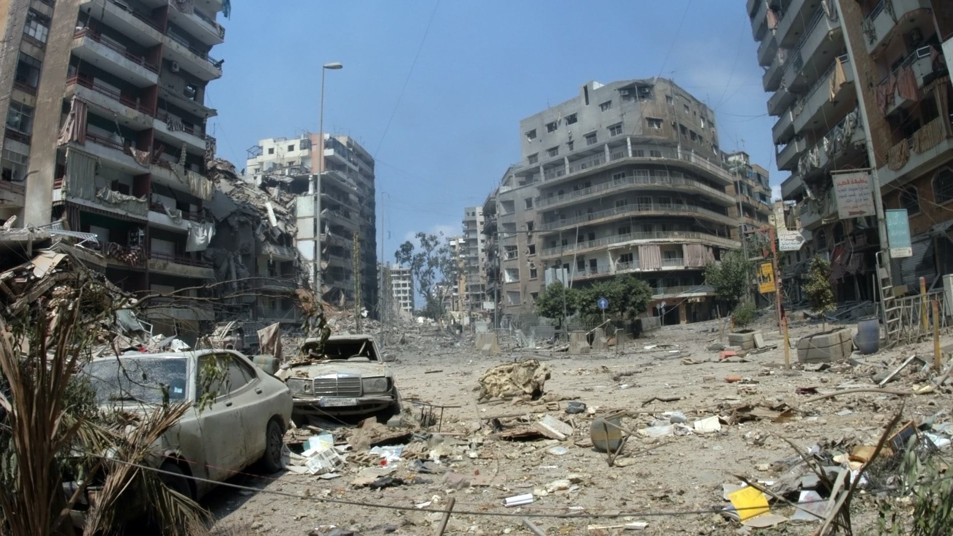
By nightfall, hundreds were dead, thousands injured, and tens of thousands were on the move, seeking safety. Over the following days, as armed conflict escalated, the number of displaced people surged from 100,000 to 1.3 million—more than a quarter of Lebanon’s population uprooted in less than a week.
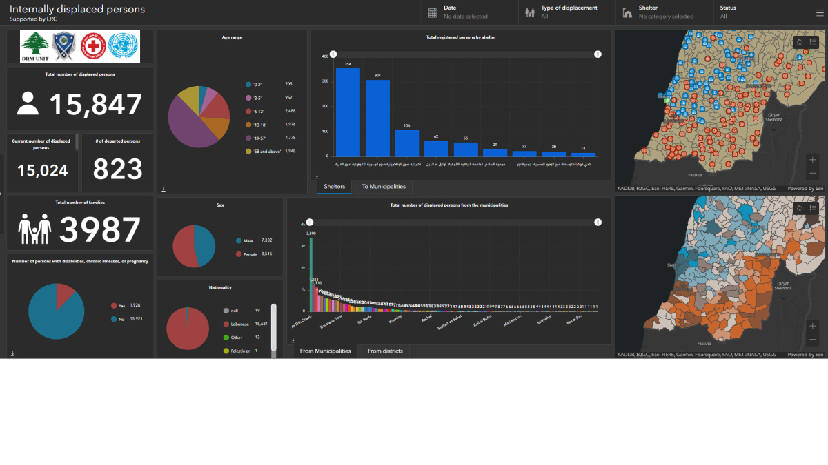
LRC developed and refined a system for tracking casualties, displacement, shelter needs, environmental impacts, vulnerability, and health risks, in coordination with the National Disaster Risk Management (DRM) Unit, Lebanon’s National Council for Scientific Research (CNRS), government ministries, UN agencies, and local actors. LRC tracked it all with field surveys, real-time data, and machine learning.
As the war intensified, LRC activated emergency operation rooms at the governorate, local, and ministry level and developed tools to monitor displaced people both inside and outside shelters—tracking arrivals, departures, remaining residents, people with disabilities, older people, and other vulnerable groups.
As of March 2026, when the war broke out again, Lebanon’s crisis coordination system was still running. More than a million people have been displaced by renewed bombardment. Many of them returned to the same shelters they fled to just 15 months before. The system tracking them was not built for this moment. It was built through years of crisis response.
Schools became emergency shelters overnight. Families who had fled earlier conflicts, along with Syrian refugees, found themselves displaced again. And amid the chaos, dozens of humanitarian organizations mobilized to help, each rushing to deliver aid through their own systems and networks.
Without coordination, that goodwill turned to waste. “People were throwing away food at some shelters, and in other places they were not receiving anything,” said Dr. Chadi Abdallah, director of research at CNRS. International aid organizations, each with their own data collection forms and reporting systems, couldn’t see the complete picture. Local relief groups distributed aid through their own networks.
But Lebanon’s geographic information system (GIS) changed that. As panic turned into provisioning, all those actors began working from the same maps, the same shelter lists, the same needs assessments.
Lebanon didn’t start from scratch. Syrian refugees required long-term displacement tracking. The Beirut blast demanded rapid damage assessment. A cholera outbreak meant coordinating door-to-door vaccination campaigns. Each crisis built the foundation, and by 2024 the system was ready.
In 2023, LRC formalized its experience into a preparedness and response system built for worst-case escalation, including scenarios where individual-level tracking wouldn’t be possible, and worked with humanitarian partners to standardize terminology and reporting across shelters.
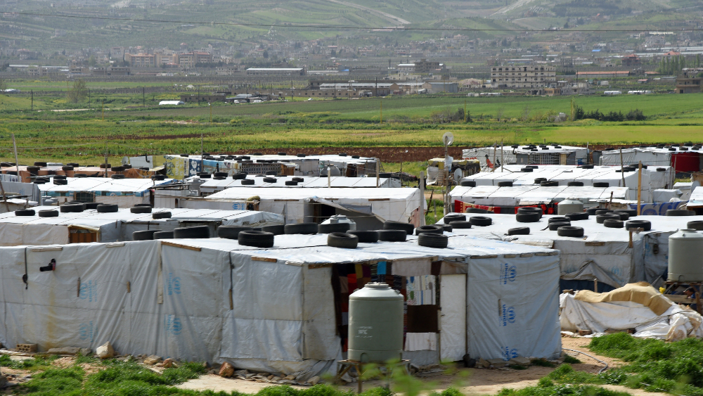
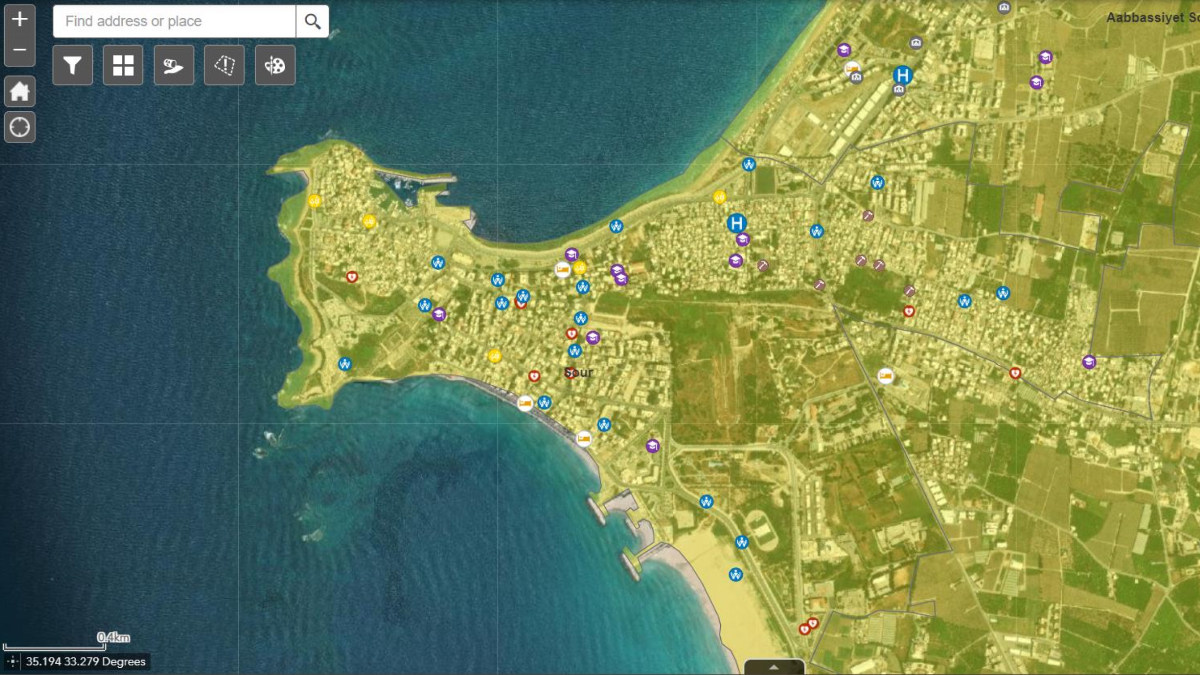
Within days of the September 2024 crisis, the Lebanese Red Cross (LRC) deployed 120 team members to 20 operation rooms. Kassem Chaalan, disaster risk reduction program manager at LRC, had spent years training these volunteers to use GIS technology for humanitarian response and resource coordination. Now they put that training to work, tracking more than 1,000 shelter sites in real-time.
Shelters had been identified and mapped with GIS just prior to the escalation, with their capacities, locations, and conditions, allowing operation rooms to guide displaced families toward available spaces based on proximity, needs, and real-time occupancy.
“When internally displaced people called our operation rooms seeking support, we could direct them to open shelters,” Chaalan said. When shelters filled, the team marked them as full and redirected families to shelters that still had room.
The Lebanese government’s National Emergency Plan had anticipated mass displacement and designated how government agencies, humanitarian groups, and scientific institutions would coordinate response across ten humanitarian sectors. LRC had already surveyed every school—space, rooms, and conditions. When the Ministry of Education designated schools as emergency shelters, LRC had the facility data mapped.
Three entities coordinated the national operations room. CNRS provided scientific modeling and standardization. DRM supplied map data and disaster assessment. As an auxiliary to the government, LRC activated its emergency medical services, blood bank, volunteers, disaster risk management, and disaster risk reduction teams on the ground, using data architecture to support response data collection, analysis, and decision-making.
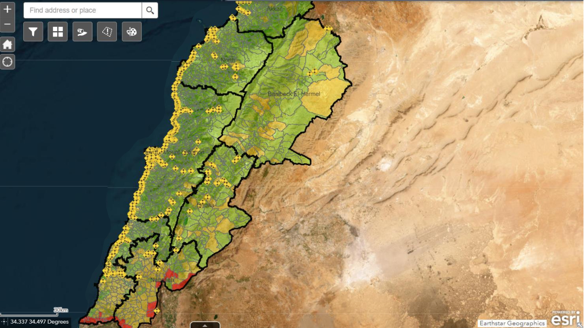
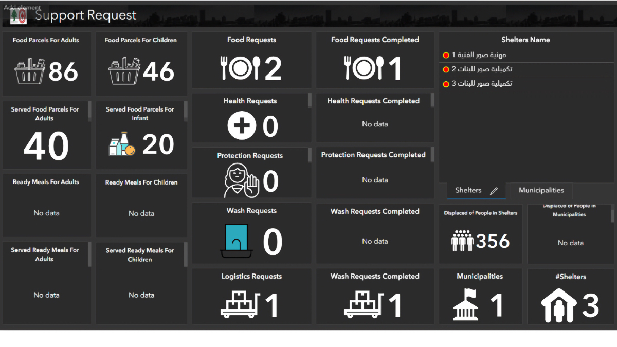
Bashar Mokdad at the DRM Unit described how inputs were aggregated to track changing conditions. “Our role ensures that data coming from different actors is standardized, classified, and validated,” he said. “This not only allowed us to unify systems, but also to reduce duplication in both reporting and aid distribution.” The DRM Unit harmonized inputs from UN agencies, local NGOs, the High Relief Commission, and the Council of the South—each using different reporting systems—into a single dashboard. Public dashboards extended that transparency outward, giving citizens and decision-makers a live view of the response and a clear record of who delivered what, where, and when.
“The Lebanese Red Cross played a critical role,” Mokdad said, “deploying trained responders across governorates who were highly experienced in GIS and contributed directly to data management at the national level.”
Field teams used surveys to record and map each family’s situation—where they came from, where they were sheltering, and what they needed. When a shelter housed pregnant women or elderly people, partners could direct specific supplies and services.
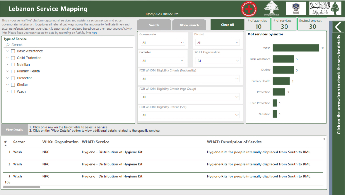
Organizations with reporting systems integrated Lebanese government data directly. Those without established systems received credentials to access the Lebanese aid coordination system. A system of systems approach emerged to gather a complete picture and deliver aid to those in need.
Only about 200,000 people—roughly 20 percent—found space in the thousand-plus emergency shelters. The remaining million stayed with relatives, rented apartments, or found other accommodations—but still needed help. The Ministry of Social Affairs, working with the World Food Program (WFP) and the World Bank, planned cash assistance programs to help families meet their immediate needs. But first, they needed to know the location of people outside shelters.
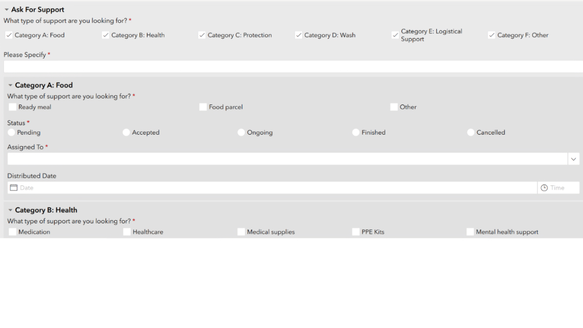
The partners created a survey distributed through local authorities, reaching people wherever they had found temporary shelter. To build trust in the survey, the government addressed data security concerns head-on. Information about individual needs was stored on Lebanese servers, not in the cloud. Personal details remained hidden in public dashboards, which showed only aggregate numbers. The survey included explicit consent language and phone numbers for local operation rooms where people could verify its authenticity.
LRC developed a self-registration tool and supported field tracking so municipalities could identify displaced people living outside shelters, in coordination with the Ministry of Interior, Ministry of Social Affairs, WFP, and local NGOs. The effort captured information on about 900,000 displaced people in host communities or requesting cash assistance. The survey was successful in gathering details from 90 percent of those displaced. “This information was the key to help families start rebuilding,” Chaalan said.
The system matched aid deliveries with actual needs for shelter populations and displaced families outside shelters. It tracked aid from UN agencies, international organizations, and local groups to prevent duplicate deliveries.
“We found out there were duplications not only at the UN and international organization level but at the local level,” Chaalan said. “Local institutions provided goods that were not reported.” So LRC teams gathered data on what every shelter had received.
Daily calls identified gaps. Before distributing aid, coordinators informed the operation room which shelters they planned to visit and what they would deliver. “Then we put it in the system—it’s booked for this institution,” Chaalan said. “Even if it’s not yet delivered, it’s recorded, so other organizations know to provide their goods elsewhere.”
Shelter managers, sector leads, and displaced people provided feedback that refined the system.
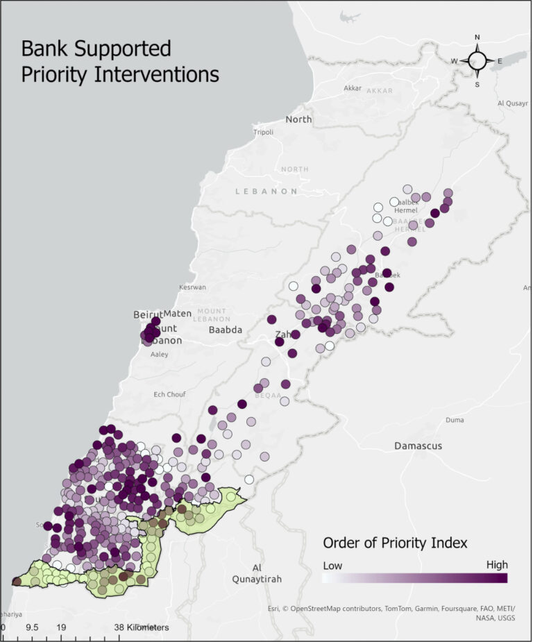
When the ceasefire took hold in late November 2024, the system shifted from tracking needs to guiding return. The same data now guided which communities to rebuild first.
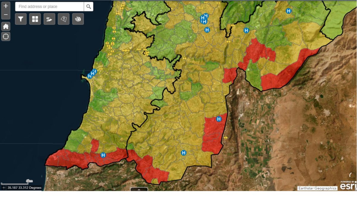
CNRS worked with the World Bank on a rapid damage and needs assessment covering 253 villages. The assessment recorded damage from aerial bombardment and ground conflict and estimated $12 billion in needs. The World Bank secured $250 million in loans for infrastructure repair–just 2 percent of what was required. With limited funding, prioritization was essential.
“We needed to prioritize which villages we are going to work on,” Abdallah said. CNRS developed a GIS model that balanced multiple factors: the extent of damage, distance from economic centers, and critically, the population displaced from each area.
That prioritization now guides World Bank spending–and determines which communities get rebuilt first.
Lebanon’s experience demonstrates what becomes possible when government agencies, UN partners, and aid organizations work from shared geographic data rather than parallel systems. CNRS standardized the data. The DRM unit provided maps and assessment tools. LRC designed surveys and dashboards, trained personnel, and validated data to support decision-making across sectors and levels. UN agencies brought sector expertise. International organizations contributed field data. The innovation was using GIS to enable coordination at scale under crisis conditions with limited resources.
The approach is spreading. The Philippines invited Lebanese experts to share lessons on coordinating multiple organizations with limited budgets. Red Cross societies in Germany, Morocco, and Ukraine are adapting the model.
“The system is very powerful because we would not be able to coordinate actions without it,” Chaalan said. “But if you have the system but you don’t know the on-the-ground dynamics, it will not work.”
In a region where crisis is ‘business as usual,’ as Abdallah puts it, that pathway matters. The next crisis is already here.
Renewed bombardment has almost exactly mirrored the scale of the 66-day war. Many families have returned to shelters they know. Lebanon’s DRM unit is tracking 1,049,328 registered displaced people using the re-activated crisis coordination system.
This time, the Ministry of Social Affairs is administering the self-registration survey. Despite exhaustion of repeated displacement, response rates have increased. The trust that took years to build is holding.
The system serving and receiving them is stronger too—deepened by the Lebanese government and the teams who know these people and this land.
Learn more about how humanitarian assistance groups use GIS to prepare, manage, and deliver effective responses.