


August 15, 2023 |
David Gadsden | Conservation
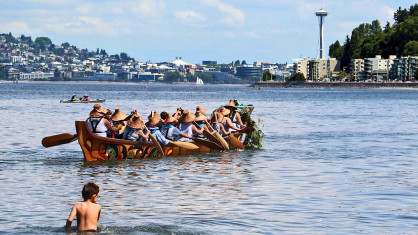
In early August 2023, tribe members from coastal Native nations throughout the Pacific Northwest, Canada, and Alaska spent over a week paddling more than 130 canoes along the Salish Sea and its tributaries. In addition to the canoes, more than 700 cars and trucks, 89 trailers, and 82 boats caravanned in support.
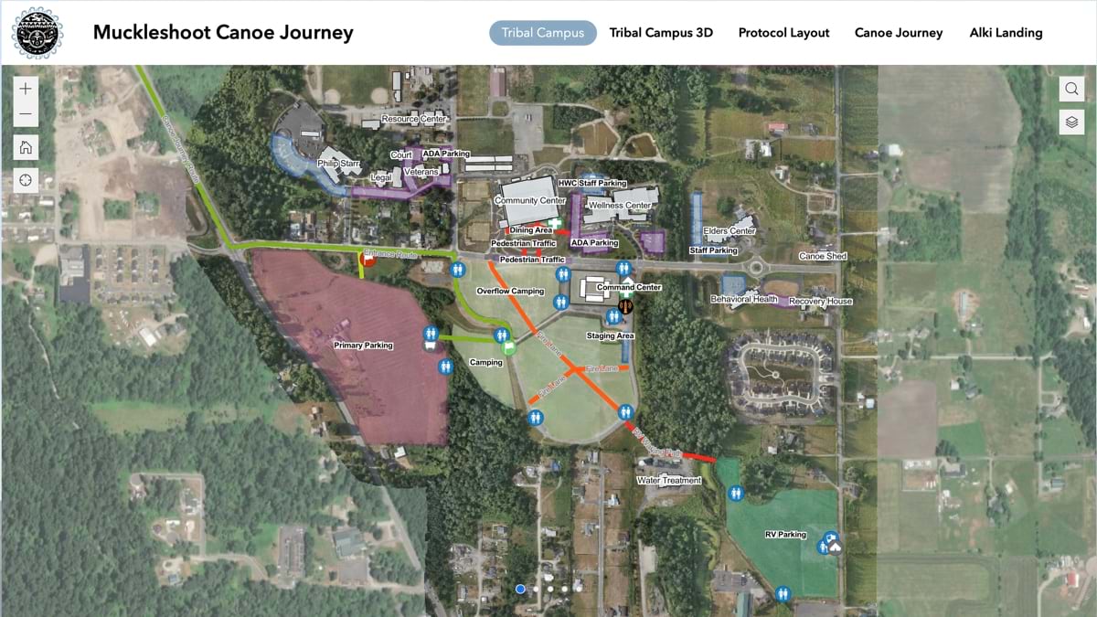
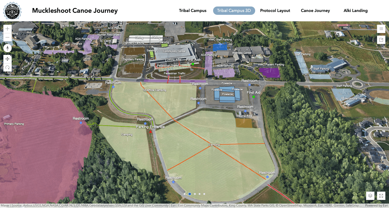
The tribe members had all come together for the annual Intertribal Canoe Journey, an important celebration that reenacts trading trips of their ancestors. Leading up to the canoe launch, the Muckleshoot Tribe—original inhabitants of central Puget Sound watersheds and hosts of the 2023 event—created smart maps to guide the voyage.
Grant Timentwa, GIS program manager for the Muckleshoot Tribe, used geographic information system (GIS) technology to make the maps and coordinate logistics. “This year, I really pushed for the use of web and mobile applications for the route map and community center map to make it easier for everybody,” Timentwa said.
It wasn’t until 1990 that the Native American Languages Act passed Congress, entitling tribal members to speak their own languages and practice their cultural traditions, reversing forced assimilation. The Intertribal Canoe Journey predates the passage of this act by just one year.
Since the first canoe journey, the Paddle to Seattle in 1989, this epic event has happened regularly with a focus on the reclamation and revitalization of tribal history, culture, and traditional practices. The canoe journey sparked a renewal of traditions, such as canoe carving, which are taught to young people to keep the culture alive.
For past journeys, the hosting tribe would print paper maps to help guide canoe families. This year, everyone had access to digital maps that communicated locations of shoreline sites with details about amenities such as restrooms and parking. All the information participants needed was hosted on the Muckleshoot Tribe’s GIS hub site with smart maps that showed the overall journey as well as each waypoint.
Unlike a static paper map, GIS maps made it easy to update information and coordinate across tribes. “When I share the map with canoe families, they mark them up and say, ‘Here’s a date change,’ or ‘Here’s a route that was added, or scratched off,’” Timentwa said.
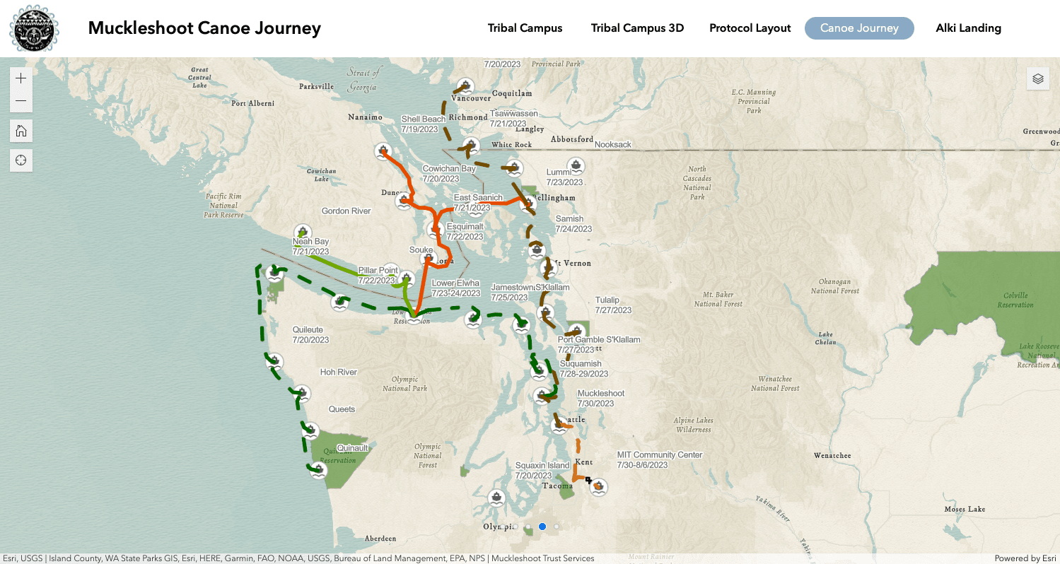
Maps provide the means to collaborate with local authorities and make plans for each site, including the coordination of supplies and ensuring public safety. Designing routes can be tricky, considering ferries and other water traffic—but smart maps helped in that area as well. “We have to be cognizant of the shipping containers that cross when we map routes,” Timentwa said.
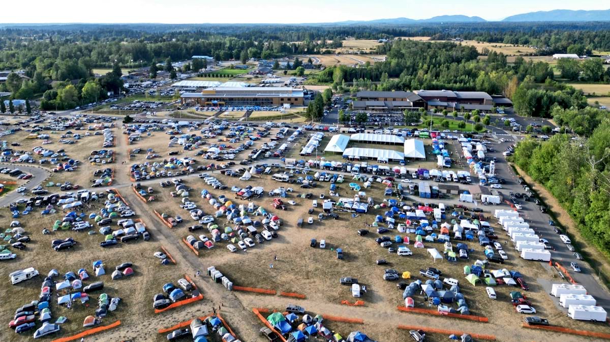
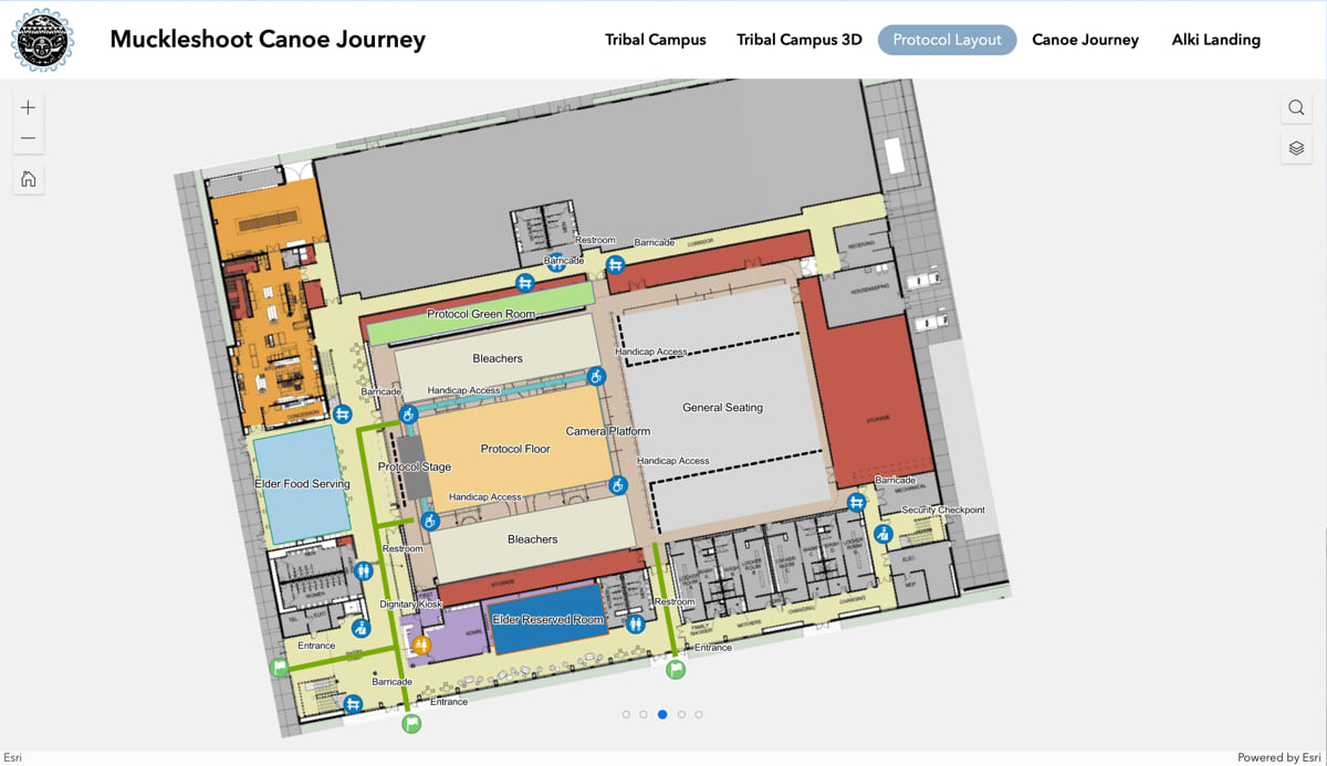
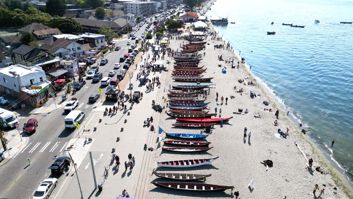
The route culminated on the Muckleshoot Indian Reservation, at Seattle’s Alki Beach, for a weeklong around-the-clock celebration. Before each canoe family could come ashore, protocol required each tribe’s members to introduce themselves in their tribal language and request permission to land. Once permission was granted, groups pitched in lead participants from the canoes to the weeklong gathering, guided by a detailed map of the Muckleshoot Nation.

More than 10,000 guests, tribal members, and the public learned about each of the tribes that took part in the canoe journey. Tribes took turns on the Muckleshoot stage to share their traditional stories, music, and dance. In the preceding week they had paddled to a series of Native nations, including the Quinault, Makah, Lower Elwha Klallam, Lummi, Swinomish, Tulalip, Jamestown S´Klallam, and Suquamish reservations.
Many of the participating tribes, such as the Alaska Native tribes and First Nations in Canada, are well known in the Pacific Northwest. They were able to share their canoeing traditions and explain how “they also use the water as their highway for sustenance, gathering, and travel,” Timentwa said.
Learn more about how Native American policymakers, administrators, scientists, and instructors use GIS to make their tribal organizations more efficient and effective.