January 9, 2025 |
Adam Carnow | Infrastructure
A bridge is due for inspection. A highway needs resurfacing. A rail line requires maintenance. A seagull population needs counting. At the Massachusetts Department of Transportation (MassDOT), these projects don’t get off the ground without the whir of a drone.
Coordinated by the MassDOT Aeronautics Division, the department’s drone program operates across the commonwealth. As a shared service for all MassDOT divisions, the program documents everything from bike lane construction to vegetation growth and guard rail conditions. Drones let teams work faster, more safely, and at a fraction of the cost of manual or piloted aircraft survey methods.
Yet when the program first deployed at this scale, the vast and varied nature of MassDOT’s projects led to data challenges. Drone imagery streamed in but didn’t land in a unified archive—leading to missed opportunities to make the data more valuable. The program lacked repeatable workflows and quality standards. Data processing bottlenecked, imagery asset deliveries lagged, and crews duplicated each other’s work.
MassDOT Aeronautics staff needed to achieve three core goals of drone data management: accessibility, reliability, and usability.
Sinan Abood became chief of data and analytics for MassDOT Aeronautics in 2023, with a clear mandate to make drone imagery easy to find, trust, and use. He reframed drone imagery not as a collection of individual project outputs but as an enterprise asset. As such, he created a complete, end-to-end management system around it: the Aeronautics Data Hub.
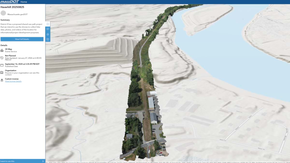
The hub, built with geographic information system (GIS) technology, holds data spanning every drone mission MassDOT has flown since 2021. The hub puts current and historical drone data—in the context of the mission’s exact location and time—into the hands of every leader, engineer, field team, and analyst at the agency.
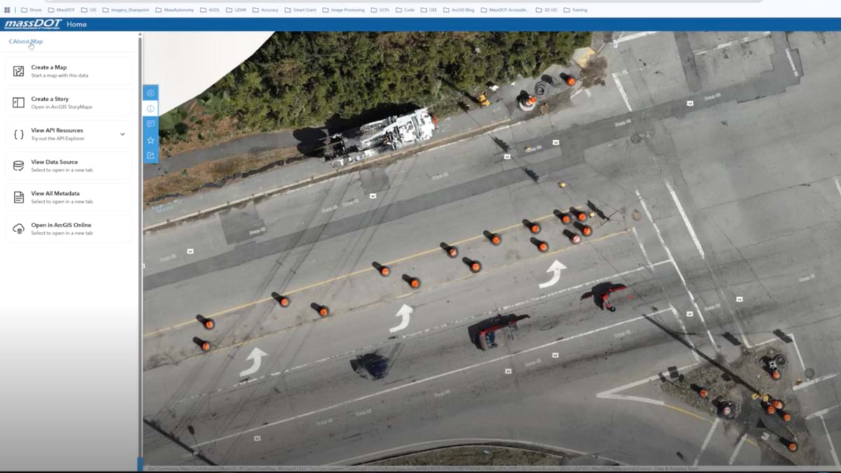
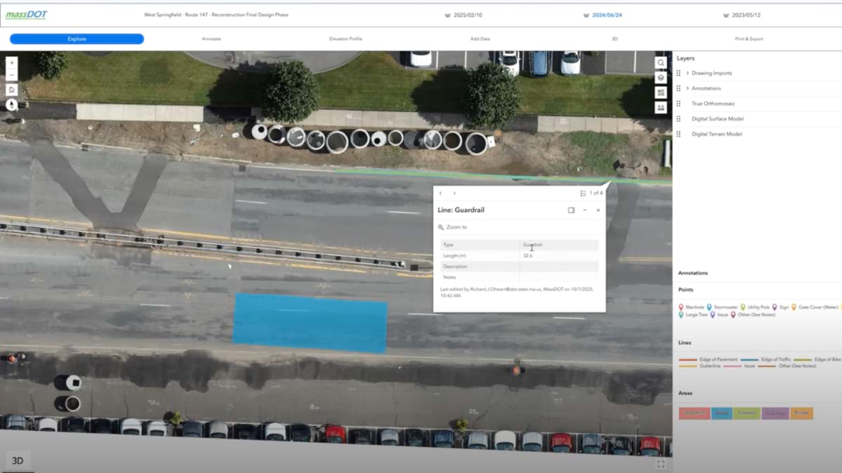
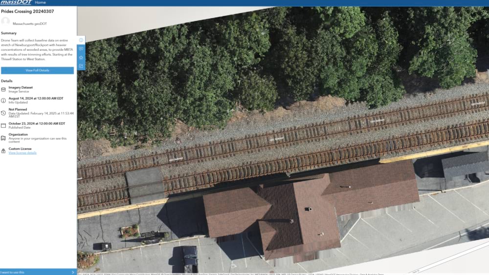
With a few clicks, managers monitor progress, inspect work, and investigate delays. Road crews annotate assets like maintenance holes and drainage systems to estimate costs before breaking ground. Rail maintenance teams pinpoint where vegetation needs to be cleared without shutting down a line for manual inspection. Highway engineers trust that data meets quality standards for precise measurements and safe roadways.
“Data is accessible—you can find it, you can search for it,” Abood said. “It’s catalogued; it’s dated. It’s a living system of record that you can go back to.”
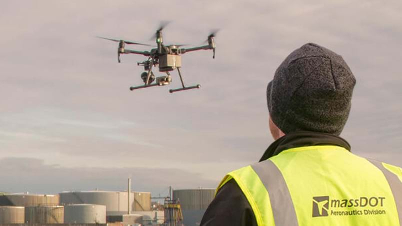
MassDOT’s drone program supports all divisions—including rail and transit, airports and aviation, and highways and roads—plus partners like the Massachusetts Bay Transportation Authority (MBTA), the Massachusetts Department of Conservation and Recreation (DCR), and the US Coast Guard. This creates an expanding flight volume and a growing stream of imagery data pouring in each week.
Abood recalled that “finding imagery assets was not easy,” before he and his team built the GIS hub. “The default approach of processing data and putting it in a shared folder did not suffice,” he said. “We found that out the hard way.”
Datasets were scattered across teams, systems, and storage locations. Without consistent naming conventions, standardized metadata, or defined workflows, even basic questions were hard to answer: Is this the most recent dataset? Who collected it? Can it be reused? In some cases, large datasets were delivered by hard drive or uploaded across multiple cloud platforms.
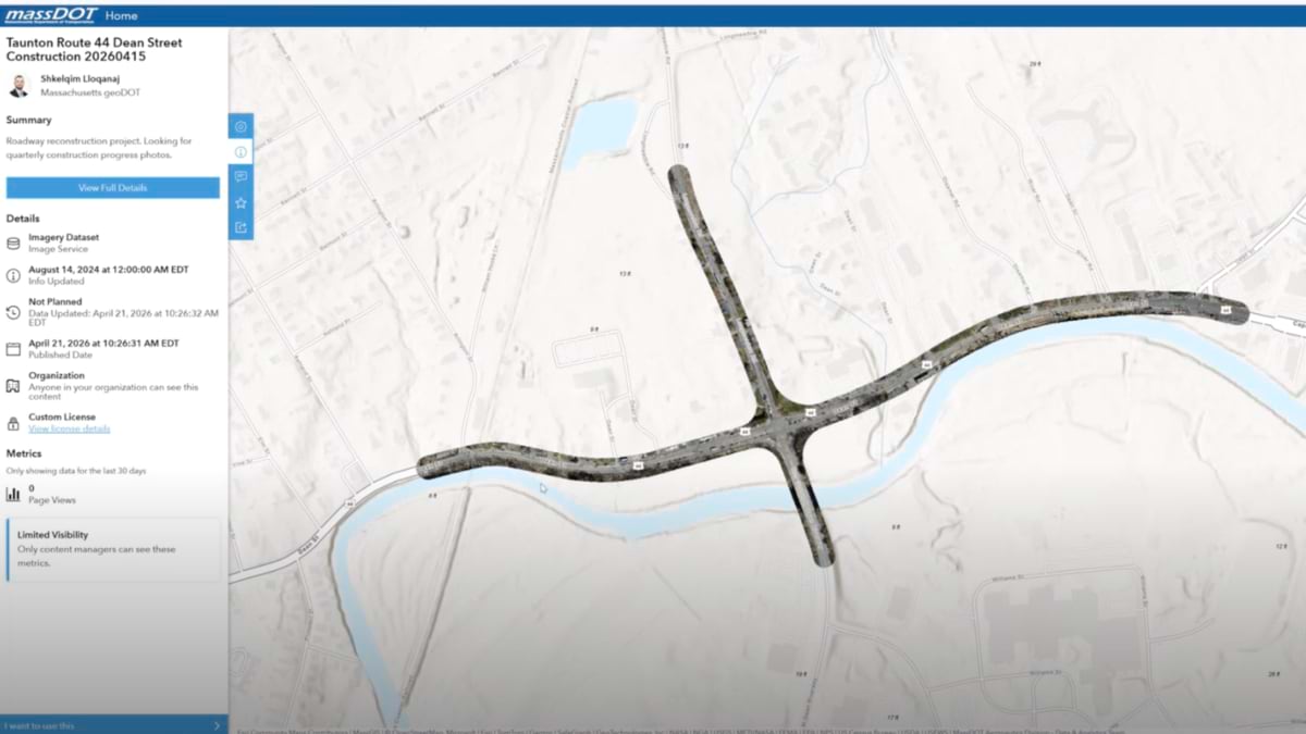
With the Aeronautics Data Hub now in place, each imagery dataset follows a consistent naming convention—using location, year, month, and date of the mission—and includes a summary describing why the data was collected, along with three or four tags to further refine searchability.
This new ease of access and better awareness has fueled a dramatic uptick in interest across MassDOT stakeholders. In previous years, only two districts were regularly submitting requests for drone data; this year, all six districts are.
“Every division and every stakeholder can see what drones are capable of and think about, ‘How can I leverage this technology to make my life easier and more efficient?’” Abood said.
Today, MassDOT Aeronautics manages and monitors the entire drone program.
“We monitor how many drones we fly, who flew, where they flew, what they collected, and so on,” Abood said. “Before, we didn’t have that capability.” With six full‑time pilots and roughly 55 more pilots in MassDOT’s distributed program deployment, centralized tracking has proved essential for organizing such a complex portfolio of work.
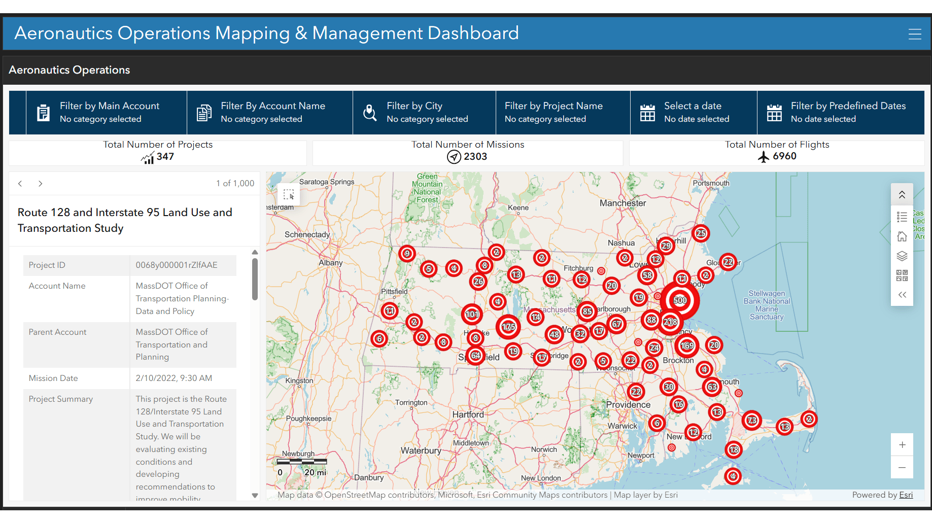
Interactive GIS dashboards get updated every Friday. These show where teams flew, what was collected, and what was processed. Leadership can search the database by city, project name, or date—or click into the interactive GIS map to find mission details and check progress. They can also review individual pilot stats, like hours flown and trainings completed, or see whether an aircraft has been used heavily enough to warrant predictive maintenance.
“Accessibility is the most important thing,” Abood said of the hub’s intuitive design and simple navigation. “You need to make it as easy as possible. People are busy. Some of them spend 90 percent of their time in the field.”
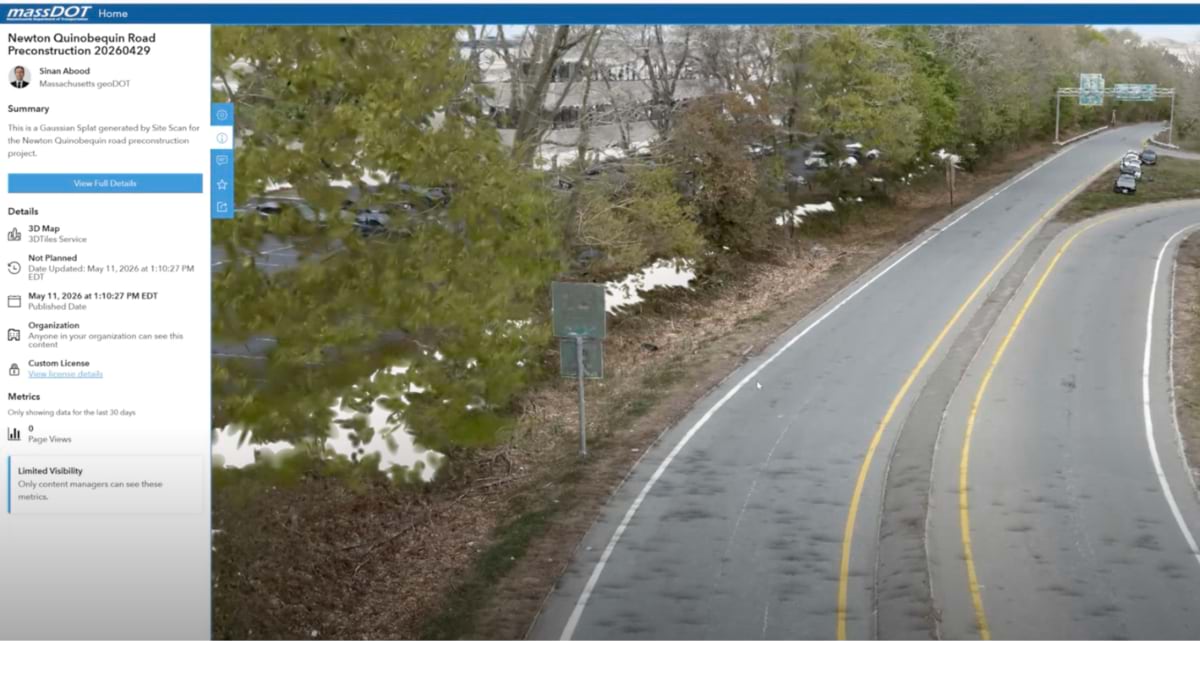
Authorized MassDOT users can sign in, view datasets, run analyses, build dashboards, and drop maps into presentations. Visual tools help people interpret imagery coverage areas. Explanatory pages break down complex products and concepts like True Orthos, 3D meshes, and digital surface models so that requesters better understand what they are asking for and what is possible. Abood works directly with engineers and members of other specialized teams to ensure that the hub speaks their language—that annotations and terminology make sense to anyone using imagery data.
“We want as many people as possible to use our data and integrate it into their workflows so they can grow and we can grow with them,” Abood said.
Maintenance crews consult up-to-date, highly detailed orthomosaics to prioritize repairs on bridges, roadways, and runways. Emergency response teams rely on rapid-response imagery to assess storm or accident impacts within hours. Environmental analysts compare historical collections to track changes in vegetation, erosion, and habitat health.
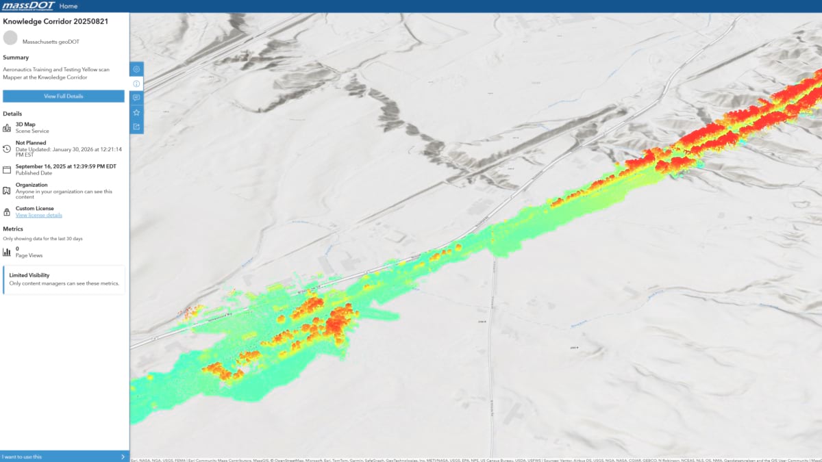
Lidar data, historically one of the program’s biggest bottlenecks, can now be served quickly and reliably through the image server and portal. In a recent test, MassDOT Aeronautics processed and delivered 10 miles of lidar data, streaming it seamlessly at more than 400 million points—even from an iPad on a 5G network. Abood wants to keep pushing what the system can do and show other teams how lidar can be applied to complex, time-consuming work like vegetation management and volumetric analysis.
Teams and leadership embracing the hub are enthusiastic about the new opportunities drones make possible.
“It’s all positive feedback,” Abood said, who notes that budget cuts can make truly impactful change a challenge. “Leadership is very happy that we could leverage existing resources to build this and make it available for all of MassDOT . . . We’re even getting requests from other departments of transportation to understand how they can implement the same approach.”
Learn how GIS turns imagery into an enterprise asset.