February 28, 2023 |
David Gadsden | Conservation
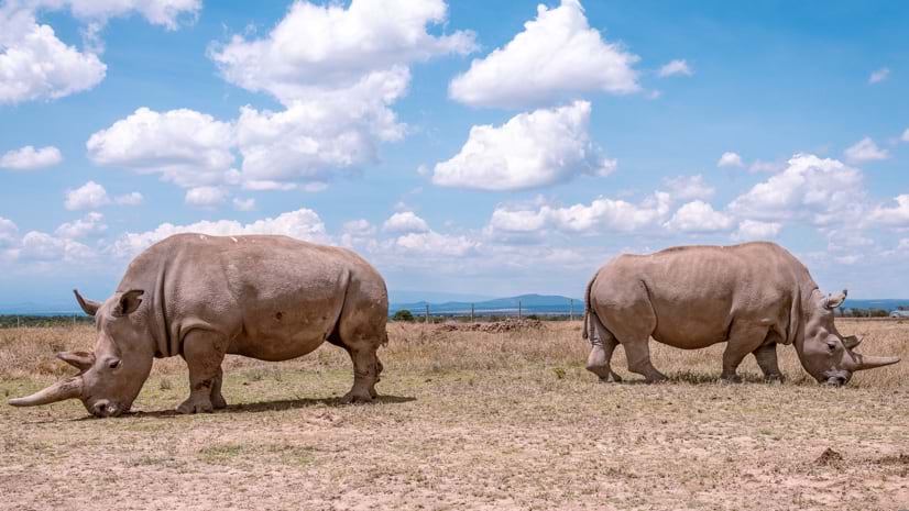
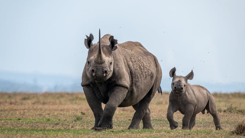
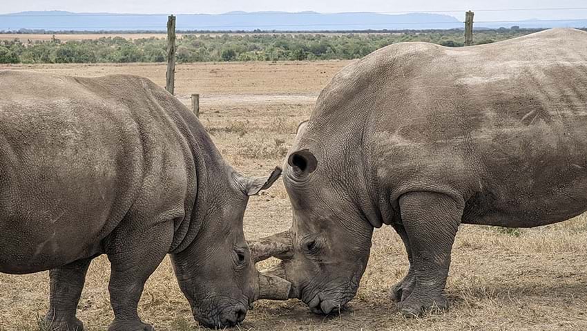
Fatu and Najin are the last two northern white rhinos left on Earth. The mother-daughter pair live under 24-hour armed protection at Ol Pejeta Conservancy (OPC) in Kenya. Weighing more than 3,000 pounds, their huge frames belie the delicate balance in which they exist.
Driven to the brink of extinction by habitat loss and poaching, Fatu and Najin offer the last hope for this keystone species. Eggs harvested from Fatu have been used to create embryos. The aim is to produce calves that can learn from their elders before they’re gone.
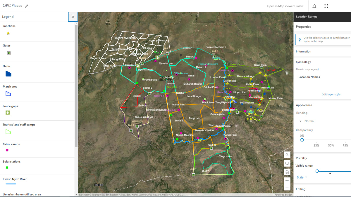
It’s a stark reminder of human impact on biodiversity and the need for better stewardship. Protecting endangered wildlife takes intense monitoring. As a sanctuary for some of the most vulnerable wildlife in the world, Ol Pejeta conducts this monitoring with the help of powerful technology, including smart maps and real-time dashboards driven by a geographic information system (GIS).
The conservancy’s data analysts use GIS technology to visualize animal movements on maps and better understand the relationships of migratory wildlife throughout the conservancy. This gives OPC management greater awareness to inform decisions and prioritize conservation programs.
“A visualized product is more easily consumed and understood by management,” said Kennedy Muriithi, senior officer, Innovation and Tech Lab at Ol Pejeta. “GIS has been able to assist us in monitoring wildlife, ecosystem health, and responding to challenges, such as human-wildlife conflict, poaching, and rescue and treatment of injured wildlife.”
Modern approaches to environmental monitoring have made their way into field operations at Ol Pejeta as well. Rangers record wildlife observations, images, and measurements of habitat parameters and environmental factors such as rainfall using GIS data collection tools. The ecological monitoring team can view and analyze this data as it syncs with the online repository and populates dashboards for each monitoring program.
“The data updates in real-time,” said Benard Gituku, the ecological monitoring unit manager at Ol Pejeta. “This is particularly helpful for projects that may take a week or more to complete. Program managers can check the progress of activities as they are happening.”
It’s a big step forward from the conservancy’s previous workflow of logging field notes on paper and inputting data into spreadsheets at the office. Data was stored offline on computers, which limited sharing and collaboration. There was also the risk of losing data due to machine loss or failure.
“It was tedious, and it was hectic,” Gituku said.
Quality data breeds quality analysis. Alfred Kibungei, the conservation data analyst at Ol Pejeta, welcomed the end of manual data collection.
“We had a lot of problems with inconsistencies in data [before moving to GIS technology],” Kibungei said. “What changed almost immediately was the level of accuracy at which we’re able to report findings, like wildlife sightings or mortalities. And we’re able to provide more details including GPS coordinates to guide management actions.”
When Kibungei began mapping at Ol Pejeta, field staff had to carry handheld GPS devices and record coordinates on paper to be mapped later. “GIS allows us to collect geo points in real-time and fix what we call ‘checks’ to regulate the kind of data received from the field. It now comes in accurately and in the right manner,” Kibungei said.
Though Fatu and Najin garner worldwide attention as the last of their kind, the critically endangered eastern black rhino is Ol Pejeta’s flagship species. African black rhino populations plummeted by 98 percent between 1960 to 1995. Through Ol Pejeta’s diligence and successful breeding programs, black rhino numbers in the conservancy have steadily risen—from 20 to 167 since 1993. The conservancy is now the largest eastern black rhino sanctuary in East and Central Africa.
“The successful growth of the eastern black rhino population has been a result of concerted efforts to fight poaching and close monitoring [of the animals],” Gituku said. “This ensures informed management actions are put in place.” Ol Pejeta uses rhino protection squads and veterinary experts to ensure the animals remain safe and healthy. As an added precaution, only specialized teams have access to rhino-related data.
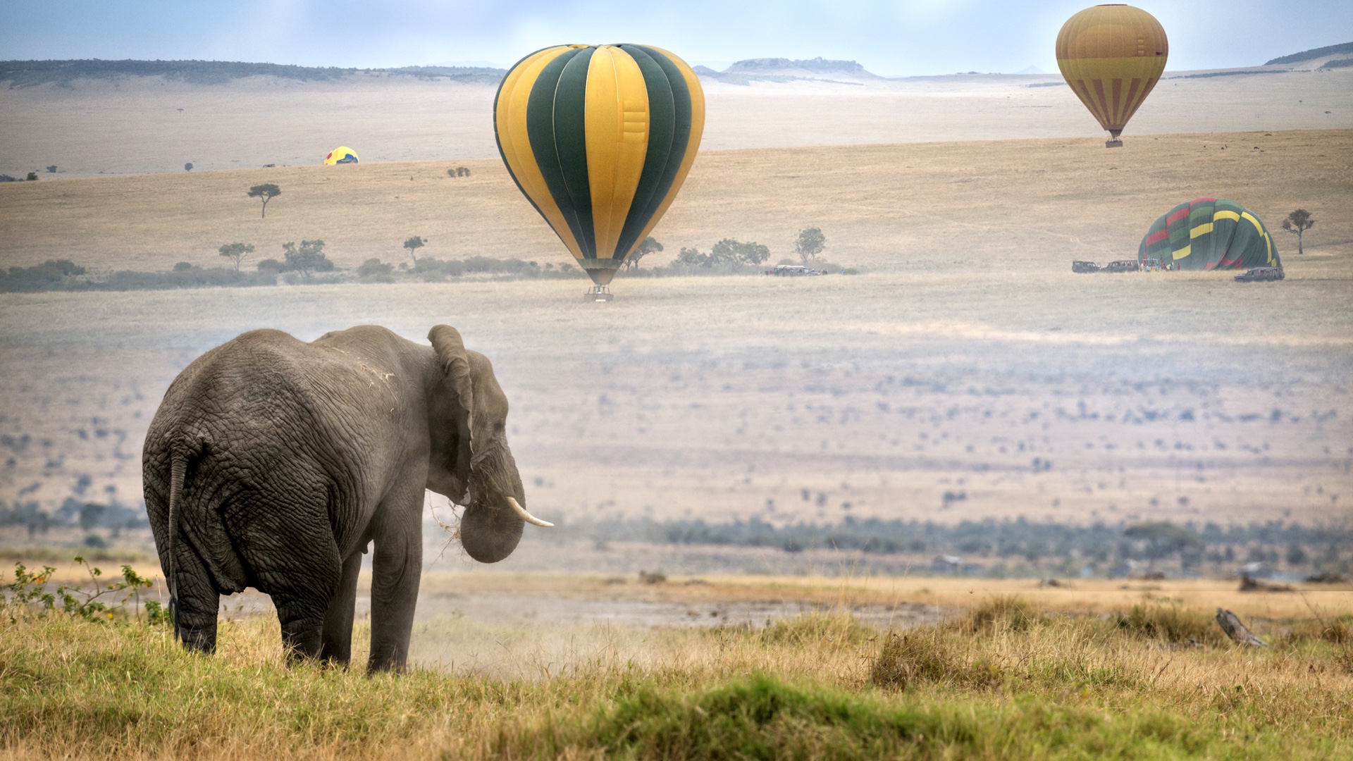
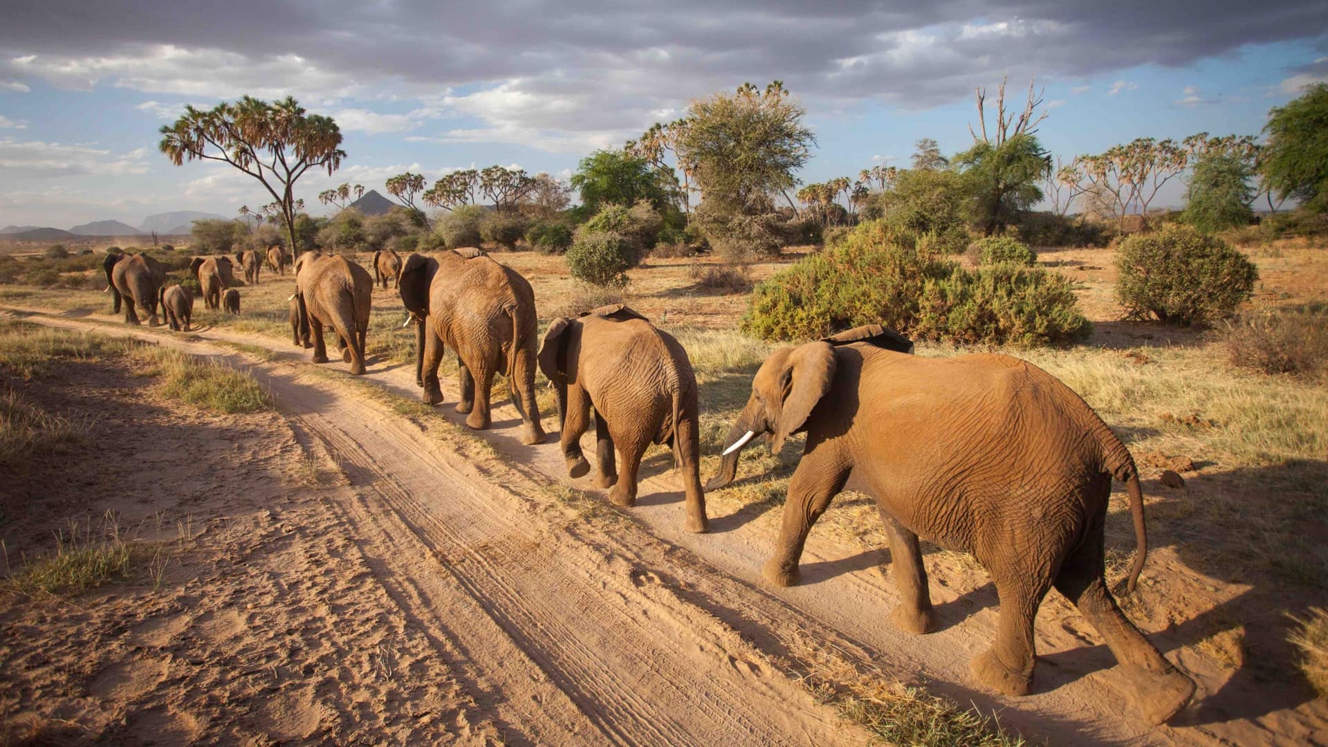
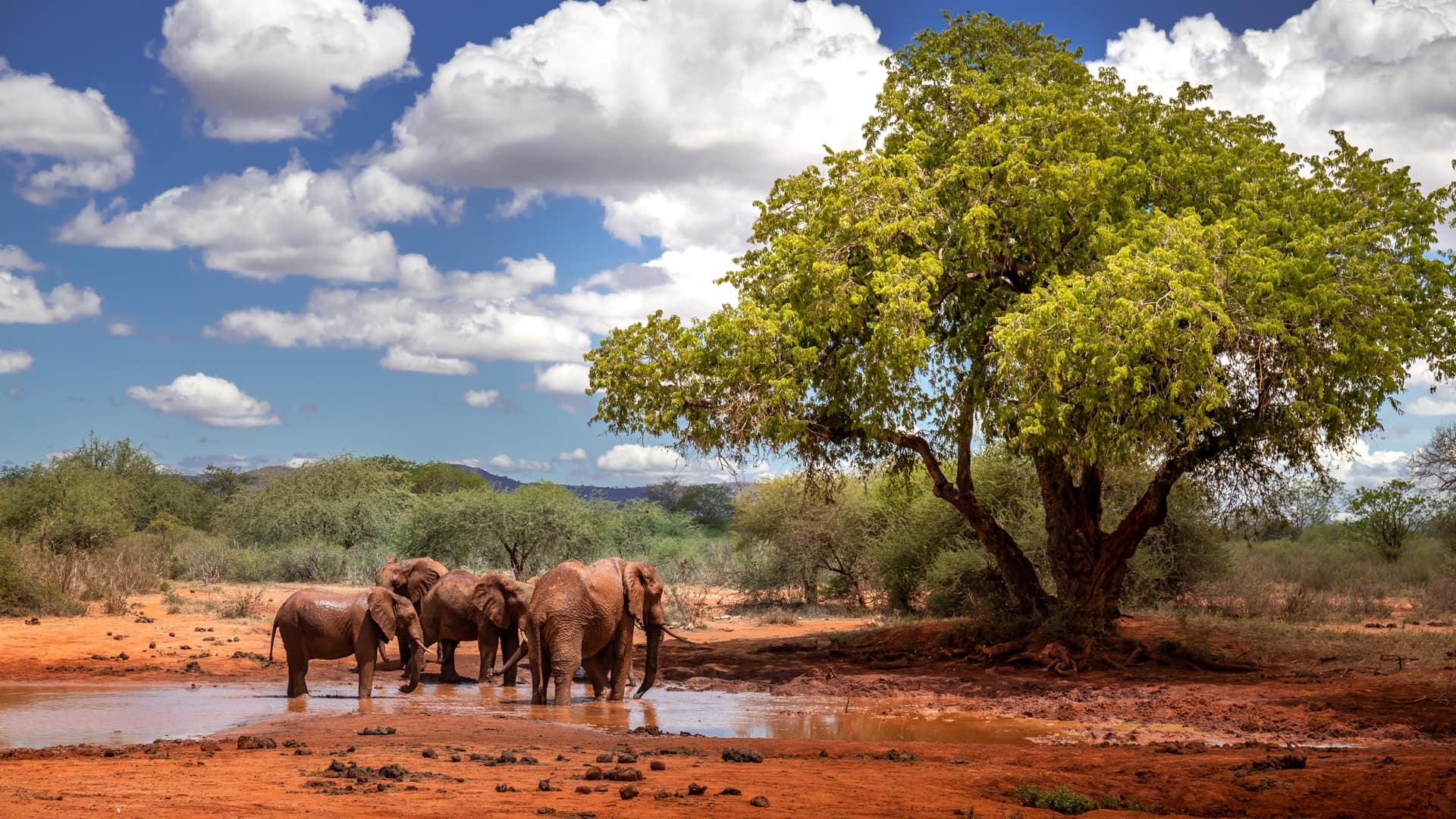
In addition to its flagship species, Ol Pejeta gives refuge to an array of other endangered animals. Elephants, wild dogs, cheetah, Grevy’s zebra, and the locally threatened Jackson’s hartebeest are among the species that roam the conservancy’s 90,000 acres.
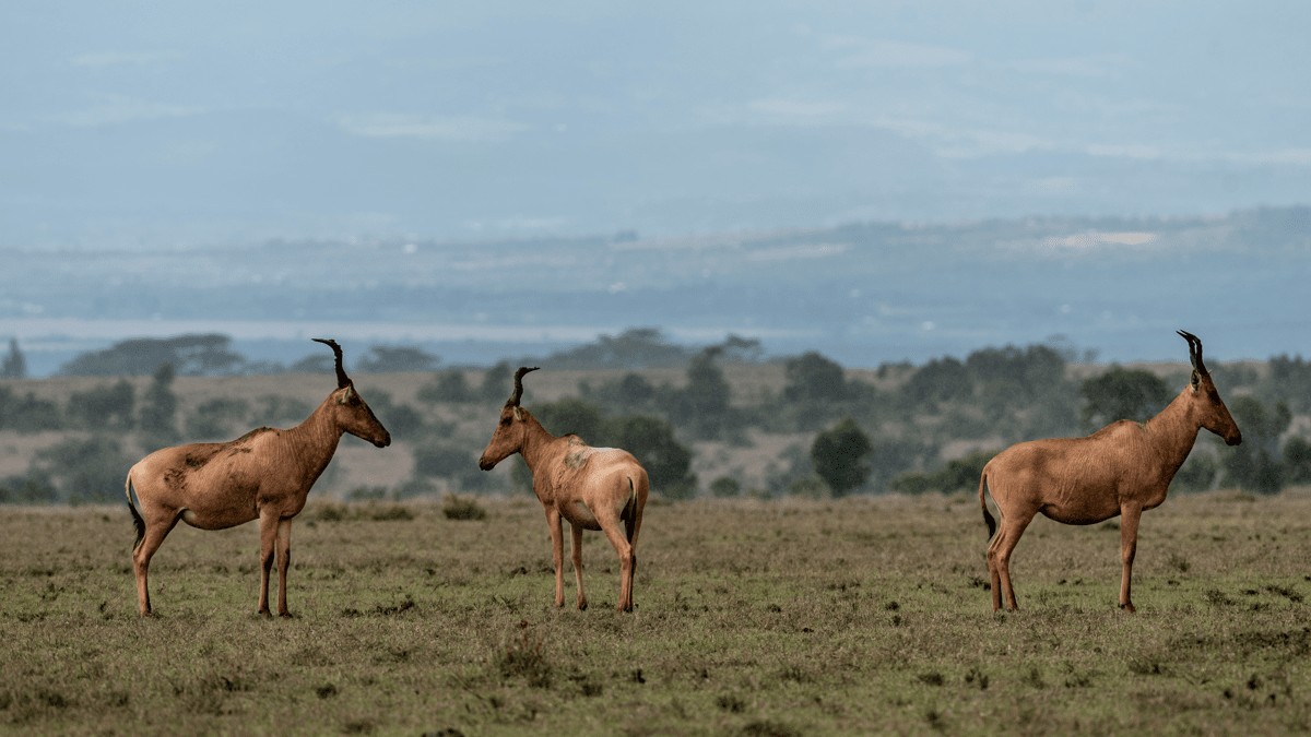
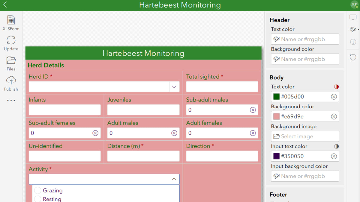
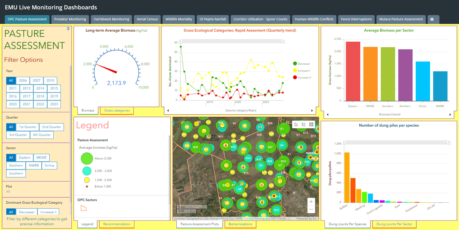
The ecological monitoring team currently maintains dashboards for 10 critical conservation programs including pasture assessment, rainfall, and wildlife mortality. One species-specific dashboard tracks Jackson’s hartebeest, a long-faced antelope whose numbers in the conservancy have been on a decline.
“We have less than 100 hartebeest here,” said Kibungei. “The population is declining, mainly due to predation by lions. So, we monitor these species at monthly intervals.”
Monitoring teams drive through predetermined routes with known hartebeest territories to locate and identify herds, count individuals, classify them by age and sex, note habitat selection, and record neighboring species.
“We want to look at the dynamics in the population, look at survival rates. Changes in habitat utilization determine the impact of predation,” Kibungei said. “Since some of the hartebeest herds are found in a lion-free section of the conservancy, we are able to compare hartebeest performance in the presence and absence of lions.”
Data-driven maps allow managers to detect overlaps between hartebeest and lion territories, noting shifts in hartebeest movement, numbers, and age-sex ratios. To help mitigate further decline in hartebeest numbers, the conservancy has enclosed a significant portion of the population in a lion-excluded area. This gives the hartebeest herd a space free of predation pressure, where they are able to breed and grow in numbers that can then be used to repopulate the core conservation area.
Agriculture and tourism drive revenue at Ol Pejeta to support conservation and community development programs. Located in Central Kenya’s Laikipia County, the conservancy has the country’s highest density of wildlife outside of the Maasai Mara. Ol Pejeta also owns the largest herd of the Boran breed of cattle in the world, with more than 6,000 heads that graze alongside wildlife—generating income and promoting soil and grass health.
The ecological monitoring team assesses pastures quarterly, using GIS apps to record measurements of grass quality and quantity. The data is used to guide optimal grazing practices to achieve a balance in utilization and optimal output levels for both cattle and wildlife.
Tourism, which accounts for a large part of Ol Pejeta’s revenue, has a potential to impact the environment. However, the conservancy staff take great care to safeguard wildlife and neighboring communities.
“We work closely with the National Environment Management Authority to make sure that our impact—within and outside the conservancy—is minimal,” Gituku said. “The habitats retain their integrity, and the wildlife lead a healthy life that’s as natural as possible without human interference.”
When animals break fences, damage crops, or cause other human-wildlife conflict, the incidents are recorded in the GIS database. By mapping reported conflicts, it is easy to identify hot spot areas and problem animals. The Ol Pejeta problem animal control team uses these visualizations to coordinate ranger deployment and hasten conflict response.
Managing human-wildlife conflict is as critical to Ol Pejeta as protecting Fatu, Najin, black rhino, hartebeest, and other endangered wildlife. As human populations grow and habitats are lost to development and climate change, Ol Pejeta’s ecological monitoring work becomes more important.
“We’ve been able to bring human-wildlife conflict data together and clearly see the hot spots,” Gituku said. “Then, we have our team ready to respond as quickly as possible.”
Learn more about how conservation professionals achieve sustainable results with the power of geography.