




May 5, 2026 |
Anthony Schultz | Public Safety
Gordie Blum has spent his career in America’s national forests. Now Acting Associate Deputy Chief, he knows what those lands hold—165,000 miles of trails and 193 million acres of mountains, grasslands, wild rivers, and high country. These public lands draw more than 164 million visits a year for fishing, hunting, hiking, camping, and the kind of off-road vehicle riding that national parks don’t offer. With interest in access to nature growing, the agency has been working toward creating a single map-based guide that helps visitors navigate and make the most of what’s out there.
The Forest Service has needed this for a long time, Blum said. Visitors want to know where to go, how to get there, what to consider. Are there closures? Fire hazards? The questions are basic. The answers were scattered.
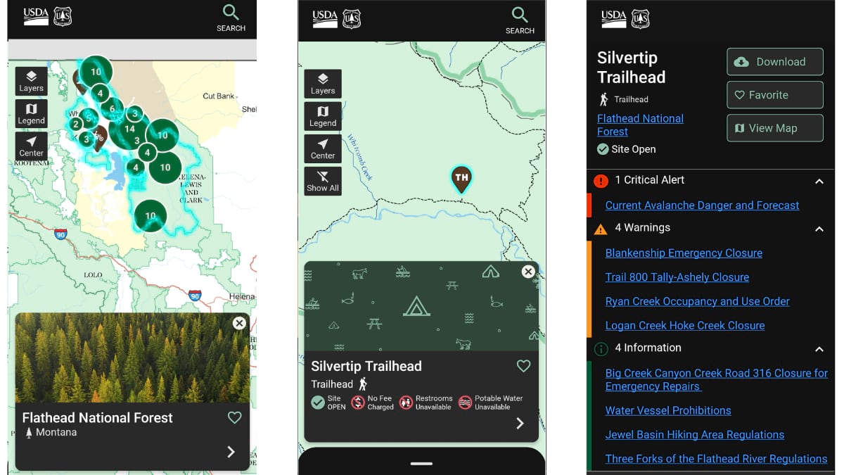
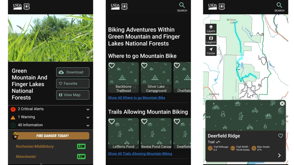
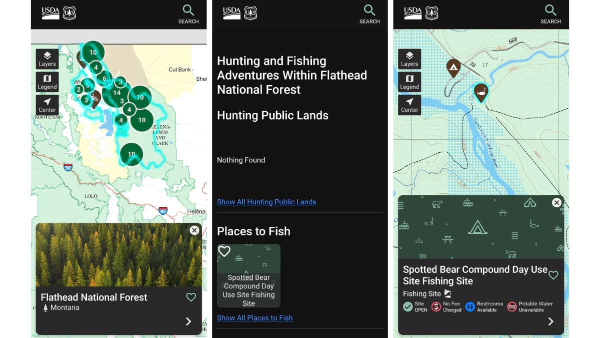
The National Forests and Grasslands app changes that: one application, authoritative Forest Service data, every national forest and grassland in the country. Offline maps that work where cell service ends. Real-time conditions from live agency feeds. A design built around how visitors plan a trip.
The Forest Service had built digital capability over the years: regional apps, forest-level tools, an interactive visitor map, a tour platform. Each served a purpose. But maintaining separate applications across a system this large was costly, and the experience depended on which forest a visitor was headed to and which tool they happened to find.
Chase Martin, the app’s product owner and a digital communications specialist with the Forest Service, describes the goal: take what was working, understand what visitors expected, and build one application that delivers it consistently.
The team studied the National Park Service app, which had earned strong reviews, and used it as a baseline for what visitors expect from a federal recreation app. The Forest Service’s own ambitions and data assets shaped the ArcGIS mobile approach.
Commercial trail apps are useful. But their data is often user generated. “This is the authoritative data for where this trail, where this site, is positioned on national forest lands,” Martin said. “This is the up-to-date data about uses, amenities, and conditions. That’s what we’re providing.”
The app draws from two sources that are already part of the agency’s daily operations—no new data entry required.
The first is the Enterprise Data Warehouse—the EDW public data site—which holds the agency’s full inventory of recreation resources: trails, rec sites, wilderness areas, roads, motor vehicle use data. Aaron Dueck, the app’s lead developer, has worked with this data for years. A geographic information system (GIS) specialist since the late 1990s, he ran mobile GIS programs for the Bureau of Land Management for 17 years before joining the Forest Service. Dueck indicated that trails and rec sites are the primary layers now, with more data in the works.
And the second source is the agency’s web content—alerts, conditions, closures, and seasonal access changes that local public affairs officers update daily. That content flows into the app automatically.
“There is no third spot to update information,” Martin said. “It’s consistent across the entire nation.”
The app is designed to make data updates easier for staff, with no added workload. Beyond internal feeds, the app pulls National Weather Service reports, authoritative fire data, and select information about other nearby public lands. The app road map includes location-aware alerts and closure orders.
“We’re drawing from multiple authoritative sources, and the app brings it all together,” Dueck said.
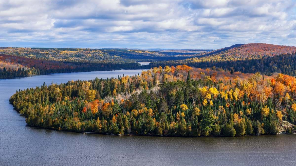
The Forest Service manages the world’s largest trail system—165,000 miles, motorized and nonmotorized, connecting rural communities to economic activity and urban populations to landscapes many don’t know they can reach. About 70 percent of Americans live within two hours of a national forest. National forests offer things many national parks don’t—off-road vehicle riding, equestrian trails, and wild and scenic river access. Large portions have limited or no cell coverage, which makes an offline-capable map more than a convenience.
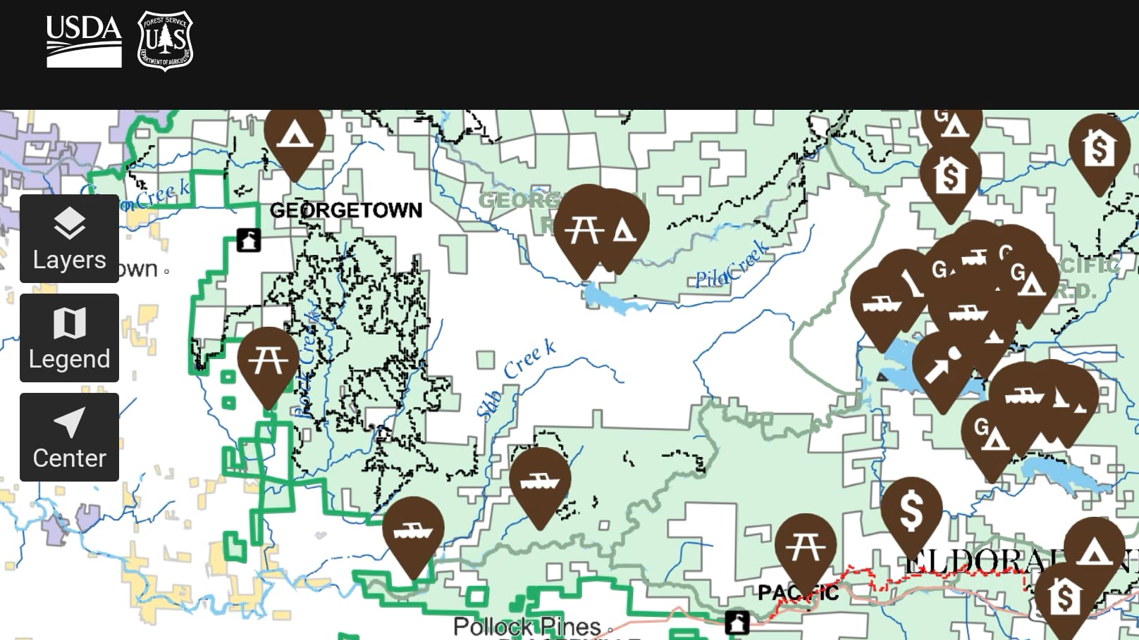
The FS Base Map—the Forest Service’s authoritative cartographic product—can be downloaded for each individual national forest. The app adds map packages with recreation sites and trails data, delivered through ArcGIS Online infrastructure for offline use. GPS on the device handles location when there’s no network. The blue dot keeps you oriented.
“The app fits our goal to do a better job spreading the word about what we do and what we provide,” Blum said.
Search a forest and photographs appear, terrain becomes navigable, sites that lacked any digital presence become findable. “All of our national forests have places that are just great to get out and enjoy,” Blum said. “You can have a really special day out there, no matter where you go.”
Real-time fire information, local public notices, and emergency closures are available when connected. These alerts help visitors plan before they head out and stay aware when they have a signal.
“We hope to reach as many people as we possibly can with this app,” Dueck said. “Having a solid cloud-based infrastructure has been helpful to get this app out the door.”
The app launched in June 2026 during Great Outdoors Month, timed to appear on National Trails Day. Version 1.0 was designed to set the foundation. The approach as Blum said was to “cover the basics, get it out there, and grow from there.”
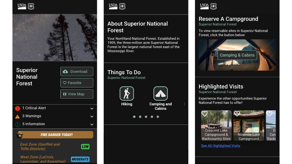
Version 1.2 will add wilderness areas, wild and scenic rivers, and expanded motor vehicle use data. Version 2.0 will add tour guide functionality, giving visitors a curated sense of what makes each forest worth the trip. Reservations already connect to rec.gov: Find a campground, tap a button, and the reservation system opens in context.
For visitors heading into areas with no signal, the map in their pocket reflects the same data the agency uses—current, authoritative, and specific to where they are.
“Put the phone down, listen to nature, recharge,” Blum said. “You can stay connected to the degree you need to.”
Download the app. Download the map. The public forests and grasslands await your visit.
Explore how GIS supports outdoor recreation and public lands access.