
July 14, 2022 |
Anthony Schultz | Resilience
Sarah Hartsburg spent years on wildland fire crews—engine, helicopter, hand crews—before she moved into geographic information system (GIS) technology. Early in her career, her crew would spend days going structure to structure near a fire, assessing risk, documenting what needed protection, and filling out forms.
“Every time a new team came in, the crews were reassessing the same structures again,” said Hartsburg, now a national data manager with the US Wildland Fire Service, “because the data wasn’t making it to where it needed to be. All that work was being repeated—and the crews on the ground could have been doing something else.”
That gap—between what firefighters know in the field and what gets captured, kept, and shared—is what a decade of investment in digital tools has helped close. For years, the agencies responsible for wildland fire in the United States fought fire together but often operated with disparate data standards. The National Interagency Fire Center in Boise, Idaho, became their common ground, and the NIFC Org, a shared ArcGIS Online platform, became their common operating picture—shared standards, shared tools, and a shared view of every fire across the country.
That bridging of technology is now being followed by an organizational one. On January 12, 2026, Brian Fennessy—a California fire veteran who began his career with the US Forest Service and the Bureau of Land Management—was appointed to lead the new US Wildland Fire Service, consolidating the Department of the Interior’s fire agencies under a single mission. “Wildfire response depends on coordination, clarity, and speed,” Fennessy said in a press release. “This effort is about bringing programs together and building a framework that better supports firefighters and the communities they serve.”
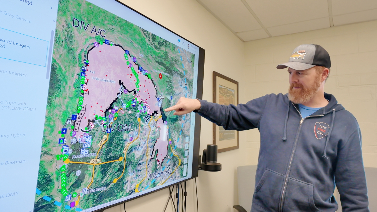
Skip Edel has been supporting wildland fire operations with GIS since 2000. He was there when the data lived in local geodatabases on individual computers, when maps were printed once a day and pinned to a bulletin board, and when a firefighter who didn’t make it back to the incident command post by nightfall simply didn’t get their updated data on the map. He is now the Fire GIS Program lead for the US Wildland Fire Service and an administrator of NIFC Org, where he and his team have spent years welcoming everyone to the platform and tuning it to fit their needs.
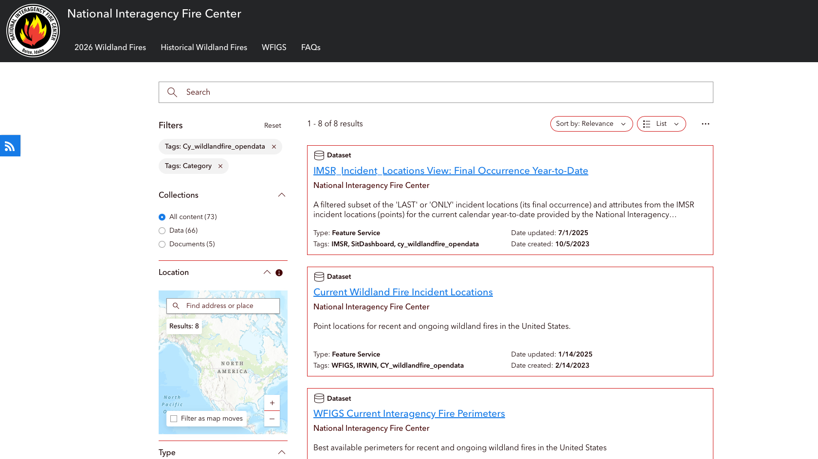
The name chosen for the platform reflects its founding principle. The National Interagency Fire Center in Boise has long been a gathering point for federal, state, and local agencies working wildland fire together—and when the NIFC Org was established, membership was extended to any cooperator responding to wildland fire, regardless of agency or jurisdiction. In 2014, about 300 users—mostly GIS specialists—were part of that organization. Today there are 35,000, mostly field firefighters accessing the system from a phone or tablet.
“We really changed our workflow,” Edel said. Before, GIS staff updated maps overnight and those maps stayed static until the next shift. In rapidly moving fire, that 24-hour cycle created gaps in awareness. “They just pull out their phones and collect data. If they’re on the way to a new incident, they can see the fire and the area around it—they can get a picture of what they’re getting into.”
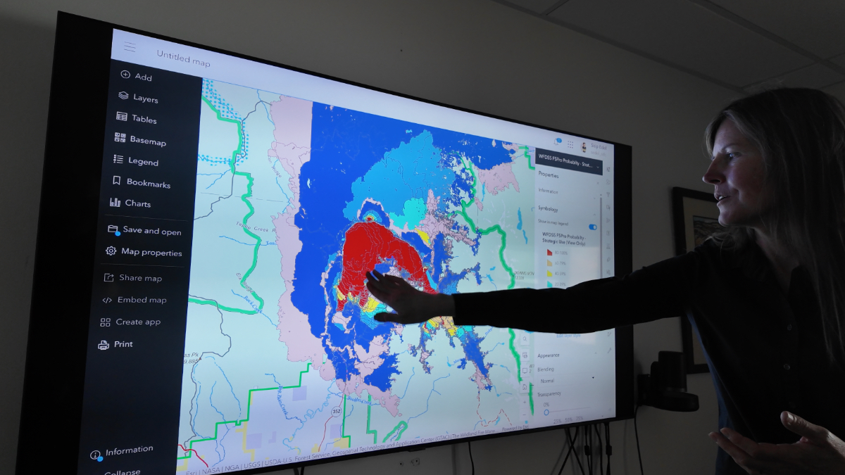
At the core of the platform is the National Incident Feature Service, or NIFS. It’s not a map. It’s a standardized, continuously updated data layer open to all wildland fire personnel regardless of agency or affiliation. Any authorized GIS user can pull the data service directly into their own mapping environment to interrogate, model, and analyze wildfire incidents. That data can be layered with fuel moisture, weather, topography, and historical fire records—building a picture of what a fire is likely to do before it does it.
“A goal of the Wildland Fire Service is to better use resources and better respond to wildland fire,” Edel said. “We have a common operating picture throughout the country—the National Incident Feature Service runs from Puerto Rico to Hawaii, available to anyone in between.”
In 2025, approximately 6,700 wildland fire incidents were documented in NIFS with full operational tactical details all mapped using standard symbology. “Standards help anyone on the fire line understand what you’re trying to communicate,” Edel said.
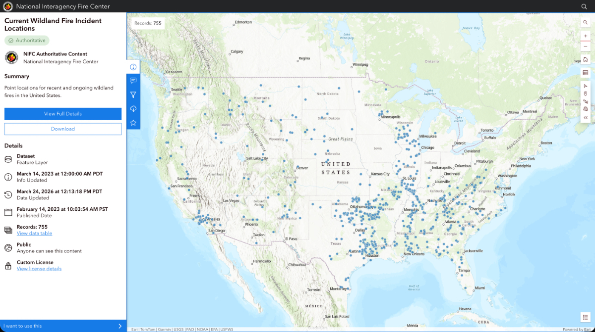
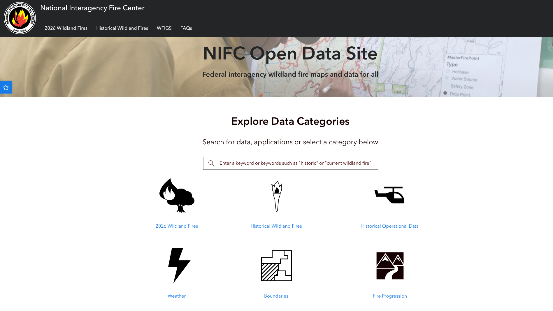
Fire perimeters and incident locations are published publicly to the NIFC Open Data Site—but the tactical picture, the fire lines, drop points, and planning lines that firefighters work from, stays within the NIFC Org.
For every fire, there are evacuations and people waiting to learn whether their home survived. With all-digital workflows, public awareness happens much more quickly now. Every five minutes, NIFS data approved for public release is pushed to the NIFC Open Data Site.
“The GIS folks just focus on serving the firefighter on the incident,” Edel said. “We scrape the data for public awareness off the top automatically.”
The scale of demand for that public feed is striking. Last year, the portal logged billions of hits over the summer fire season—a measure of how many people are anxious about their homes and properties. Google scrapes the data. Apps like Watch Duty pull fire polygons directly. Insurance companies use perimeter data to position private engine crews.
That public picture is only as current as what firefighters are building on the ground. When crews arrive at an active incident, the intelligence collected by the team before them is already waiting. “Incoming resources were headed right to where they were needed,” said Craig Gallagher, a wildfire GIS specialist with the US Wildland Fire Service, “and they had that picture at their fingertips as soon as they connected.”
That same commitment to sharing has driven a steady expansion of what the open data site offers the public. Current fires update continuously. All incidents from the current year are available as they occur. Historical fire perimeters go back to 2020, with earlier records being added as agencies digitize their archives. A new fire progression feature stacks daily fire extent perimeters so anyone can watch how a fire moved across the landscape—updated daily, and sometimes more frequently.
For residents in fire-prone areas, this helps them understand how fires behave, how quickly they move, and what the terrain and history of a place suggests about where a fire is likely to go. The data that firefighters use to make decisions is increasingly the same data available to the people who have to live with the consequences.
Now that firefighters can instantly share data, that same connectivity also shares everyone’s location. NIFC piloted the capability with roughly 1,500 firefighters in Texas in 2025 and is rolling it out to all firefighters this year. On a fast-moving fire incident, that location awareness changes how decisions get made—who needs support, where effort is being duplicated, and where coverage is needed with no one there yet. The map stops being a record of what happened and starts being a tool for what happens next.
Location sharing among firefighters is one input in a much richer intelligence picture—one that includes field observers scouting terrain ahead of crews, fixed cameras on ridgelines watching for smoke, and infrared flights scanning fire perimeters after dark. When crosswinds ground aircraft and a fire is moving fast, FireGuard—a program that puts National Guard intelligence analysts on round-the-clock satellite monitoring—provides a much-needed input that spans North America. And on the horizon, Earth Fire Alliance’s FireSat constellation, purpose-built for wildfire detection, will provide global coverage at intervals that current systems can’t match.
When all those inputs converge, fire behavior becomes more predictable. Analysts already run thousands of simulations to map where a fire is likely to go before it gets there. Better prediction means earlier decisions, more time to position resources, and less destruction from fires. AI is being tested to help manage that data flow. A voice interface could reduce the steps between a field observation and a map update. The less friction between what a firefighter sees and what gets shared, the more useful the picture becomes for everyone.
Hartsburg moved into GIS because she wanted to fix how data traveled. Now, she’s pursuing fire behavior analyst training—following the data from the map into the models. She’s not alone. Across the wildland fire community, the tools are pulling people forward into new roles, new skills, and new ways of thinking about the growing challenge of wildfires.
Learn more about how GIS is applied to prepare, mitigate, suppress, and recover from wildland fire.