March 12, 2024 |
Carrie Speranza | Public Safety
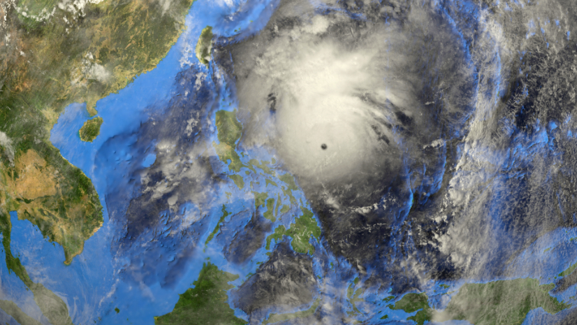
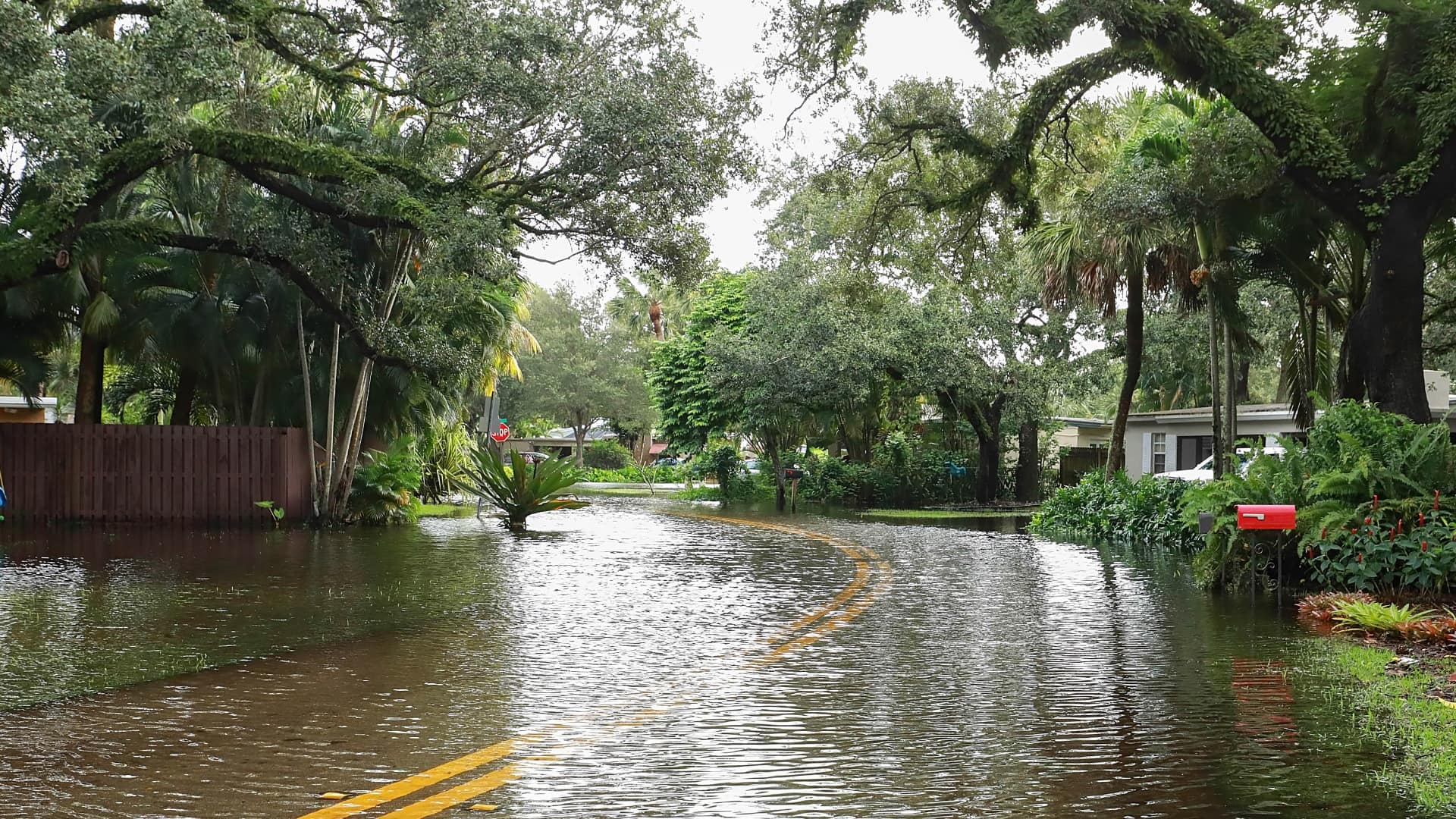
The Philippines ranks among the most disaster-prone nations on Earth. Spread across more than 7,000 islands in the volatile Ring of Fire, people there face constant threats from earthquakes, volcanic eruptions, and the world’s most powerful typhoons. Each year brings 20 to 25 storms—many of them catastrophic.
When disaster strikes, recovery has traditionally been the responsibility of corporations. Utilities are owned by private conglomerates that have the equipment and logistics to shoulder a rebuild. These disparate efforts have made recovery uneven across the country, enhancing economic divides.
But record-breaking typhoons in 2009 pushed corporate executives—rivals in some cases—to pool resources. Formalizing as the Philippine Disaster Recovery Foundation (PDRF), major domestic and multinational companies set out to tackle readiness and recovery in cooperation.
As a private-led recovery organization, PDRF has a novel scope. Its motivation, however, is straightforward. “If communities don’t bounce back, the economy suffers,” said Guillermo A. (Bill) Luz, who co-founded PDRF as an executive with Ayala Corp, a real estate conglomerate. “Resources are unevenly distributed—some towns get more, others get nothing. We balance deployment and direct donors to underserved areas.”
With a small team, Luz built a roster of 80 member companies and mapped their resources using geographic information system (GIS) technology to inventory assets by location, company, and resource type. “We don’t handle physical goods,” Luz explained. “We act like a control tower, using data to direct companies and resources.”
Everything seemed to be progressing successfully. Luz made a move back into the private sector.
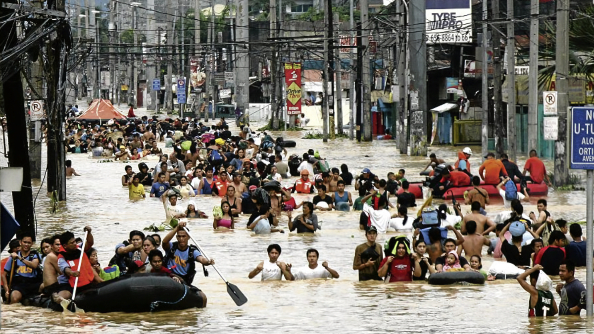
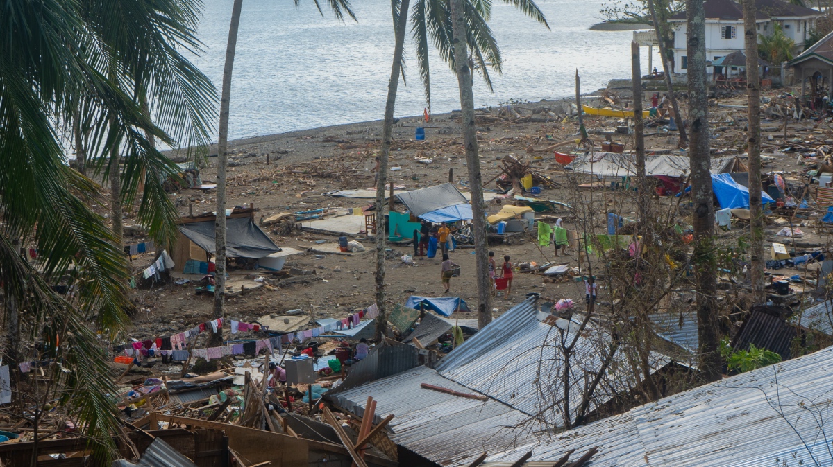
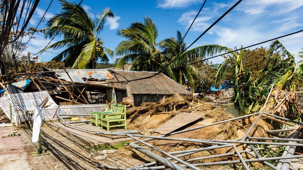
Then, Super Typhoon Haiyan slammed into the Visaya islands in November 2013, and everything changed. The storm remains the most powerful on record globally, resulting in 6,000 fatalities and leaving millions without homes. Tacloban, a city the size of Madison, Wisconsin, faced near-total destruction.
“After Haiyan, we realized how blind we were,” Luz said. “We can’t just respond after disasters—we needed to invest in preparedness, prevention, and mitigation.”
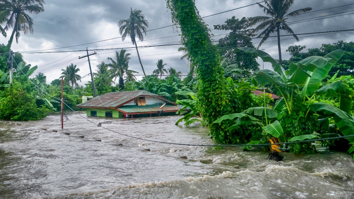
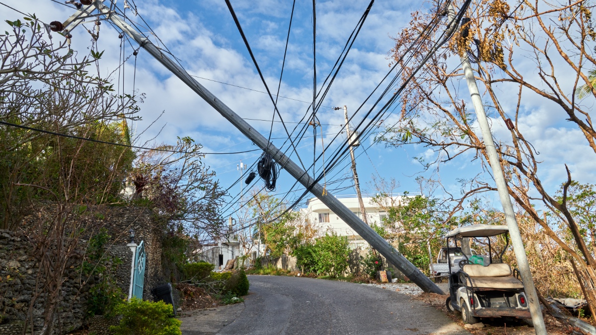
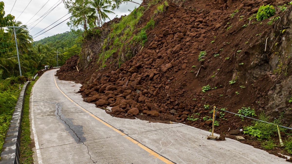
Rural areas endured prolonged power outages and remained inaccessible for months. Floodwaters ruined newly harvested rice crops. Landslides blocked roads. Desperation led to looting. A wrecked oil tanker leaked fuel along the coast.
The devastation sparked a decisive shift among foundation leadership. Loud and clear, they announced that the “R” in PDRF, which previously meant Recovery, would now be Resilience.
All they needed was a top corporate responsibility executive to uncoil the strategy, tactics, and data.
In disaster recovery, you rebuild. In resilience, you don’t break—you maintain operations under stress and adapt as conditions change.
The questions are always urgent: Where are the people in need? Where are the supplies? How can responders get there safely and quickly?
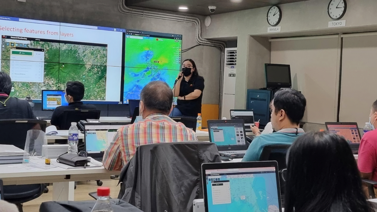
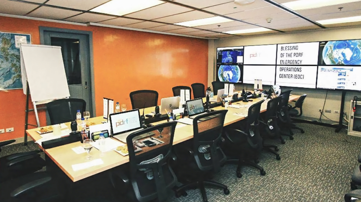
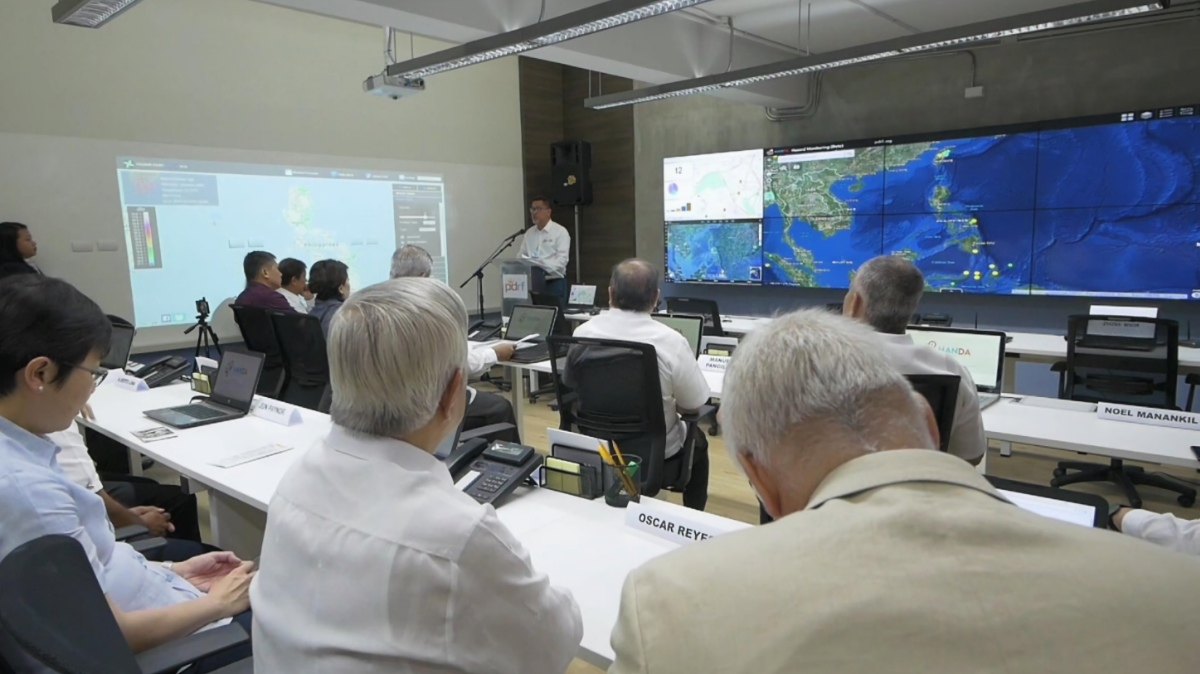
PDRF needed a command center. A place to centralize everything they knew about people, buildings, and the landscape. Where real-time weather conditions and seismic activity could be monitored around the clock.
At a Cold War-era facility closed by the US military after a massive volcano eruption, PDRF opened the first private sector-led Emergency Operations Center (EOC) in the world. The hub monitors hazards. It coordinates warnings, evacuations, asset deployment, and emergency services.
In Tagalog, the word handa means “get ready”–which is also the name for their custom GIS system: Hazard and Disaster Analysis for Business Resilience (HANDA).
At the EOC, teams work around the clock, building forecasts, monitoring conditions in real-time. They workshop simulated disaster scenarios with local business leaders, supply chain partners, government agencies, and local authorities.
Situations that once triggered chaos now trigger alerts.
A month before the Mayon Volcano erupted, GIS models forecasted lava paths by combining seismic data, geological layers, and population information. Risk maps gave businesses time to safeguard staff and equipment. Authorities launched early evacuations and staged relief supplies in safe zones. Donors responded with precision, sending the right amount of food, water, and hygiene kits.
The benefits go beyond immediate response. After earthquakes in Cebu and Davao, PDRF teams geotagged damaged buildings. Comparing those locations with fault lines and seismic activity revealed why some structures collapsed while others stood—insights now shaping safer construction.
Preparedness also paid off during COVID-19. PDRF quickly partnered with public health agencies to set up testing sites and track the transmission of the disease. Maps guided food distribution during lockdowns, and daily vaccine-rate maps optimized supply, reducing waste and accelerating protection.
In a typhoon, advance warning is currency for business continuity. With GIS-based hazard modeling, PDRF buys members valuable time to prepare and mobilize resources.
“The weather service focuses on accuracy to avoid public panic, but for us, preparedness is the priority,” Luz said. “For typhoons, we aim for 7–10 days of advance warning—even if forecasts aren’t perfect.”
Using HANDA, PDRF analyzes streams of weather data and decades of typhoon tracks. Luz said they can send three or four advisories before a storm arrives, detailing rainfall, wind speeds, and the places most at risk.
Maps display multi-hazard models that combine weather, ocean, and geospatial data, showing how risks interact—typhoons trigger floods and landslides. Risk metrics, layered with demographic and population data, help planners anticipate needs and allocate resources.
Companies use a GIS app to map where employees live and notify them, prepare plants for severe conditions, and arrange alternative sourcing before disaster strikes.
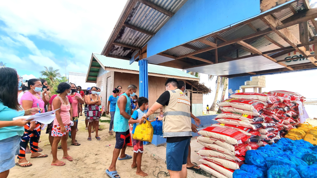
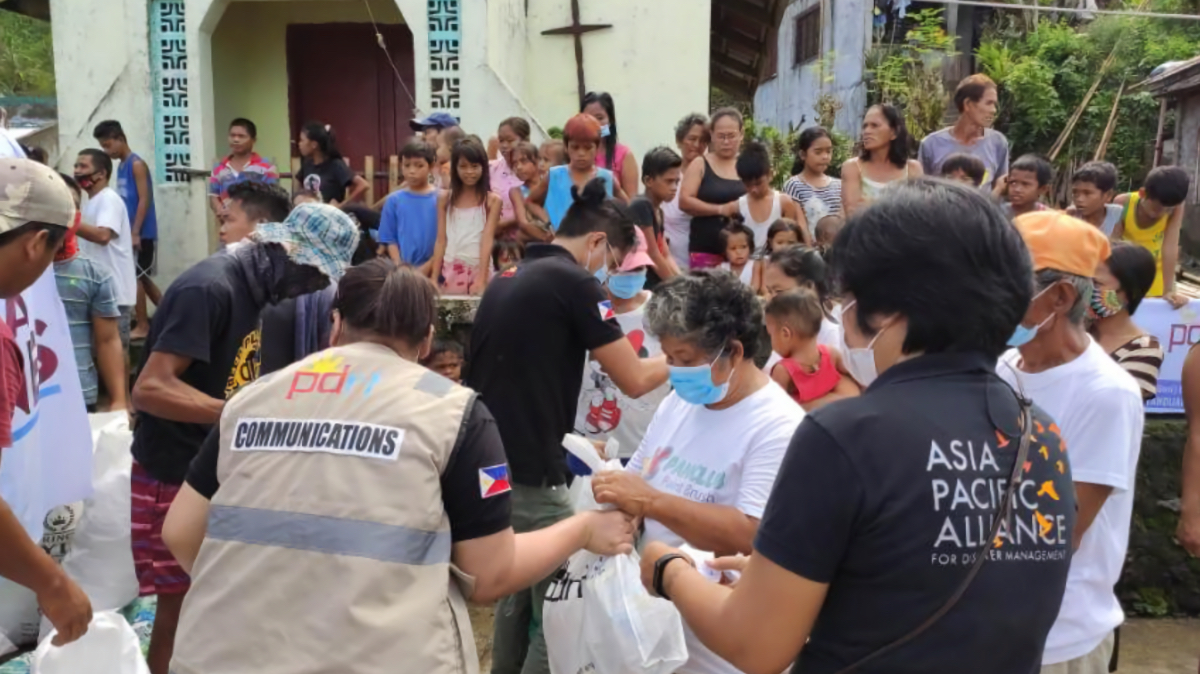
A single phone call activates prearranged commitments. Supplies are ready for trucking and shipping partners pick them up and route them where needed. Utilities mobilize crews to restore essential services. If repairs can’t happen right away, PDRF deploys generators, fuel, and mobile cell towers through its network of corporate partners.
On the ground, partner companies and NGOs take rapid damage assessments using a mobile GIS application. Maps update in real time. Government and UN teams get directed to affected areas, ensuring coordinated response.
“Mapping has made PDRF different from other organizations,” Luz said. “Seeing everything on screen and zooming in live has been a huge benefit.” Not just leading up to disaster, but afterward as a tool for documentation and storytelling.
Transparency proves crucial in disaster recovery. When Typhoon Odette—a super typhoon with devastation comparable to Haiyan—struck in December 2021, it impacted about 13 million people across the central and southern Philippines. As PDRF rolled out aid, GIS technology tracked every step.
A dynamic map showed where goods were delivered, with each dot linking to photos that documented which company donated, where, and when. A companion dashboard quantified the response: thousands of ready-to-eat meals, hygiene kits, liters of fuel and drinking water, and tons of goods moved by logistics partners.
Ramping up community involvement is the way forward. PDRF had considered opening another EOC in Cebu, the principal city in the Visayas. “That was costly,” Luz said. “Instead, we encouraged others to build their own centers and link with us, creating a network that shares data.”
That trust is scaling as mapping for resilience expands with PDRF as the data hub, training center, and organizational template. Several government agencies and hyperlocal programs are now part of the network, Luz said.
In 2024, PDRF’s network reached 12 regions, with six new emergency operations centers set up in cities across the country. Over 4,300 people—from city officials to small business owners—took part in hands-on training to prepare for disasters and keep businesses running. Local governments received new tools for hazard mapping and early warning, and 266 staff members got direct support to operate these systems.
The network grows faster and more responsive as new communities join. Resilience depends on collective effort, and shared data informs every action.
“Losses are not inevitable,” Luz wrote in a recent op-ed. “The [United Nations Office for Disaster Risk Reduction] has found that every $1 invested in disaster risk reduction can generate savings of up to $15 in response and recovery.”
Learn more about how GIS helps communities prepare and adapt by mapping and analyzing hazards and demographics for a more equitable approach to resilience that can change future outcomes.