May 25, 2021 |
Christopher Thomas | GIS for Good
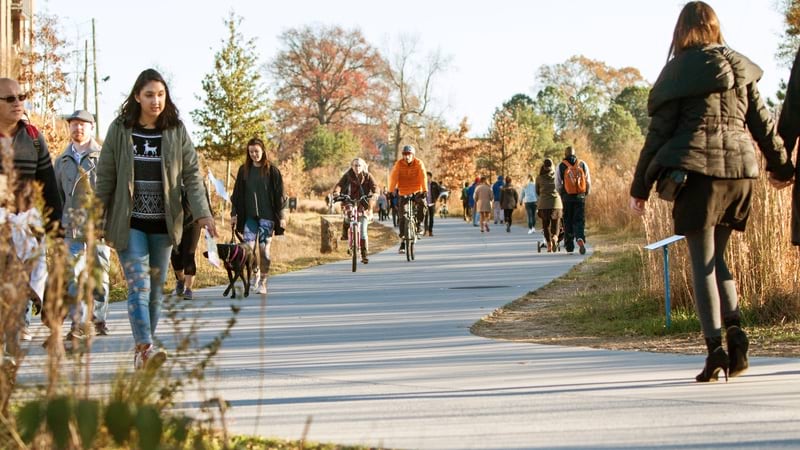
There’s a running joke that in Atlanta, all navigation prompts include “Peachtree Street,” because there are 71 roads with some form of that name. But with the city’s tremendous growth—adding two million residents between 1996 and 2014—actual live trees were becoming a rarity in and around Atlanta. In the 1990s, 27 acres of tree canopy coverage per day were lost during the construction boom brought on by the 1996 Olympic Games.
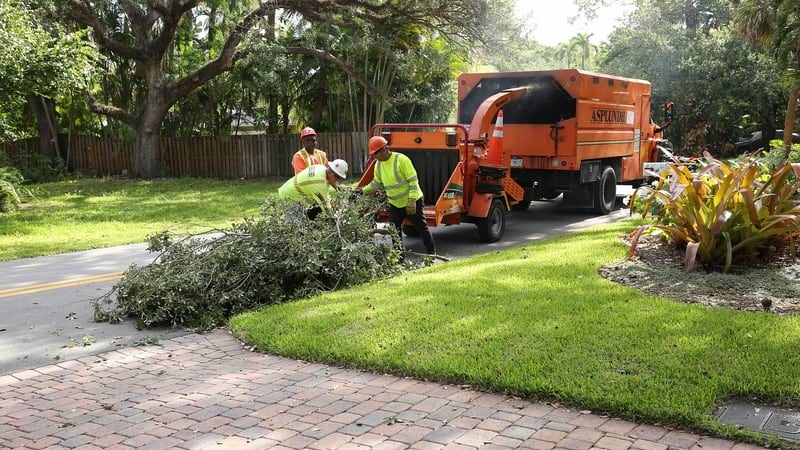
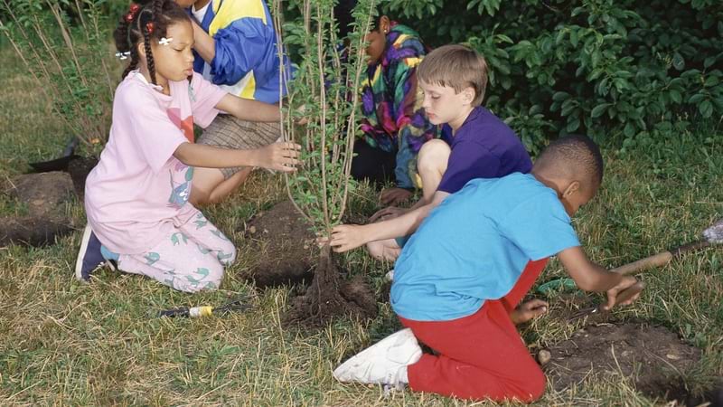
Trees Atlanta works to mitigate the city’s tree loss and increase downtown tree canopy through planting, education, and conservation. The nonprofit is a community of employees and volunteers who recognize the benefits of trees and green space. The efforts to revive Atlanta’s roots in nature put Trees Atlanta on the map for redefining what urban spaces can look like. The nonprofit uses geographic information system (GIS) technology to record, map, and track its work to keep Atlanta green.
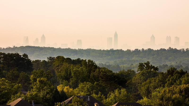
Trees Atlanta has had success in safeguarding the reputation of Atlanta for being a “city in a forest,” with its 48 percent tree canopy coverage. But there’s an uphill battle statewide; the US Forest Service has singled out Georgia for the fastest urban tree loss in the nation.

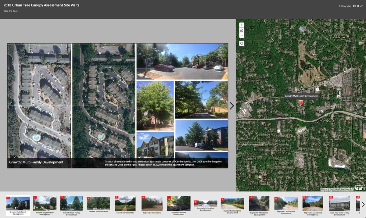
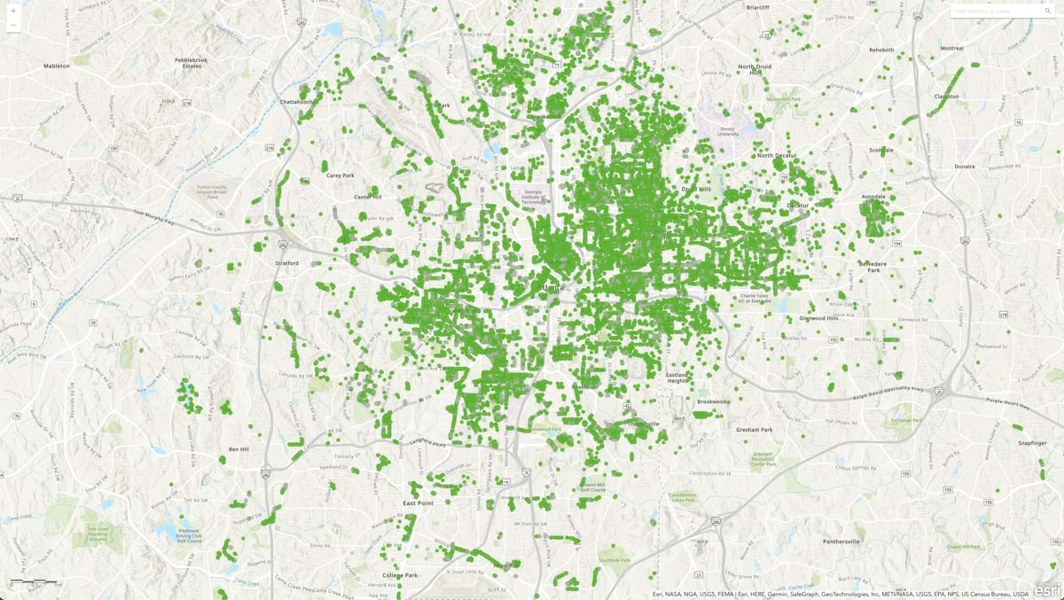
Before implementing GIS, the Trees Atlanta team members could not gather a full picture of their work in specific neighborhoods or throughout the city. But now, from start to finish, the workflow of Trees Atlanta tracks the steps that accomplish its mission. Fifty employees and dozens of volunteers use GIS to log activities.
“That really expanded the possibilities for how we could record our planting locations, what kind of information we could record, and the quality of care we could give each tree,” said James Moy, data manager with Trees Atlanta.
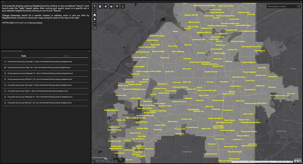
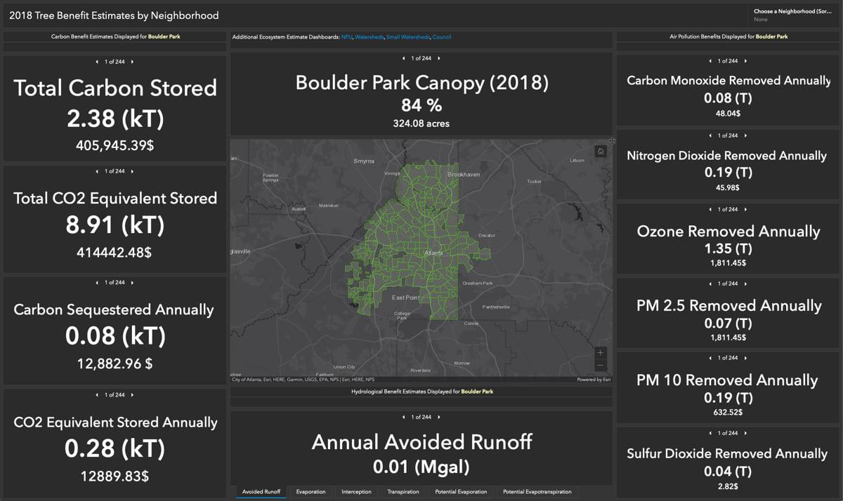
Moy has trained his coworkers to use a suite of GIS products in their daily workflows. Coordinators use GIS maps to plan and prioritize planting projects. Places where trees are needed are scouted and plans are shared with government officials and the surrounding community to gather feedback and gain approvals. Mobile workers use GIS apps to navigate and track where they need to prune and water trees as well as where to treat trees that may be infested with invasive pests. GIS data collection tools provide mobile workers a place to track their hours, and GIS dashboards show them the acres of trees they have conserved.
Coordinators use the same maps to select appropriate species that fit the conditions of specific areas. Volunteers are given access to the maps so they know where to go plant trees, and the system tracks where and when to maintain the trees until they reach maturity.
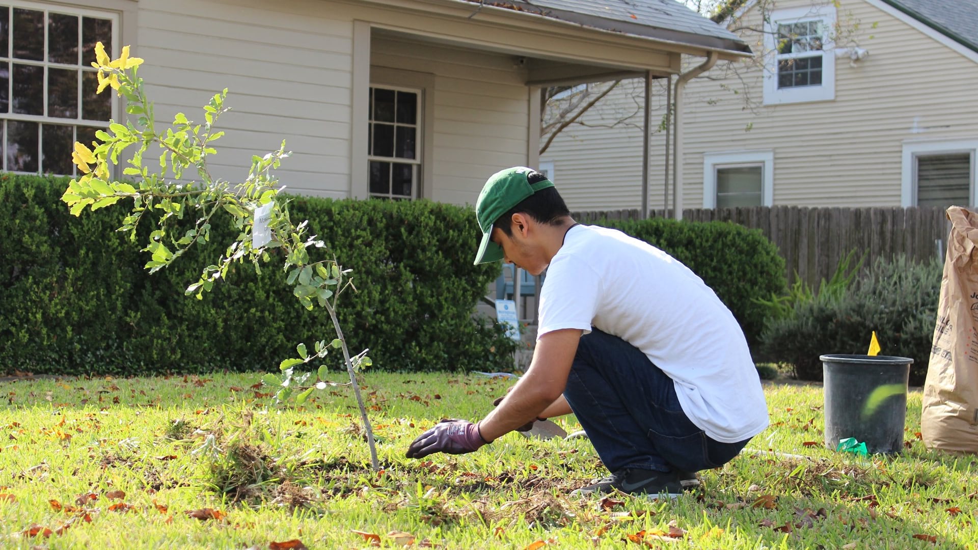
To date, Trees Atlanta has planted and cared for over 150,000 trees. To choose sites, the organization uses maps to understand the socioeconomic conditions in neighborhoods and engages with community members to gain their support.
“When you get into community forestry, you realize that humans are a part of the ecosystem, especially in an urban place,” Moy said. “The most important thing for choosing tree planting sites is whether they are going to be well-received by the people.”
Several years ago, the organization analyzed the factors leading to tree survival. Staff found that when an active community group participated in planting, trees flourished.
About one-third of the tree planting sites are requested by community members. Another third of the sites are agreed upon by the nonprofit’s employees and volunteers, who return to communities year after year, answering the question, “Where are we going next?” The final third are selected by coordinators who use spatial analysis and satellite imagery in GIS to determine where trees are needed most.
Look nice and growing well aren’t the only criteria for determining which trees get planted. Of the 7,000 trees planted in 2022, 83 percent were native species. More native species have been planted recently because the public has a greater interest in supporting plants that occur naturally in the region and adapt well to changes in climate.
Trees Atlanta brings in information from the USDA Plant Hardiness Zone Map to determine which trees have the most adaptability. “We’re looking more into native adaptive trees that have evolved in a slightly warmer climate farther south from Atlanta, with warmer winters and hotter summers,” Moy said.
The trees planted early in the organization’s history are now becoming mature, and communities are seeing the benefits.
“Those mature trees provide a lot of shade, and that turns into better health outcomes. We’ve also seen animals moving back to places where they haven’t been seen in a long time,” Moy said.
As far as beneficial health impacts, a Clemson University study of a region in Northern California found that annual average healthcare costs were $374 lower for those living near green space.
In addition to health benefits, trees provide food beyond that of the ubiquitous peach tree. Trees Atlanta was instrumental in the creation of the Urban Food Forest at Browns Mill, the country’s largest edible-foods forest on public land, with 7.1 acres of land ripe with 2,500 pesticide-free edible and medicinal plants.
Food from the forest is grown under a model of agroforestry, a method of growing trees and shrubs to provide nourishment and an ecologically resilient landscapes. Ten minutes away from Atlanta’s bustling airport, the expansive forest was once a small family farm. But unrealized property development brought blight and neglect to the Lakewood and Browns Mill neighborhoods, where many residents live in poverty and the closest grocery store is a 30-minute bus ride away.
“The Urban Food Forest at Browns Mill is a resource that anyone can use to enjoy green space, harvest food that was collectively grown by the community, and learn techniques to grow food,” Moy said. “The forest demonstrates practices of permaculture to mimic the growing practices of Indigenous peoples.”
Since 2001, Atlanta’s Tree Protection Ordinance has been a critical tool to preserve the city’s tree canopy. But the ordinance hasn’t been enough to protect trees against a wave of development. To remove a tree, a permit needs to be approved by the city, but illegal removal still occurs, creating threatening conditions for the oldest trees.
Trees Atlanta has been working with the Georgia Institute of Technology on tree canopy assessments to continue to innovate and find ways to maintain Atlanta’s status as a “city in a forest.”
Analysis of the benefits of the forest is guiding decision-making as climate continues to change. Atlanta mayor Andre Dickens, elected in November 2021, is committed to the city’s trees, and he ties tree canopy protection directly to climate change impacts in the second bullet point of his environmental and clean energy plan.
In response to a question about rising temperatures in the city, Dickens replied, “The reduction of the tree canopy only enhances the urban heat island effect and the rising energy costs that make it more expensive to keep our homes cool. The first effort from the City of Atlanta needs to be in the protection of our tree canopy.”
Learn more about how foresters use GIS for sustainable forest management.