This club is the sum of its supporters. Before we showed up they'd saved it multiple times. It's a temple as much as a football pitch. @Wrexham_AFC has been one of the greatest experiences of my life.
Ryan Reynolds
Writing on X
In the heart of Wales sits an unlikely intersection of Hollywood star power, historic sports culture, and cutting-edge digital technology.
The revitalization of the Wrexham football club’s stadium, led by the team’s owners, American television actor Rob McElhenney and Canadian movie actor Ryan Reynolds, has become more than a construction project. It’s a community rebirth. It’s also a prime example of how innovative technology can help preserve heritage while building for the future.
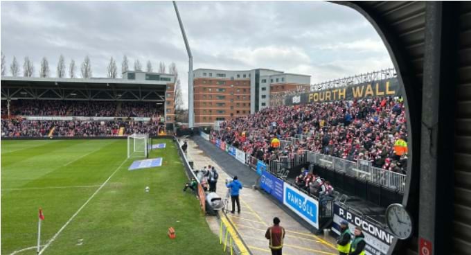
Wrexham Association Football Club is the third-oldest football club still in existence. Its Racecourse Ground is the world’s oldest international football stadium still in use. When the club changed hands, modernizing the stadium was a top priority. With Hollywood star owners documenting their efforts in an FX docuseries, the stadium played a lead character.
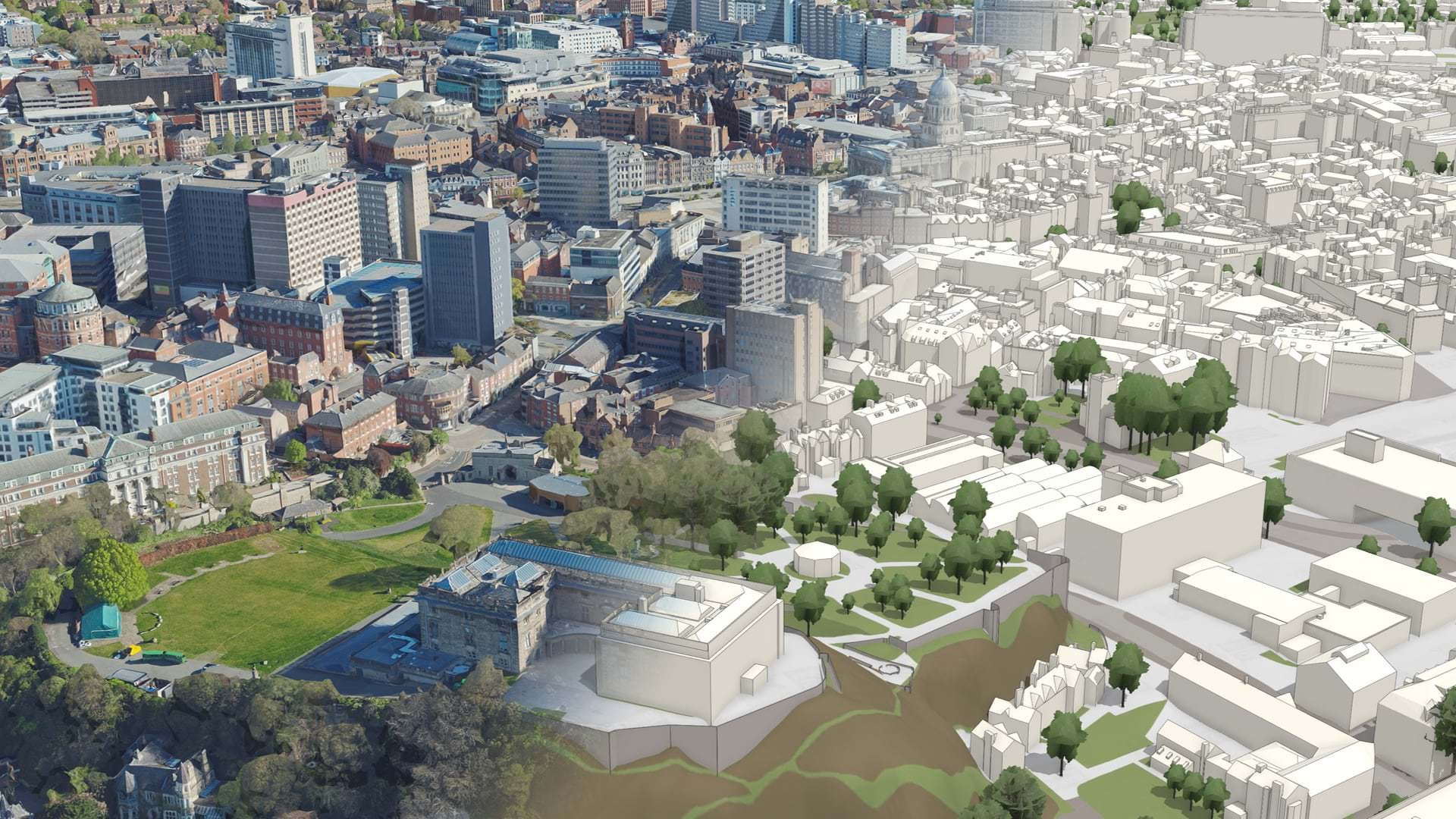
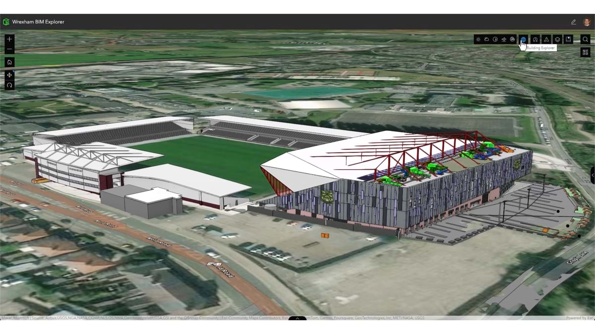
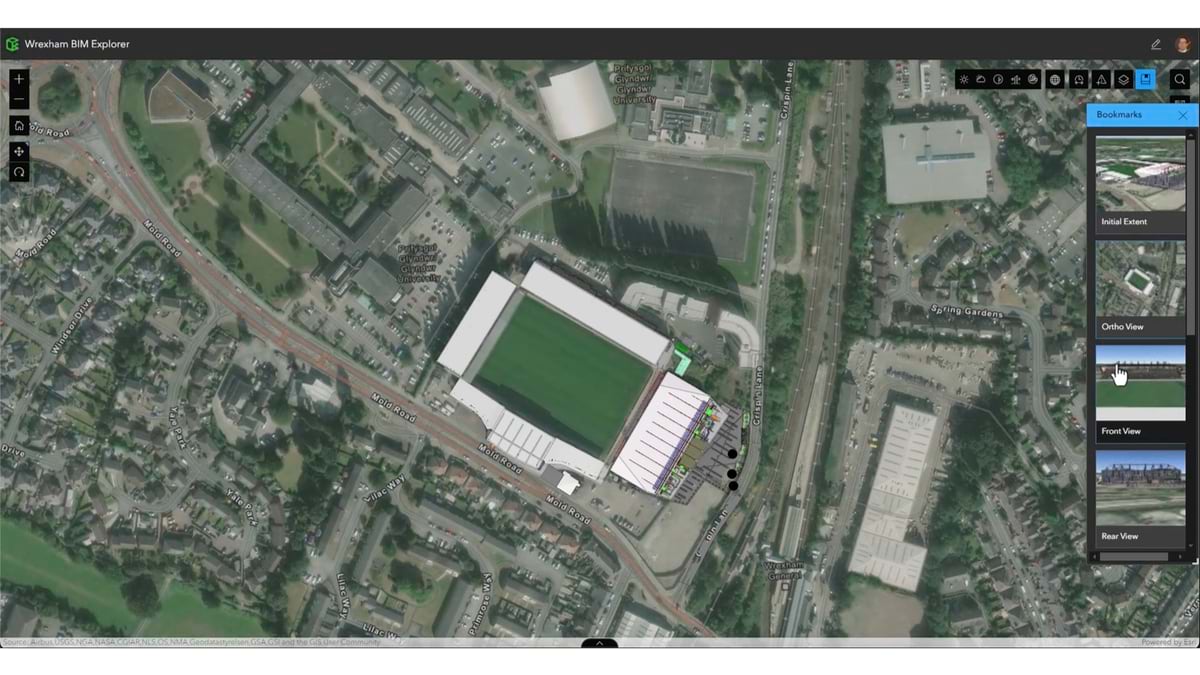
The club needed more seating and the stadium’s end stand had become unsafe and was decommissioned in 2007. The rebuild called for careful construction, as the stadium tightly knits into the neighborhood, nearby roads, and the adjacent rail station. The Kop stand project used the context provided by geographic information system (GIS) technology from Esri combined with building information modeling (BIM) from Autodesk to take on the challenge.
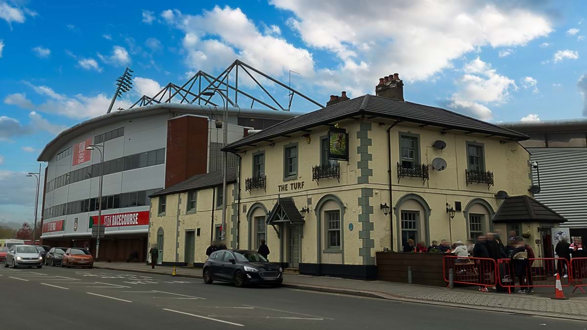
For residents of Wrexham, the stadium weaves deeply into the community fabric. People still talk about the 1934 Gresford disaster when 266 coal miners died in a gas explosion. Many had traded their shifts so they could watch a football match the next day. The new stadium design pays tribute to Wrexham’s roots in mining and brickmaking, and player uniforms honor the lost miners with a “1934” patch.
“It’s really about preserving the community and heritage of the people,” said Sarah Widdowfield, UK and Ireland digital hub manager at Ramboll, the engineering and architecture firm behind the stadium’s redesign. “That sense of identity is so deeply rooted that any drastic change would have risked alienating the very supporters the project is meant to serve.”
For Widdowfield and the team at Ramboll, the stadium project integrated the past with the future while also affording the opportunity to try the integration of BIM with GIS.
“This is the first project where we put together a team, showed examples, connected data between Autodesk and Esri platforms using ArcGIS GeoBIM, and walked through it with the project team to get feedback and ideas,” said Joe Segretto, geospatial and transforming delivery senior manager at Ramboll.
The key benefits became clear as the pilot progressed.
Traditionally, different professional teams worked in isolation, using specialized tools that didn’t easily share information. But the technology integration supported smooth collaboration.
“ArcGIS GeoBIM allowed environmental teams to continue to use their GIS tools to collect site data and connect to the Autodesk Forma (formerly Autodesk Construction Cloud) where all our design people work,” Segretto said. “That brings together two different teams that may not have talked to each other before.”
The value goes far beyond simple convenience. The team identified three main areas where ArcGIS GeoBIM enhanced their work:
Seeing the BIM models integrated in the context of the site within GIS helped bring designs and different project teams together.
The pilot demonstrated how the technologies combined were greater than the sum of their parts. “It really has sold the capabilities of GIS and BIM integration in the teams,” Widdowfield said. “It’s put it to the front of people’s minds that there’s a new integrated way to work.”
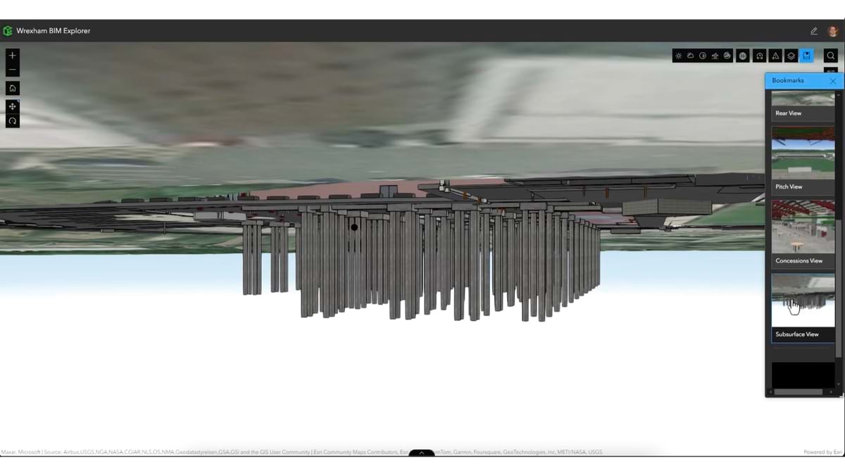
One of the most profound benefits was the ability to visualize designs for the 5,500-person-capacity Kop stand at one end of the stadium. The design and construction teams could view the project in its full geographic context in 2D and 3D.
“Previously, if you wanted to visualize the designs, you would have a list of files and folders. You could look at individual BIM models, but the visualization was more focused on design,” Segretto said.
This limited view meant designers couldn’t easily understand how new construction would interact with the surrounding environment. “It’s nice to be able to see this in context with everything else around it,” he added.
The environmental context represents another key advantage of taking a holistic GIS and BIM approach.
The stadium project took a practical and strategic approach to sustainability. Nature-based solutions were used to manage stormwater runoff. The Kop stand design incorporated solar panels for on-site energy generation, and the site was enhanced to support biodiversity. The design also accommodates future infrastructure needs, such as upgraded power systems, and includes flexibility for hospitality space upgrades as the club advances through the football ranks.
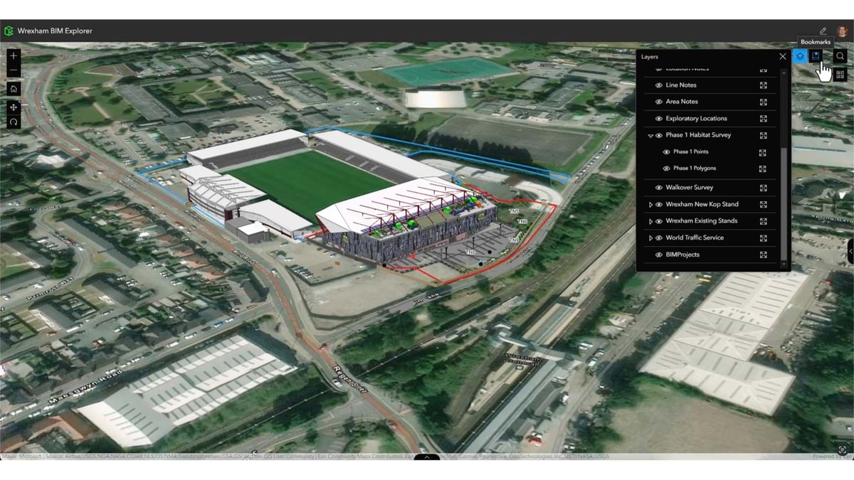
“Our ecologists use ArcGIS Field Maps to go out and conduct species surveys and habitat assessments,” Widdowfield said. “They’re identifying what the habitats are like there currently, and then they do a postdevelopment Biodiversity Net Gain (BNG) assessment.”
Ramboll staff are proud of the firm’s commitment to a sustainable future. The tight integration of GIS and BIM tools will help them assess the green design’s positive impacts on the environment.
An immediate positive impact for Ramboll came from stakeholder feedback for the GIS-BIM integration pilot.
“Every single person that we’ve showed this to has gone, ‘Wow!’” Widdowfield said. “Having the capability to look at this information together in such a usable platform has sparked excitement.”
Beyond the stadium, Ramboll is buzzing with conversations about how they can apply these capabilities to other projects. “The more people start working with this and seeing what’s possible, the more questions they’re asking,” Segretto said. “And it’s always about, ‘This is great, and how can I do the next thing?’”
The Wrexham stadium project signifies the future of infrastructure—how we can build and maintain facilities and services while honoring community heritage.
For Wrexham, the stadium’s transformation connects directly to broader revitalization efforts. “They’re looking at transport, regeneration of the city center, and the non-match-day amenities that include a hotel, retail shops, and room for offices,” Widdowfield said.
When Reynolds and McElhenney purchased the struggling club in 2020, they brought not just financial resources but also powerful marketing expertise. The club has steadily progressed from the fifth tier of English football to the EFL Championship (the second tier). Fueling the success is increased financial investment, a global fan base surge, and the “Welcome to Wrexham” television series.
This club is the sum of its supporters. Before we showed up they'd saved it multiple times. It's a temple as much as a football pitch. @Wrexham_AFC has been one of the greatest experiences of my life.
The impact of the actors’ involvement extends beyond publicity. “It’s probably as much on the business side as it is stoking the passion for the Red Dragons,” Widdowfield said.
In April 2025, Wrexham became the first team in English football history to win back-to-back-to-back league promotions. In a town hard hit by the loss of the mining and steel industries, the team’s success has restored civic pride to a historic Welsh community.
Learn more about how architecture, engineering, and construction (AEC) professionals use GIS to build smart communities and assets for the future.