displaying 263 results

Esri startup partner Epistemix models COVID-19 infections based on varying levels of population immunity. The results are convincing.

Newly published Esri Press books spotlight GIS in state and local government, health, and conservation.
The release of ArcGIS Enterprise on Kubernetes was just one of several noteworthy announcements at the 2021 Esri Developer Summit.

Charlottesville Fire Department switched from conducting fire hydrant inspections with pen and paper to using the ArcGIS Field Maps app.

Geographers can serve as interpreter for local interests while speaking for underrepresented communities during the redistricting process.
Despite a global pandemic, the Esri community from around the world joined together in July to watch the first virtual Esri UC.
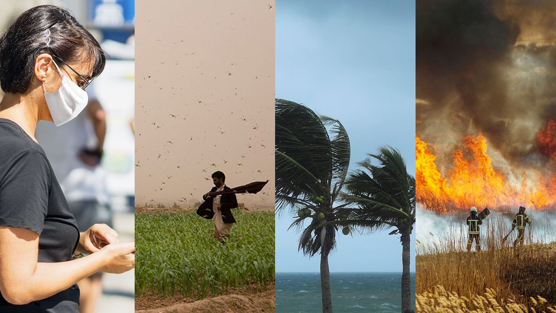
In this time of global calamity, organizations should get ready for what may come next. Building resilience could make all the difference.
The first virtual Esri User Conference (Esri UC) engendered a global camaraderie and a hope for creating a geospatially literate society.

Two cities and one local utility got assistance from Esri partners to upgrade their geospatial technology and streamline processes.

The GIS team at Crestwood implemented the ArcGIS Pipeline Referencing extension to better edit and administer its pipeline data.
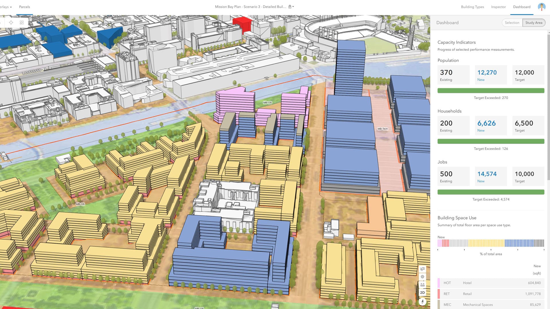
With an immersive 3D experience, ArcGIS Urban allows planners, governments, and citizens to visualize proposed development in their cities.
The preauthored maps in the new Esri Maps for Public Policy app foster collaboration and drive fact-based decision-making.