displaying 820 results
Pokémon GO sparked consumer interest in 3D technology and augmented reality. The longer-term effects may be felt in business.
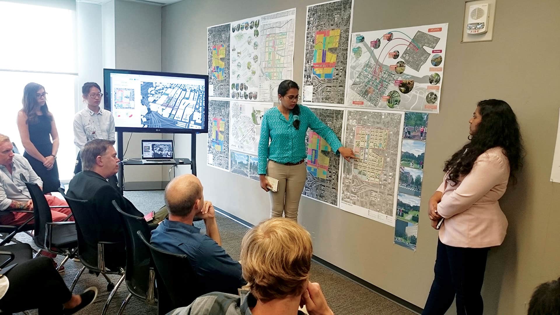
Grad students used modern geospatial technology to redesign Atlanta’s Old Fourth Ward and study urban design principles.

The National Science and Technology Center for Disaster Reduction used 3D GIS to put together a war game simulation for flooding.
Understanding the structure, extent, depth, and distribution of subsurface materials is important for many disciplines, including geology...
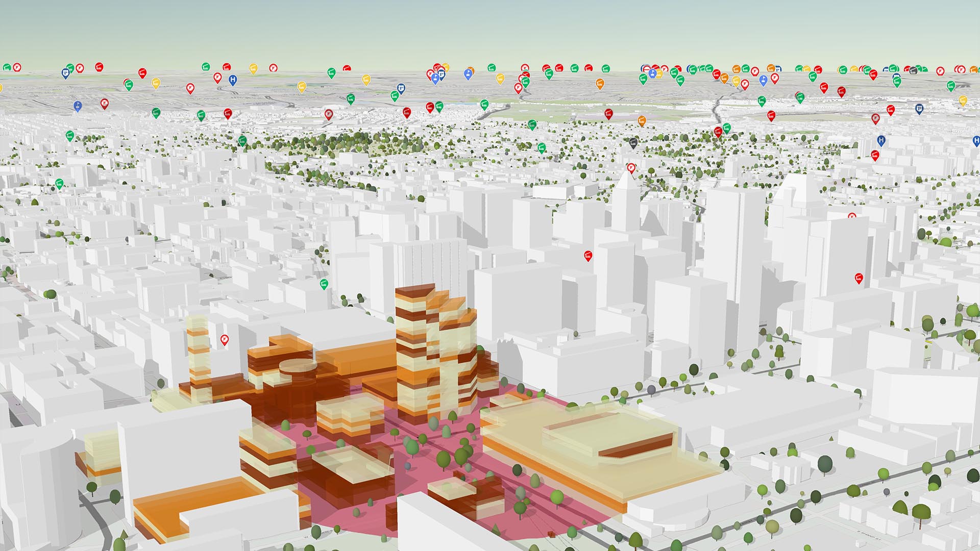
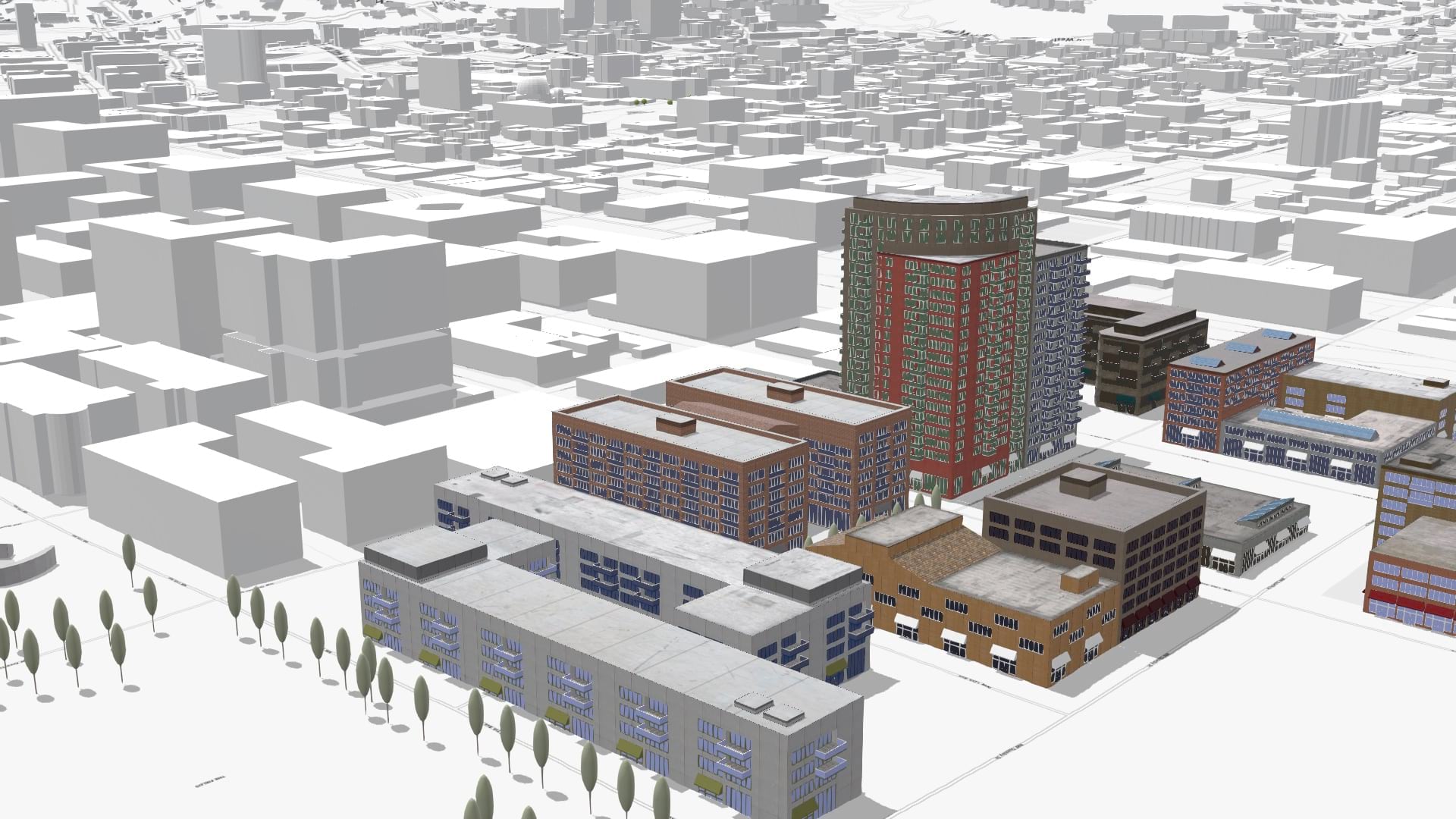
To make design options real, urban planners, architects, and designers need strong 3D visualization power.

Esri-Autodesk integration partnership will foster BIM and GIS integration and the application of geodesign principles.
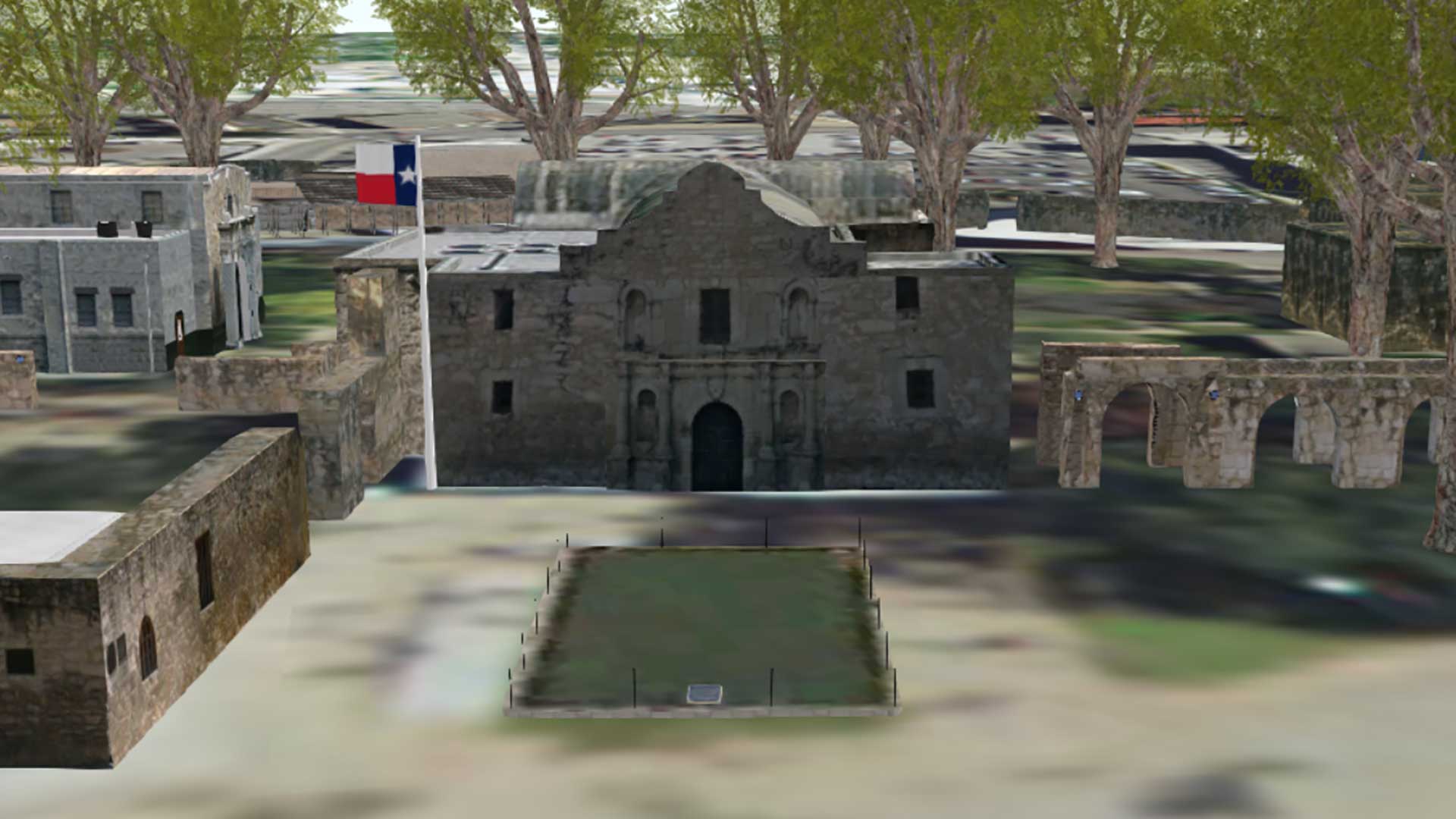
Engineers restoring the original site of the battle of the Alamo are using 3D GIS visualization of historic site.
Add context to your scenes with the new OpenStreetMap layers from ArcGIS Living Atlas of the World.
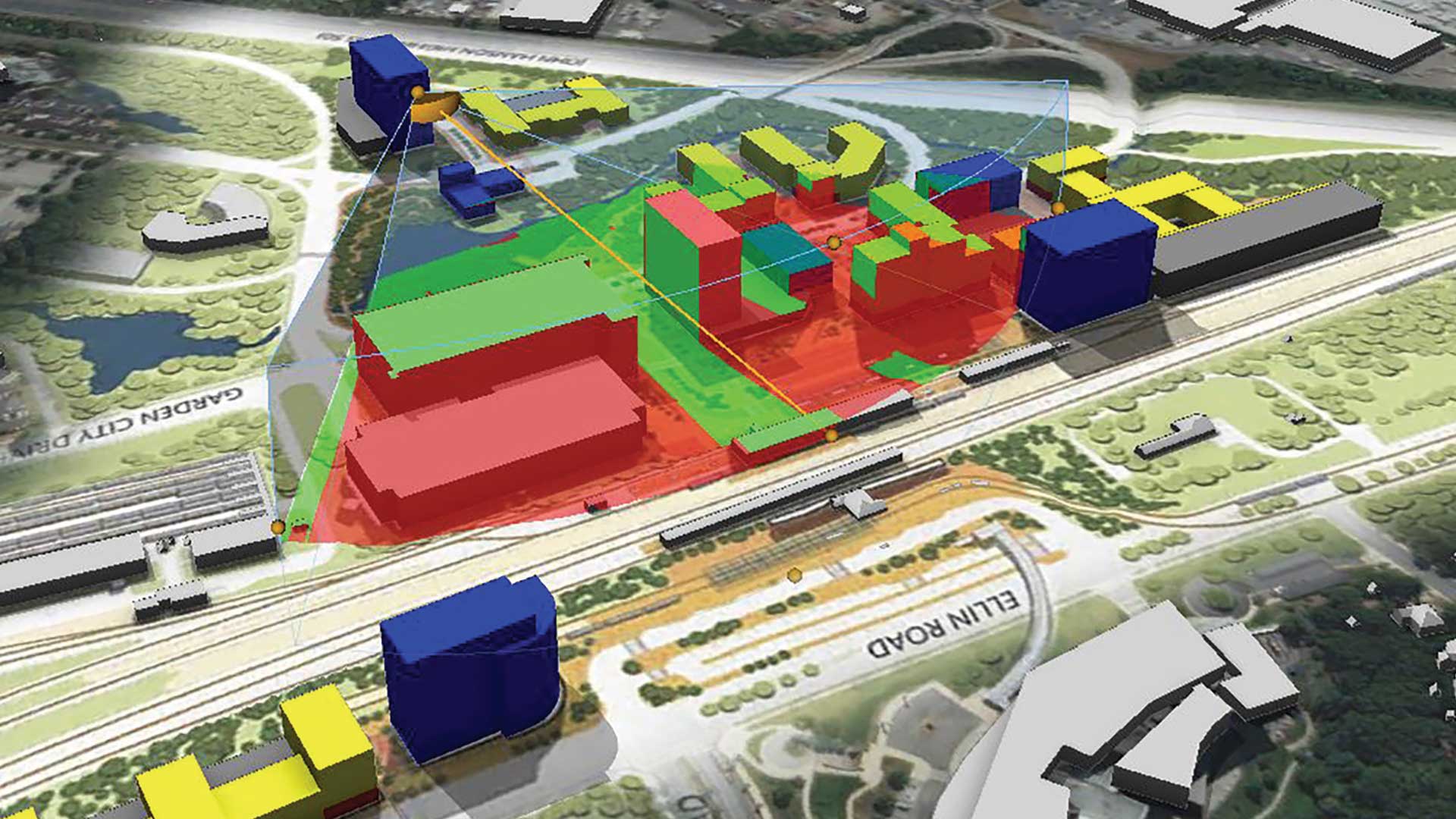
Gensler is using 3D GIS to create plans, visualize scenarios, and support collaboration and decision-making in design projects.
Three Esri Startup Program partners have harnessed the data power in ArcGIS Online, as well as the 3D visualization capabilities of the ArcGIS…

West Chester University uses a range of Esri technology to teach students about GIS and has introduced a new course on designing smart cities.