Few parents will forget late 2016, when their children began asking for rides around town to hunt for digital monsters. Pokémon GO, the mobile game that superimposed digital creatures onto the real world, became a sensation immediately after its release. Its success in the consumer gaming world may even have accelerated the use of location-based 3D technology in business circles, contributing to a growing recognition of 3D’s benefits in a diverse collection of industries.
Niantic, the company behind the game, made extensive use of augmented reality (AR), imposing 3D digital characters onto physical reality—essentially merging the gamer’s world with Pokémon’s world. Players use a mobile device with location services enabled to spot game characters at street corners, in pizzerias, and on the subway. Key to the game’s success—and to that of any augmented reality app for consumers or businesses—is reliable location data about the built and natural environments.
Now, Niantic wants to enhance its location intelligence by crowdsourcing a better map of the world. Late last year, the company acquired cloud AR mapping startup 6D.ai to process the raw geographic data captured by gamers as they scan their surroundings with smartphone cameras. As many businesses have learned, an accurate 3D map of outdoor space and indoor environments is the foundation of applications made not just for entertainment, but for safety, efficiency, and insight.
Creating an Interactive Real Estate Market
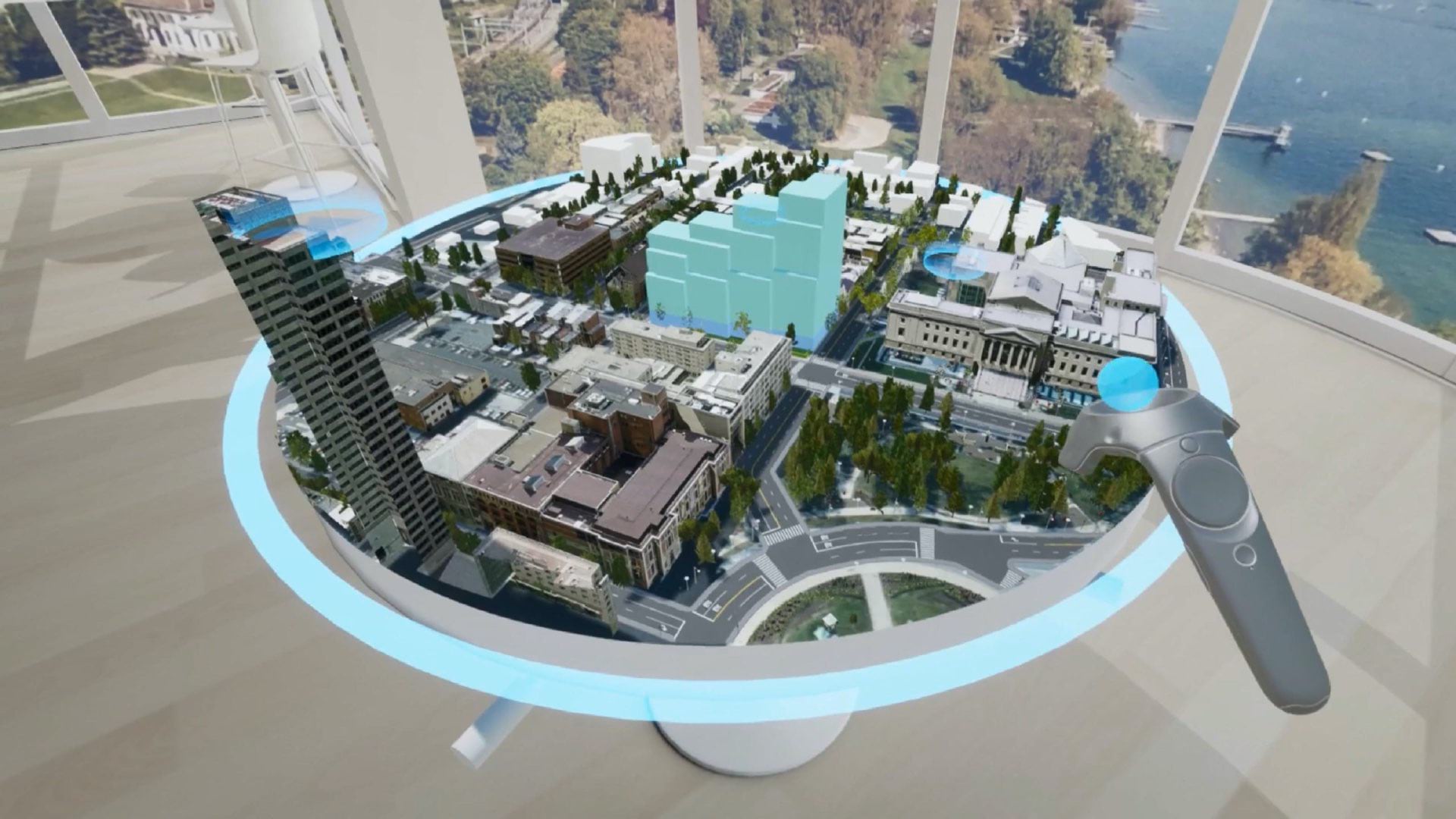
Cushman & Wakefield, one of the world’s largest commercial real estate firms, has embraced 3D technology to give its brokers an edge in competitive markets. To help clients evaluate cities and properties before and after site visits, the firm uses geographic information system (GIS) technology to deliver rich, interactive visual experiences.
Tim Relyea, executive vice chairman of Cushman & Wakefield in Texas, explained in a recent WhereNext article how he uses location-aware 3D. Relyea’s client meetings center on PRISM, a GIS-based app for iPads and tablets:
When the client wants to examine a specific market, Relyea uses PRISM to zoom in to the location for a 3D view of specific buildings. That reveals building data, stacking plans—even which floors of the property are available for lease. With a couple taps, he can deepen the view by adding local demographics, workforce analytics, and building amenities.
GIS-based location intelligence drives the PRISM experience, revealing data such as transportation access and commute times, market demographics, and amenities like walkable parks and local food trucks and restaurants. With that insight, clients can rule out properties that don’t fit their goals and spend more time on-site investigating those that do.
Getting an X-ray View of Utilities
In some industries, the need for safety and efficiency has driven the evolution of 3D maps into augmented reality experiences. Some utility companies, for instance, are finding new ways to use GIS technology to maintain assets.
In Toms River, New Jersey, water utility workers can now peer through pavement with the help of GIS-based augmented reality. Wearing HoloLens glasses, they see 3D digital representations of water pipes, telco lines, and other underground utilities. They know that each line is where it appears to be because its precise location is stored in a GIS database. The X-ray vision helps workers dig safely and close service tickets faster.
It’s no surprise, then, that the Wall Street Journal reported that businesses using AR glasses experienced 20 percent or greater efficiency improvements in operational tasks or that spending on AR technology is forecast to exceed $60 billion by this year, according to the Harvard Business Review.
Transparency Is Good Business
One frequent byproduct of location-based 3D applications is collaboration. Whether it’s Pokémon GO players exchanging tips or utility workers discussing a repair project, a single 3D version of the truth often elevates conversation and cooperation.
In a sign of the times, corporate managers and HR decision-makers recently have teamed up over 3D models to optimize indoor space as workers return from COVID-19 lockdowns.
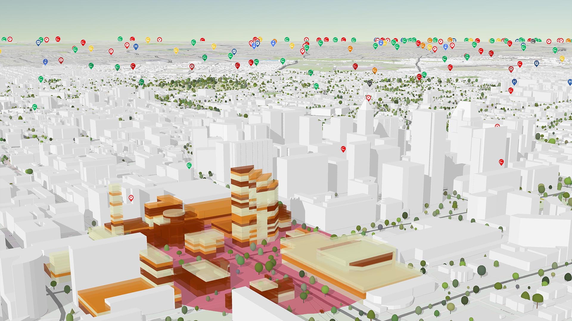
In Boston, city planning now happens around a 3D digital map of the city. A recent article explained how that benefits Carolyn Bennett, geospatial data manager at the Boston Planning & Development Agency, and her colleagues:
The 3D model gives everyone involved a way to visualize the proposed project, iterate on its design, and analyze impact on downtown Boston.
“Project review is a collaborative effort between partners, a give and take,” Bennett said. “We work with the proponent to achieve the best outcome for both the city and the developer.”
These innovators have found advantage in incorporating 3D-based location intelligence into their operations. Future adopters across the business world are likely to find that location data creates a reliable foundation for rich 3D and AR apps that deepen insight, speed operations, and enrich collaboration.
The Esri Brief
Trending insights from WhereNext and other leading publicationsTrending articles

December 5, 2024 |

March 3, 2026 |

June 23, 2026 |

March 17, 2026 |

April 7, 2026 |

June 9, 2026 |