displaying 778 results

Read about the latest books from Esri Press, which will help you up your GIS game.

German students or their parents or guardians use a new online survey created with Esri technology to sign up for school bus transportation.

States are set to receive funds to repair aging infrastructure, and Virginia is ready with a detailed list of priority projects.

Anne Shaw, Executive Director at Transport for West Midlands, discusses geospatial technology's role in public transportation.

GIS analysis revealed land adjacent to highway right-of-ways that are excellent sites for placing solar panels.
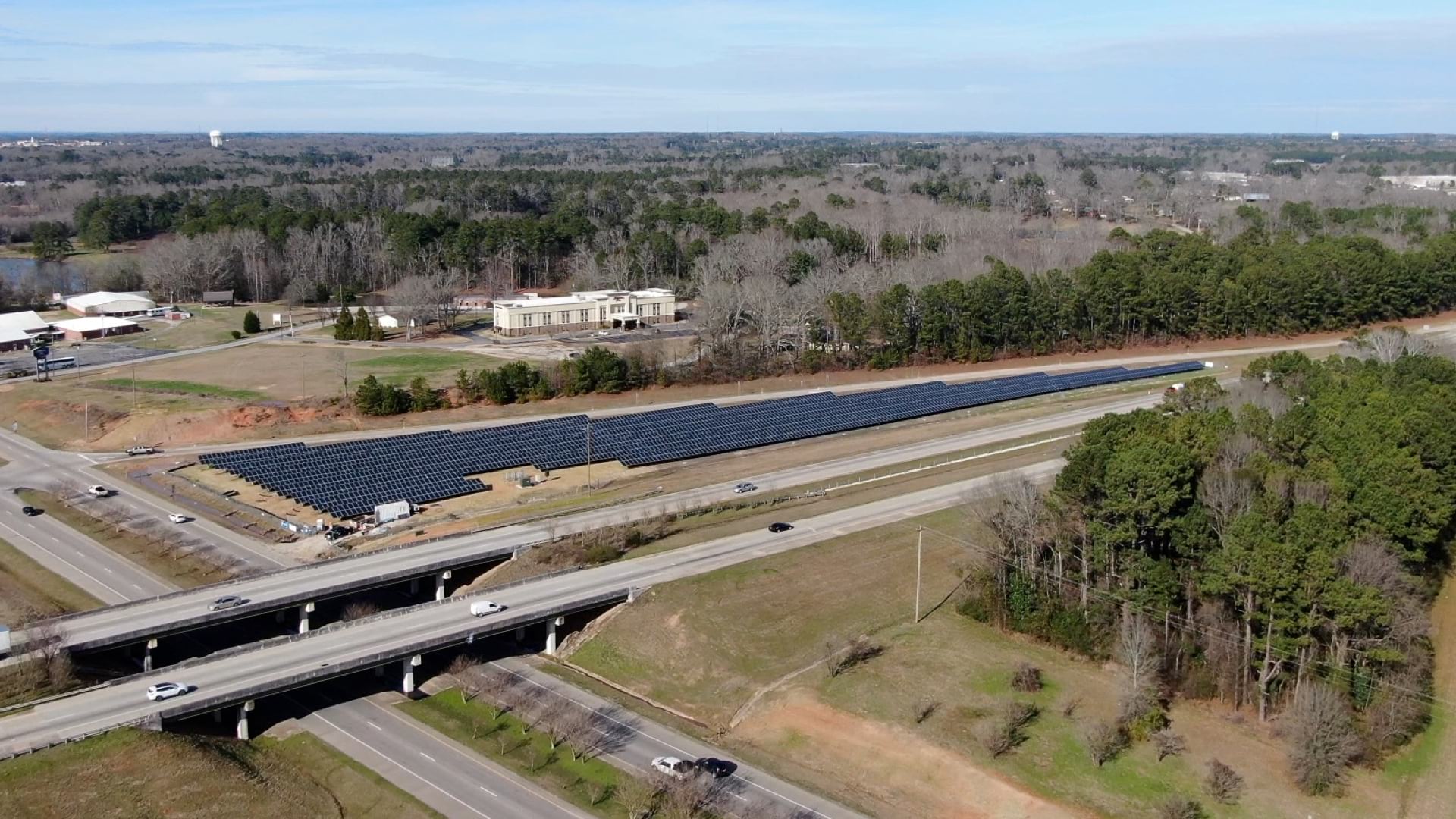
The Ray, an Atlanta-based nonprofit, wants to harness highway right-of-way land to host vast solar panel arrays.

A new Vision Zero DC website, built using ArcGIS Hub, helps the city work closely with community members to transform transportation safety.
The Utah Department of Transportation uses the UPLAN portal it created in ArcGIS Online to share and work with maps.
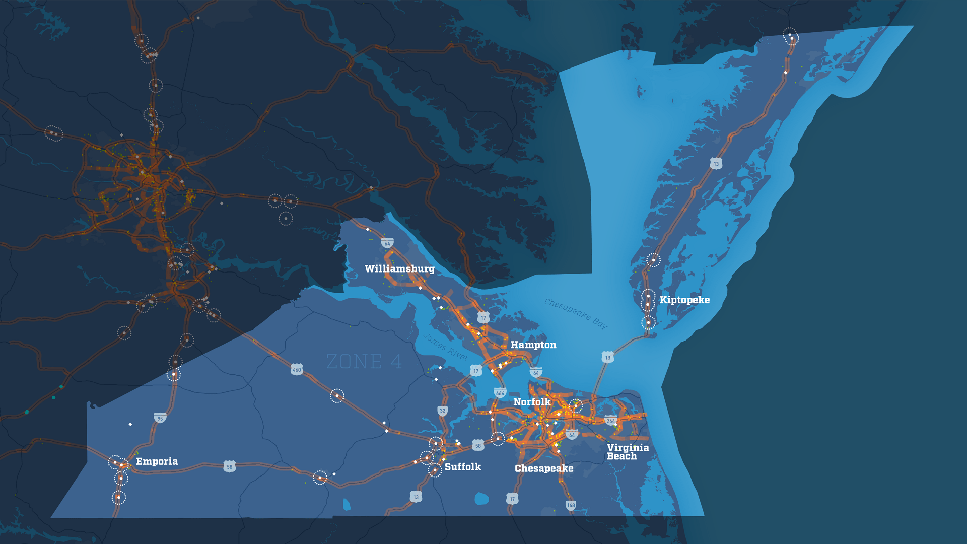
With the Virginia Department of Transportation's truck parking data viewer, the state can better evaluate the needs of Virginia truck drivers.
With ArcGIS Maps for Adobe Creative Cloud, GIS users and creative professionals can make stunning data-focused maps right in Adobe programs.
GIS Helps Inform Key DC Transportation, Tourism, and Enforcement Stakeholders

Louisville planners and engineers use map analysis to prioritize road safety projects and advance goal of zero traffic fatalities by 2050.