displaying 884 results
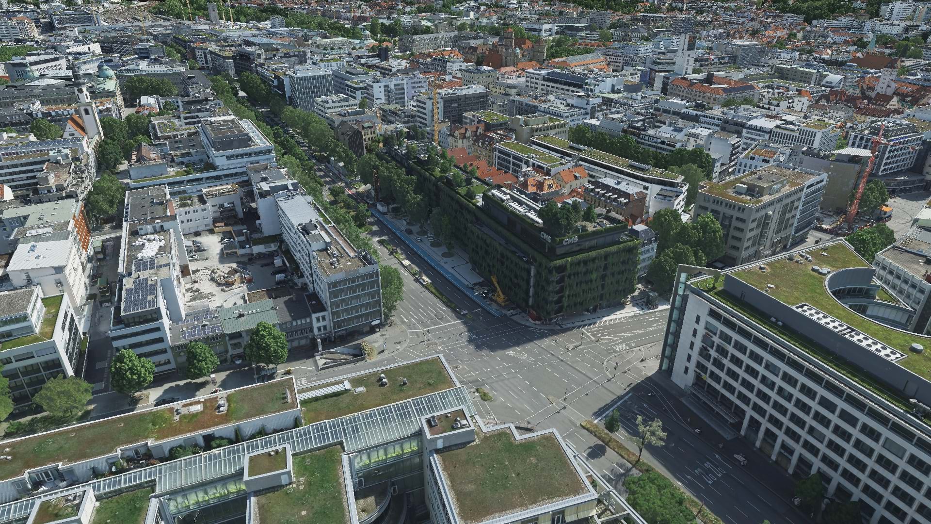
With aerial data and reality mapping, GeoFly helped create a 3D model of the City of Stuttgart to build an even smarter city.

In Malawi, NASA Harvest used ArcGIS Survey123 to collect ground truth data on small farms. The results will help bolster food security.

Thanks to three new data models, capital improvement projects have been streamlined to better meet the airport’s current and future needs.

Recent updates to the app make it easier to design more sophisticated forms and make the data collection experience more efficient.

To understand changing climate conditions, people need access to sound data, tools, and workflows. This will require a geographic approach.

By implementing advanced analytics, 3D modeling, and innovative data management systems, Esri partners help their clients blaze new trails.

Facilities need to be transformed in ways that are both flexible and sustainable. ArcGIS Indoors can help.

To continue training employees through the COVID-19 pandemic, Singapore’s Urban Redevelopment Authority digitally transformed its courses.

Newly published Esri Press books spotlight GIS in state and local government, health, and conservation.
The release of ArcGIS Enterprise on Kubernetes was just one of several noteworthy announcements at the 2021 Esri Developer Summit.
Two cities and one local utility got assistance from Esri partners to upgrade their geospatial technology and streamline processes.

ArcGIS Analytics for IoT can help organizations use the big, real-time data generated by IoT devices to gain spatial insight and awareness.