displaying 999 results

Executives who have focused on the well-being of employees and customers and on stabilizing operations now add business recovery to their agenda.

New books from Esri Press make the business case for GIS, help readers plan for future public health events, introduce Web GIS, and more.

ArcGIS Knowledge allows users to visualize various types of data in multiple ways—as maps, link charts, cards, and more—to reveal patterns.
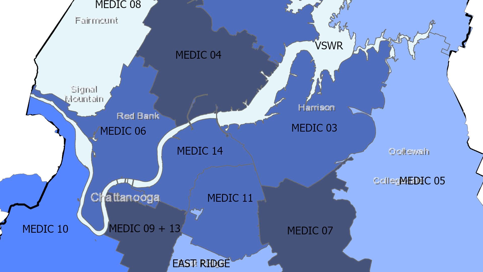
In Hamilton County, Tennessee, a research team used GIS to determine the most effective way to distribute naloxone kits among EMS stations.

Esri startup partner Epistemix models COVID-19 infections based on varying levels of population immunity. The results are convincing.

Organic Valley delivers custom reports to its farmers, providing insight from satellite imagery on when to move dairy cows between pastures.

In Pennsylvania, Kansas, and Montana, local authorities turn to GIS to plan vaccine distribution and to be transparent about who they prioritize.
It feels like thorns scraping your eyes each time you blink.

As the world prepares for the most complex global vaccination campaign in history, location intelligence provides essential capabilities.
A leading health services company applies location intelligence to an age-old business challenge in its home-visit program.