The Esri Brief
Get location tech news in your inbox
Trending articles


Consulting with companies on sustainability practices and environmental compliance is a growing business, projected to become a $36 billion slice of the global economy by 2027.
That growth is being fueled in part by increasing consumer interest in climate-friendly practices and a corporate trend toward improved environmental stewardship. Those forces and the ongoing drive for regulatory compliance make it vital for companies to receive fast, accurate environmental impact assessments so they can continue to grow responsibly.
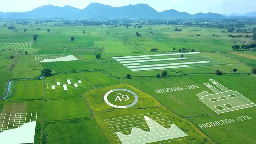
To meet this rising need, one environmental consulting firm headquartered in Lisbon, Portugal, is discovering new value in a modern geographic information system (GIS). Company leaders have known that GIS technology can analyze massive amounts of data and plot the results on easy-to-understand smart maps. But now, the team at Bioinsight is finding that maps are also tools for collaboration, communication, and even project management.
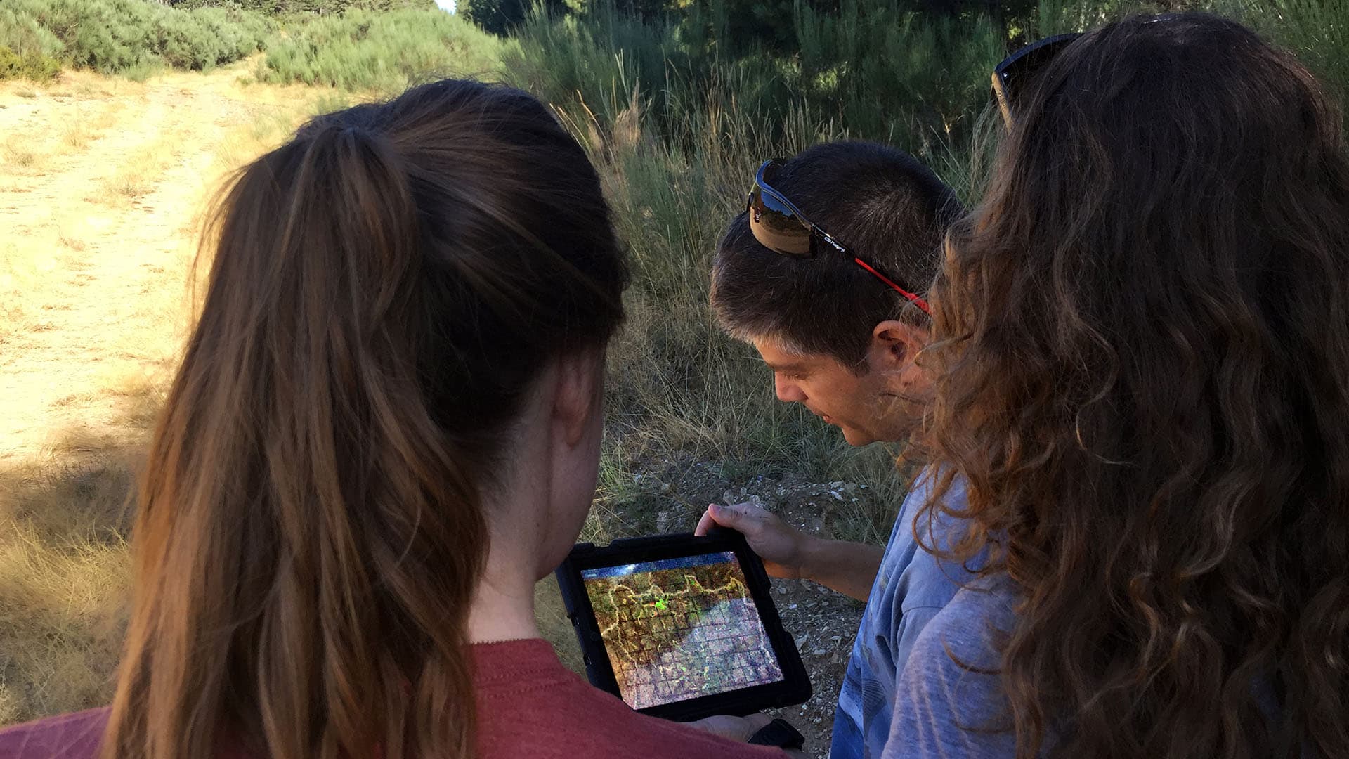
Through mobile devices and a new generation of lightweight GIS apps, Bioinsight project managers stay in touch with the work of biological survey teams in remote areas on several continents.
As the environmental impact assessment industry grows more competitive, Bioinsight relies on location technology to not only help clients achieve their sustainability goals, but to ensure projects are completed faster and accurately, wherever in the world they take place.
Location Intelligence for Environmental Impact Assessments
As an environmental consultancy, Bioinsight analyzes how planned wind farms, pipelines, power substations, roads, and other structures will affect animal and plant life in areas under consideration for development.
Its environmental impact assessments give companies the data they need to lessen projects’ ecological impacts, ensure regulatory compliance, and address any additional concerns up front.
Bioinsight CEO Miguel Mascarenhas says it’s important to perform early location analysis and deliver quick, efficient impact assessments to help companies avoid environmental problems that might otherwise emerge after a site is operational.
“Just to give you an example, we can be studying a road, and … we still don’t have a specific project for the road, but we have different corridors for the implementation of the road,” Mascarenhas says. “We start assessing which one of the corridors is going to have the least [environmental] impact and which one [we] should be avoiding.”
The road might provide access to a wind farm, the most frequent subject of Bioinsight’s environmental impact assessments. These sustainable energy projects continue to gain favor with customers and energy providers around the world, but they can’t be built without impacting the surrounding location.
That’s why Gonçalo Costa, a Bioinsight ecologist and large-carnivore specialist, says it’s crucial to document the types of birds and their flight paths around a proposed wind farm site. And it usually must be done on a tight time frame.
“One of the things that we do … is to sample points for the movement of birds of prey around the area,” Costa says. When the team performs that work with mobile GIS apps that automatically capture the location of data entered, the work is more efficient. “It’s practically done in the field,” he says. “You have it [digitized], and it saves us a lot of time.”
As competitors enter the marketplace, Bioinsight’s use of GIS for communication and project management has been a game changer, according to Mascarenhas. “That can accelerate our job,” he says. “That’s something that’s important for keeping our competitiveness.”
Bioinsight’s teams routinely use GIS mobile and desktop apps to monitor progress on different continents.
“If you have a plan where we need to go to 30 or 40 different places to collect data in remote areas, sometimes access is not easy, and we don’t have any type of good reference points,” Mascarenhas says. A smart map “is perfect to be able to look at when I’m at the office … and say, ‘Okay the tasks of today have been done and the information has been collected.'”

To better serve clients and keep the business competitive, Bioinsight has employed GIS technology to help teams collaborate across borders in as close to real time as possible.
Improved Collaboration Saves Time, Money
Just a few years ago, the process of sending teams of biologists into remote areas to survey animal and plant species could be very costly, time-consuming, and sometimes frustrating.
On-site researchers logged the type, number, and movement of species on paper along with details such as map coordinates, day, date, time, temperature, and weather. That and other project data was sent by mail to Bioinsight headquarters in Lisbon, where it was entered into spreadsheets and analyzed.
Considering the data’s plodding journey through the mail and the time spent digitizing it, as many as five days might pass between data collection and an updated report. And the more times the information was handled or reentered, the higher the likelihood of a mistake.
To make matters worse, if the analysis revealed that the researchers were in the wrong spot or not observing the specified plants or animals in the required numbers, the project manager might need to direct the team back to the remote area to gather necessary data, a costly consequence in terms of time and money.
Bioinsight staff found they could communicate more efficiently through GIS technology.
“While the team is in the field, I can start looking at the data and make sure that the data are accurate and are the data that I needed,” Mascarenhas says. “If not, I can contact them and say, ‘I need you to spend another day on the field. Stay there. Don’t come back.’ That’s important for us because sometimes I’m here in Portugal, but our project is in Brazil or is in South Africa.”

For this international company, the fast analysis and near real-time reporting enabled by GIS mean problems can be corrected on the fly rather than during late-stage project review.
Communication via Smart Maps
When biologists in the field in Brazil or elsewhere have smart maps on their mobile devices showing precisely where they need to survey animal and plant species and can log sightings on mobile GIS software, data is more accurate, collaboration is more natural, projects run more efficiently, and costs decline.
Whether they are in Lisbon or on a project site thousands of miles away, all who need to see the progress on an environmental assessment can check the shared smart map, a process that often alleviates the need for email or phone calls.
“I think the right word is communication,” Mascarenhas says as he describes the benefits of GIS-based collaboration. “Because, again, people that work with us when they go to the field … already know what we need [them] to do.” They just need a little guidance via digital maps.
Even if team members have to wait until they return to their lodgings at night to connect to the internet, the latest data is available just a few hours after it has been collected—much more efficient than the multiday lags that used to occur.

Managing projects through GIS-driven smart maps saves time for managers and costs for the company by eliminating extra trips back into the field.
Expanding to Additional Stakeholders
Bioinsight’s collaboration doesn’t stop with company employees or subcontractors. The firm has found ways to extend the collaborative capabilities of GIS to its work with local residents. This allows more stakeholders to get involved in high-interest projects by performing tasks that don’t require trained biologists.

In the northern part of Portugal, Bioinsight’s staff set up game cameras in about 30 locations to document movements of the wolf population—an endangered species in Portugal and one that sometimes preys on livestock or pets. The goal is to document the movements of the small wolf population, educate residents, and promote conservation.
“It’s a collaboration between us and the local people to join together in a project with a species of wolf that’s sometimes problematic,” Costa says. “It’s one of the examples where we can use GIS.”
Bioinsight scientists set up the game cameras, then rely on a volunteer team to collect data after a set period of time.
“They are not GIS professionals,” Costa says. But the smart maps on their phones guide the volunteers to the right locations. Once they’ve found the cameras, they send the SD cards to Lisbon. There the Bioinsight team analyzes the images to understand wolf activity and monitor the health of the local population.
“I don’t have to go on a second trip, spending the expense of going there,” Mascarenhas says. “It’s a good example also of how we can save money and interact with a local team.”
Where Next? More Collaboration, Greater Speed
The head of Bioinsight sees even more use of GIS and smart mapping for communication and project management going forward. Whatever type of assessment the team undertakes, the client benefits from the speed and accuracy of data collection, and Bioinsight distinguishes itself as a purveyor of fast, reliable environmental analysis.
“It’s data communication and speed,” Mascarenhas says, “to have the data as soon as possible on our desktop so that we can start analyzing and making decisions regarding the subject we are studying.”
All photos courtesy of Bioinsight