Editor’s note: This is the first installment of WhereNext’s Fast Four series—short interviews with industry experts on innovative sectors of the business world. For more, visit the Fast Four library.
With the United States on the cusp of a once-in-a-generation infrastructure overhaul and other countries pledging similar action, the architecture, engineering, and construction (AEC) industry is poised for a surge of activity.
AEC firms design, plan, and build structures that support the global economy—the buildings, train lines, seawalls, and utility networks that enable our economy. Increasingly, their work will rely on the adoption of digital tools, according to a recent Deloitte report.
In this short video, we explore how location technology has improved efficiency and effectiveness in AEC projects, and how emerging innovations will help AEC companies construct and strengthen the infrastructure that businesses and communities rely on.
For an inside look, watch the video or read the interview transcript below.
Chris Chiappinelli: Welcome to the WhereNext Fast Four series. In these short videos, we explore the past, present, and future of location technology in different areas of the business world. Today, we’re taking a look at the AEC industry—architecture, engineering, and construction. I’m talking to Marc Goldman to get a sense of how companies in this industry use location intelligence and GIS technology.
Marc, let’s go all the way back to the beginning, if we could. What business challenge inspired the earliest uses of GIS in AEC?
Marc Goldman: Thanks, Chris. You know, even before we talked about the AEC industry or GIS, architects, engineers, construction professionals, they build things in places and locations. So the context of where you’re building and bringing together location information with other types of format has always been critical.
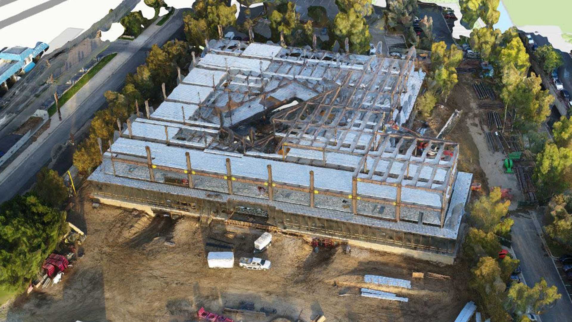
I was actually personally involved on a project back in the early ’90s where GIS and traditional AEC information in the form of CAD [computer-aided design] were being combined. And in this case, we were trying to highlight opportunities for repurposing blighted buildings from vacant to being zoned correctly as community-owned resources. And we wanted maps to zoom down from the block level all the way down to individual floor plans. We had information that was geographic in nature—the city grid itself—but we needed to get all the way down to those design floor plans.
So we combined GIS and CAD and created the views that we needed. It was difficult back in those days. For years—going back to the formation of CAD and desktop GIS—there’s been a need to bring these together. It used to be difficult, but we’re doing some great things now to bring them together.
Chiappinelli: That’s a good, quick history on the integration of those technologies. If we move to present day, can you give us two business challenges or opportunities that AEC companies tend to address with this technology?
Goldman: AEC firms are using GIS to do the high-level, broad planning at urban level, campus level, where you might have multiple buildings or a highway or new infrastructure going through a large environment, and understanding the context at that great scale is really important for figuring out where your roadways are going to go and where your bridges are going to be impacting potential neighborhoods. That demographic information overlaid with the geographic information is great for the AEC industry.
And then there’s the more detailed levels, zooming all the way into an individual building, wayfinding on campuses and within buildings themselves. You enter a building at the front, and you want to know how to get to where you’re going. That building has been designed by an architect who hopefully kept in mind the location intelligence, the complexity or the ease of getting from point A to point B, and GIS is great for that.
Chiappinelli: Interesting. It’s a nice combination of the macro and micro there. Maybe if we push ahead, look out a bit, is there a use case for GIS that’s just emerging today that you expect AEC firms might be using in the next few years?
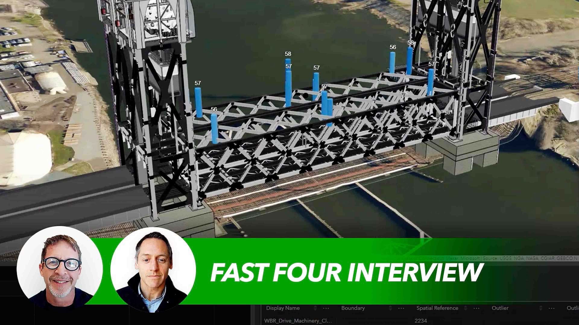
Goldman: Firms that I’m working with and that I’m hearing from on a pretty regular basis are really pushing the capabilities and the idea of digital twins. The combination of GIS with BIM—which has been around for a while, building information modeling—it’s enabling digital twins. It’s allowing these digital representations of projects to be connected to the physical project itself.
I heard about a bridge up in the northeast of the US where the physical bridge itself had IoT sensors, and those sensors were feeding a GIS-based 3D map so the construction team knew whether or not they were potentially creating a dangerous situation of the existing conditions. So this concept of digital twins in AEC is really going to take off, and GIS is just foundational to it.
Chiappinelli: Very interesting—a lot of interesting developments on tap for the AEC sector. Thank you, Marc, for your perspective.
If you’re interested in learning more about geospatial technology in AEC in particular, check out the URL on the screen, or if you’re watching us on WhereNext, you can see the link in the article.
The Esri Brief
Trending insights from WhereNext and other leading publicationsTrending articles

December 5, 2024 |

June 23, 2026 |

March 3, 2026 |

March 17, 2026 |

April 7, 2026 |

June 2, 2026 |