Leaders of the Boston-based agricultural startup Indigo Ag think that to get a really good look at soil, you need to see it from outer space. The company’s innovative use of satellite imagery, geospatial technology, and data-driven analytics to make farming more profitable and resilient in the age of global warming earned it the number one spot on CNBC’s Disruptor 50 list last year.
Indigo Ag is introducing innovations in almost every sector of the industry, from hosting digital marketplaces to streamlining transportation logistics.
At the heart of Indigo’s quest to reform how crops are grown are microbial seed treatments. These naturally occurring microbes—selected for their ability to help plants withstand stress—are applied to corn, soybean, rice, and cotton prior to germination. The technology has the potential to create higher yields for farmers while reducing risk and the need for chemicals, fertilizers, and other expensive and potentially harmful inputs. Indigo Ag executives believe a combination of these crop treatments and a broader commitment to a more beneficial way of farming, guided by location intelligence, can help address the most vexing problem of all: climate change.
A Map of the World’s Food Supply
To back that effort and work with farmers on practices and microbial treatments tailored to their unique environments, Indigo Ag leans heavily on geographic information system (GIS) technology. The system makes it possible to process trillions of data points generated through remote sensing (satellite scans of Earth), sensor data from farm equipment, and mobile data entered by farmers and agronomists.
“You need that multiple-angle view of what’s happening on the ground to build something lasting,” says David Potere, head of geoinnovation at Indigo. “It’s that center point, that intersection, where we think all the value is.”
Potere co-founded TellusLabs, which Indigo Ag acquired in 2018 and which serves as the foundation for the company’s geospatial platform known as Atlas. Tellus was started with the idea of creating a living map of the food world, combining machine learning and remote sensing to detect patterns in crop growth and health.
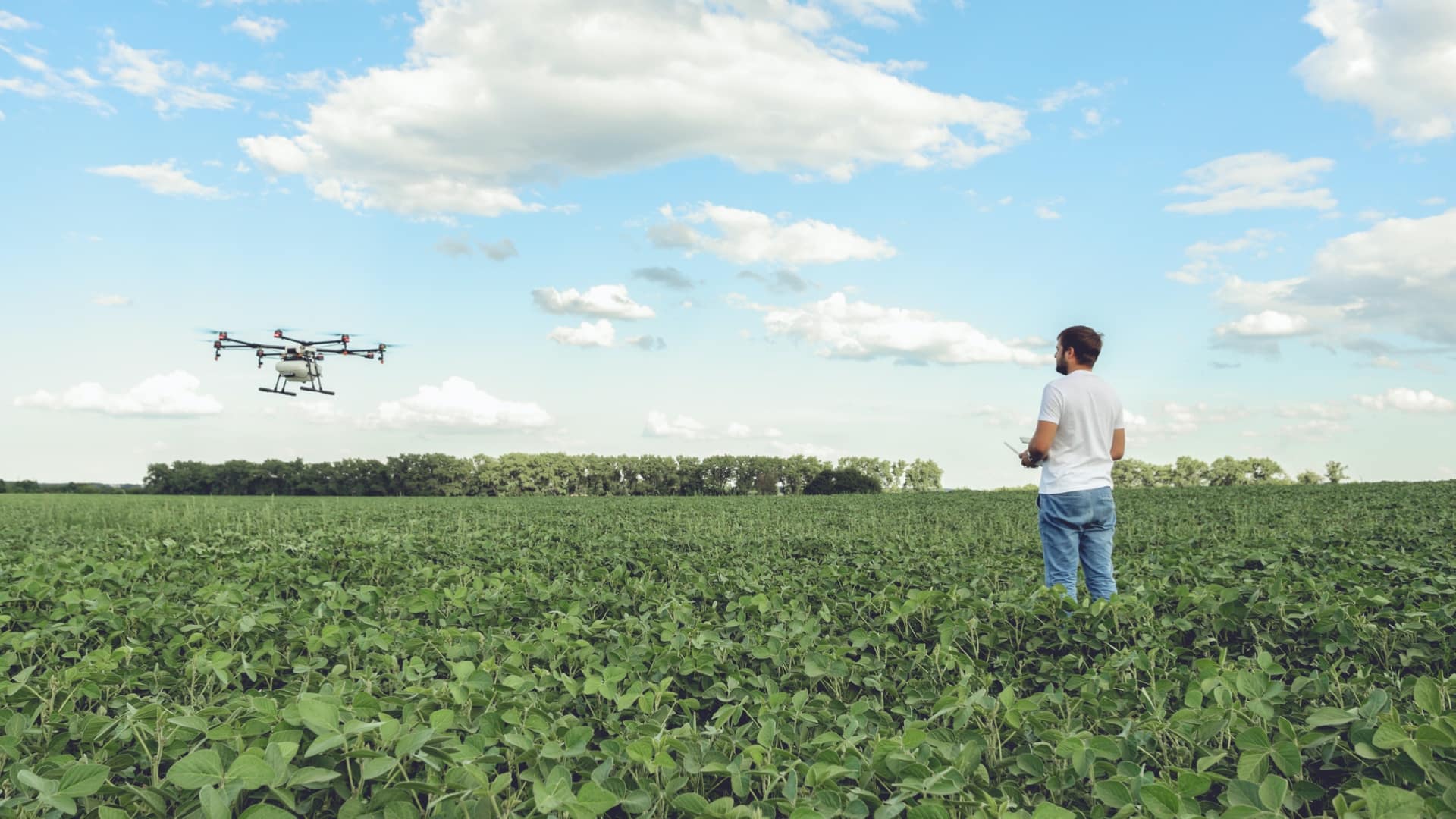
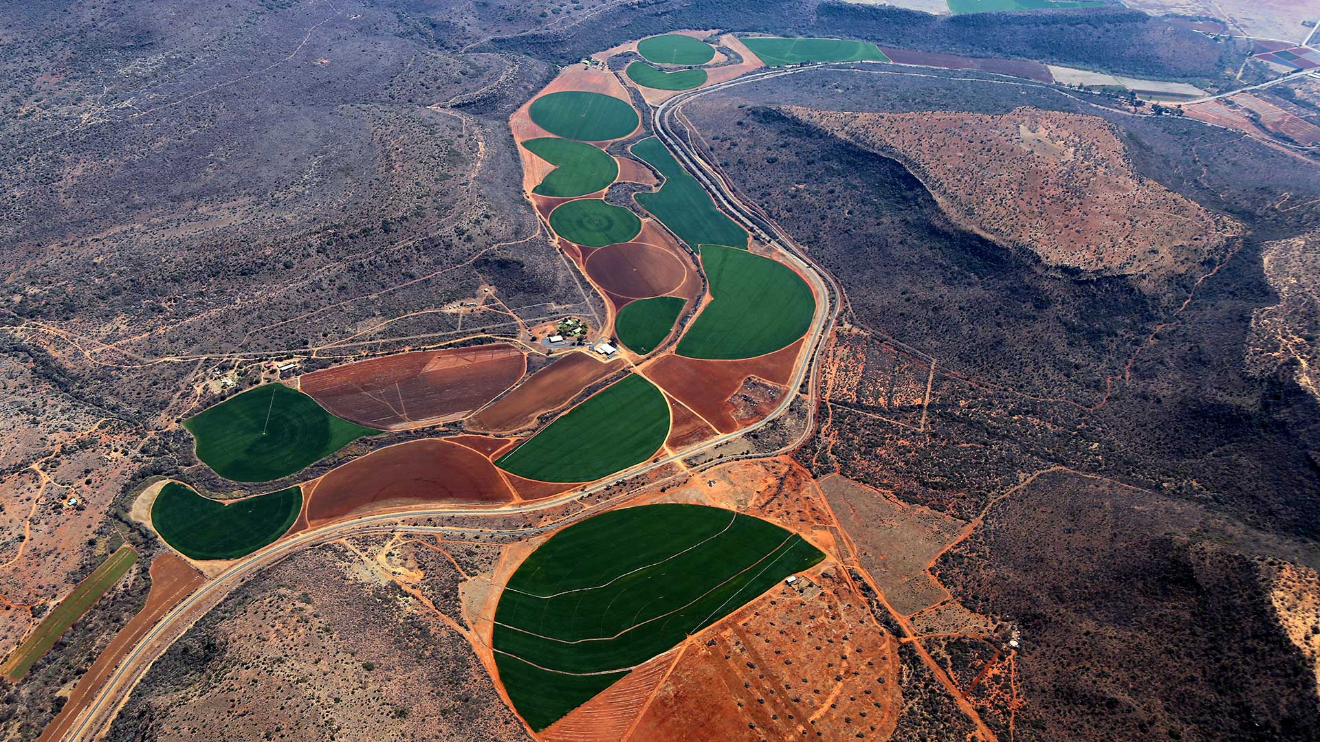
Now the technology is enabling Indigo to provide farmers with the location intelligence needed to make their labor more efficient. Drawing on a complex array of data points including planting dates, the pH of the field, soil types, and climate and weather patterns, Indigo’s agronomists aim to match the right seed treatments to the land being cultivated, or forecast crop volumes to help farmers estimate what they’ll bring to market. Drones or satellites can relay information about plant canopies, with the color and quality of the leaves giving agronomists an integrated view of plant health and maturity.
Location analysis is also aiding the company’s effort to incentivize carbon sequestration. Based on soil studies and satellite data, Indigo Ag can suggest carbon-sequestering practices a farmer might implement, then measure progress and allocate carbon credits.
In comparison to industrially farmed plots, fields farmed in the regenerative fashion that Indigo encourages are often more resistant to extreme weather events like floods. These nature-based solutions also can bolster the farmer’s bottom line, as properties produce healthier, higher-yielding crops. By bringing to life various data layers—many invisible to the human eye—the smart maps making this insight possible are helping to fulfill the promise of precision agriculture.

What we're doing with a three-dimensional view of agriculture is we're turning what's typically been a vulnerability or a hindrance to learning—this variation within fields—into an advantage. The way you do that is with geospatial technology.
Indigo Ag and the Quest to Clean Up Dirty Data
The world of agriculture has become increasingly data driven, with companies like John Deere manufacturing equipment that captures information as it operates, and farmers using drones and other sensors to track conditions across thousands of acres.
But accurately and consistently gathering data about a working field is a far more difficult task than equipping, say, an office building with IoT sensors. Every piece of land—even every row of crops—is unique, and every season brings unpredictable inputs in terms of water, wind, heat, and cold, especially in the age of climate change.
“Nothing is the same in agriculture—any farmer will tell you that,” says Chris Malone, who works closely with Potere as head of field data solutions at Indigo.
Indigo Ag uses GIS technology to orchestrate the information value chain across agriculture, bringing order to the complicated process of deriving insight from datasets that can be as dirty as the bottom of a farmer’s boot. Potere, who served in the navy, earned a PhD in geodemography, and worked at Boston Consulting Group before starting Tellus, brings a geospatial approach to everything he does.
He sees this as a unique moment in time, when computing power has caught up to the ambitions of agtech pioneers like Indigo. “It does feel like now is a kind of moment where this is actually going to start happening,” Potere says, “because we’ve been looking long enough, hard enough with satellites, and because cloud computing is cheap and prevalent enough, and because machine learning is now capable of dealing with these volumes.”
Combined with geospatial technology, those tools yield a detailed, dynamic vision of the agricultural landscape that can help farmers make choices that lead to greater profitability and resilience, and actively contribute to a healthier planet by drawing carbon out of the atmosphere and reducing on-farm emissions.

Part of the carbon story is to take action on climate via the soil. We have to learn how to do that. It's not a dominant practice in the US right now.
Growing Profits with Location Analysis
The laboratory of Indigo Ag’s insights is its Indigo Research Partners program. Working with over 100 farmers who collectively farm around one million acres and have agreed to test the microbially treated seeds and instrument their fields with sensors, the Indigo team tests theories and assumptions in real-world settings with scientific precision. Data collected with iPads in the cabs of pick-up trucks, from sensors on combines and similar farm equipment, and from satellites floating thousands of miles above generates valuable insight that allows Indigo to hone location intelligence about seed treatments and carbon-reducing techniques.
In contrast to carefully controlled small plot trials often used in agriculture, this approach enables Indigo Ag to follow the evolution of crops against variables like moisture levels or sun exposure in real-life, rugged, and unpredictable circumstances. A field of about 100 acres might be split into four quadrants, three planted with different bundles of microbial products, one set aside as the control.
Through Indigo Ag’s multi-layered data collection, farmers and agronomists can track land-based factors like geography and soil type; human decisions made by the farming team such as which seeds they plant and at what rate; and the outcomes of those actions.
The team has developed a product called Mufasa that uses multifactorial spatial analysis to pull these disparate strands of information together and overlay the data on maps. From there they determine where to make an intervention, such as using more or less irrigation, or whether a microbial product works better in silty loam or clay loam soil. Finally, Indigo will employ data to understand the effect of interventions.
This location analysis and the insights it produces are leading to real results for farmers whose profits are increasingly squeezed by market volatility and the destructive effects of climate change. For Ben Riensche, an Indigo Research Partner and sixth-generation Iowan farmer who specializes in soybeans and corn, Indigo Ag’s data-powered feedback and microbial treatments have improved crop yields by more than 10 percent. Location-specific insights about farming practices helped Kansas grower Tony Hein boost profits by $50,000 a year while reducing environmentally harmful inputs like pesticides.
Regenerative Practices Enlisted for Climate Resilience
At Indigo Ag, location intelligence also plays an important role in helping agricultural properties transition to regenerative practices. The idea behind this approach is to turn back the clock on some intensive industrial farming practices that have depleted the land of resources and made vast sections of the country, including the Corn Belt, more vulnerable to climate change.
Practices such as using cover crops (noncommercial plants that hold carbon in the soil and prevent erosion over the winter); crop rotation; and reducing tillage help to keep carbon out of the atmosphere, making farms stronger while reducing reliance on fertilizer and pesticides.
Farmland in Livingston County, Missouri recently saw a severe drought—a weather event that’s becoming increasingly common due to climate change. Through spatial analysis, Indigo found that the fields being farmed regeneratively—easy to spot on color-coded smart maps—fared better than those farmed conventionally. While all farms in the afflicted area suffered, those using practices like cover crops had a longer, better run of plant health because the stronger soil was more capable of retaining water.
Meanwhile, Hancock County in Ohio has been handling extreme weather events at the opposite end of the spectrum in recent years: floods. Due to massive rainfall, many farmers lost the ability to even sow their fields. But Indigo Ag’s analysis found that plots using regenerative practices were better able to manage the excess water and had a more productive season than conventional fields, which were often left unplanted.
Given the number of variables that has to be taken into account, and the diversity of conditions across hundreds or thousands of acres, the transition to healthier practices can be difficult to manage without the insights generated by GIS-backed technology. “From a risk mitigation perspective, transition to regenerative practices looks like an insurance policy, if you can do it safely and smartly,” Potere says. “Having an insights engine that lets you look everywhere and scale the learnings from our 100,000 partner acres is a really important part of building a climate system.”

What's really cool about regenerative farming is . . . it's a form of climate action, but farmers that do these practices build soils that are more resilient to the effects of climate change, like flooding and drought.
Feeding the Demand for Net Zero
The other major positive outcome created by regenerative farming is carbon sequestration. With green consumerism on the rise, companies like Apple, Ford, and BP are pledging to go net zero on carbon emissions within the next few decades.
To help support these goals, there’s momentum building behind the idea of a carbon credit system or marketplace, in which farmers will be paid for their efforts to trap more carbon in the soils of the land they tend, or reduce their emissions. It’s a nature-based solution that’s garnered support both in the private and public sector, where the issue has rare bipartisan accord. Such a system would allow companies to offset their own emissions, or advertise that the crops moving through their supply chains are carbon neutral. Farmers in turn would be motivated to pursue carbon-reducing techniques like cover crops or practices that reduce on-farm emissions like limiting nitrogen use, because they could sell the associated credits. In some lean years that could even make the difference between a net profit and a net loss.
The practices Indigo Ag is helping farmers put in place based on location intelligence can help restore cultivated soils, raising carbon content closer to the levels found in forest and prairie soil. By trapping more carbon in the soil and reducing on-farm emissions, farmers can play a role in climate solutions.
The company sees an opportunity both to aid this transition and to be one of the major players in the nascent field, with data-gathering technology capable of verifying that a farmer is reducing on-farm emissions through sequestration and abatement. Indigo starts by testing the soil, establishing the current amount of carbon, and working with the farmer to determine which practices will work best for their location and conditions. Over time, the farmer will get credits as the amount of carbon in the soil increases—currently around $15 per metric ton of carbon, but with the potential to increase.
This is Indigo Ag’s first season with growers enrolled in the program. Following the current extensive period of sampling, they’ll move into credit generation next year.
The company is already moving ahead on a sustainable grain programs with companies like Anheuser-Busch, which came to Indigo with the goal of growing rice with 10 percent less water, 10 percent less nitrogen, and 10 percent fewer emissions. A year in, the brewer has already saved two million gallons of water and reduced fertilizer use by 250,000 pounds.
A New Way to See Farmland
Amid escalating environmental crises and an agricultural industry strained by global volatility, it’s clear that the way the world farms must change. Some methods of regenerative farming harken to the past, returning modern farmers to the chemical-light, soil-healthy methods of their grandparents. Other new approaches, like using smart maps and machine learning to decipher patterns in satellite imagery, are only possible due to recent advances in digital tools and location technology.
Situated on the cusp of these changes, Indigo Ag is helping to create a more beneficial agriculture system through data, overcoming the challenges both in collecting it from the field and analyzing it to derive useful insight. Where farmers once had to rely on intuition to make decisions about how they farmed their crops, Indigo Ag’s use of geospatial technology is making it possible to see farmland in a new way, layered with data scooped up from the earth and analyzed from outer space.
“The beauty of geography and the power of geospatial is that it’s an integrative science,” Potere says. “It’s the natural place to bring diverse data domains together and create something of real value.”
The Esri Brief
Trending insights from WhereNext and other leading publicationsTrending articles

December 5, 2024 |

January 6, 2026 |

March 3, 2026 |

March 31, 2026 | Multiple Authors |

July 25, 2023 |

February 17, 2026 |