Drones are proving their value in business by saving time and money and delivering on new customer expectations. As innovators map drone highways to support these activities, they’re finding location intelligence an indispensable ally.
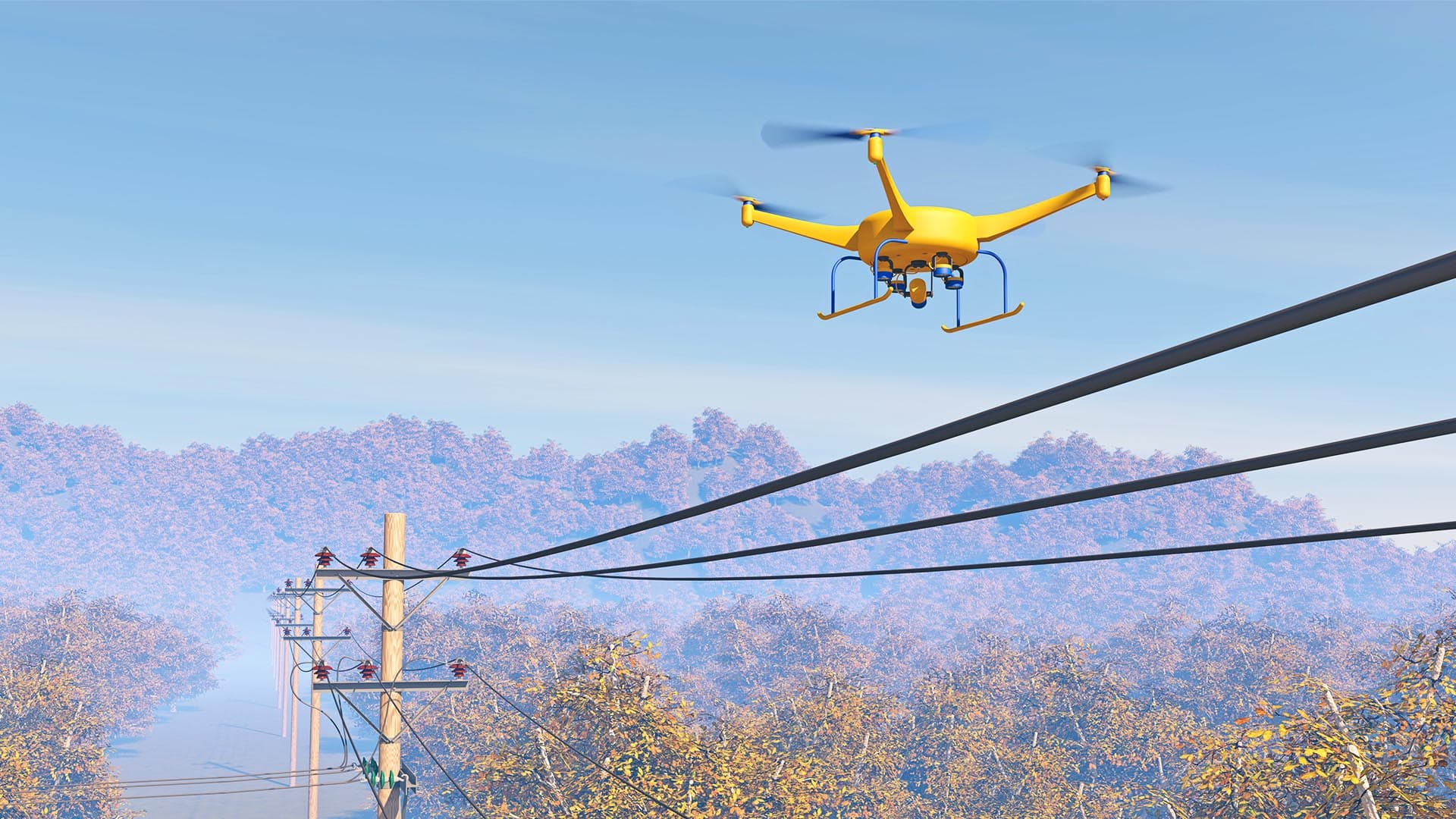
With the COVID-19 crisis, interest in drone use spiked as companies sought ways to perform contactless delivery of food and medical supplies. Recent surveys show that contactless deliveries are just the latest in an already long list of drone uses ranging from just-in-time parts exchanges to the inspection of bridges, rail tracks, power lines, tall buildings, and even crop and soil conditions.
A survey released in September 2019 showed that 45 countries were using or planning to allow the use of drones to deliver a wide variety of products and services, including pilotless air taxis.
One of the early leaders exploring the business benefits of drone use is centered in Detroit. A development called the Detroit Region Aerotropolis is testing the concept that convenient access to air travel—by conventional plane and drone—will stimulate economic activity.
Aerotropolis Concept Catches On in Detroit
With 6,000 acres open for development between the Detroit Metropolitan and Willow Run airports, plus investments from public and private partners and a history of local automotive innovation, the aerotropolis concept found a welcoming home in the Motor City area. This partnership of Detroit-area counties, airports, economic developers, and private businesses is taking smart-city planning to a new level by using location technology to create drone highways and drive further adoption of drones as business tools.
“Detroit built the automobile, and it allowed people to move throughout the world,” says Christopher Girdwood, executive director of the Detroit Region Aerotropolis Development Corporation. “And maybe we’ll be the first to build highways in the sky that allow people to move in new ways.”
Though still in early phases, the aerotropolis is attracting interest from several types of businesses, according to one of the people involved in the project. Peter S. Rogers, first vice president of CBRE’s advisory and transactions services in Detroit, says he’s met with third-party logistics companies about leasing warehouses and distribution facilities inside the aerotropolis region.
Rogers also notes that large open acreage is likely to draw manufacturing-related companies building factories to make parts or assemble products. Other observers suggest that those companies could add a new use case to the list of drone applications: just-in-time delivery of critical manufacturing equipment.
Motor City Drone Highways Could Change the Nature of the Supply Chain
With a prominent ongoing role in automobile production, Detroit businesses have a special interest in using drones to strengthen supply chains by moving materials and parts via time-saving drone highways.
For instance, if a vital piece of manufacturing equipment breaks and must be replaced, drone highways could reduce downtime from weeks or days to a matter of hours or even minutes, minimizing lost production time.
“In and around the Motor City in southeast Michigan, you have the Big Three automakers,” Girdwood says. “And the Big Three move a lot of just-in-time, high-value cargo in between plants, and then tier-two, tier-three suppliers need to move into other facilities. That movement of cargo must be managed efficiently. And if it’s not in time, it can delay assembly lines. It can take supply chains to a halt.”
As part of reimagining the B2B supply chain, Girdwood also proposes a scenario for the average consumer: grocery deliveries that arrive by drone minutes after they’re ordered.
“What if there was an automated robotic sorting facility that could pick all of your fresh, frozen, canned, and boxed groceries within 7 to 10 minutes, and then ship it out to you via a highway in the sky in another 7 to 10 minutes? [That] cuts an hour and a half of your time and gives it back to you,” Girdwood says.
Drone Skyways Will Be Built on a Foundation of Location Intelligence
As project leaders and partners build out the Detroit Region Aerotropolis on the ground, they’re also advancing an innovative vision for the skies above. To incorporate drones into the region’s transportation plans, these leaders are relying on the location intelligence and smart mapping capabilities of geographic information system (GIS) technology.
Much of what will transpire in the air—including the intricate flight patterns drones will follow and the real-time adjustments they’ll make—depends on what exists on the ground. Girdwood and the aerotropolis team are using location technology to coordinate that interplay and create new business opportunities.
“The authoritative data that we’re using is coming from a GIS platform that communities have been building,” Girdwood tells WhereNext. “The system includes their planning documents, their current land-use plans, [and] all of their infrastructure. All of that data has been built on a platform that now we’re pulling from.”
Such data reveals the height and location of power lines, buildings, event spaces, and cell towers, as well as restricted areas such as military installations, schools, and hospitals.
That information “will dictate where highways in the skies can and cannot be built,” Girdwood says, and location technology will help planners create the airborne infrastructure. “You could not do what we’re trying to do without a geographic information system that’s tried, tested, true, and interoperable.”
In the case of the Detroit Region Aerotropolis, the mapping and drone tracking system was created by Airspace Link. The company’s system uses GIS-based digital mapping to determine the safest, most efficient route for a drone to take on the way to pick up and deliver items.
Compatible with systems used by local government, airports, and the Federal Aviation Administration (FAA), the Airspace Link platform has been approved by the FAA for the authorization and notification of drone flights that go beyond the pilot’s sightline. The new system passed an important test this summer in air space below 400 feet, where drones are allowed to fly.
In addition to facilitating long-term planning for drone highways, the system monitors information in real time and adjusts drone routes as needed. With the ability to quickly process changing information, GIS technology can automatically adjust a drone flight to weather conditions. Or, if a town in the Detroit area submits a real-time alert about a large gathering of people on the ground or police and medical helicopters flying at low altitudes, the system will automatically reroute drones away from the large-group event or crowded airspace, says Michael Healander, president & CEO of Airspace Link.

Everything we're doing—from creating a drone to the GPS of your location, [to] what hazards are around you, what airspace is the president flying through—it's all geospatial.
Drone Usage Was Already Growing Quickly before Pandemic
Even though the aerotropolis concept is still relatively new, drone-based services have already impacted a wide variety of businesses.
The aforementioned survey noted several accomplishments in 2019:
- UPS creating a drone delivery business
- University of Maryland Medical Center in Baltimore receiving the drone delivery of an organ for transplantation
- Uber announcing plans to deliver food by drones in San Diego
- Flirtey receiving approval to deliver automated external defibrillators (AEDs) in Reno, Nevada, to assist cardiac patients
- Memphis-Shelby County Airport Authority launching a security initiative to permit drones to inspect freight-hauling airplanes and package warehouse areas.
- Pilotless air taxis being tested by EHang, a Chinese company that also demonstrated a two-passenger model in the US in early January of this year.
Far from simply being one-time feats of technical prowess, these milestones represent the early stages of what will likely be a large market. Even such a complex undertaking as a pilotless air taxi service has sparked serious interest, with Uber Elevate announcing that its drones will start flying passengers in 2023 in the US and Australia.
The acceptance of drones as an essential business tool has also risen. A 2018 survey involving US companies with at least $50 million in revenue found that 90 percent believed drones saved time and money, and that usage was expected to double quickly.
Drone Services Can Aid Companies and Products, Both Large and Small
In general, the services that drones provide fall into two categories—delivery and nondelivery applications. Many of these have been already been tested and found valuable. However, companies that manage drone highways still need governmental permission to request, approve, and monitor flight paths. Airspace Link, for instance, is an FAA-approved provider, so its GIS-based system must enforce the FAA’s flight rules for drones.
To pave the way for more services and more activity on these aerial highways, manufacturers will soon be required to install electronic IDs that let drones and other aircraft sense the presence of a drone and determine whether it is on an approved path. In short, as the devices grow in number and sophistication, the need for trusted location intelligence is rising, too.

We're building highways in the sky. Bring your inventions, bring your technologies, bring the ways you want to use this public infrastructure to southeast Michigan and use it safely in a way that there is a market demand for.
A New Kind of Air Traffic Control
Girdwood and the Detroit Region Aerotropolis team have watched the evolution of the drone economy, and they’re taking an active role in its advance.
“When [we] started talking about creating highways in the sky, we thought, what better way to test the risk tolerance of the FAA than to do it right next to the airport?” he says. “This is creating highways in the sky next to the 18thbusiest airport [Detroit Metro] in the United States.”
Because Airspace Link is FAA approved, the company has authoritative data about what happens in the sky, and overlays that with location data from the ground to create safe flight routes. (See sidebar for more on how the data is gathered.)
When a local manufacturer or automated grocery fulfillment center needs to schedule a drone delivery, that location-aware platform will make the transaction possible.
“That sorting facility, that fulfillment center will be able to type in the route where they need to deliver,” Girdwood says. “Airspace Link will be the third party that provides the FAA approval and the local airport approval if required, to make that whole operation work.”
And that future is not far off. “These highways in the sky are not just a pipe dream,” Girdwood says. “They’re actually being built.”
The Esri Brief
Trending insights from WhereNext and other leading publicationsTrending articles

December 5, 2024 |

June 23, 2026 |

March 3, 2026 |

April 7, 2026 |

March 17, 2026 |

June 2, 2026 |