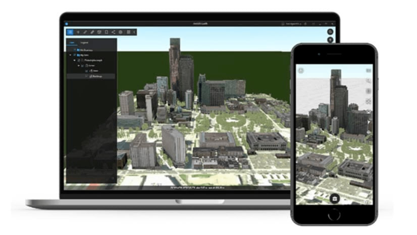
| ArcGIS Earth is an interactive 3D experience for users to plan, visualize, and evaluate events on the globe. ArcGIS Earth provides situational awareness of an environment on desktop and mobile for improved decision-making. Ingest data in different formats, including 3D models, KML, TXT, and open services from ArcGIS or with a URL, to explore areas of interest in 3D. Manipulate KML in its entirety to understand changing circumstances. ArcGIS Earth is a free and easy-to-use tool to quickly fuse, manipulate, and collaborate with 3D data for research, planning, supporting time sensitive briefings, and graphic presentation. |
The ArcGIS Earth October 2020 release includes new 3D capabilities, support for additional data types, and many user experience enhancements. With the October 2020 release of ArcGIS Earth we have migrated from the .NET Framework to .NET Core. Upon this new platform, ArcGIS Earth will introduce several new capabilities and optimized overall performance.
Significant performance and usability improvements are as follows:
- Improved Symbology workflow and added two new symbol types: Types (Unique Symbol) and Counts and Amounts (Colors).
- Bookmarks capability has been redesigned with better workflow and more functionalities.
- Upgraded ArcGIS Earth’s Automation API to ASP.NET Core REST API by .NET Generic Host.
- Enhanced the accessibility of ArcGIS Earth, including a new design for keyboard shortcuts and use of the keyboard to move focus to and away within each tool.
New Features
New data type Support
- Support for version 1.0 and 1.1 GPX files for online and offline usage.
- Support for GeoJSON files for online and offline usage.
- Support WFS (Web Feature Service), which is a dynamic feature service that follows the specifications of OGC.
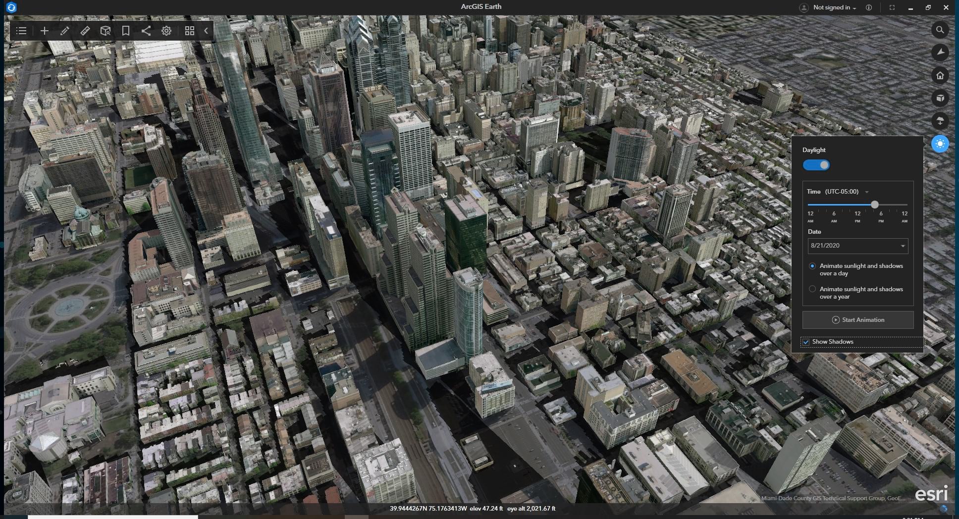
Daylight
The Daylight rendering capability allows you to change how sunlight and shadows affect your scene during different times of the day and year. You can configure the sunlight and shadow effects by setting time, date, animation methods, and whether or not to show shadows.
- Set up the start-up time zone, time, and date.
- Animate the daylight as it cycles through the months in a year on the scene.
- Animate the daylight as it cycles through the minutes in a day on the scene.
- Display dynamic shadows on the scene.
Underground Mode
Underground mode enables you to navigate underground datasets and easily adjust the transparency of the terrain surface.
Enhancements
Bookmark editing and management
-
- Added a bookmark description editing panel.
- Ability to add an image and description to bookmarks.
- Ability to set the fly-in transition effects to bookmarks.
- Added bookmarks tab to manage bookmarks by group.
- Support to export bookmarks as KML.
Pop-ups
-
- Ability to pin the pop-up window at the right corner.
- Ability to maximize the pop-up window.
- Earth now remembers the pop-up status and position.
Table of contents
-
- Ability to resize the table of contents window.
- Support to remember the table of contents window size once it is collapsed.
Automation API
-
- Upgraded to ASP.NET Core REST API by .NET Generic Host
- Support to enable the Automation API in ArcGIS Earth for users who do not have admin rights.
Download the latest version of ArcGIS Earth for desktop at the ArcGIS Earth Product Page. For additional information check out our documentation and YouTube Playlist.
About the author


Article Discussion: