ArcGIS Earth is an interactive 3D experience to plan, visualize, and evaluate events on the globe. It’s a free and easy-to-use tool that provides situational awareness on desktop and mobile devices for improved decision-making.
This month’s release of ArcGIS Earth 1.10 builds on improvements to the disconnected workflow released last year. As you may recall, in April 2019, we introduced a new way to take your 3D scenes and content offline with a single file called a mobile scene package. For those familiar with the “portable globe experience”, this new data type allows for clip, zip, and ship workflows. Mobile scene packages can be created in ArcGIS Pro and also by developers who are building applications with the ArcGIS Runtime SDK. Now with 1.10 users can work with this new data type, expanding the variety of information that works directly inside of ArcGIS Earth.
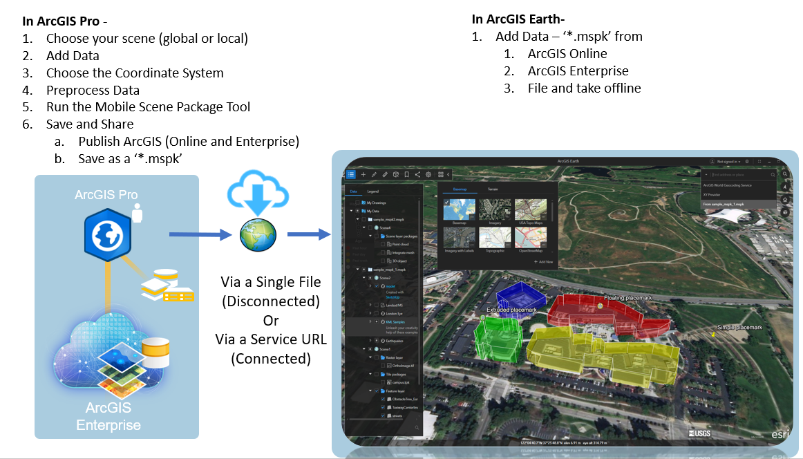
Mobile scene packages have the extension ‘*. mspk’ and can be shared for access across your organizations to ArcGIS Online or Portal for ArcGIS 10.7.0 or later. Mobile scene packages can become quite large. We anticipate that there may be requirements in the terabytes. The team is looking for your feedback on sizing requirements of these packages to help us improve support for this new data type. Mobile scene packages can be accessed from your desktop computer; disconnected from a network in the field on your laptop, or from mobile versions of ArcGIS Earth.
Download ArcGIS Earth 1.10 and add your mobile scene packages today!


Article Discussion: