We are all already familiar with GPS navigation outdoors and what wonders it does not only for our everyday life, but also for business operations.
Outdoor maps, allowing for navigation via car or by foot, have long helped mankind to find even the most remote and hidden places. Increased levels of efficiency, unprecedented levels of control over operational processes, route planning, monitoring of deliveries, safety and security regulations and much more have been made possible.
Some places are, however, harder to reach and navigate than others. For instance, places like big indoor areas – universities, hospitals, airports, convention centers or factories, among others. Luckily, that struggle is about to become a thing of the past. So what’s the solution for navigating through and managing complex indoor buildings?
Indoor Mapping and Visualization with ArcGIS Indoors
The answer is simple – indoor mapping. Indoor mapping is a revolutionary concept that visualizes an indoor venue and spatial data on a digital 2D or 3D map. Showing places, people and assets on a digital map enables solutions such as indoor positioning and navigation. These, in turn, allow for many different use cases that help companies optimize their workflows and efficiencies.
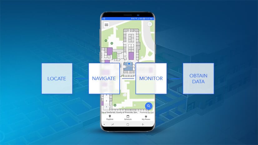
Mobile Navigation and Data
The idea behind this solution is the same as outdoor navigation, only instead it allows you to see routes and locate objects and people in a closed environment. As GPS signals are not available indoors, different technology solutions based on either iBeacons, WiFi or lighting are used to create indoor maps and enable positioning services.
You can plan a route indoors from point A to point B with customized pins and remarks, analyze whether facilities are being used to their full potential, discover new business opportunities, evaluate user behaviors and send them real-time targeted messages based on their location, intelligently park vehicles, and the list goes on!
With the help of geolocation, indoor mapping stores and provides versatile real-time data on everything that is happening indoors, including placements and conditions of assets and human movements. This allows for a common operating picture, where all stakeholders share the same level of information and insights into internal processes.
Having a centralized mapping system enables effortless navigation through all the assets and keeps facility managers updated on the latest changes, which ultimately improves business efficiency.
Just think how many operational insights can be received through visualizations of assets on your customized map – you can monitor and analyze the whole infrastructure and optimize the performance accordingly.
How to engage your users/visitors at the right time and place? What does it take to improve security management? Are the workflow processes moving seamlessly? Answers to those and many other questions can be found in an indoor mapping solution. Interactive indoor experiences are no longer a thing of the future, they are here and now.
Learn more about indoor mapping and ArcGIS Indoors


Commenting is not enabled for this article.