ArcGIS Living Atlas of the World is the foremost collection of geographic information from around the globe. It includes curated maps, apps, data layers, and tools from Esri and the global GIS user community that support your work. Living Atlas is built-in to the ArcGIS system and is available across all products and environments.
Lots of great questions were asked and answered at the Living Atlas showcase during the 2022 Esri User Conference. Here’s a summary of some of the frequently asked questions and topics.
Quick links
Use the links below to jump to specific questions.
What is ArcGIS Living Atlas and how is it different than ArcGIS Online?
What types of content can I find in Living Atlas?
How often are Living Atlas live feeds updated?
How can I find the resolution and vintage of Living Atlas imagery?
Is there an archive of older imagery?
How do I enable public use of Living Atlas layers that I am using in a map?
What’s the difference between subscriber and premium Living Atlas content?
Can I customize Living Atlas basemaps?
If I think I have found an error in one of the basemaps or in the geocoder, how do I report it?
How do I learn about new content or updates in Living Atlas?
Can I use ArcGIS Living Atlas in my enterprise organization?
My organization is completely disconnected, behind a firewall. How can I use Living Atlas content?
Can I use Living Atlas content in analysis?
How can I find all OpenStreetMap (OSM) content in Living Atlas?
How can I contribute to Living Atlas?
Does it cost credits to contribute to Living Atlas?

What is ArcGIS Living Atlas and how is it different than ArcGIS Online?
ArcGIS Living Atlas is a curated collection of authoritative, best of breed content from Esri, Esri partners, and the GIS user community. Living Atlas content is not separate, it’s a subset of ArcGIS Online content.
What makes Living Atlas content different is that it’s vetted and curated by Esri subject matter experts and is integrated directly into common workflows across the ArcGIS system. For example, you can easily search and use Living Atlas basemaps and content when making maps in Map Viewer, Scene Viewer, or ArcGIS Pro. You can use Living Atlas content in field apps, stories, dashboards, and experiences. Living Atlas content can also be leveraged by developers in custom apps and services using ArcGIS Platform.

What types of content can I find in Living Atlas?
ArcGIS Living Atlas contains a broad array of content types. Much of the content is ready-to-use maps, apps, and layers. Other content (like deep learning packages and raster function templates) are intended primarily for use in ArcGIS Pro.
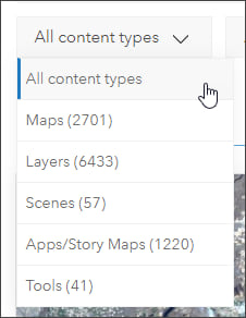
The main content types found in Living Atlas are maps, layers, scenes, apps, and tools. Each of the main types contain different subtypes. The main content types can be filtered in the Browse tab at the Living Atlas website.

How often are Living Atlas live feeds updated?
ArcGIS Living Atlas live feeds are updated regularly, the update frequency depends on the source and available data. You can learn about the update frequency by viewing the item overview for the live feed. For example, viewing Active Hurricanes, Cyclones and Typhoons we learn that the source is checked for updates every 15 minutes. Viewing Satellite (MODIS) Thermal Hotspots and Fire Activity we learn that the update frequency is every 30 minutes. The National Weather Service Smoke Forecast is updated every 24 hours by NWS.
The Live Feeds Status dashboard also shows the update frequency. Open the drop-down to see when the feed was last updated, when the next update check will occur, and other usage statistics.
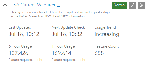
For more information, see Introducing ArcGIS Living Atlas Live Feeds Status.

How can I find the resolution and vintage of Living Atlas imagery?
Living Atlas world imagery is published in several different ways, as tile layers and ready-to-use basemaps with and without reference layers. World imagery uses Maxar as a primary commercial source, which is complemented by contributions via the Community Maps Program. These sources deliver 1 meter or better satellite and aerial imagery in many parts of the world, with higher resolution in many urban areas. The recency and resolution of the imagery depends upon the scale at which it is viewed and also the geographic location.
To learn more about the imagery, use the Imagery with Metadata map and zoom to your area of interest. Click the map to see the resolution, collection date, and source of the imagery. You can also add the World Imagery layer to any map to obtain the same information.
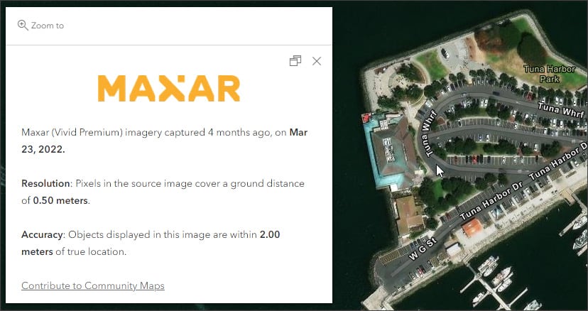
Use the World Imagery Updates app to learn more about recent updates and map coverage. The link to the app is included in the World Imagery item details.

Is there an archive of older imagery?
Wayback imagery is a digital archive of the World Imagery basemap, enabling users to access more than 100 different versions of World Imagery archived over the past 6 years. Each record in the archive represents a version of World Imagery as it existed on the date it was published. See the Wayback Imagery group to view the archive.
Using the World Imagery Wayback app you can browse and discover previous versions of the World Imagery basemap. The app also includes swipe and time animation tools, and can be used to create and share maps and animations from the imagery archives. Shown below is an animated GIF created using the Wayback app.
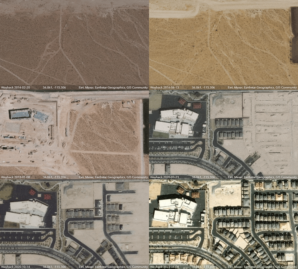
For more information, see Explore imagery archives using World Imagery Wayback.

How do I enable public use of Living Atlas layers that I am using in a map?
Much of the content found in Living Atlas is public and ready-to-use in maps, scenes, and apps with no restrictions or authentication required. However, some content is not publicly available and requires an ArcGIS account to access. This content is marked as subscriber content using badges found on the items.
You can’t authorize subscriber content in Map Viewer or Scene Viewer for public use. The best way to enable subscriber content publicly is via an app, story, dashboard, or experience. For more information, see Use ArcGIS Living Atlas subscriber content in maps, scenes, and apps.
To double check public access, use the public URL in an incognito window. For example, instead of using:
use:
https://www.arcgis.com/apps/instant/media/index.html?appid=f4416793304440c894297ea04fe9a30d

What’s the difference between subscriber and premium Living Atlas content?
Subscriber content is the collection of layers published by Esri that requires an organizational subscription account to access. These are layers such as Landsat 8 imagery, NAIP imagery, landscape analysis layers, and historical maps. Subscriber content is provided as part of your organizational subscription and does not consume any credits.
Premium content is a type of subscriber content. It’s the collection of content published in Living Atlas that requires an organizational account to access and also consumes credits when used. View all Living Atlas premium subscriber content.

Can I customize Living Atlas basemaps?
Living Atlas basemaps can be customized in a variety of ways and can be combined with your own layers. Blend modes and effects can be applied to basemap layers, including reference layers. You can author unique basemaps using a combination of Living Atlas reference layers and combine them with your own layers. The Vector Tile Style Editor offers full control to design your own custom basemap. For more information, see Vector Tile Style Editor documentation.
You can customize basemaps for use in specific maps and apps, or can include them in a custom basemap gallery for your entire organization. For more information, see Create a custom basemap gallery for your organization.

If I think I have found an error in one of the basemaps or in the geocoder, how do I report it?
From the Contribute tab on the ArcGIS Living Atlas website, scroll to the bottom and click Visit Community Maps to find Provide Feedback. The link opens a group containing three maps to deliver feedback on geocoding, imagery, and basemaps. This is the best way to provide feedback.
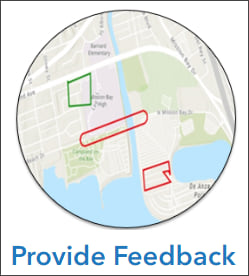
Alternatively, you can add comments to any of the Living Atlas items or add your comments in the ArcGIS Living Atlas Esri Community.

How do I learn about new content in Living Atlas?
Unlike other Esri products, Living Atlas does not publish specific release dates for content. As content is finalized, it’s pushed live. These resources are the best way to learn about what’s new (and also learn how to use Living Atlas content):
- ArcGIS Living Atlas home
- ArcGIS Blog (Living Atlas product tag)
- ArcGIS Living Atlas blog
- ArcGIS Living Atlas Esri Community blog

Can I use ArcGIS Living Atlas in my ArcGIS Enterprise organization?
Yes. A subset of ArcGIS Living Atlas content is configured into ArcGIS Enterprise portal installations. Basemaps and other content, such as live feeds and wide variety of subscription and other items are included. The installed items are static, but point to the same URL endpoints for the services as found in ArcGIS Living Atlas. For example, live feeds in Enterprise point to the same external online endpoints, therefore are updated automatically.
Newer and more dynamic content (subject to URL changes) does not appear in your Enterprise portal, but subsequent Enterprise updates include new items that meet the criteria for Enterprise use and access.
All publicly available layers in ArcGIS Living Atlas can be discovered via ArcGIS Online search in Map Viewer and Scene Viewer if your organization is configured to allow internet access. Non-subscriber content can also be directly added to maps and scenes via the service URL.

My organization is completely disconnected, behind a firewall. How can I use Living Atlas content?
For self-contained offline use, ArcGIS Data Appliance is a content solution that consists of hardware and data and is designed to run with ArcGIS Enterprise software. ArcGIS Data Appliance enables you to create, publish, and share map services securely behind your firewall. It connects directly into your internal network and comes preloaded with terabytes of global basemaps and reference layers from Living Atlas. For more information, see the ArcGIS Data Appliance documentation.

Can I use Living Atlas content in analysis?
Living Atlas content can be used in analysis depending on the content type, type of analysis you want to perform, and software used to perform the analysis. For example, feature layers are ideal as direct input for all types of analysis. Imagery layers can be used as direct input for on-the-fly analysis and used in subsets for more advanced raster analysis. Vector tile layers (such as Living Atlas basemap layers) cannot be used for analysis, rather are intended for visualization only.

How can I find all OpenStreetMap (OSM) content in Living Atlas?
You can find all OSM Living Atlas content in several ways. One way is to search for all OpenStreetMap content published by Esri at the Living Atlas website. Other destinations for OSM content are:
OpenStreetMap ArcGIS Online Home
OpenStreetMap Vector Basemaps (ArcGIS Online group)
OpenStreetMap Layers (ArcGIS Online group)

How can I contribute to Living Atlas?
You can contribute by nominating your content for inclusion in Living Atlas, or helping Esri improve basemaps by providing feedback, creating or editing detailed (large scale) features, and improving our imagery and elevation by contributing your own high resolution data.
Nominate your content
Living Atlas is a trusted source of authoritative content across the ArcGIS system. Contributing your best public content makes it easier for everyone to find and use, and can substantially increase its value and usage beyond just your organization.
By sharing your layers and maps, you’re also helping to build a Global GIS, allowing people from around the world to have easy access to data and information, and accelerate the progress of mapping, analysis, and decision making.
To begin, go to the Contribute tab at the Living Atlas website and click Nominate Your Content.

Improve the Esri basemaps
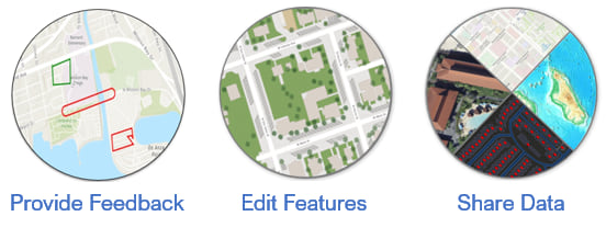
Every map starts with a basemap and more detailed and accurate basemaps make for more informative and trustworthy maps. Through Esri Community Maps, you can help enrich the entire collection of Esri basemaps, including vector basemaps, imagery basemaps, and elevation.
You can provide feedback, edit features, or send us your authoritative data that will improve the basemaps. Become a contributor to Esri Community Maps and your work will benefit many others.

Does it cost credits to contribute to Living Atlas?
No additional credits are consumed when you contribute to Living Atlas.

More questions?
Your questions and comments are encouraged at the ArcGIS Living Atlas Esri Community site. The Living Atlas team (and user community) actively monitor and respond to questions, ideas, and comments.


Commenting is not enabled for this article.