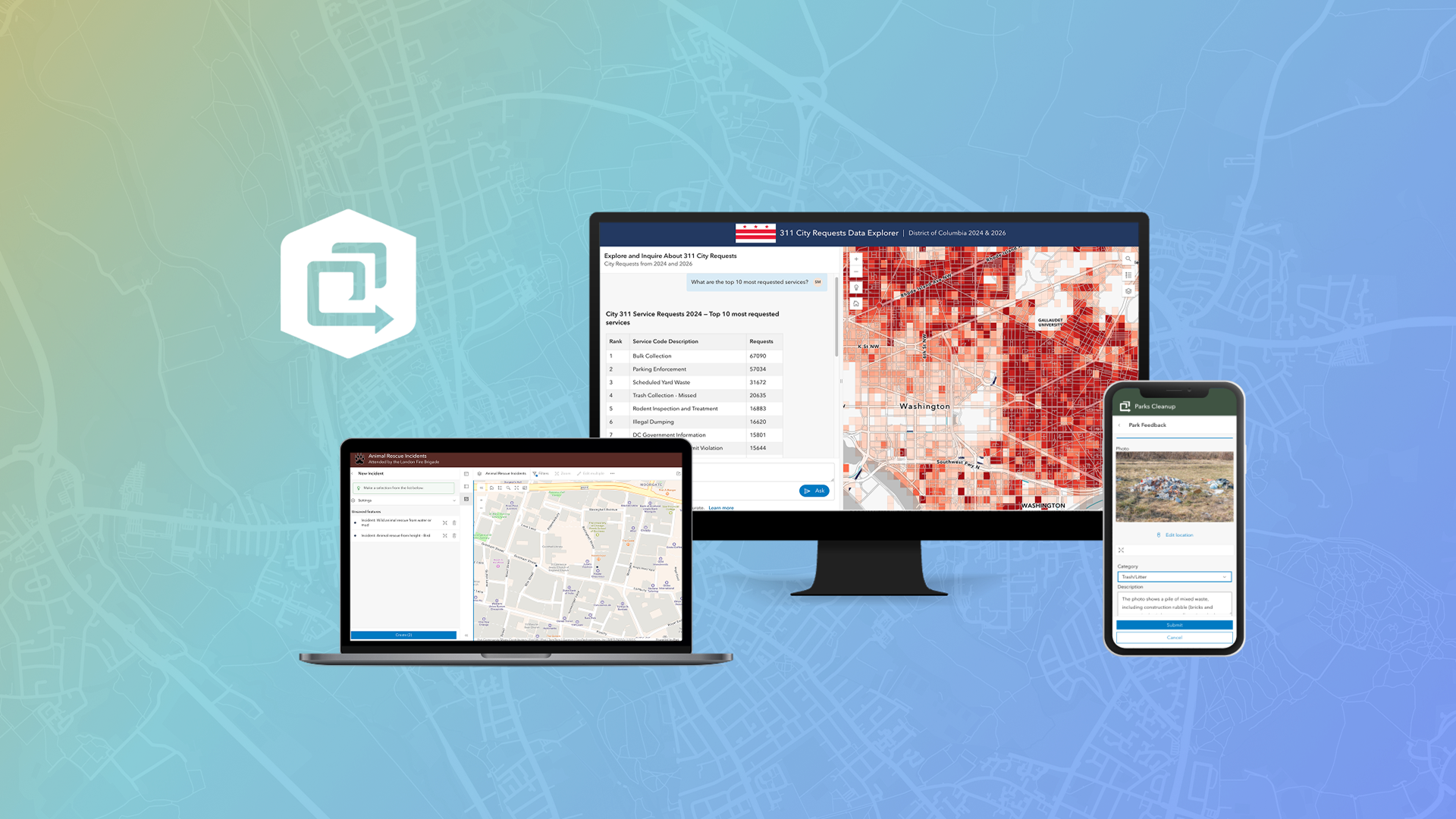
The June 2026 ArcGIS Online update introduces new features and key updates throughout the site. The same applies for ArcGIS Instant Apps, as we have rolled out several updates and new features to our existing apps, further improved choosing and managing your apps on the Instant Apps home page, and addressed various bugs and enhancements to help stabilize and improve your experience across the site. See the highlights below.
New template: Data Explorer (beta)
Use the new Data Explorer (beta) template to create a map that allows app users to interact with and filter data out of your map through a chat interface, removing menus or the need for complex query syntax. Leveraging AI-powered Natural Language GIS (NLGIS) technology, users can filter specific features from preselected feature layers, search and locate essential data, and describe spatial data in maps and tables.
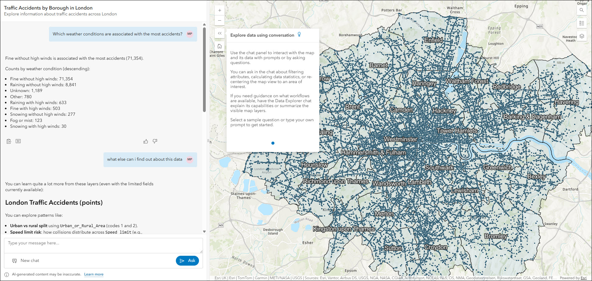
Utilize three available ArcGIS agents in the app to ask questions about data in the map, search for locations and navigate, and receive guidance on how to use the app and its capabilities. For example, ask, “Since September 27, 2022, what are the average, maximum, and minimum sale prices of three-bedroom homes with two or more bathrooms within 10 miles of San Diego?”. Or, “Zoom to Cook County and show me the area where bear and wolf sightings are concentrated.”
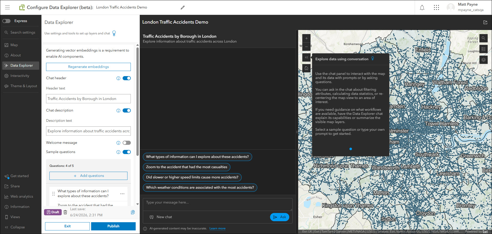
Your organization must support the use of AI assistants in order to create apps using Data Explorer (beta). Please consult with your organization administrator about enabling AI assistants if you do not see Data Explorer (beta) as a choice when choosing a template when using Instant Apps.
Take a look at all of the details about this exciting new app in ArcGIS Instant Apps: Introducing Data Explorer (beta).
Manager updates
Review and edit data from multiple maps and layers using the Manager app template. For example, review problems and feedback with new public transit stations that were collected using crowdsourcing. Use the app configuration to choose each map used in the project that you want included for review. A browser in the configuration lets you search and find any map you have access to so that there’s no need to rely on having everything contained inside a single group. Two new editing capabilities have been added to Manager:
- Copy/paste: App users can now copy and paste features and their attributes directly in the app. This supports pasting into the same layer or into other layers from the map. Select features to copy either from the map directly or within the table. Buttons for copy and paste appear in the table and selected features area. App authors can enable copy/paste using the “Copy and paste” setting located in the map settings on the Manager tab of the configuration.
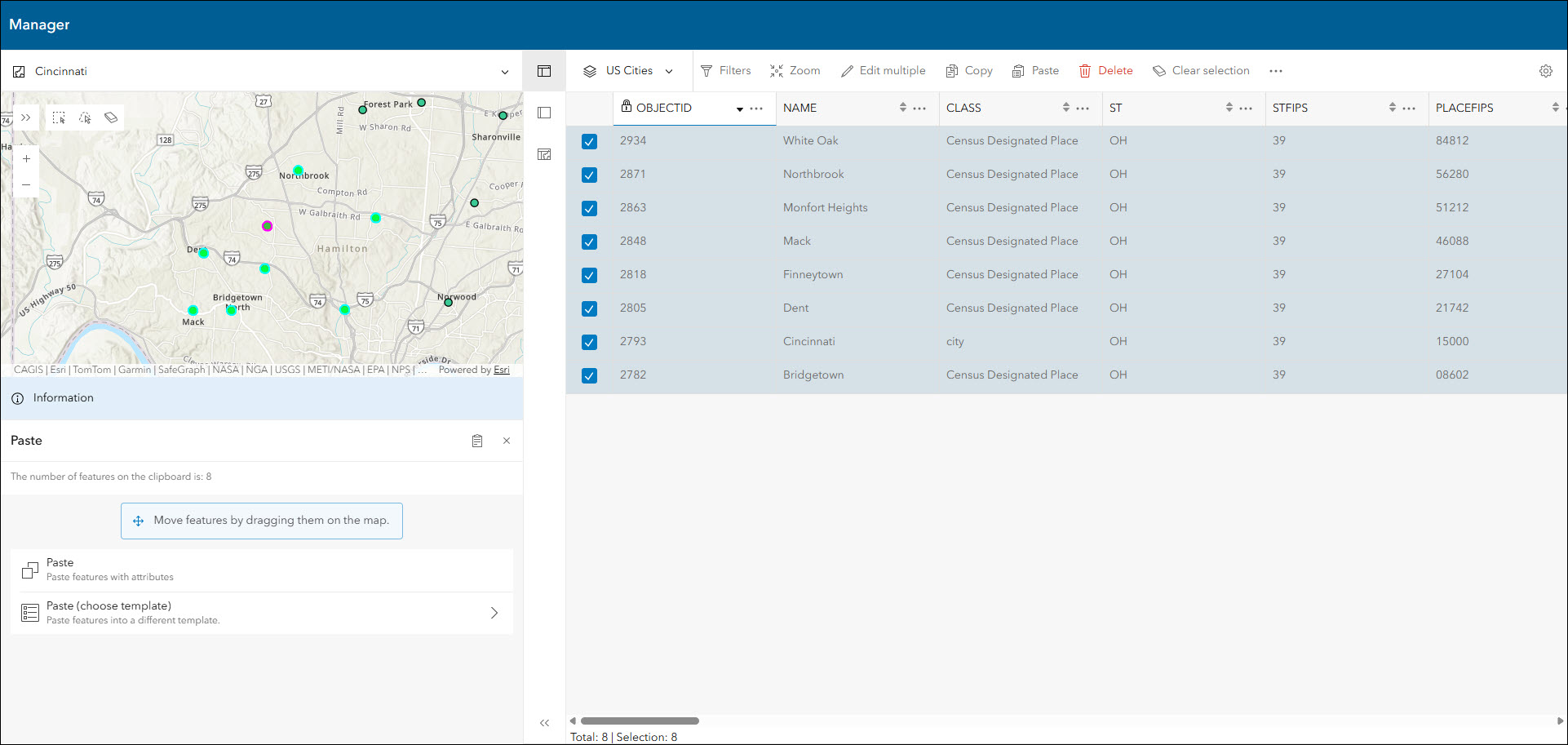
- Bulk feature creation: When creating new features, app users can now create features in bulk. To draw additional features just click in the map while editing before clicking the “Create” button and the new feature will be added. Once all new features have been drawn and all desired attribute values have been set, click the “Create” button at the bottom of the panel to create all of the new features in bulk.
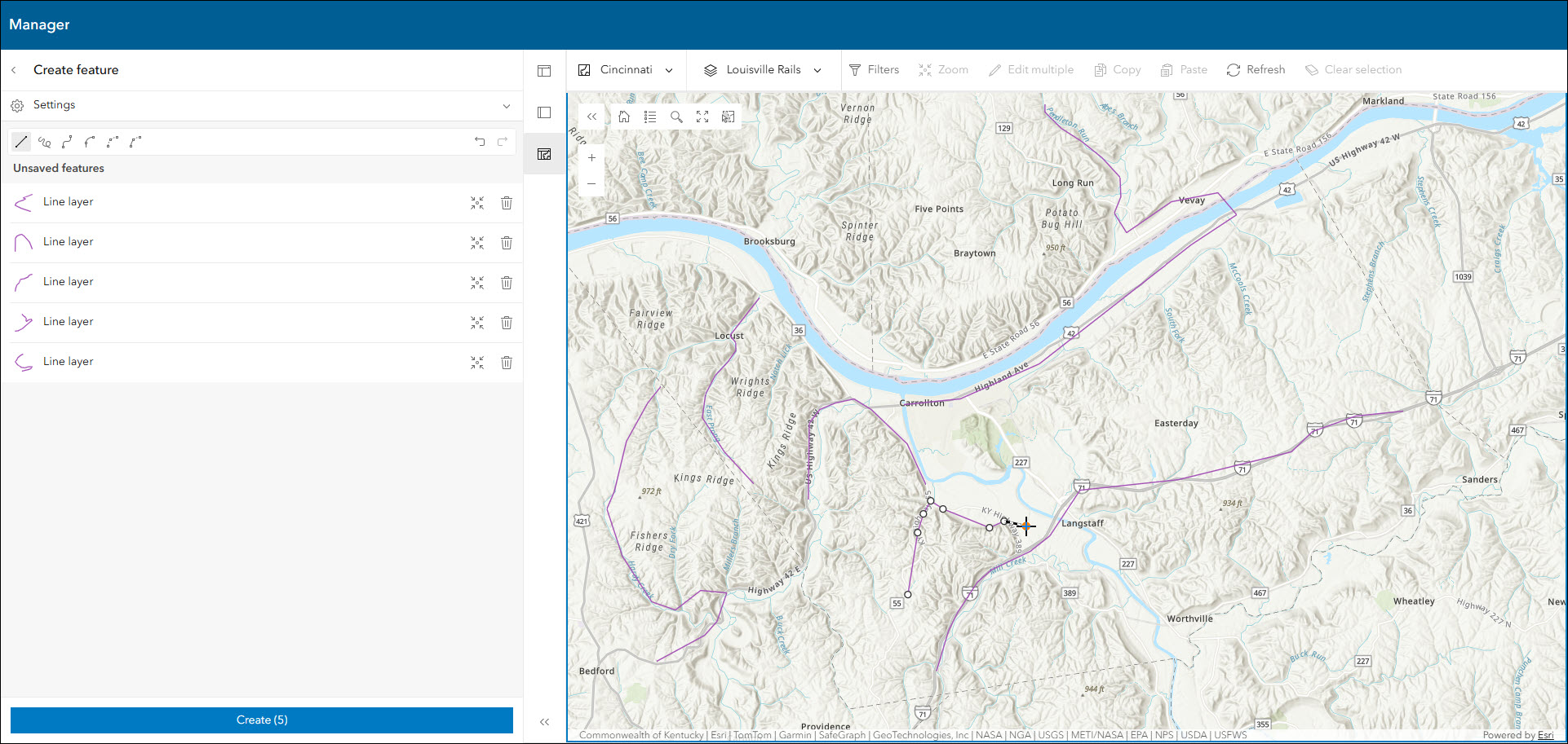
Take a look at all of the details and what else is new with Manager in our What’s New in the Manager Instant app blog.
Nearby updates
Highlight points of interest within a defined search radius or map extent using the Nearby template. Create an app that helps users find focused types of locations such as schools or voting sites within a searched distance of an address or their current location. We have improved Nearby with a brand new UI upgrade that offers a modernized layout in a more map-featured design. A few key upgrades include a compact action toolbar, an improved use of screen space to remove large panels, and extended theming so that results and search buttons adhere to the branding that you set.
To see everything that is new in Nearby, please take a look at Nearby Instant App Gets a Refresh: Improved UI, Mobile Experience, and New Options.
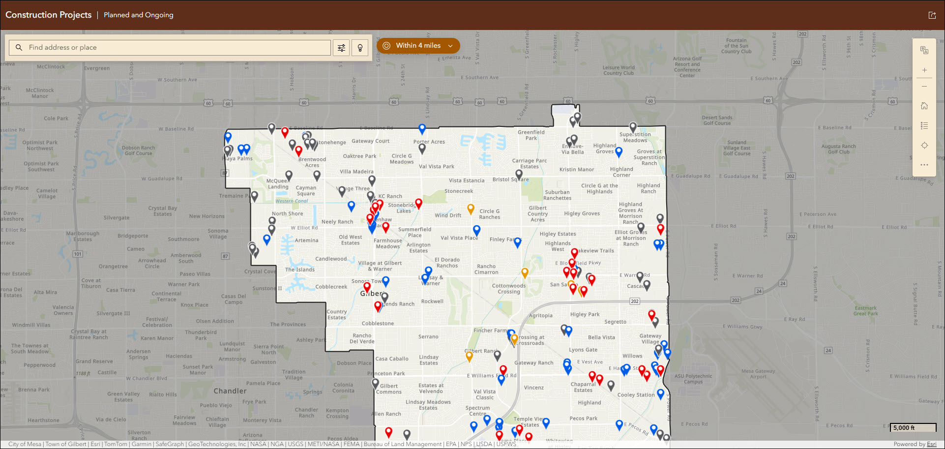
While these improvements enhance the overall experience, a few updates may affect existing apps and require minor reconfiguration. For a summary and step-by-step list of what could be impacted, take a look at the New look coming to Nearby: Important changes in the June 2026 update blog.
Reporter updates
View and submit issues or observations in an area using the Reporter app template. This app lets users create a report that displays on the map. They can also view existing reports and use basic map exploration tools to navigate the map.
ArcGIS Online organizations that have AI capabilities enabled can now configure their apps created using Reporter to offer AI text extraction (beta). This means that layers with reporting enabled can now be configured to use a description to be populated. In the app configuration, choose a layer and a field, and then supply a clear and detailed prompt of what information the AI service should extract from the user’s text description. The extraction will populate the field that you chose. Find these settings in the configuration on the Reporter > AI text extraction tab. Note that this feature is currently in beta, and that it is only available to signed-in users in the published app for now.
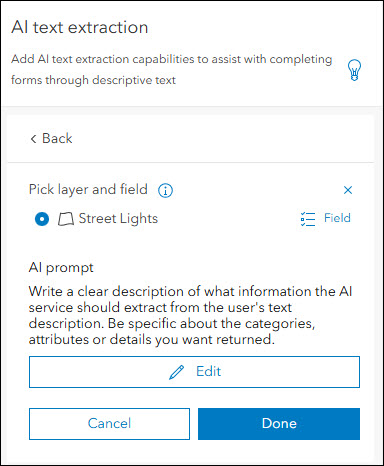
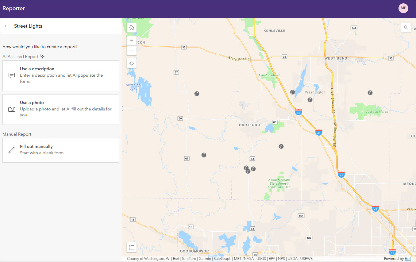
Take a look at all of the details in What’s New in Reporter Instant App (June 2026).
Compare updates
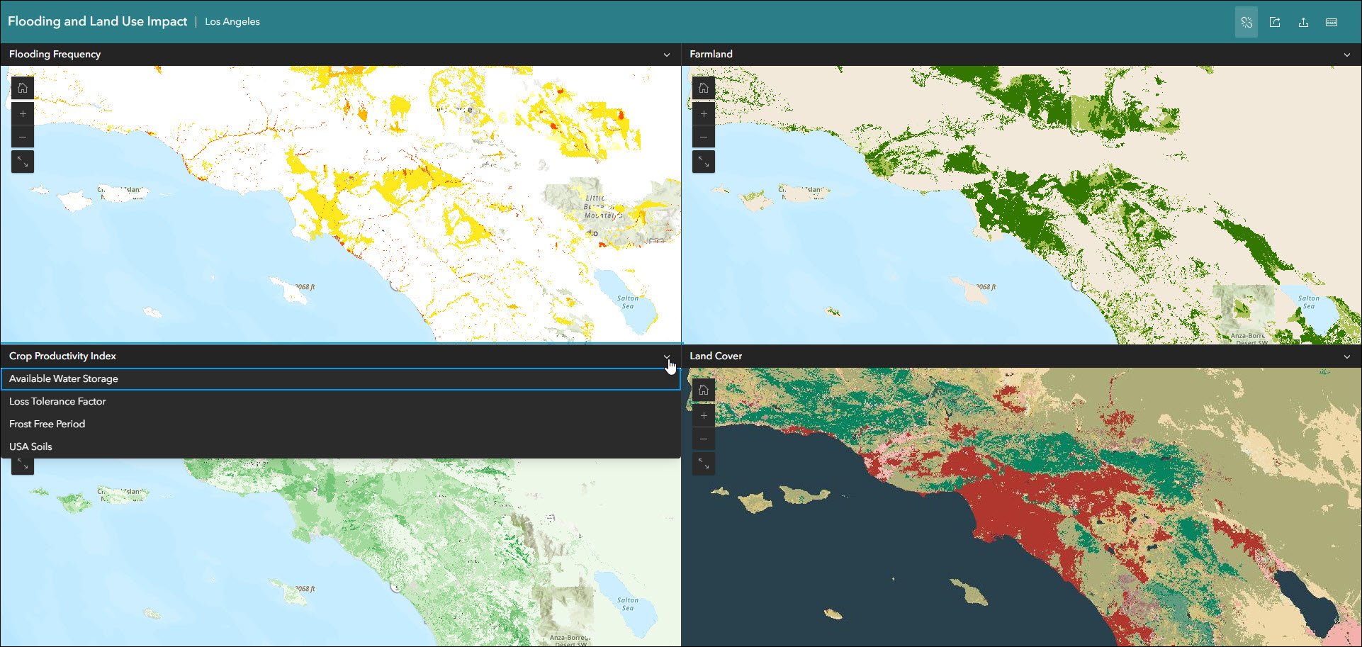
Visualize data at one or more locations using multiple maps and scenes with side-by-side or stacked layouts in the Compare template. Choose between two comparison modes to compare multiple maps at the same location or compare multiple locations of the same map. When using Multiple maps mode in the configuration, app authors now have the ability to configure more than four maps or scenes to be available for comparison by app users. The app layout supports a maximum of four maps or scenes to be displayed at once, but any additional maps or scenes are available using the header drop-down menus with a few simple clicks.
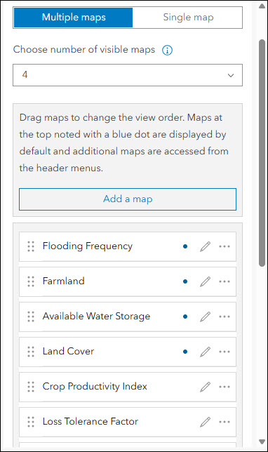
Find the “Add a map” button on the Compare > Multiple maps section of the configuration to choose as many maps or scenes that are needed to be included in your app. These can be modified and reordered as desired right in the configuration. Use the “Choose number of visible maps” setting to increase how many maps you want visible in the layout (maximum of 4). All additional maps beyond the value you declare for this setting will be available in the app via the header drop-down menus.
Basic updates
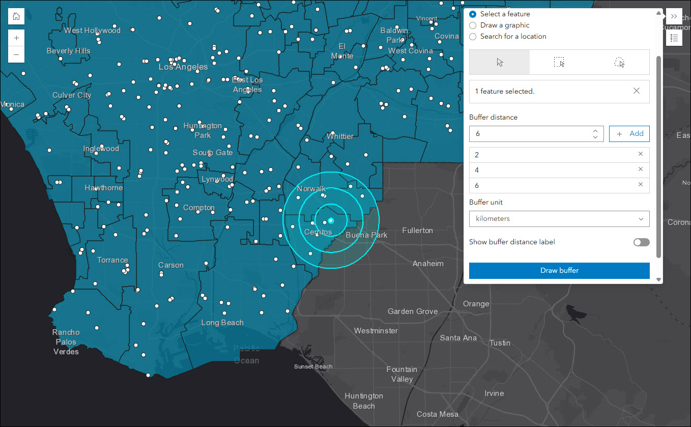
Quickly create an app to share your map in a simplistic layout using the Basic template. Display and animate time-enabled data, utilize map navigation tools, and leverage swipe to compare data from layers in the map. We have added a new buffer tool to Basic that let’s app users create a simple buffer ring on the map based on a distance. Choose to generate the buffer around a specific feature in the map, a hand drawn graphic, or a searched location. The buffer distance and units can be declared directly in the app. Note that the buffer that is created does not generate a new layer, it exists only as a simple graphic during that session of using the app.
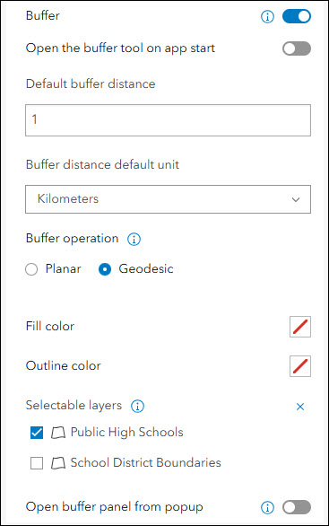
In the configuration, enable the “Buffer” tool on the Interactivity > Modify section. Several options can be configured such as the fill and outline colors, selectable layers, and the ability to open the buffer panel from the popup.
Atlas updates
Atlas provides viewers with tools to explore maps and layers with light weight mapping and data exploration capabilities. Viewers can open a map and add individual layers to it. They can utilize measurement tools, generate an elevation profile, toggle the view between 2D and 3D, use a swipe tool and adjust transparency on layers, and view data as a table. Users can share the map they create by exporting to a PDF or a screenshot.
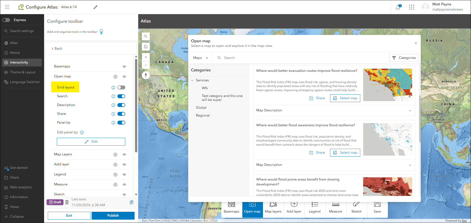
The June 2026 update includes a new setting that impacts how content is displayed when using the “Open map” option on the toolbar. Find the new “Grid layout” setting on the Interactivity > Configure toolbar > Open map section of the configuration. Use this setting to control if content is displayed in a grid or a list in the “Open map” dialog for app users who are looking to open a map.
App header updates
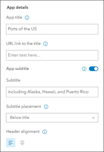
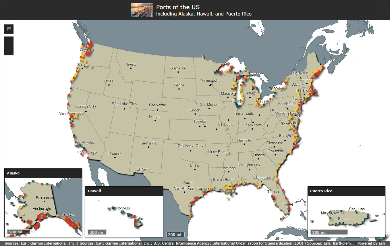
The app header is available in most templates and offers a space to title and brand your app. In the configuration, the header can be customized with title text, hyperlink, and custom HTML. The June 2026 update adds a couple new settings to provide even more fine tuning to how your app’s header looks.
- A subtitle can now be included with the option to place it next to or below the main app title. Use the “Subtitle” and “Subtitle placement” settings to configure this.
- All of the information in the header can now be center aligned if desired, including the title, subtitle, and logo. Use the “Header alignment” setting to configure this.
Category Gallery retired, replaced by Gallery
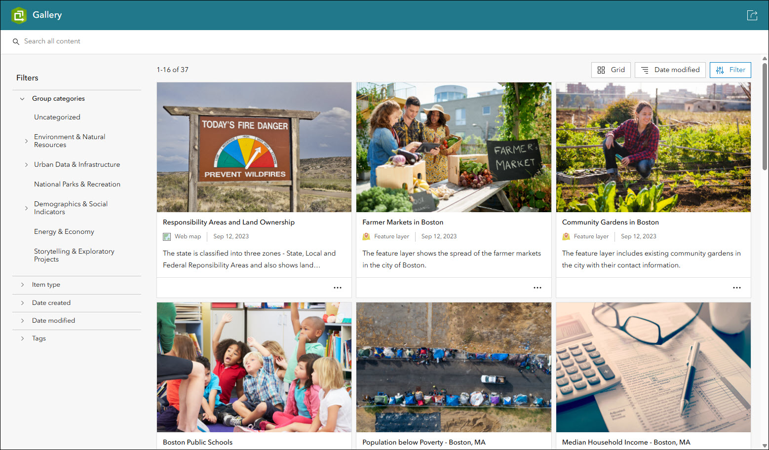
In the March 2026 update we introduced the new Gallery template for showcasing items from a group in a filterable and searchable grid or list. As of June 2026, the older Category Gallery template has been retired, with Gallery being its replacement solution. Any existing apps you have created using Category Gallery will continue to work and be configurable, but this marks the end of Category Gallery being an available template choice when creating new apps using ArcGIS Instant Apps. Moving forward, please check out the new Gallery template and begin taking advantage of its updated UI, feature enhancements, and configuration updates.
For all details, please check out ArcGIS Instant Apps: Introducing Gallery.
Esri Community ideas implemented
We have implemented the following ideas posted by you on the Esri Community for ArcGIS Instant Apps:
- Instant App Swipe Tool Toggle
- Set Default Measurement Unit in Atlas Instant App
- Nearby: disable search radius options
- Atlas find current location
More information
For more information please reference our documentation page where you can find details about getting started with creating and sharing ArcGIS Instant Apps.

Article Discussion: