Imagery is so much more than a pretty picture, right? We purchase, collect and acquire imagery with the goal of extracting information from it, whether through visualization or analysis. However, it must be shared before you or anyone in your organization can take advantage of imagery. Once you find a place to host your imagery, it can be challenging to decide how to share it.
This article aims to equip you with the information you need when sharing imagery and rasters. Within ArcGIS, you have three ways to share (or “stream”) your imagery and raster data: map tile cache, tiled imagery, and dynamic imagery. But if you’re new to imagery, you’re probably wondering what the differences are, the benefits and disadvantages of each and, which one is best for you. So, let’s dive in…
What is Map Tile Cache?
Think of map tile cache as a collection of images tiled together to create a pretty picture, often a basemap. This picture is optimized for performance and designed to scale. What makes this tile service fast is that pre-processing and compression are performed before it’s served. Because each tile is cached and optimized for display, the tiles are drawn immediately as you pan and zoom around the map.

An example of a map tile cache is the World Imagery Service accessible from ArcGIS Living Atlas of the World.
Benefit
Map tile cache is highly performant, making it ideal for visualization. When imagery or elevation data is solely intended to serve as a backdrop or basemap, we recommend streaming your imagery as map tile cache.
Disadvantages
Although map tile cache receives high marks for performance, please note that what you’re really streaming are “dumb” compressed image tiles. The rich information typically contained within imagery is lost. The tile caching process automatically saves your imagery as 8 bit and projects it to one projection– typically Web Mercator. What does this mean? Minimal analysis can be performed. A map tile cache doesn’t provide access to spectral bands, image metadata, or the ability to reproject the imagery. That said, if you need to empower stakeholders to do more with imagery than basic visualization, we recommend streaming tiled imagery or dynamic imagery layers.
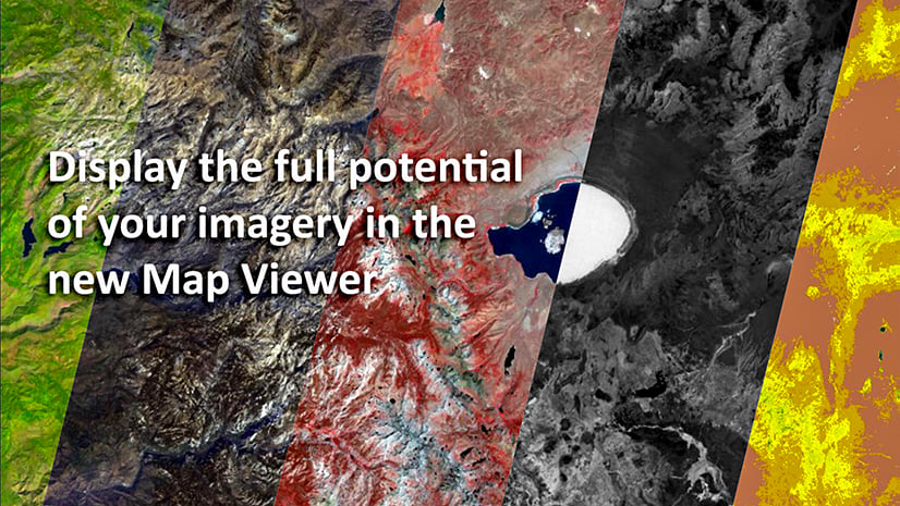
What are Tiled Imagery Layers?
Like map tile cache, tiled imagery layers bring a collection of images together to create a single service or carpet of imagery. However, unlike a map tile cache, the images do not have to be compressed or projected, so more information from the original imagery stays with the streaming service.
Benefits
Tiled imagery provides an experience that’s “just right” for visualization and analysis. It’s fast and performant, like map tile cache – with tiles rendering on the client-side, no server compute required. And, the rich content within the imagery you purchased, collected, or acquired is preserved – no pixel fidelity is lost. This means you don’t limit the number of bands you can stream; the bit depth stays true to the originating image, and you can obtain pixel values for any location. This lets you perform analysis, set renderings, and visualize different band combinations using a single analysis-ready imagery layer.
Disadvantages
This option is not ideal if you have overlapping, multiresolution, or multitemporal imagery. As mentioned above, tiled imagery layers treat your data like a carpet of imagery with a pre-set projection and pixel size. If you want to stitch imagery together in real-time from different sensors or on different days for a given area, we recommend streaming dynamic imagery layers.
What are Dynamic Imagery Layers?
Dynamic imagery is an image collection that’s dynamically mosaicked/stitched together on-the-fly by the server. As you pan and zoom the map, imagery for an entire area is fetched from the server to cover the specific extent required. It works as follows: for the area of interest, a call is made to the server to pick all the imagery in that area, process them if required, stitch them together and then send those back to the client’s view. The result gives you a “dynamic” view based on the mosaic rules you’ve specified, extracted directly from the source imagery.
Benefits
You can use dynamic imagery layers to analyze overlapping and multitemporal imagery. This image service is great for use cases that require you to step through time and dynamically sort imagery based on attributes, such as cloud cover, date of acquisition, or nadir angle.
For scenarios where cloud cover is an issue, dynamically choose available imagery without clouds. Or, if performing a change detection workflow, use a dynamic imagery layer to query two images from different dates.
And if that wasn’t enough, dynamic imagery layers empower you to process the imagery on the server using raster functions before streaming the pixels back to the client. Juhan Yoon showed an example of this during the FedGIS conference.
Towards the tail end of his second demo, Juhan walks through a 30 by 30 Conservation Priority application featuring a dynamic imagery service. The service contains 27 layers from ArcGIS Living Atlas of the World. And, empowered the end-user to perform a suitability analysis on-the-fly directly within the app. The processing all happens on a single dynamic imagery service: it pulls the imagery for the area of interest, runs the suitability analysis, and loads the result in the app – WOW!
To summarize, the essence of a “dynamic” imagery layer is the ability to finely control what is received.
Disadvantages
Because the data is processed on-the-fly, dynamic imagery layers tend to be slower and slightly more expensive than the previous options, but it’s a result of providing more capabilities. They also require processing power from your server. And, if hosting your imagery via ArcGIS Image for ArcGIS Online, these services cannot be streamed publicly, only within your organization. However, as an alternative, you can provide public access via ArcGIS Image Dedicated, our Managed SaaS, or ArcGIS Image Server.
Which Image Service Type is Right for You?
I hope these tips help you decipher the various image services and select the one that best serves your needs. As a visual aid, I hope you find the following matrix helpful.

Take the next step
Need a quick way to host and share your imagery and raster data? See what ArcGIS Image for ArcGIS Online can do for you. Watch a demo or learn more about the ArcGIS Image product suite.
Are you looking for more resources on sharing your imagery and raster data? Check out our Imagery Workflows site.


Article Discussion: