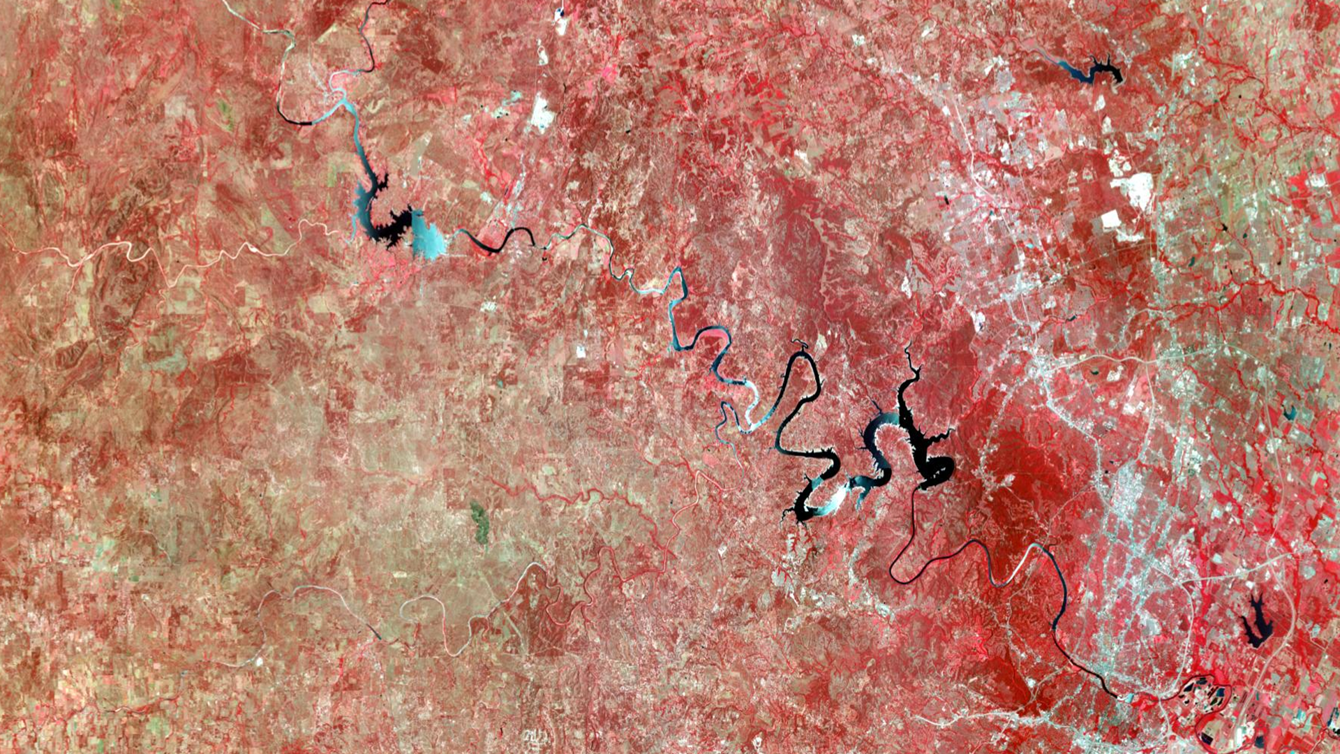
The ArcGIS Online imagery November 2026 update introduces powerful new capabilities for raster analysis in Model Builder, change detection in Experience Builder, and focusing scatterplot charts on areas of interest —all within a fully managed SaaS environment.
Imagery in ArcGIS Online makes it easy to host, explore, analyze, and share imagery at scale-without standing up or maintaining your own infrastructure. From simple visualization to advanced analytics and deep learning, organizations can turn imagery into actionable insights using a secure, fully managed SaaS environment. Once imagery is organized and published, teams across the organization can use it in maps, apps, and analysis workflows to support faster, more informed decisions.
The November 2026 update builds on this foundation with raster analysis tools in ModelBuilder, the Image Change Detection widget in Experience Builder, and support for areas of interest in scatterplot charts.
Enhancements include:
- Raster analysis tools added to Model Builder (Beta)
- Fourteen tools available, with more coming in future releases
- Image change detection widget for Experience Builder
- Three change detection methods: Spectral change, Image index change, and Pixel value change
- Map viewer imagery enhancements
- Area of interest support added to scatterplot charts
For more information about imagery in ArcGIS, please see the What’s new in imagery blog.

Raster analysis tools added to Model Builder (Beta)
- Build end-to-end GIS workflows: Combine feature and raster analysis tools in a single model to create complete spatial analysis workflows.
- Growing raster analysis support: Fourteen raster analysis tools are currently available, with additional tools planned for future releases.
- Credit usage: Analysis sessions consume credits while you build, edit, and run a model. This differs from how raster tools and raster functions are processed in Map Viewer.
- Key Considerations
- Processing extent: The default is Full Extent. Consider setting a Custom Extent within the model to focus analysis on the study area.
- Processing limits:
- Standard analysis session: up to 15,000 × 15,000 cells
- Raster-optimized analysis session: up to 100,000 × 100,000 cells
- Input imagery: The imagery layer used as input may impose additional processing-extent limits.
- ArcGIS Pro models: Models created in ArcGIS Pro cannot currently be imported and used in this environment. However, a model published as a webtool from Pro can be consumed as a webtool in ArcGIS Online.
- See Raster Analysis Comes to ModelBuilder in Map Viewer (Beta) to know more.
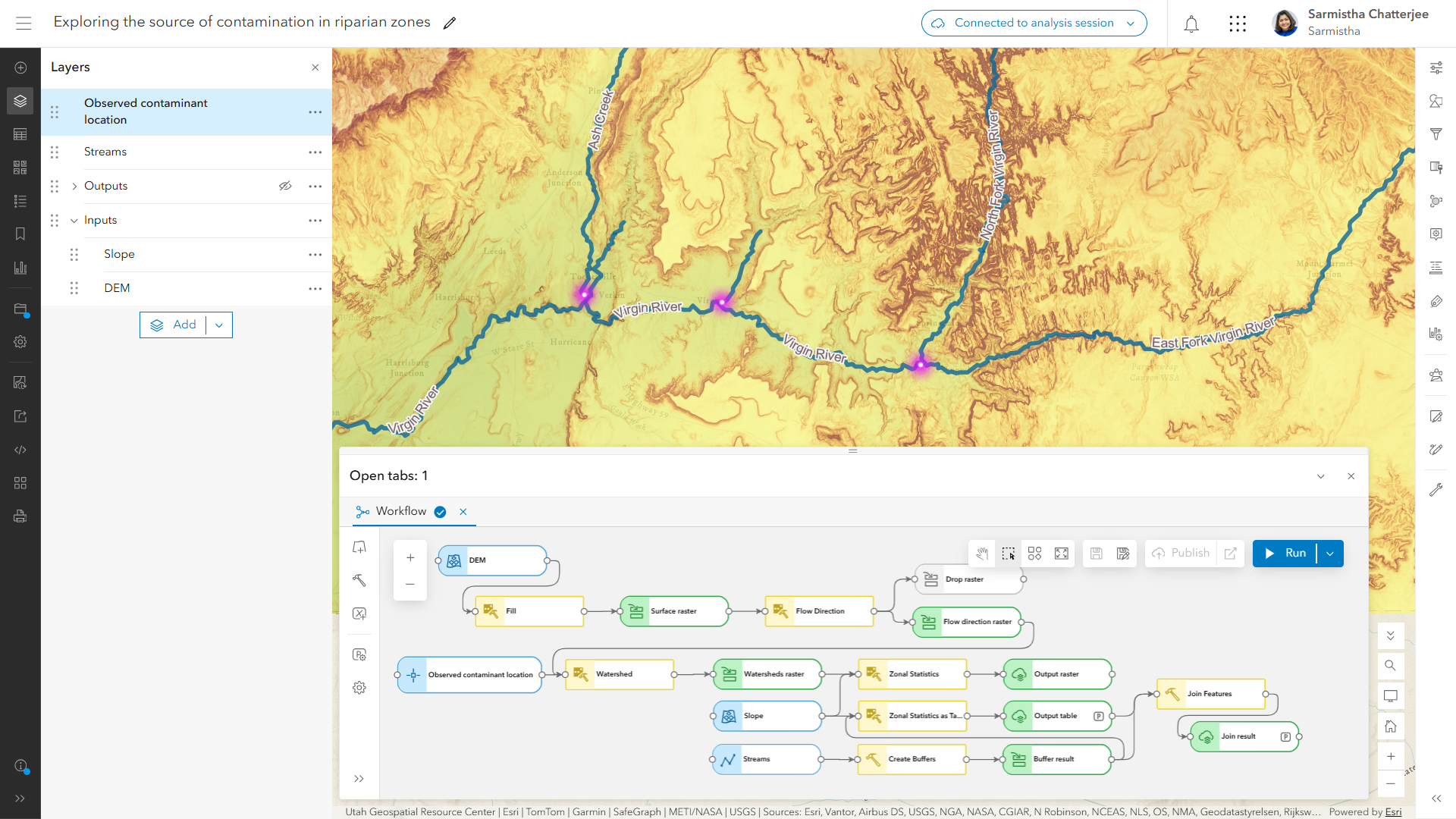
Image Change Detection widget for Experience Builder
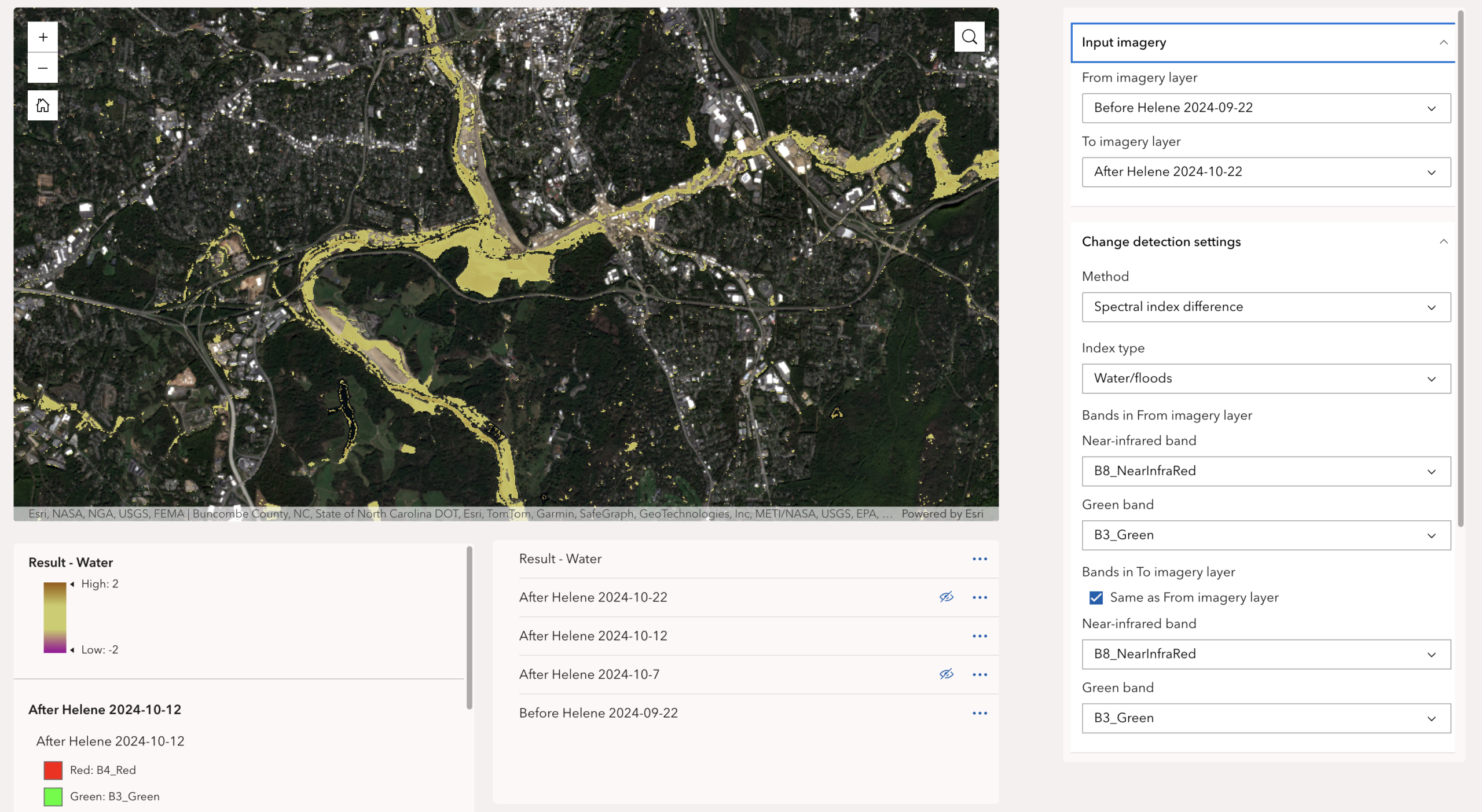
A new imagery widget, Image Change Detection, has been added to ArcGIS Experience Builder. This powerful new tool compares two imagery layers with a method you choose and create a difference imagery layer where each pixel contains the magnitude of change.
How It Works
- Flexible inputs: Use imagery layers directly from a web map created in the Map Viewer and added in Map widget, or selected imagery layers for your Area of Interest (AOI) straight from the Image Collection Explorer widget.
- Multiple methods: You can apply different change methods to explore potential changes, or find interesting changes in your AOI.
- Pixel-level output: Get an immediate visual representation where each pixel quantifies the magnitude of change, and type, such as flood, burn scars, vegetation change etc. if the method is image index change.
- On-the-fly results: The widget instantly generates a difference imagery layer based on your current view. As you pan or zoom, it continues updating the result layer simultaneously for a smooth, uninterrupted user experience.
Map Viewer imagery enhancements
Area of interest added to scatterplot charts
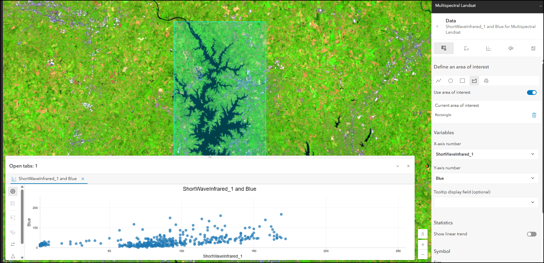
Focus your scatterplot charts by selecting an area of interest within the map. Scatter plot charts in Map Viewer react to the visible extent of the map, but now can be focused on a specific area by drawing an area of interest.
Ready to take the next step?
As an ArcGIS Online user, you can start exploring these new imagery capabilities today. The Product Team is interested in your thoughts and ideas as you explore. Influence the direction of future releases when you visit us and leave a comment via the Imagery in ArcGIS Online community on Esri Community.
Interested in seeing how others are using imagery in ArcGIS Online? Check out stories from Skytec, LLC, the City of Johns Creek, and the National Trust from the UK.
As an ArcGIS Online user, you can start exploring these new imagery capabilities today. Read blogs on the latest practices and tools such as, mapping mangrove dynamics with raster functions or choosing the perfect imagery layer. Explore the tutorial gallery.



Article Discussion: