Setting the Stage
If you happened to catch any of my recent blogs about ArcGIS Pro leading up to the Esri User Conference (UC 2023), you’ll know that I’ve been doggedly determined to knock out some work around the house before heading down to San Diego for a week and then off for vacation. A couple weeks ago I was trimming roses, while the following weekend I was painting the patio. With only three days left before I leave for the conference, the heat is on.
Literally! This past weekend was the first time this year that the temperature topped 100° F in Redlands. What a time to have five cubic yards of mulch dropped in the driveway. Which brings me to analysis in ArcGIS Pro.
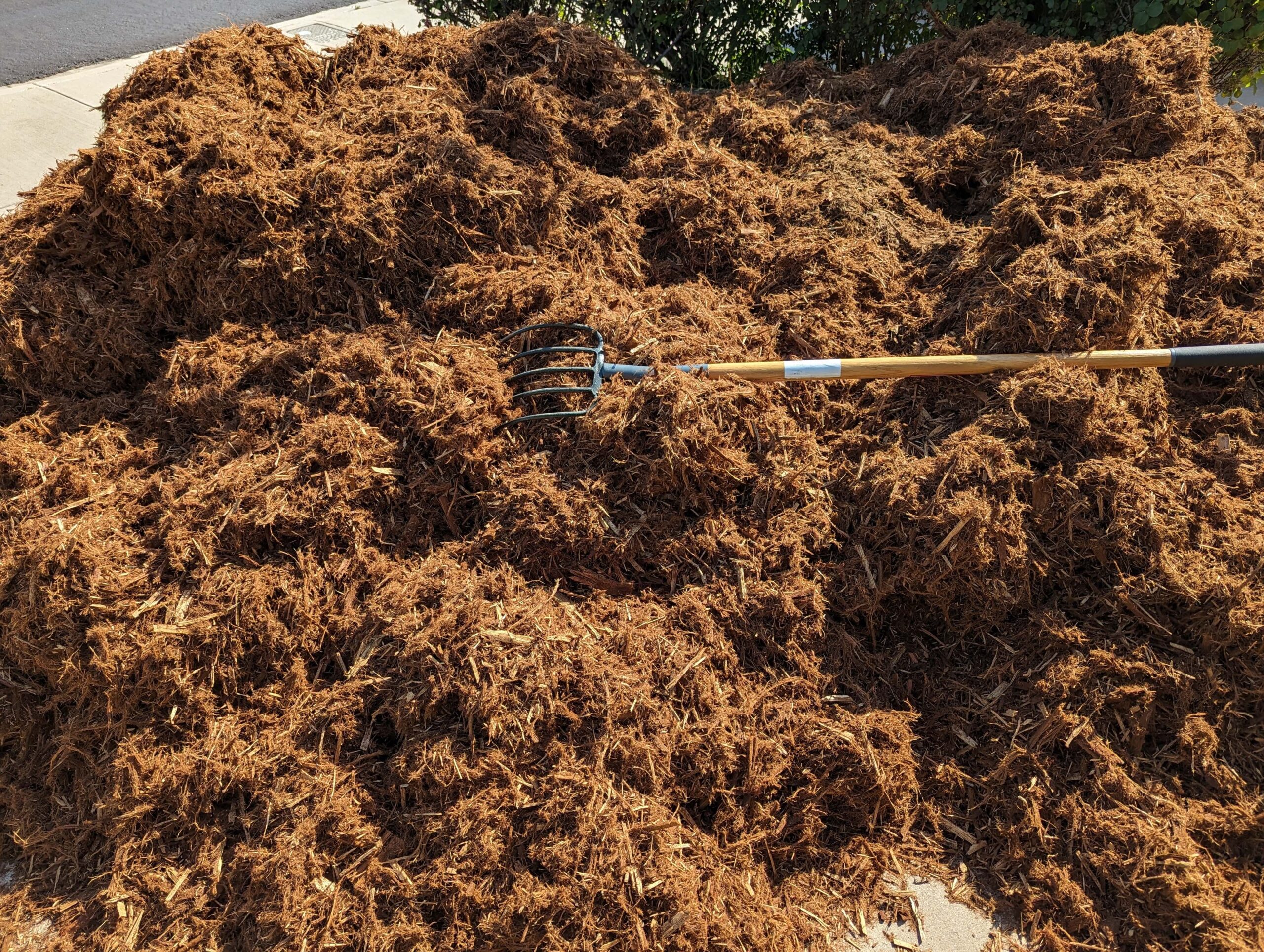
When you’re going to refresh the mulch around the house and you have a bed here, one there, a little one in the front, a long thin one on the side, and a big curvy one in the back, how do you know how much mulch to order? Of course, the answer is obvious to those of us who work with GIS – get an aerial of your yard and measure the area of the beds you need to cover. Determine the depth of mulch you want and calculate the volume. And that is exactly what I did using ArcGIS Pro. Granted, this is an elementary analysis example, but it demonstrates the broad applicability of spatial analysis to everyday tasks.
With so much analytical power in ArcGIS Pro, it is impossible to even scratch the surface of the capabilities – that isn’t what this blog is about. Rather, I’ll highlight a handful of key points, noteworthy improvements and some fun productivity tips.
Analysis Highlights in ArcGIS Pro
Geoprocessing Tools
I know that not all ArcGIS Pro users are coming from ArcMap, but out of curiosity I did a quick comparison of the number of geoprocessing tools available in ArcGIS Pro (3.2 which is scheduled for release this October) and the final version of ArcMap 10.8.2. ArcGIS Pro has 1,105 new tools compared to ArcMap and 300 new parameters for existing tools.
How is that possible? For starters, there were a number of operations done through the UI in ArcMap that could not be scripted, so many of those types of tasks were included as geoprocessing tools in ArcGIS Pro to open up the ability to fully automate workflows.
Additionally, there have been huge leaps forward in ArcGIS Pro to work with big data. So we see advancements in tools for deep learning and object detection, using and training AI models, and GeoAnalytics Desktop tools to provide a parallel processing framework for analysis on big data using Apache Spark.

Going hand in hand with big data is the element of time, as collecting location data over time is often how data has become so large and continues to grow with each passing day. Geoprocessing in ArcGIS Pro has kept pace with this growth by introducing a suite of multidimensional tools and continuing to build out space time pattern mining tools.
And if that weren’t enough, some tools have come into existence with functionality that was first introduced in ArcGIS Pro such as attribute rules and contingent values. I could write more about all of the geoprocessing advancements in ArcGIS Pro, but we must move on…
Exploratory Analysis Tools
Now for some of what I consider some of the most fun tools in ArcGIS Pro – the exploratory analysis tools. Using exploratory analysis in 3D, you can investigate your data by interactively creating graphics and editing analysis parameters in real time. The interactive tools help you create analytical objects by clicking in the scene or using input source layers. Depending on the tool, the analysis feedback in the view is color-coded to distinguish what is obstructed, unobstructed, or out of range. You can manipulate analysis parameters and receive real-time visual feedback in the scene.

There are seven exploratory analysis tools: Line of Sight, View Dome, Viewshed, Slice, Cut and Fill, Elevation Profile, and Object Detection.
Rather than reading about each, check out these excellent exploratory analysis how-to videos!
Notebooks
In calls with users last week, two separate people told me how excited they were to be working with Notebooks directly within ArcGIS Pro. ArcGIS Notebooks are built on top of the Jupyter Notebook, an open-source web application that allows you to create and share documents that contain live Python code, visualizations, and narrative text. With ArcGIS Notebooks integrated into ArcGIS Pro, you can perform analysis and immediately view results in a geographic context, interact with the emerging data, document and automate your workflow, and save it for later use or share it. ArcGIS Notebooks uses include data cleaning and transformation, numerical simulation, statistical modeling, machine learning, administrative tasks, and more.

Productivity Tips
Let’s wrap up with a few of my favorite productivity boosters for analysis in ArcGIS Pro.
Automate geoprocessing using history
Geoprocessing history entries can be dragged onto a ModelBuilder view. The tools and all parameter settings will be added and connected in the model. You can also right-click history entries and select Add To Model, and the tools and all data required to run the tools will be added to an open model. If no model is open, a model will be created in the project toolbox. You can select multiple history entries and add them to a model to build a connected chain of processes in the model, where the output of one tool may feed into another tool as input.
Geoprocessing history items can also be converted to Python. Right-click any history entry and select Copy Python command to copy the geoprocessing tool command as Python code. You can also send Python code to the Python window using the Send To Python window command or by dragging and dropping the history item. History items can also be saved as a Python script (.py) that contains all of the selected tools in History using the Save As Python Script command.
Search and filter elements in a model
Don’t overlook the ability to search and filter ModelBuilder elements. That capability, combined with Find and Replace, makes navigating and maintaining your models a breeze.

Schedule geoprocessing tools
In ArcGIS Pro, it is possible to schedule geoprocessing tools to run at a later time or with recurrence. Scheduling a geoprocessing tool allows you to do the following:
- Automate a tool you need to run regularly.
- Run a long-running or computationally intensive process at a convenient, specified time when you will not be using the machine for other tasks.
- Run multiple geoprocessing tools concurrently outside the ArcGIS Pro application using a stand-alone Python file.
Spatial Analytics at the User Conference
If you are attending the User Conference next week and are interested in learning more, plan on attending one or more of the following:
Spatial Analysis and Data Science Events and Activities
If you’re particularly interested in some awesome new functionality coming to ArcGIS Pro later this year, don’t miss ArcGIS Pro: The Road Ahead.
Or come visit us in the Spatial Analytics showcase area. There are a number of kiosks related to analysis in ArcGIS Pro. Use this UC map to find the following:
Geoprocessing
ArcPy
ModelBuilder
Charts
Data Engineering
GeoAnalytics
Spatial Statistics & Machine Learning
3D Analyst
Network Analyst
Spatial Analyst
For ArcMap Users
Most of what I’ve touched upon here is functionality that was not available in ArcMap. Remember that ArcGIS 10.8.2 is the current release of ArcGIS Desktop and will enter Mature Support in March 2024. There are no plans to release an ArcGIS Desktop 10.9, and it is recommended that you migrate to ArcGIS Pro. See Migrate from ArcMap to ArcGIS Pro for more information.
Additional Resources
An overview of the GeoAnalytics Desktop toolbox
GeoAI: AI-driven geospatial workflows
Exploratory analysis how-to videos
Get started with notebooks in ArcGIS Pro
Banner photo by Friderike on Unsplash


Article Discussion: