When it comes to landscape art, traditional Japanese and Chinese ink paintings are some of my favourites. There is something so satisfying about the simple yet purposeful brush strokes.
The other day I tried to mimic a sumi-e painting, and this was the result.

I learned a lot along the way, and have some ideas for next time, but thought I have something repeatable and worth sharing.
Find the Perfect Vista
I treated this as if I were painting. So I packed my virtual tools in an ArcGIS Pro scene, and zoomed around the world looking for the perfect vista. There were an unlimited number to choose from, but I eventually settled on a scene in Japan.

I made dozens of bookmarks along the way. It was actually an essential part of the tour.

Vertical Exaggeration
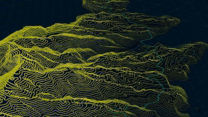
I don’t know what it is, but I find that mountains never feel as tall as they should when looking at them virtually in 3D. Luckily you can vertically exaggerate. This made the area feel more like the inspiration.


Paint
Of course, an ink inspired painting needs ink. I took out my brushes, ink, paper and painted away. I scanned the results and picked one to apply to the scene.

I created a polygon that covered the area and selected the ink image as the fill.


Atmosphere
You may have noticed I had no sky. I had turned that off in the settings as I was going to add a painted sky in the layout. Those settings can be found in the properties under illumination.

The main thing I noticed that my painting was missing was depth. I identified the peaks with some handy map notes.

Then I digitized very general polygons around the mountains.

With these, I added a field with transparency values. Then in the symbology tab under vary symbology by attribute, I used the transparency field to have more transparency in the distance and less in the foreground.

The result did a nice job mimicking atmospheric perspective. I then added a multiply to the layer so that the ink would show through.


Layout
Finally, I added the map to the layout and then layered some images; a sky to the background, and some trees to the foreground.

And there you have it. A sumi-e inspired landscape painting all done in ArcGIS Pro.


Commenting is not enabled for this article.