Over four live chats from August through November, the ArcGIS Storytelling and ArcGIS Living Atlas teams will create a food access story while working through four key stages of geospatial storytelling. From uncovering story ideas and finding supporting data to assembling, refining, and publishing a complete story, we’ll go behind the scenes of the entire process, demonstrating practical techniques you can use in your own storytelling projects.
August 12: Finding the story in your information
September 9: Adding ArcGIS Living Atlas content
October 14: Assembling and theming your story
November 10: Putting the finishing touches on your story

Finding the story in your information
In our first chat, we walked through the early stages of the geospatial storytelling process, demonstrating how information can be transformed into a focused narrative. Using food access as our example, we explored techniques for identifying story ideas, organizing thoughts, and planning the structure of a future story.
Get inspired
Data layers. Published papers. Strategic goals. Inspiration for a story can come from anywhere. For this chat series, we were inspired by Jim Herries, Senior Principal GIS Engineer for ArcGIS Living Atlas, and his informational story, Measure and Map Access to Grocery Stores, in which he explains data, methodologies, and tools used to measure food access.
Jim provides an in-depth overview of what’s available to ArcGIS users — and we were excited to work with him to use this information to craft a narrative using geospatial storytelling techniques.
Brainstorm
Start by organizing your thoughts and collaborating with others for input. There are endless ways to put your ideas to paper (or screen); during the chat, we discussed using our story planning worksheet and collaboration tools to brainstorm story ideas.
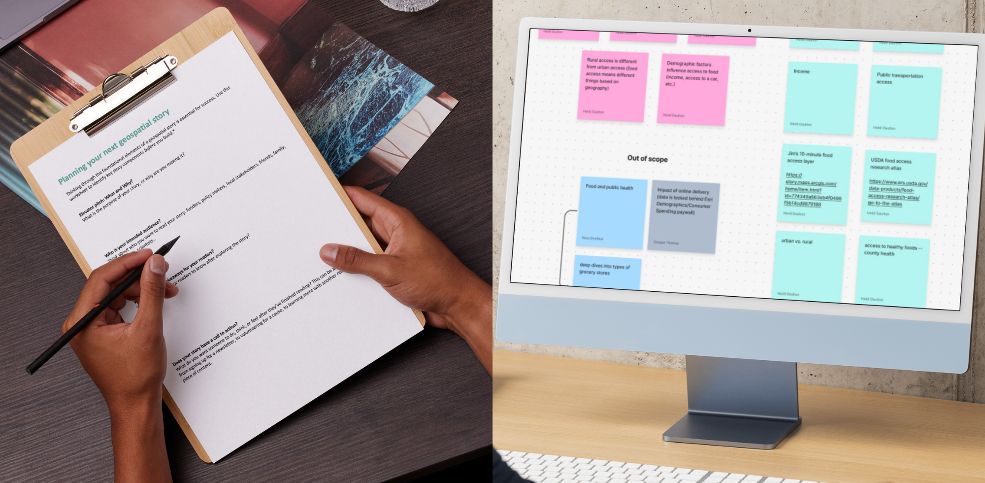
Specificity is key to creating a digestible story that keeps your audience engaged from beginning to end. For example, a case study, comparison, or unique perspective are tried-and-true methods for distilling a complex or broad topic into something that resonates with your readers.
By transforming information into a specific narrative, we aim to shift our primary audience from GIS professionals to those seeking a basic understanding of or affected by food access.
Outline
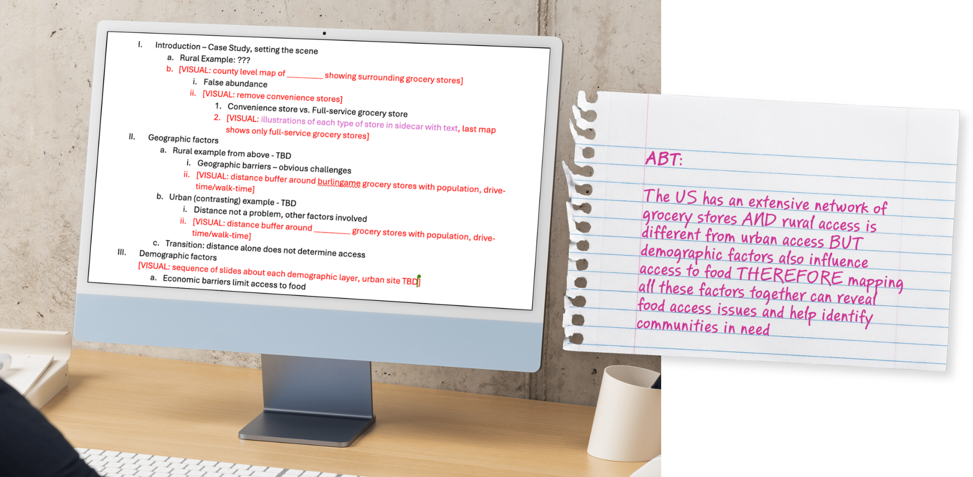
An outline helps focus your idea, giving you a chance to determine what you should — and should not — include in your story. An evolving outline is typical; expect to identify new information — or a lack of it — as you build your story. Your outline also serves as a guide for building your story structure and content inventory.
Content inventory
Visual media. Data visualizations. Anecdotes. Think about what will bring your story to life, making it a memorable experience for your audience. Which of these assets do you already have on hand? What maps will you need to make? Identifying these pieces early on will make it easier to outline, draft, and assemble your story.
Further learning and practice
The following resources were shared during our live chat to reinforce key concepts you should consider in the early stages of crafting your geospatial story:
Worksheet
Story planning worksheet
Use this worksheet to identify key story components before you build.
Blog
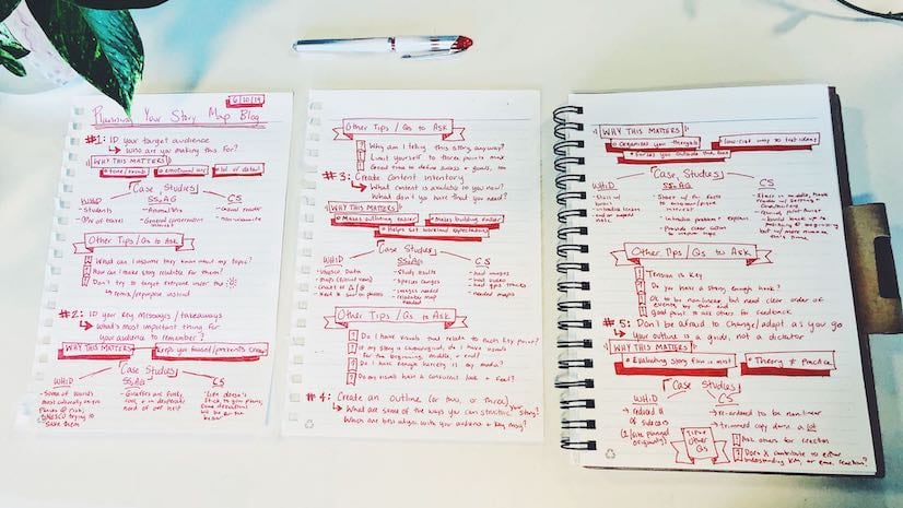
Planning and outlining your story: How to set yourself for success
Create memorable stories by working through foundational questions first.
Tutorial series
Introduction to geospatial storytelling
Combine maps and spatial data with other visual elements to captivate audiences.
StoryScape
I need a hero
Tell your story from a specific perspective to connect with readers.
Finding your rhythm
Use pacing, structure, and intentionality to create harmonious reading experiences.
Watch the recording
If you missed the live chat or want to review the discussion, we’ve got you covered! Find the recording below or visit our playlist of previous ArcGIS StoryMaps Live chats.
Join us for Chat 2
Register for our next ArcGIS StoryMaps Live chat on September 9, Adding ArcGIS Living Atlas content for geospatial storytelling. We will discuss how to find, evaluate, and incorporate ArcGIS Living Atlas of the World content that strengthens your story and helps transform ideas into maps. See you there!
2026 ArcGIS StoryMaps Competition
Are you putting in the work to craft a compelling geospatial story? Get inspired by the 2025 competition winners and submit your own story to the 2026 ArcGIS StoryMaps Competition.

Being a winner of the 2025 ArcGIS StoryMaps Competition is much more than a title; it is an invitation to push innovation and ensure we portray stories with heart and resilience. As a 2024 ArcGIS StoryMaps Competition winner, I can tell the 2025 winners that you are about to see a spike in views — if you haven’t already — and this is not something to take lightly.



Article Discussion: