Are you ready for FedGIS? This year’s conference is just around the corner, and it will undoubtedly help you leverage geographic information systems (GIS) to drive innovation and make a positive impact in your federal government role. One of the highlights of the conference this year is a spotlight-focus on imagery and remote sensing… which just happens to be my favorite topic. With a full schedule of sessions, workshops, and activities, you can expect to learn about everything imagery and GIS –from the latest in image management to image visualization, analysis and using imagery for 3D reality mapping.
I’ve compiled a convenient PDF of all-things imagery at the conference, so you don’t miss out on a single opportunity to see how imagery from street-level cameras, drones, crewed aircraft, or satellites can amplify the power of your GIS.
In this blog, I’ll give you a sneak peek into the role imagery will play at the conference and why it’s a must-attend event. But first, you might be wondering how imagery and remote sensing impact what you do day-to-day …
The importance of imagery and GIS
The Esri Fed GIS Conference is all about how GIS empowers you in your government role. This event showcases how GIS can integrate various sources of information to help organizations effectively tackle their most critical challenges. One key aspect highlighted at the conference is the significance of imagery as an essential enterprise asset. When integrated with other GIS data, imagery provides valuable additional information. By leveraging imagery and its derived products, we can gain deeper insights into different areas on Earth, enhancing our decision-making process and enabling us to find impactful solutions to complex issues. Let me share a few reasons I think imagery is so important in your work:
Enhanced situational awareness
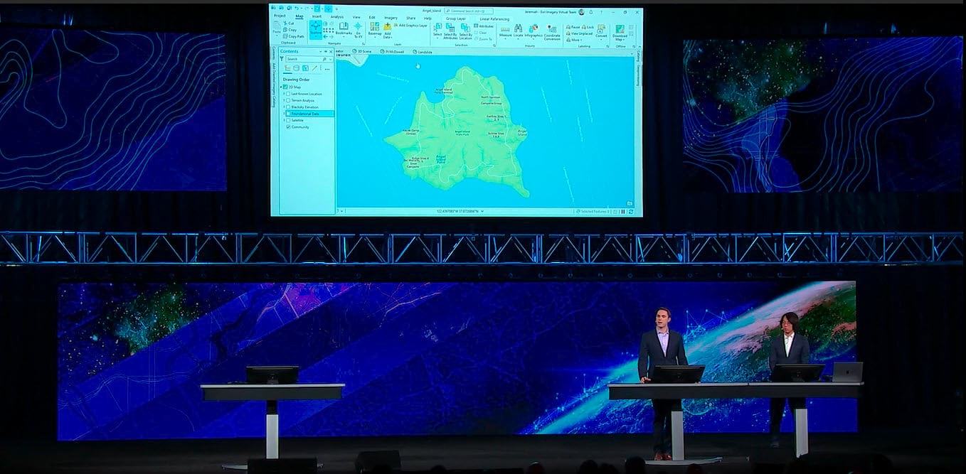
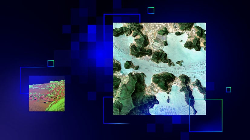
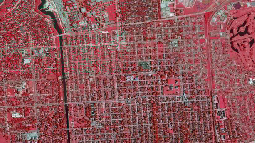
Combining remotely sensed data, such as synthetic aperture radar (SAR), lidar, or electro-optical images with GIS provides a comprehensive understanding of any area of interest – large or small. Integrating different resolutions of imagery and video from different platforms, such as street level, drone, aerial, and satellite systems, allows you to monitor changes, identify patterns, live stream events in real-time, and enrich your GIS with powerful scene-based context. You can even take your visualization to the next level and modernize your traditional 2-dimensional workflows by using Esri technology and imagery to create 3-dimensional scenes. By visualizing data in three dimensions, you get a more immersive and realistic perspective, enabling better analysis, identification of spatial relationships, and improved accuracy when assessing an area of interest.
Effective planning and resource allocation
Integrating imagery and remote sensing data with your GIS enhances planning, improves project outcomes, and boosts decision-making confidence. It can provide the geospatial context needed to make policy decisions, identify high-risk areas, plan transportation routes, and respond to natural disasters.
National security and defense
Imagery and remote sensing technologies are vital for national security and defense purposes. Government agencies can utilize satellite imagery to monitor borders, track illegal activities, and assess potential threats. By integrating imagery with GIS, officials can analyze spatial data, identify vulnerabilities, and develop strategies to enhance national security.
See previously inaccessible areas
Imagery, in conjunction with GIS, enables you to unlock valuable information about remote or hard-to-reach locations that can only be accessed through visual exploration. Satellite imagery in particular, with its global coverage and high-resolution capabilities, plays a pivotal role in this process. You can analyze satellite imagery within its geographic context, and perform reality mapping, which is creating precise representations of areas and objects on the Earth’s surface. This allows you to navigate an area virtually, providing unprecedented opportunities in research, planning, and decision-making.
And now, get ready for the information you’ve been waiting for. It’s all about imagery at FedGIS 2024!
Pre-Conference Imagery Summit
The Imagery Summit at FedGIS is an all-day event held on February 12, 2024, at the Walter E. Washington Convention Center. It’s a unique opportunity for you to delve into the world of imagery and remote sensing within the context of GIS technology. We’ll bring together experts from various industries to share their experiences and showcase the transformative power of imagery in driving value-added workflows. With example scenarios including exploring the impact of natural disasters and revolutionizing response and recovery efforts, you’ll get valuable insights into how modern imagery and GIS technologies are shaping the future. From the plenary discussion to lightning talks and panel discussions, you’ll learn about the latest advancements in image management, visualization, deep learning, reality mapping, scalable cloud workflows, and more.
This summit brings together remote sensing experts from both Esri and the federal government to discuss advancements, trends, and innovative solutions. It’s a unique opportunity to connect with us—and others like you—who are using imagery to solve the same types of problems you are.
The Imagery Summit is included for the first time ever with your FedGIS conference registration, so for no extra cost, you will:
- See how to use ArcGIS to help you make decisions by extracting deeper insights from imagery and other remotely sensed data, including lidar.
- Learn how remote sensing and imagery data can be used to create immersive depictions of reality, providing the situational awareness needed to manage operations and drive initiatives.
- Learn from community leaders how to better utilize cloud architectures to maximize performance and support a community of users as their needs scale in size
- Meet imagery experts representing multiple federal industries so you can discover how remote sensing can be applied to meet your organization’s specific needs
Sessions and Workshops at the Conference
Throughout the main conference, you can take your pick from a wide variety of spotlight talks, workshops, demo theater presentations, and partner talks, all focusing on various aspects of imagery and remote sensing and GIS. These sessions are designed to cater to different interests and skill levels, ensuring that there is something for everyone.
Following are a few examples of the sessions you will find at the conference:
- “Simplifying Imagery Analysis in the Cloud” – Learn how ArcGIS Image for ArcGIS Online and ArcGIS for Microsoft Planetary Computer leverage the cloud for advanced image processing.
- “Reality Mapping Using ArcGIS for Digital Twins & 3D GIS” – Learn how to create photorealistic digital representations of areas of interest using drone, aerial, and satellite imagery.
- “Processing Synthetic Aperture Radar (SAR) Using Newly Released Tools for ArcGIS” – See the latest capabilities for ArcGIS to process and exploit SAR data such as the new SAR Toolbox, with special emphasis on SAR data sources supported across ArcGIS.
- “3D Across ArcGIS” – Explore the integration of 3D technology with ArcGIS and learn how it can revolutionize your visualization and analysis capabilities.
- “Using Deep Learning Studio to Extract Features from Imagery” – Dive into the world of deep learning and discover how leverage it to extract valuable features from imagery data.
There are nearly 30 imagery and remote sensing sessions, including those I listed for you above, and they’re specifically tailored to meet the requirements of your federal government work. Whether you are just beginning to leverage imagery with your GIS or a seasoned user, these sessions are designed to meet your needs.
Expo and partner booths at the conference
The FedGIS Expo is another favorite for conference-goers. This is where you can see and explore the latest in imagery and remote sensing technology by companies from around the world, universities, small businesses, and federal agencies. Organizations like NASA, BlackSky, Capella Space, NV5, ICEYE, Planet, and Wingtra (just to name a few,) will showcase the latest technology developments in the field of imagery. Or you can visit Esri in various booths around the show floor to get a demo of the latest imagery analysis and AI technology, reality mapping software, or image management solutions.

Networking and collaboration opportunities
In addition to the Imagery Summit, the social taking place after it, and informative sessions and workshops, the Esri Fed GIS Conference offers plenty of other networking opportunities. You can connect with colleagues, industry experts, and Esri representatives during the networking reception held at the Smithsonian National Museum of Natural History. And you can attend the Meet the Teams Lunch or socialize during the general Plenary Session breaks. These are perfect opportunities to exchange ideas, forge new partnerships, and gain valuable insights from others in the field.

See you at FedGIS 2024!
Now that you know that imagery is truly everywhere at the 2024 Esri Fed GIS Conference, register today so you can unlock the full potential of imagery in your work. With a dedicated Imagery Summit, a wide range of sessions and workshops, an interactive Expo, and networking opportunities, you can immerse yourself in the world of imagery and remote sensing. Whether you are interested in the latest advancements in technology, exploring new applications, or seeking to enhance your skills, this conference offers a wealth of opportunities.
**To create your custom agenda of imagery events at FedGIS, use this handy PDF.
For a complete FedGIS agenda, visit www.esri.com/events/federal/agenda.


Article Discussion: