In reality, we leverage technology to address real-world applications in operational environments. These applications range from managing a public works department, a watershed district, critical infrastructure, public health and safety, to image analysis, scientific studies and modeling, and much more.
You need current data and information to support landbase management systems for well-informed upstream and downstream decision making, such as planning and situational awareness. This updated geospatial data and information is seamlessly incorporated into existing GIS and decision making infrastructure.
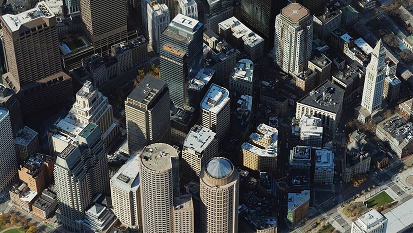
Virtually all landbase maps are created and updated using current imagery. Local, regional, and national organizations commonly acquire imagery periodically to update and maintain their landbase information. New development, asset inventory, and changes are captured in high resolution imagery collected by aircraft, drones and satellites. This imagery is calibrated and photogrammetrically corrected to remove a variety of spatial distortions before it can be used for accurate map creation and revision.
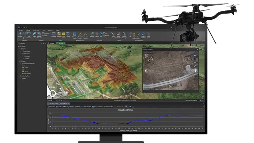
The ArcGIS Reality for ArcGIS Pro extension provides state-of-the-science products for mapping, GIS analysis and modeling. The products generated from imagery include True Orthos, photogrammetric point clouds, Digital Surface Models (DSM), DSM mesh, and 3D textured meshes with building facades.
The products and capabilities in ArcGIS Reality for ArcGIS Pro are extended with Ortho mapping tools and functionality, which also processes satellite data and scanned aerial photographs.
What makes ArcGIS Reality Mapping for ArcGIS Pro transformative is the many applications enabled by these very useful products. These foundational products support advanced GIS analysis and solutions such as change detection, surface and hydrologic applications, suitability analysis, and the creation of digital twins for modeling and situational awareness.
ArcGIS Reality in ArcGIS Pro products and solutions
A prerequisite is multiple-overlapping overhead imagery collected by drone and aircraft platforms. This imagery is processed using photogrammetrically rigorous methodologies to produce highly accurate orthoimage mosaics for map updates and photo realistic products.
Point cloud
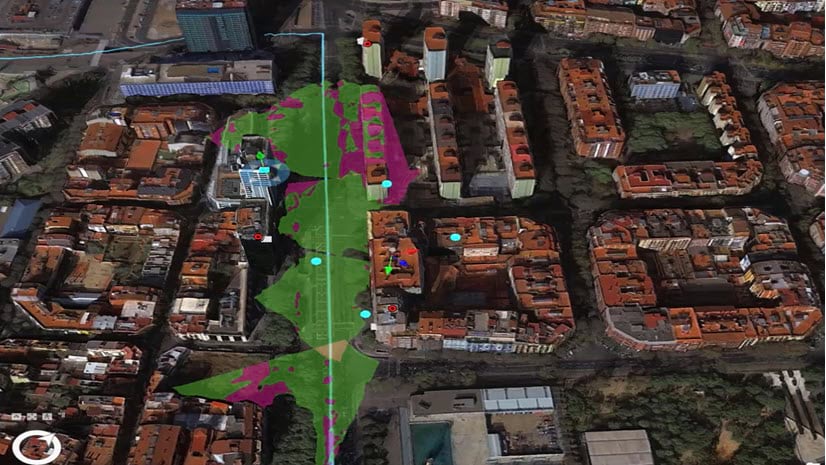
A point cloud is foundational, and is used to produce the DSM, True Ortho, DSM mesh, and 3D mesh products. A photogrammetric point cloud is a collection of 3D points generated from multiple-overlapping images taken from different angles, including nadir imagery, oblique imagery, or both. Coincident pixels in the overlapping imagery are identified using image matching techniques, and then used to compute the elevation point cloud. Each point in the point cloud corresponds to a specific location in 3D space and carries information about its position, such as X, Y, and Z coordinates.

Point clouds represent the surface geometry of an object or environment, and includes ground and above-ground features. Each elevation point can be associated with spectral information in imagery, which can be used together for advanced analysis.
Point cloud solutions
The following are solutions using point clouds:
3D Modeling – The main use of photogrammetric point clouds is in generating accurate and detailed 3D models of ground elevation, objects, and environments. The 3D points can be processed and reconstructed into surfaces and textured meshes, enabling virtual representation and visualization of real-world entities. See the overview of the 3D Analyst toolbox for more information.
Elevation Models – Features such as buildings and vegetation can be filtered out, to create a bare earth digital elevation models (DEMs). DEMs are used for topographic mapping, creating contour maps. deriving slope steepness and aspect data, characterizing landforms and hillshaded visualizations, and suitability analysis.
")
Hydrology – Point clouds are used to derive hydro-enforced DEMs used in hydrological modeling and watershed analysis. They help determine flow direction, flow accumulation, and delineate stream networks. This information is valuable for identifying drainage patterns and characteristics, flood modeling, and water resource management. See Hydrologic analysis sample applications for more information about hydrology applications.
.

Geospatial Analytics – Point clouds facilitate measurements of distances, surface area and volumetric calculations. They can be used for analyzing terrain, vegetation, urban environments, and other manmade and natural geographic features.
True Ortho
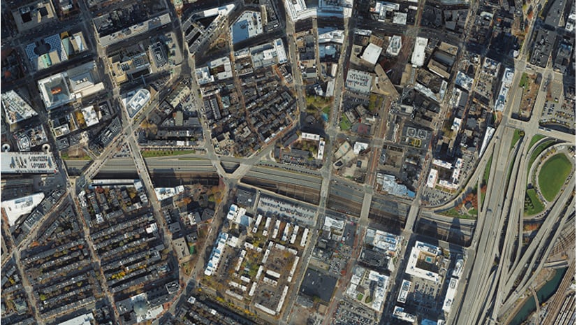
True Orthos are the most common product used by organizations with the critical task of map creation and update. Perspective distortion is removed from the imagery, and there is no displacement caused by relief or tall structures, resulting in an orthoimage with no building lean obscuring ground features. This facilitates the capture of cadastral information, digitization of accurate building footprints, and discrimination of more features of interest.
A True Ortho is orthorectified aerial or drone imagery corrected using the point cloud and a specialized algorithm used to decide which pixel from which image needs to be taken for any 3D location. The orthoimage is built by making this decision for each pixel until the entire orthoimage has been generated. See True Orthos – A Valuable Product You Should Re-Think for more details about True Orthos.

True Ortho solutions
The primary use of True Orthos is accurate map creation and GIS update for a wide variety of applications. First and foremost, a valuable characteristic of True Orthos is that they are geometrically accurate based on rigorous photogrammetric methods. They can be precisely registered to existing GIS landbase layers, and integrated into geospatial databases for effective and efficient updates.
Key applications of True Orthos include:
Cadastral mapping – True Orthos are primarily used for capturing building footprints, and other key infrastructure and landbase features for map creation and revision.

Asset inventory and management – True Orthos are used for inventory and management of assets such as buildings, infrastructure, equipment, materials and resources. They are also used for site assessment and determining the condition of assets for maintenance and management.
Change detection – True Orthos are excellent for automated change detection. In standard orthoimages, buildings and feature lean in different directions away from the center of the image frame. This results in many false positives for change, making standard orthoimage unsuitable for automated change detection.
Because building and feature lean is removed in True Orthos, automatically detecting change is more accurate. This makes updating GIS and maps more efficient and effective.
Automatic feature extraction – The inherent spectral characteristics and accurate spatial information in True Orthos are used to automatically extract features from imagery. Utilize advanced deep learning and image classification techniques in ArcGIS to detect, identify and classify features of interest to build and update GIS layers, databases and maps.
Emergency response and disaster management – True Orthos provide essential information for emergency response and disaster management. They assist in identifying affected areas, assessing damage extent, planning relief efforts, and supporting situational awareness during emergencies. Image basemaps include much more critical and contextual information than symbolic maps and GIS layers. For example, roads have variable widths, shoulders and turnouts, which can be used for ingress and egress to affected areas, marshaling and staging equipment and resources, and mitigation.
3D mesh
The 3D textured mesh product is a 3D mesh with building facades and other feature textures superimposed to create photo-realistic visualizations. Oblique imagery is particularly important for providing the textures for buildings and feature facades on the 3D mesh.
3D textured meshes provide impactful visualizations and an immersive experience, enabling stakeholders to better understand and visualize the environment, making it easier to communicate and collaborate on various projects.

Besides visualization, 3D meshes are used to help build digital twins, adding context with other GIS layers, IoT sensors and real time information, or to create simulations with real-world data. Many analysts and managers want to display textured 3D meshes along with a variety of GIS data, which helps bring their data visualizations to life.
3D mesh solutions
Besides visualization, 3D meshes are used to help build Digital Twins, adding context with other GIS layers, IoT sensors and real time information, or to create simulations with real-world data.
Mesh-based digital twins – In many cases, digital twins incorporate 3D meshes as a foundational component to represent the visual and geometric aspects of the physical features. The 3D mesh provides the shape, structure, and appearance of the object, enabling realistic visualization and interaction within the digital twin environment.
City Planning – 3D textured meshes are employed by AEC firms and city planners to create realistic and immersive visualizations of urban areas. By incorporating 3D textured meshes, buildings, roads, and other urban features can be accurately represented, providing a realistic view of the cityscape. This aids in visualizing proposed developments, assessing urban design, analyzing infrastructure placement, and evaluating the impact of city planning decisions.
Site Inspection – 3D meshes are used in combination with the source images to perform inspections, mensuration, and manage assets. For example, organizations perform inspections from their offices instead of sending field crew, which helps them target their maintenance needs more strategically, and safely.
Emergency Management – 3D textured meshes assist emergency managers with disaster preparedness, response, and recovery. By integrating geospatial data, such as building models, terrain information, and real-time data feeds, into a 3D textured mesh, emergency managers can visualize the affected areas, plan ingress and egress, assess damage, and simulate scenarios for disaster response. The textured mesh enhances situational awareness and aids in decision-making during emergencies.
Geospatial Visualization – 3D textured meshes provide context, and enable the creation of realistic and immersive representations of landscapes and physical environments. Geospatial data such as terrain models, imagery, land cover and land use information can be visualized with high fidelity. This facilitates the interpretation, analysis, and communication of geospatial information for better understanding and decisions.
Digital Surface Model (DSM)
The DSM is derived from the point cloud, and provides elevation data of the ground surface and above-ground features. It represents the highest point on the surface, incorporating terrain elevations as well as above-ground features such as buildings, trees, and other structures. DSMs enable advanced geospatial analysis and visualization such as line-of-sight, viewsheds, and feature extraction.

DSM solutions
The following are solutions using DSMs:
Topographic mapping and terrain analysis – DSMs provide elevation data for both natural and man-made features, and are essential for terrain analysis and landform characterization. When above-ground data is filtered to produce a DEM, they are used in cartography to generate contour lines, hillshades, and other topographic features. You can derive slope, aspect, curvature, and other terrain parameters to identify landforms, geomorphology, and understanding the landscape’s physical characteristics.

Image orthorectification – DSMs are valuable for orthorectifying imagery to remove both terrain and perspective distortion from imagery. They help enable the creation of True Orthos by providing building height data for the rectification process.
Image classification and feature extraction – DSMs are important for extracting features from imagery. The addition of object height aids in better automatic identification of features. For example, asphalt roofs and roads are spectrally similar. Building height information helps discriminate each feature from the other.
The Science of Where™ supports reality
Whatever application or problem you need to solve, the Science of Where™ provides the underlying scientific and technology framework to make well-informed decisions. Accurate and current geospatial information is crucial for various professionals and decision-makers at all levels involved in fields such as GIS coordination, planning, emergency response and management, and stakeholder engagement.
At the tip of the spear, the products generated with ArcGIS Reality for ArcGIS Pro adhere to rigorous photogrammetric methodologies and advanced processing techniques to ensure accurate and timely updates of landbase information. True Orthos, point clouds, DSMs and 3D textured meshes are foundational data products for addressing countless real-world applications in operational environments.
These critical products are integrated into the ArcGIS ecosystem, enabling effective processing, data management, analysis and modeling with other types of data and information systems. For example, the photogrammetric products power the analytical capabilities found in Imagery and remote sensing, Image Analyst, Spatial Analyst, 3D Analyst, Geostatistical Analyst, and more.
While the science and methodologies employed are quantifiable, the science and art of visualizing results, scenarios, and trends also contribute to better analysis, understanding of phenomena, discovery of cause and effect, and situational awareness. These qualities, together with interoperability within ArcGIS, and its inherent sharing environment, empowers stakeholders to effectively address and collaborate on a wide range of real-world applications.


Article Discussion: