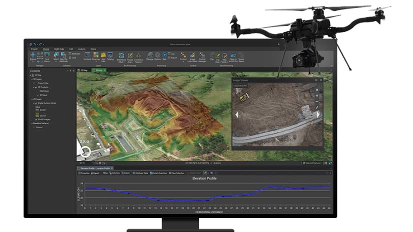
The ArcGIS System includes many advanced tools for working with imagery. For organizations with a need to orthorectify imagery, ArcGIS can create highly accurate ortho images. The purpose of this blog is to describe three different types of ortho images created in ArcGIS, and discuss the advantages of each. The three types of orthos are:
- Dynamic ortho
- Orthomosaic
- True ortho
The generation of all three types use source imagery from sensors with the image orientations and a ground reference. The photogrammetric equations used are the same, but the pixels used to represent the ground is different. The three types differ in their properties and the methods by which they are created.
Dynamic orthos can be created within ArcGIS, once image orientation is provided (either by direct georeferencing or through aerial triangulation) and a Digital Terrain Model is chosen as the reference surface. ArcGIS can orthorectify the images on-the-fly to form a virtual orthomosaic that can be viewed on a map. Such “dynamic orthos” show the location of terrain features accurately without large computation effort or needing to persist a new dataset. Changing the view location may change the image displayed given that by default the most nadir image is displayed on top. All the source data is maintained, so no pixels are lost in the processing, but all the source data must remain accessible. The display order of the image can be controlled. As an example, features on the north side of a building may be obscured when viewed in an image captured from the south side, but this area can be seen by accessing another image, captured from the north side of the building. This dynamic mosaic may be used within the ArcGIS software and may also be shared using ArcGIS Image Server or ArcGIS Image for ArcGIS Online.
In contrast to the True orthos, traditional orthomosaics are created by generating the ortho images using the best available digital terrain model. The ortho images are mosaicked together using the central portion of each image and seamlines are calculated to define the boundaries between images. The seamline placement is calculated to minimize visible changes in the image and avoid non-terrain features. Blending is then usually applied across the seamlines to further reduce visible breaks. In ArcGIS such orthomosaics are generated by adding seamlines on the dynamic ortho and then persisting the output to an orthomosaic stored as a raster dataset or as tile cache for efficient serving. The fact that only the required parts of each image are processed makes this a very efficient process, and the product can be easily reviewed for visual quality and spatial accuracy prior to creating the orthomosaic. The resulting orthomosaic uses less disk space to store, and does not require on-the-fly computation.
Orthomosaics provide accurate locations for features on the ground, while above-ground features such as buildings and trees will appear to lean away from the camera and may not be in their correct horizontal location. Such orthomosaics are well suited for many applications, where only ground features need to be correctly placed and there are few buildings or objects that create occlusions (hidden areas). Building lean can be mitigated by using longer focal length cameras or having higher overlaps. Artifacts resulting from suboptimal seamline selection can be corrected through manual editing. The computation is efficient because detailed depth information (or surface model) does not need to be extracted from the images. This makes the orthomosaics well suited for applications that focus on terrain features such as agriculture and environmental monitoring. Orthomosaics are not well suited to urban areas with tall buildings or where buildings are closer together. If change detection analysis is applied to two orthomosaics from different dates, many false changes may be identified, simply due to change in perspective of the cameras for non-terrain features.


For a “True ortho”, everything in the output image is viewed from directly above. The name indicates that the result is truly orthographic at every pixel. Buildings no longer lean or obscure the ground, and the facades are no longer visible. This is achieved by first creating a very detailed digital surface model (DSM) – for example from Dense Image matching on well overlapping imagery using pixel-wise stereo. Subsequently, this very detailed surface is used to generate an output ortho image by blending source image pixels rectified in their position given their pixel-accurate elevation. As every pixel from every image can be correctly located, the redundancy can be used to remove inconsistent information – such as moving objects like cars or solar reflections. The multiple views also enable the resolution and radiometry to be improved.
The major benefit of a True ortho is that it is free of occlusions caused by building lean, and every pixel is correctly located. This makes it ready for measurements and consistent in location with other geospatial information or subsequent image captures. Furthermore, automation is higher since no breakline or seamline editing needs to be considered. Higher image overlap is recommended for optimal results – for nadir images, 80% forward overlap and at least 60% side overlap – in order to minimize gaps in the DSM and achieve a high-fidelity True ortho. The benefits of True orthos are the very consistent results and high geometric accuracy, enabling simplified change detection. The disadvantage is that it is computationally more expensive and input orientation needs to be very accurate, requiring aerial triangulation – so the True ortho takes longer to create and therefore is less suitable for applications demanding rapid turnaround such as emergency response.

All ortho images can have artifacts. For dynamic orthos and orthomosaics, artifacts are typically caused by occlusions, non-terrain features leaning, seamlines, and ripping/blurring effects on steep edges. In addition, objects such as bridges typically become curved as they are not represented within the terrain model. True orthos have typically far fewer artifacts, although they can occur along objects that are not modeled appropriately in the DSM such as very thin structures and some “ghosting” of moving vehicles.
In summary:
- Advantages of dynamic orthos include:
- They provide the fastest workflow to provide a usable ortho image since the software doesn’t take time to process and blend multiple views.
- They support viewing of any region from multiple different directions.
- Source images may also be viewed in an “image coordinate system” or in stereo which can enhance image interpretation and measurement accuracy.
- Multi-views of each area provide redundancy that can improve accuracy of AI algorithms.
The key disadvantage is that they required more storage, require on-the-fly processing, and non-terrain objects appear to lean, and above-ground features will appear to move when the image is panned due to viewing the objects from different directions.
Dynamic orthos are best suited for projects that require near-instant access to imagery such as emergency response, where images are used for inspection applications, or as the basis for stereo interpretation and measurement. ArcGIS is unique in its ability to generate dynamic orthos and the capability is included as part of ArcGIS Pro, ArcGIS Image Server, ArcGIS Image for ArcGIS Online and ArcGIS Drone2Map.
- Advantages of orthomosaics include:
- Compact representation and fast display.
- Fast production – especially if a DTM is available.
- Can be created from images with less overlap, which reduces data capture requirements.
- Are quick and efficient to produce, assuming the increased level of artifacts are acceptable.
The key disadvantage is that buildings and other non-terrain features lean away from the camera, creating occlusions and so are not accurate for non-terrain features.
Orthomosaics are best suited for projects that focus on agriculture, mining/aggregates, natural resources, and other natural terrains. ArcGIS Ortho Mapping and ArcGIS Drone2Map Standard provide all the tools for efficient generation of orthomosaics.
- Advantages of True orthos include:
- Consistent high-quality top down ortho images that are best for digitizing the location and size of building footprints, or doing image-to-image comparisons.
- Produced in a fully automated manner, eliminating traditional requirements for seamline and breakline editing.
- Enable automated removal of moving objects, reflections, or inconsistent colors.
- Enable improved radiometry and resolution through using the redundancy of many images.
- Ideal for change detection, as locations for elevated structures stay consistent.
- Ideal for feature extraction, especially if used along with a consistent DSM.
- Create an accurate DSM as a by-product that has many uses for visualization, line of sight analysis, and computing volumetric changes.
The key disadvantage is that they are computationally more expensive to create. Furthermore, sufficient image overlap is required to extract a DSM.
True orthos are the new standard for ortho imagery, especially for applications including urban planning, construction, transportation, utilities, and many other applications focusing on manmade infrastructure. ArcGIS uses the SURE processing engine to create the industry’s highest-quality True orthos at a massive scale.
We hope this blog provides better insights to the different types of ortho images that may be created within ArcGIS, so that you can determine which is most suited for your applications and timelines.

Article Discussion: