How does that well-known CityEngine tagline go? “Create a city in a couple of weeks”? No that’s not it, “a couple of days”? Nope, also not…but we do always say how easily creating an entire city can be with CityEngine.
Well we better practice what we preach because this was certainly put to the test when we were approached by Arcadia Media on behalf of the Discovery Channel and asked to create a version of a new US capital city for their TV Series “If We Built It Today”.
As with any type of TV production, the timeline was extremely tight and we had a very strict deadline.
Basically, we had one week to create an entire masterplan from scratch, figure out where to build it (hint: don’t build in a flood prone area!), how to stylize it, decide on what kind of transportation network we want, how to incorporate the ideas of Washington DC’s original urban plan (the plan designed by major Pierre Charles L’Enfant back in 1791), take the main concepts of the McMillan plan from the early 1900’s into account and make the plan detailed enough so that it looks good on TV but not too detailed so that we miss our deadline. Sounds easy, right?
It was a pretty hectic time for us leading up to the end of 2020, but naturally, we pulled it together and came up with something pretty awesome!
You can stream the full two-hour episode on the Science Channel or Discovery+ (you will need a subscription to either of these networks though).
…and if all this wasn’t enough, we have made the whole project available as an official CityEngine downloadable example.
In this example, you can wander the streets of this fictional new Federal City yourself and check out things like the innovative “double decker avenues”, a giant park that pays hommage to the 50 states and a Washington Monument that is double the size of its original counterpart.
First step: choosing the location
The approximate location for the new capital city was already known and given to us by the producers of the show: it should be somewhere near St. Louis; a region with plenty of water where the Mississippi, Missouri and Illinois rivers meet. …but, where exactly? This is where the power of GIS comes into play. We analyzed several locations with ArcGIS Online and stored our study in a Web Scene using different layers to retrieve specific information about the environment.
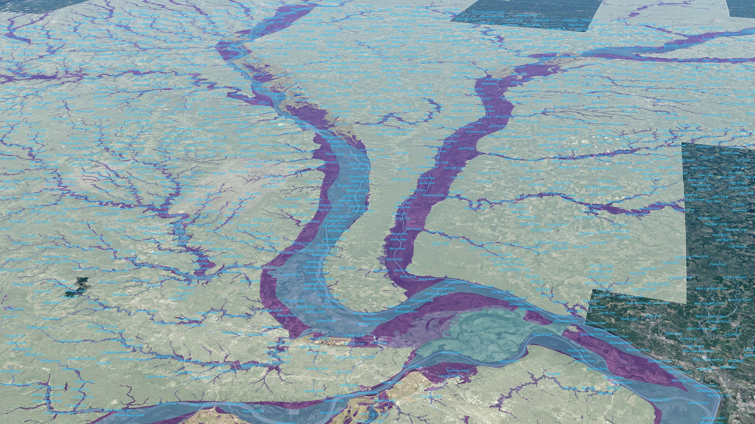
Taking the dimensions of Washington DC as a reference, we laid out a 10 x 10 mile polygon at each possible location to give us an approximate idea of how much space would be required for the new capital city.

Now let’s go through some of the candidates:
1. Monroe County, Illinois: This is the only area we considered that was located to the south of St. Louis. Although some flat, vacant area could be found to the north-east of the river, the height difference between the riverbanks and the protected zone behind the hills was too much. We want our city to be high enough, so it’s protected from flooding, but we don’t want to be too disconnected from the Mississippi.
…so let’s see if we can find something better.
2. Pike County, Illinois: We liked the natural curved shape between the meadows and the hills. But the topography around the more elevated area was not ideal. Urbanizing a zone with plenty of creeks and small valleys would require drastic changes to the natural landscape.
…so, we decided to consider other options.
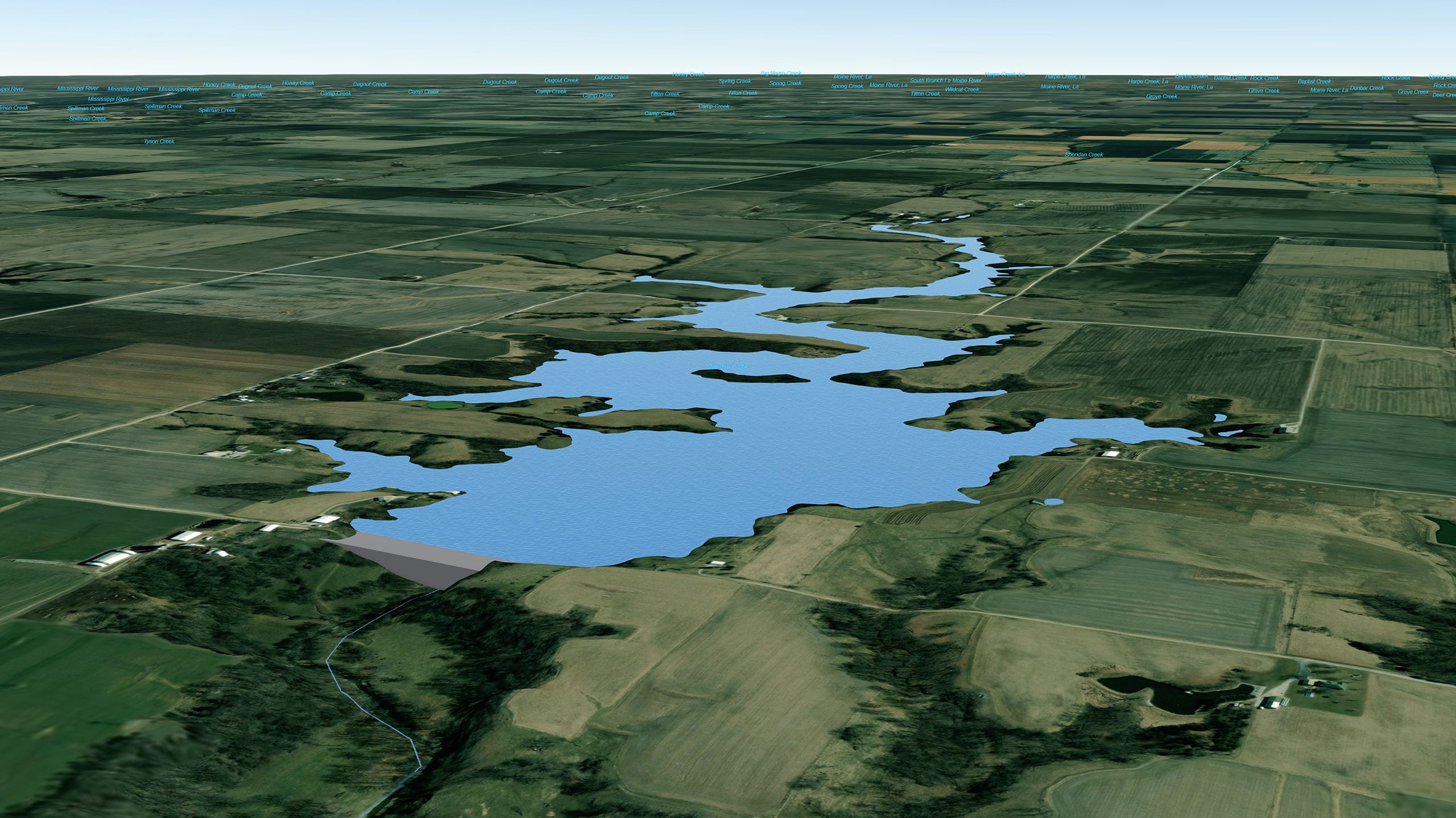
3. Hancock County, Illinois: The city of Nauvoo lies at a very special location near one of the widest parts of the Mississippi. Moreover, we can find plenty of flat lands to the east where the city could expand without major issues. We even considered building a dam at Sheridan Creek, so the resulting artificial lake would make the area even more appealing.
…but choosing Nauvoo’s location would have implied severe relocation of an iconic religious place. This is certainly not a good starting point. On top of this, it was ultimately discarded because it didn’t offer enough land near the river where the new National Mall could be planned. We also realised that we ventured too far north in our search, so let’s go down the Mississippi again and continue our federal quest.
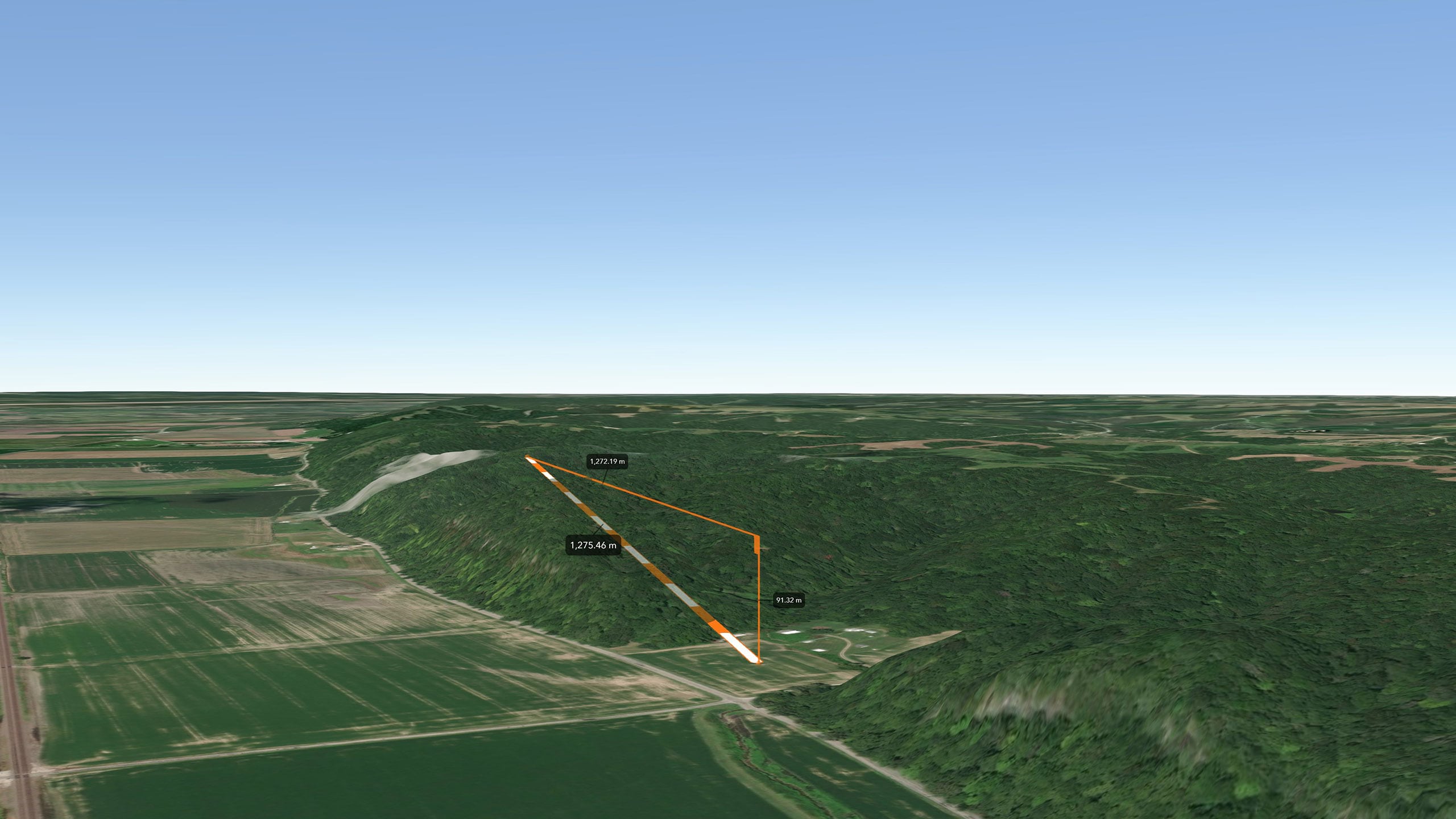
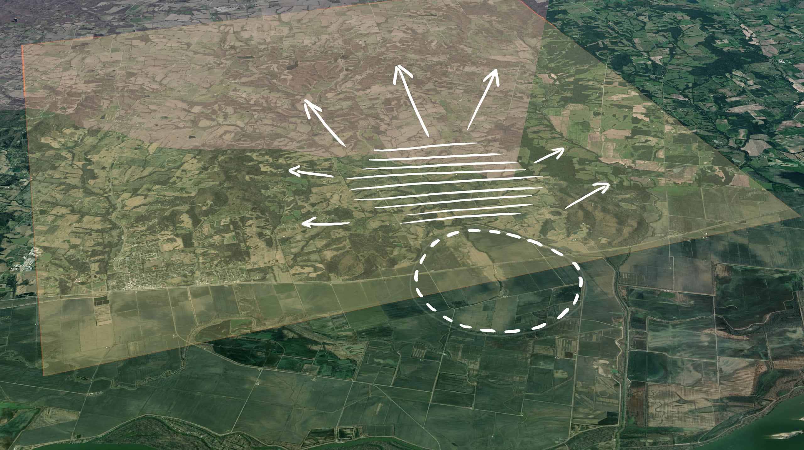
4. Lincoln County, Missouri: On the right bank of the Mississippi, just between the counties of Pike and Lincoln, there’s a location where the hills essentially form a kind of natural bay. From this point, up along Bryants Creek, there’s a gentle slope, offering a good environment for a settlement. The risk of flooding at this area could be minimized with appropriate channeling of the creek. Furthermore, the rounded area close to the river would be an excellent location for the new Mall. It is close to the river, but far enough away so it can be protected by building levees which would keep it safe during flood season. There is also plenty of room to the south-west to allow for future expansion of the city. And finally (and very important!): no major relocation of people would be required.
It looks like we found our location!
Conceptual Design
A few requirements were clear to the producers from the start:
The original 10×10 mile size of Washington DC should be maintained, the new US capital city should be able to host at least the current population of Washington DC and the most iconic landmarks should be moved to the new capital.
Another important part of this vision was to have two hills flanking the city. The construction of a new artificial canal, acting as a border between urban and agricultural environments, was also a key part of the concept.

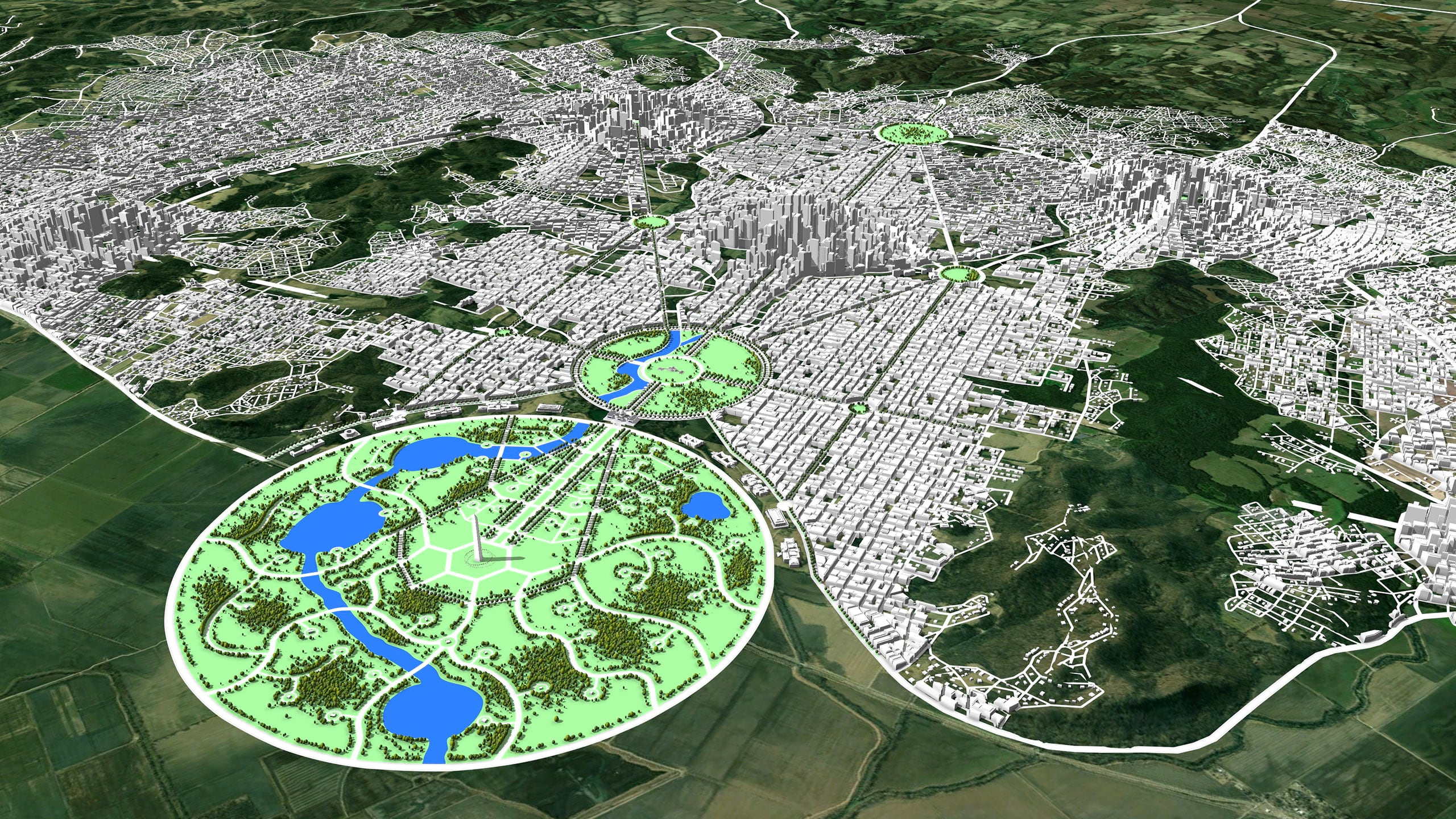
One main axis: Washington Avenue
The whole plan was conceived around one fundamental axis traced through three symbolic landmarks: The Washington Monument, The Capitol and the White House. The topography of this smooth valley really contributes to this alignment, working as the “spine” of the new capital city, around which the whole plan is assembled. This corridor is an example of how the names of historic US presidents were used to pay tribute to their legacy in designated elements of our plan.
General concept
Our concept is considered as a metaphor of the fundamental ingredients that are crucial for a democratic nation to grow as a solid, stable country.
With that in mind, it seems logical to place a large cultural area at the very base of the axis. That is the idea behind “Lincoln Park”; a huge commemorative space dedicated to exhibit the legacy of every state in the union. A place to share and celebrate, surrounded by one of the biggest rivers on earth, connecting the fertility of nature with the reality of a modern liveable city.
Further up, the Capitol stands as a symbol of the power of the people of a free country, linking cultural heritage with the home of the presidents throughout history: The White House.
Surrounding the White House are the embassies, again as a statement of the world understood as a common place, where diplomacy and cooperation are considered essential.
The Downtown Area
All around the embassy ring is where the “downtown area” is located. More precisely, we can distinguish east and north downtown, with the White House/Washington Avenue right between them. Following similar regulations to Washington DC, the building height is limited to a maximum of 10-12 storeys in this district.
This restriction serves a double purpose:
Firstly, to preserve the significance of the Capitol as the tallest landmark building around the area.
Secondly, it contributes to generate a more liveable and pleasant urban environment with more natural light at street level.
The City Centers
Further to the south-west along Washington Avenue, we encounter the first “city center”.
The “city centers” concept arose as an answer to fulfill the population capacity required by the producers.
The “George Washington Center” is meant to be the most prominent and therefore will have the highest buildings allowed in the capital.
Interconnected with the Washington Center, other satellite city centers will follow as the population gradually increases.
Finally, the new airport is placed further south, taking advantage of an existing flat zone in this area.
The Street Network
We wanted the new street network to stand out as a noticeable tribute to the geometrical design of Washington DC, planned by the French American Engineer Pierre Charles L’Enfant.
For this purpose, the White House was chosen to be the main pole from which several rays are traced at different angles, setting the primary structure of the network. These directions determine the main diagonal avenues connecting the secondary city centers, placed along a 7-mile diameter arc with its center at the White House.

The next step was finding different points along these diagonals and connecting them with new streets, until we achieve the desired subdivision level. During this procedure is important to always keep the topographical limitations in mind and ideal distance ranges within an optimal urban context.

As the street network becomes more defined, so does the location of the city centers. Each city center takes its name from a former US President.
Apart from the (main) Washington Center, we can find the Jefferson, Roosevelt, Eisenhower and Kennedy city centers.

For the last step we took advantage of the powerful capabilities of CityEngine to grow secondary street networks.
Using this tool, the grid was refined mixing different patterns like rectangular, radial or organic grids, in order to achieve a realistic result.

Lincoln Park
The true purpose of Lincoln Park is to serve as a counterpart of the existing National Mall in Washington DC; a place reflecting the identity of a nation, a place for people to gather and celebrate the most relevant moments of their past, present and future.
With a total surface over double the size of New York’s central park, this enormous natural area has been conceived to enjoy and preserve both nature and culture.
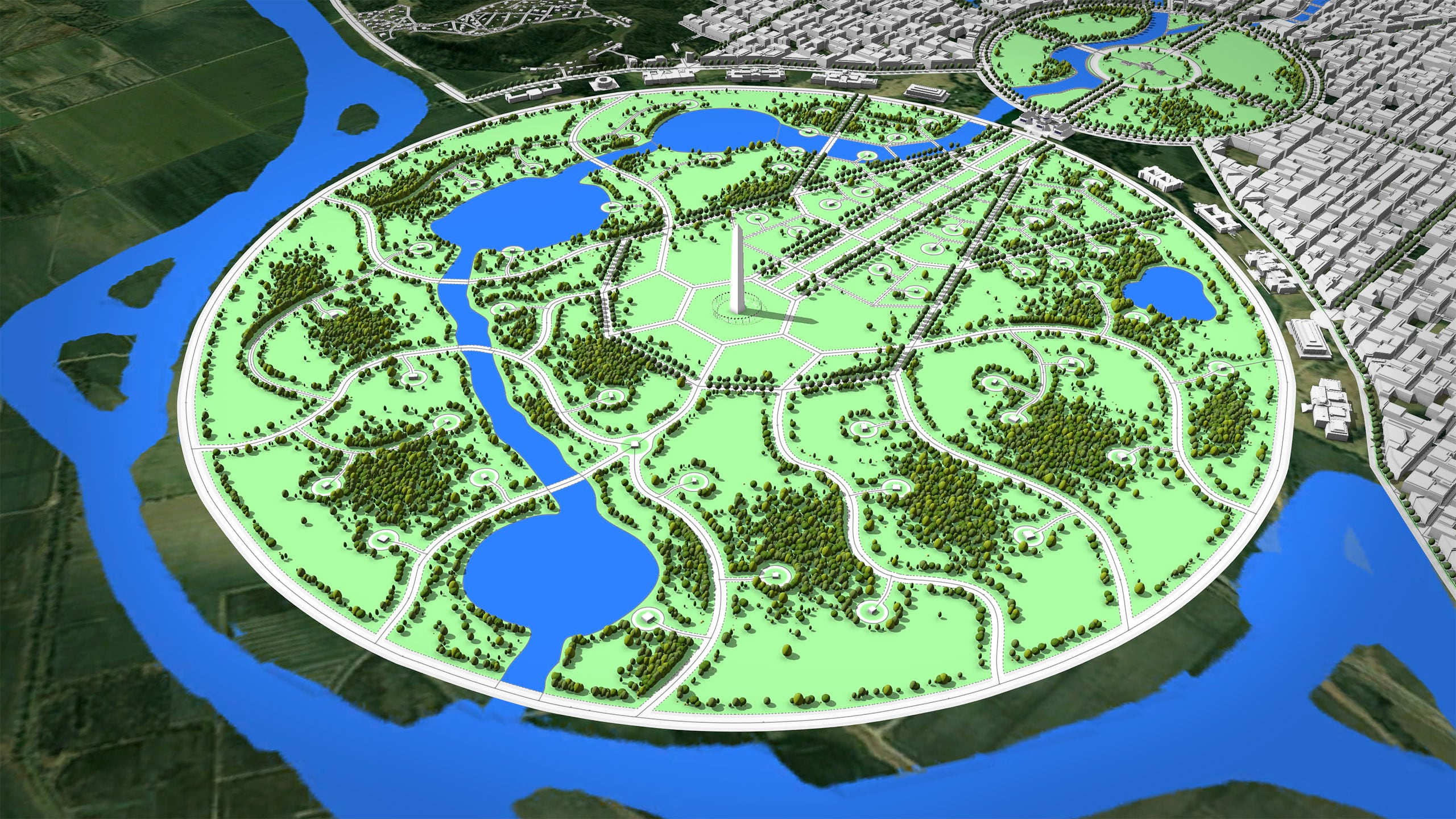
From a programmatic point of view, the configuration is very simple:
Inside the park, different paths lead to 50 pavilions corresponding to the 50 states. These buildings would house different contents and exhibitions, relative to the values of the region they represent. On the upper border, next to the city, we have a series of museums similar to the Smithsonian galleries surrounding the National Mall in Washington DC. At the bottom border, additional constructions might house recreational activities linked to the new canal.
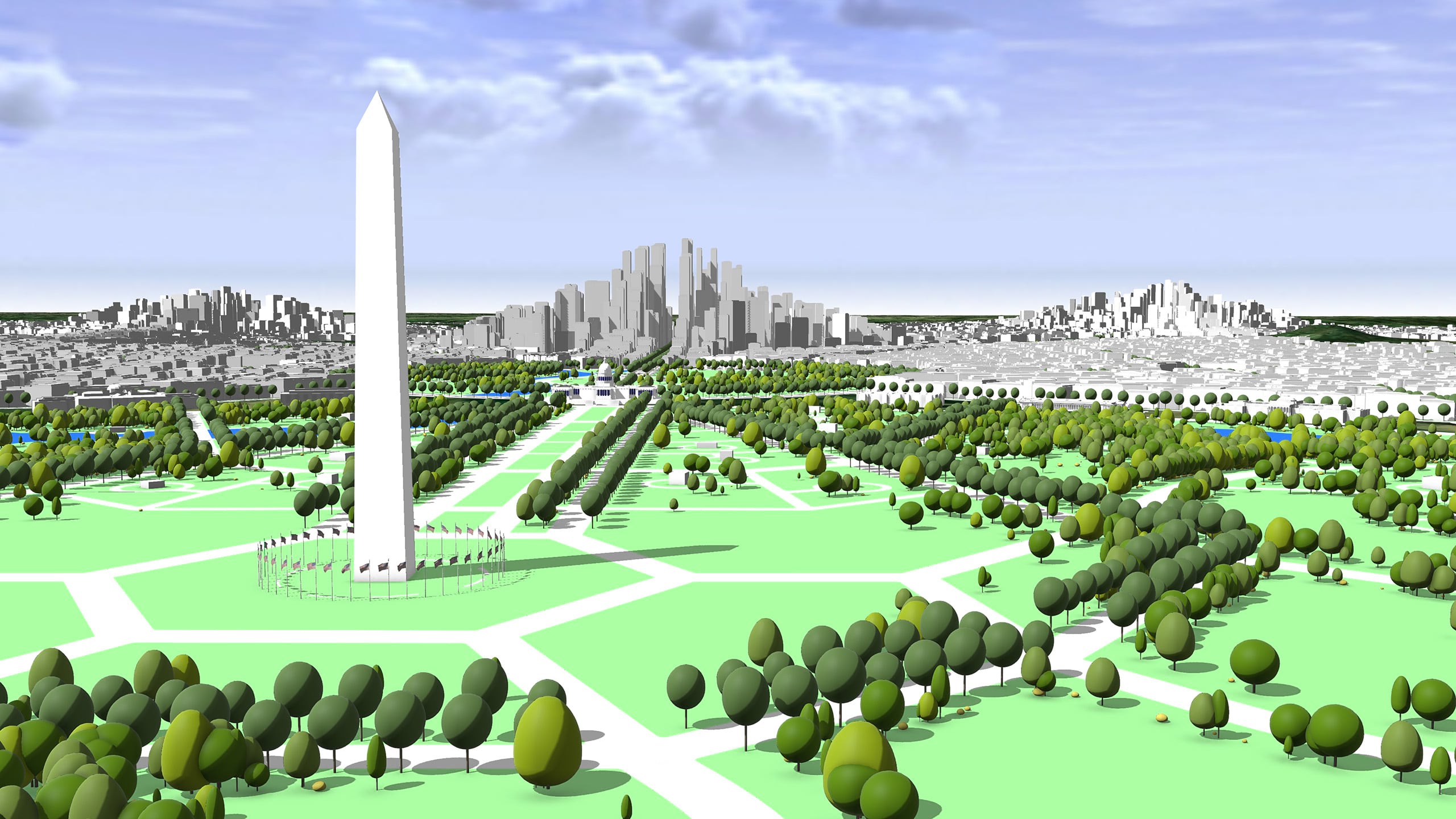
As a tribute to Washington DC’s McMillan plan, the original pattern of the National Mall is applied here to connect the Capitol to the new Washington Monument. This new obelisk is twice the size of its original counterpart in DC, and it stands right in the center of the circle.
From this point, the streets propagate further in a more organic pattern, symbolizing the folk’s identity deeply rooted in the fertile soil of their homeland.
To build this green environment in CityEngine, all streets and paths were created manually over a hand-drawn sketch placed in the background. Then, two rules were used to populate the gardens with the desired vegetation: One applied to the streets, to control the position of tree rows along them and the other applied to the shapes, offering a variety of possibilities to scatter selected plants in different ways.
The High-Speed Subway
The goal of this high-speed public transport is to be able to connect the airport with the cultural area or with any city center in less than 10 minutes as well as to provide an effective link between city centers in around 5 minutes.
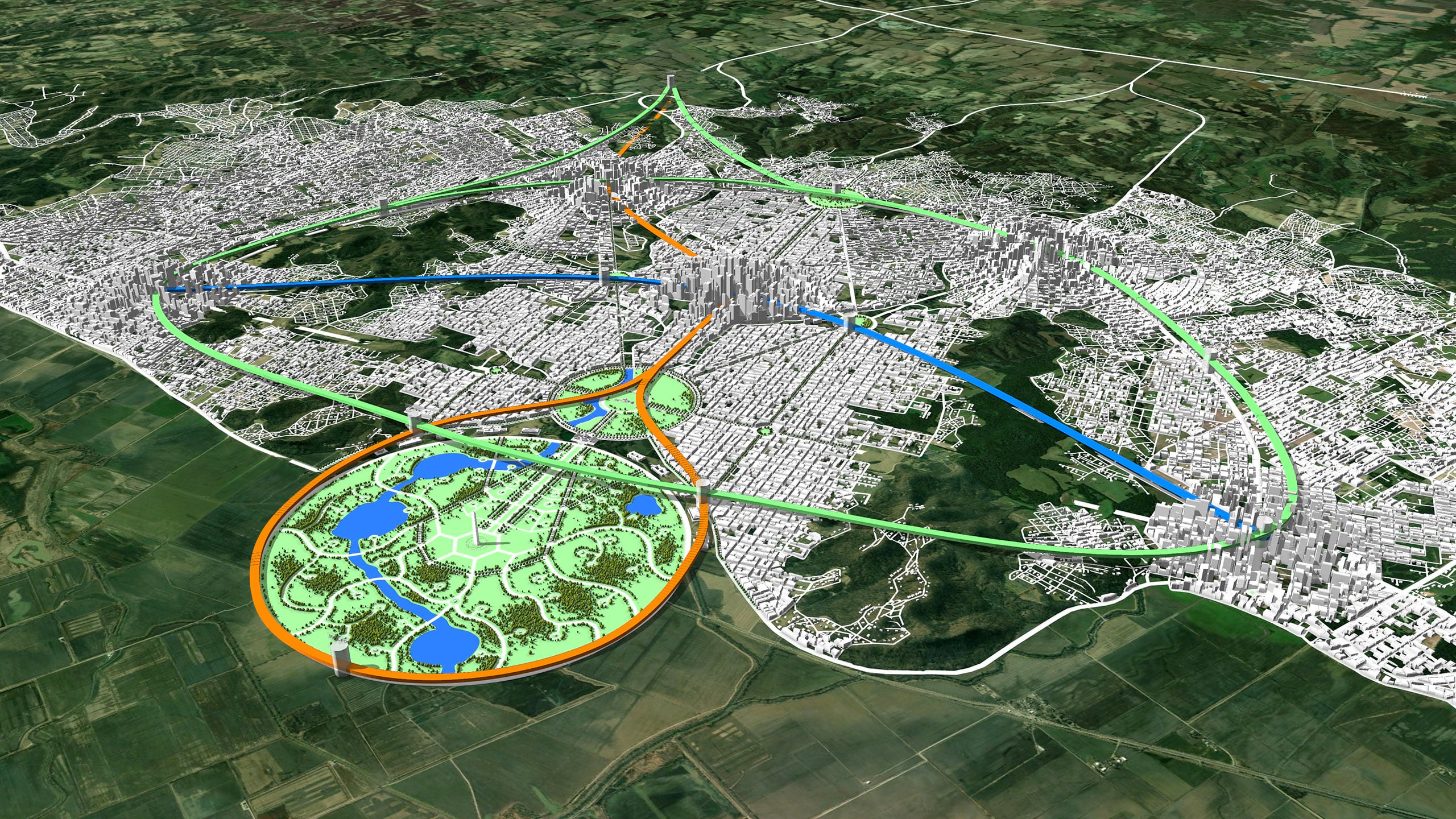
In order to achieve this, the following lines were proposed:
- Orange Line or “Central Line”: Links the airport with Lincoln Park, passing through the Roosevelt and Washington centers.
- Green Line or “Circle Line”: a big ring connecting all the peripheral centers and the airport.
- Blue line or “Arc Line”: connecting Washington center with the Jefferson and Kennedy centers.
It is important to mention that a conventional subway system, with shorter lines and smaller stations, has been also foreseen to complete an efficient public transport network of the city. However, given the conceptual nature of the project, we didn’t go into such details in this design.
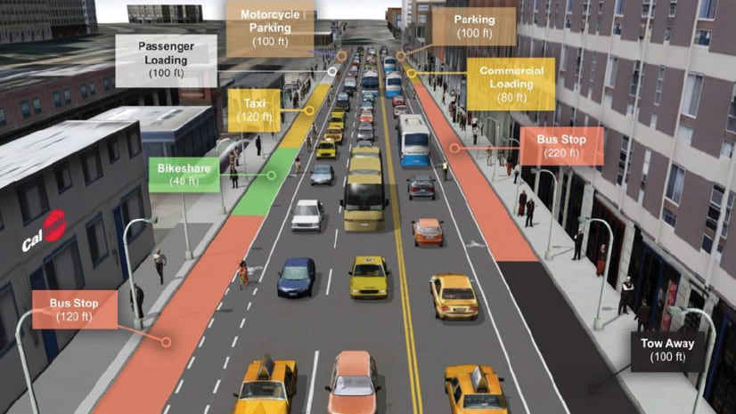
Street Profiles
Another important aspect inherent to urban planning today is the design of street profiles to guarantee accessibility, but also to conceive liveable spaces that will have a direct impact on the life quality of the citizens.
CityEngine comes with the “Complete Streets” rule set. This powerful set enables the user to generate countless configurations for the street profiles and instantly visualize the result after adjusting the attributes.
Configuring parameters, for example lane width, species of trees and their position, median design or even urban furniture is easily done by applying these rules.
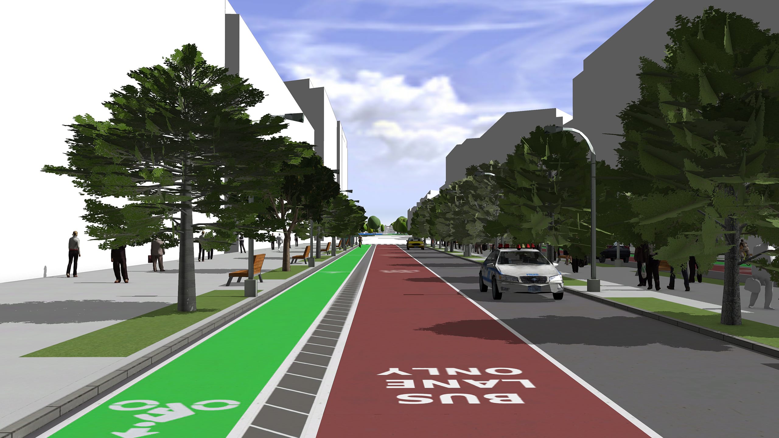
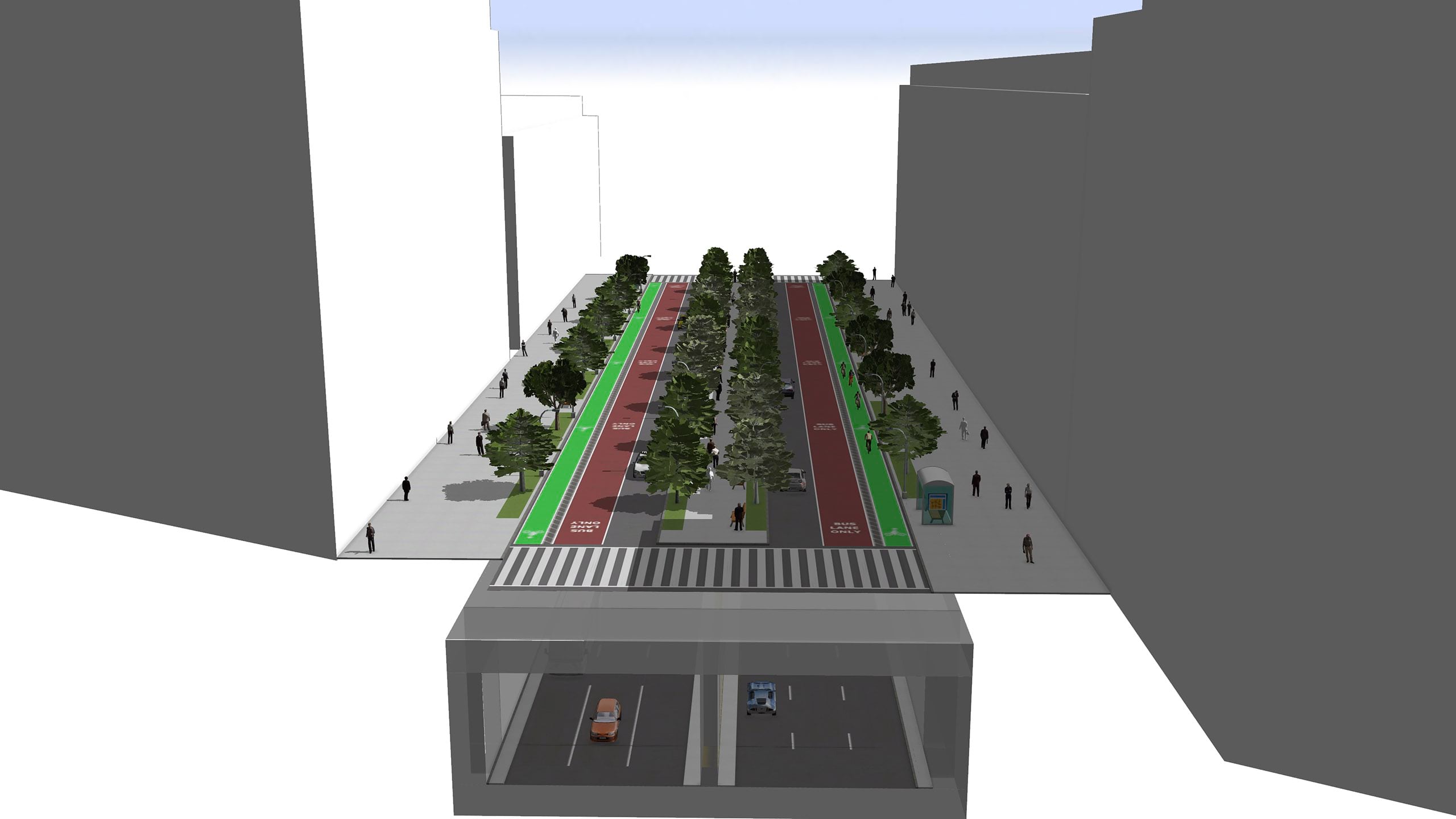
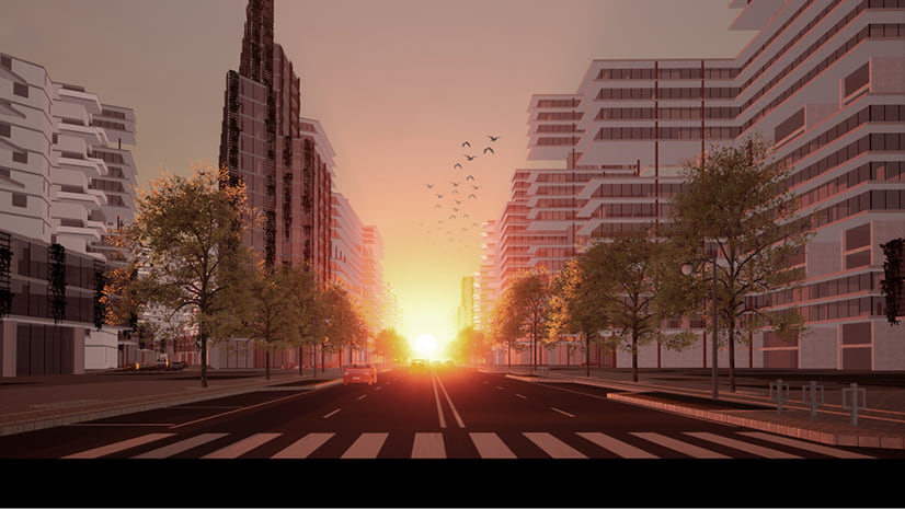
In our vision for this Federal City, we wanted to introduce the concept of “double decker avenues”.
The idea here is that the main avenues would always have an underground level which could manage the biggest amount of traffic. This measure would drastically reduce the number of vehicles circulating on the surface, resulting in much quieter, charming and liveable spaces.
The double decker avenue is a rule that builds the tunnel walls and then calls the Complete Street rule twice (once on the ground and once below the ground with other parameters).
Implementing such an infrastructure in any existing city might sound like something unthinkable. But like many other ideas, the opportunity of planning a city from scratch in the 21st century certainly turns a whole lot of dreams into plausible challenges.
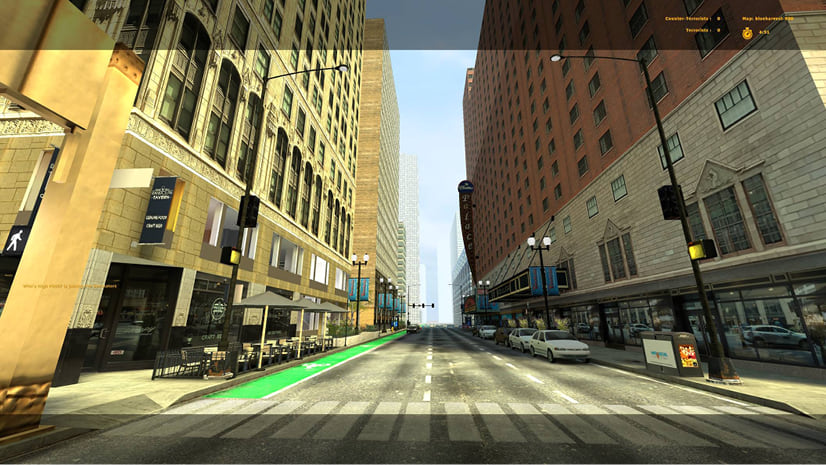
Final 3D Model
Now that we have our network laid out, let’s jump into the most fun part and generate some buildings and parks. We used different CGA rules to procedurally generate the entire city aside from the landmark buildings which were manually added.
Although CityEngine can generate quite detailed building models, in this case the goal was to provide a general vision of the new capital city. Working at this volumetric level of detail is the best way to test how the concept works together with the proposed regulations and shaping the urban landscape.

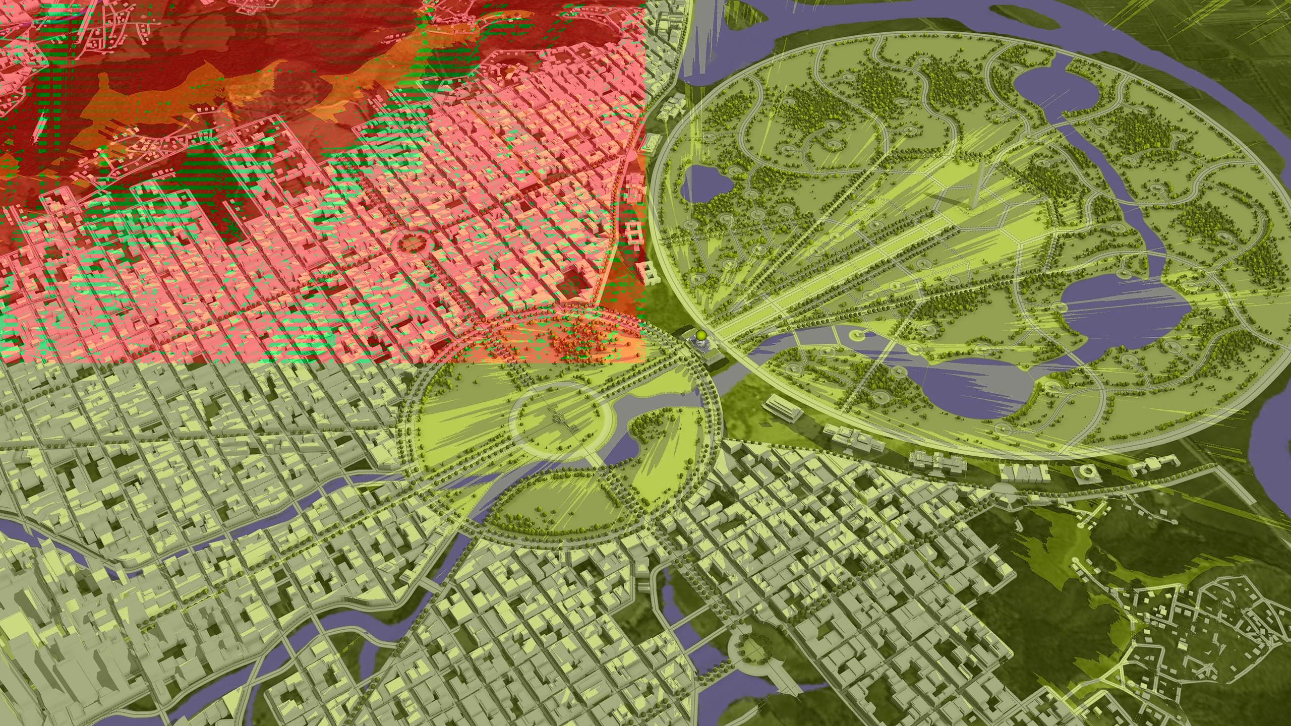
Another interesting CityEngine feature which was used during the design process is the “Visibility Analysis” tool. In this case we took advantage of this tool to adjust both the city layout and the height of the buildings, so that the Capitol as a landmark could be seen from the desired positions.
…and here’s a little bit of eye candy from the episode to wet your whistle! Go and watch the episode on the Science Channel or Discovery+ but most importantly, download CityEngine and check out the Federal City project for yourself.


Article Discussion: